North River is an alternative name for the southernmost portion of the Hudson River in the vicinity of New York City and northeastern New Jersey in the United States.
The Southwark Rail-Road was a small part of the Pennsylvania Railroad system in Philadelphia, Pennsylvania.

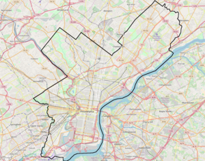
Transportation in Philadelphia involves the various modes of transport within the city and its required infrastructure. In addition to facilitating intracity travel, Philadelphia's transportation system connects Philadelphia to towns of its metropolitan area and surrounding areas within the Northeast megalopolis.

The Philadelphia, Wilmington and Baltimore Railroad (PW&B) was an American railroad that operated independently from 1836 to 1881. Headquartered in Philadelphia, it was greatly enlarged in 1838 by the merger of four state-chartered railroads in three Mid-Atlantic states to create a single line between Philadelphia and Baltimore.

Philadelphia was an early railroad hub, with lines from all over meeting in Philadelphia. The first railroad in Philadelphia was the Philadelphia, Germantown and Norristown Railroad, opened in 1832 north to Germantown. At the end of 1833, the state-built Philadelphia and Columbia Railroad, part of the Main Line of Public Works, opened for travel to the west, built to avoid loss of travel through Pennsylvania due to projects such as the Erie Canal. At the same time, the north-south leg of the Philadelphia City Railroad opened, running south along Broad Street from the Philadelphia and Columbia.

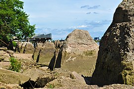
Penn's Landing is a waterfront area of Center City Philadelphia, Pennsylvania, situated along the Delaware River. Its name commemorates the landing of William Penn, the founder of Pennsylvania, in 1682. The actual landing site is farther south, in Chester. The city of Philadelphia purchased the right to use the name. Penn's Landing is bounded by Front Street to the west, the Delaware River to the east, Spring Garden Street to the north, and Washington Avenue to the south, and is primarily focused on the Christopher Columbus Boulevard corridor.
Pennsport is a neighborhood in the South Philadelphia section of Philadelphia, Pennsylvania, United States.
The Delaware Extension was a rail line owned and operated by the Pennsylvania Railroad in Philadelphia, Pennsylvania.
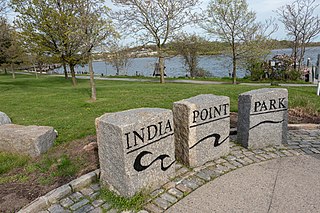
India Point Park is a park in the Fox Point neighborhood of Providence, Rhode Island at the confluence of the Seekonk River and Providence River. The park takes its name from the maritime activity connecting Providence with the East and West Indies. The East Bay Bike Path begins at the eastern end of the park, and crosses over the Washington Bridge before heading to Watchemoket Square in East Providence and continuing on to the Bristol waterfront north of the Mount Hope Bridge. The park is also a part of the Washington–Rochambeau Revolutionary Route.
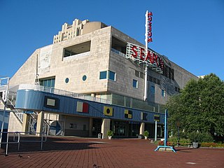
The Independence Seaport Museum was founded in 1961 and is located in the Penn's Landing complex along the Delaware River in Philadelphia, Pennsylvania. The collections at the Independence Seaport Museum document maritime history and culture along the Delaware River. At the museum are two National Historic Landmark ships and the J. Welles Henderson Archives and Library.

The Philadelphia Lazaretto was the Second quarantine hospital in the United States, built in 1799, in Tinicum Township, Delaware County, Pennsylvania. The site was originally inhabited by the Lenni Lenape, and then the first Swedish settlers. Nearby Province Island was the site of the confinement of the Christian Moravian Indians who were brought there under protective custody from Lancaster, Pennsylvania, in 1763 when their lives were threatened by the Paxton Boys. The facility predates similar national landmarks such as Ellis Island Immigrant Hospital and Angel Island and is considered both the oldest surviving quarantine hospital and the last surviving example of its type in the U.S.

The Central Waterfront is a neighborhood of Seattle, Washington. It is the most urbanized portion of the Elliott Bay shore. It runs from the Pioneer Square shore roughly northwest past Downtown Seattle and Belltown, ending at the Broad Street site of the Olympic Sculpture Park.

SS Pennsylvania was an iron passenger-cargo steamship built by William Cramp & Sons in 1872. The first of a series of four Pennsylvania-class vessels and the lead ship in her class, Pennsylvania and her three sister ships—Ohio, Indiana and Illinois—were the largest iron ships ever built in the United States at the time of their construction, and amongst the first to be fitted with compound steam engines. They were also the first ships to challenge British dominance of the transatlantic trade since the American Civil War.

SS Indiana was an iron passenger-cargo steamship built by William Cramp & Sons of Philadelphia in 1873. The third of a series of four Pennsylvania-class vessels, Indiana and her three sister ships – Pennsylvania, Ohio and Illinois – were the largest iron ships ever built in the United States at the time of their construction, and among the first to be fitted with compound steam engines. They were also the first ships to challenge British dominance of the transatlantic trade since the American Civil War.

SS Illinois was an iron passenger-cargo steamship built by William Cramp & Sons in 1873. The last of a series of four Pennsylvania-class vessels, Illinois and her three sister ships—Pennsylvania, Ohio and Indiana—were the largest iron ships ever built in the United States at the time of their construction, and amongst the first to be fitted with compound steam engines. They were also the first ships to challenge British dominance of the transatlantic trade since the American Civil War.

The Wilmington Rail Viaduct is a series of fills and bridges, about 4 miles (6.4 km) long, that carries the Northeast Corridor through the city of Wilmington, Delaware, above street level. Constructed between 1902 and 1908, the structure consists principally of fills supported by heavy stone retaining walls, punctuated with plate girder bridges over streets, and augmented by a few sections of brick arch viaduct. Its construction is typical of the Pennsylvania Railroad's architectural practices at the time, and the viaduct has been documented by the Historic American Engineering Record and listed on the National Register of Historic Places. Built by the Pennsylvania Railroad (PRR) as part of a series of grade crossing eliminations along the Northeast Corridor, the elevation of the rail line necessitated several other changes to rail infrastructure in Wilmington, including the construction of the Wilmington Shops at the east end of the viaduct, and the construction of the Wilmington Station and adjacent Pennsylvania Railroad Office Building along the elevated right-of-way.
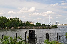
The Philadelphia Belt Line Railroad owns a 2.66-mile (4.28 km) long railroad line running along the Delaware River waterfront in Philadelphia, Pennsylvania. It was created in 1889 to allow any Philadelphia railroad to access the waterfront. The railroad, which does not operate any trains itself, is currently maintained by Conrail Shared Assets Operations and used by CSX Transportation and Norfolk Southern Railway.

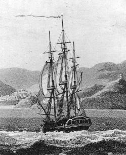
SS Haverford was an American transatlantic liner commissioned in 1901 for the American Line on the route from Southampton to New York, then quickly on the route from Liverpool to Boston and Philadelphia. During her early years, this ship, mainly designed to transport migrants and goods, was the victim of several incidents. Her company was integrated into the International Mercantile Marine Co. (IMM) in 1902 and she was used by other companies within the trust, the Dominion Line and the Red Star Line.

Columbus Boulevard is a major north-south thoroughfare in Philadelphia, Pennsylvania. It is famous for being the location of the Penn's Landing area and is generally parallel with Interstate 95 south of the Benjamin Franklin Bridge. The road extends south towards Pattison Avenue and is home to many big box retailers between Snyder Avenue and Oregon Avenue.

The Delaware Railroad was the major railroad in the US state of Delaware, traversing almost the entire state north to south from the mid-1850's until 1976. It began in Porter and was extended south through Dover andSeaford before reaching Delmar on the border of Maryland in 1859. Although operated independently, in 1857 it was leased by and under the financial control of the Philadelphia, Wilmington, and Baltimore Railroad, which was purchased by the Pennsylvania Railroad (PRR) in 1881. In 1891, it was extended north approximately 14 miles (23 km) with the purchase of existing track to New Castle and Wilmington. It remained a part of the PRR system and then Penn Central until 1976 when Penn Central went bankrupt at which point it was absorbed into Conrail.