Related Research Articles

Juab County is a county in western Utah, United States. As of the 2010 United States Census, the population was 10,246. Its county seat and largest city is Nephi.

The Great Basin is the largest area of contiguous endorheic watersheds – those with no outlets – in North America. It spans nearly all of Nevada, much of Utah, and portions of California, Idaho, Oregon, Wyoming, and Baja California, Mexico. It is noted for both its arid climate and the basin and range topography that varies from the North American low point at Badwater Basin in Death Valley to the highest point of the contiguous United States, less than 100 miles (160 km) away at the summit of Mount Whitney. The region spans several physiographic divisions, biomes, ecoregions, and deserts.

South Pass is the collective term for two mountain passes on the American Continental Divide, in the Rocky Mountains in southwestern Wyoming. It lies in a broad high region, 35 miles (56 km) wide, between the nearly 14,000 ft (4,300 m) Wind River Range to the north and the over 8,500 ft (2,600 m) Oregon Buttes and arid, saline near-impassible Great Divide Basin to the south. The Pass lies in southwestern Fremont County, approximately 35 miles (56 km) SSW of Lander.

The California Trail was an emigrant trail of about 1,600 mi (2,600 km) across the western half of the North American continent from Missouri River towns to what is now the state of California. After it was established, the first half of the California Trail followed the same corridor of networked river valley trails as the Oregon Trail and the Mormon Trail, namely the valleys of the Platte, North Platte, and Sweetwater rivers to Wyoming. The trail has several splits and cutoffs for alternative routes around major landforms and to different destinations, with a combined length of over 5,000 mi (8,000 km).

The City of Rocks National Reserve, also known as the Silent City of Rocks, is a United States National Reserve and state park in south-central Idaho, approximately 2 miles (3.2 km) north of the border with Utah. It is widely known for its enormous granite rock formations and excellent rock climbing.
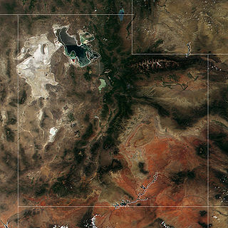
The Great Salt Lake Desert is a large dry lake in northern Utah, United States, between the Great Salt Lake and the Nevada border. It's a subregion of the larger Great Basin Desert, and noted for white evaporite Lake Bonneville salt deposits including the Bonneville Salt Flats.

The Muddy River, formerly known as the Moapa River, is a short river located in Clark County, in southern Nevada, United States. It is in the Mojave Desert, approximately 60 miles (97 km) north of Las Vegas.
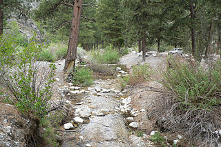
Carpenter Canyon is a canyon on the western side of the Spring Mountains, partially within the Humboldt-Toiyabe National Forest, in Clark County, southern Nevada west of the Las Vegas Valley.

The Hastings Cutoff was an alternative route for westward emigrants to travel to California, as proposed by Lansford Hastings in The Emigrant's Guide to Oregon and California. The ill-fated Donner Party infamously took the route in 1846.

Mountain Springs is an unincorporated community in Clark County in southern Nevada. It is located in Mountain Springs Summit, the pass over the Spring Mountains through which Highway 160 connects Las Vegas and Pahrump. Public buildings include a fire house and a saloon.

The Old Spanish Trail is a historical trade route that connected the northern New Mexico settlements of Santa Fe, New Mexico with those of Los Angeles, California and southern California. Approximately 700 mi (1,100 km) long, the trail ran through areas of high mountains, arid deserts, and deep canyons. It is considered one of the most arduous of all trade routes ever established in the United States. Explored, in part, by Spanish explorers as early as the late 16th century, the trail was extensively used by traders with pack trains from about 1830 until the mid-1850s.
Donner Party timeline provides an almost day-to-day basic description of events directly associated with the 1840s Donner Party pioneers, covering the journey from Illinois to California—2,500 miles, over the Great Plains, two mountain ranges, and the deserts of the Great Basin.

The Pancake Range is located in east-central Nevada in the United States. The range extends as an irregular sinuous line for approximately 90 miles (140 km) with a roughly north-south trend in Nye and White Pine counties. The range reaches an elevation of 9,240 feet (2,820 m) at Portuguese Mountain. Neighboring ranges include the White Pine, Grant and Quinn Canyon ranges across Railroad Valley on the east-southeast; and Park and Hot Creek ranges across Big Sandy Springs and Hot Creek valleys on the west-northwest. The south end of Newark Valley lies at the extreme north end of the range. The Lunar Crater Volcanic Field lies at the southwestern end of the chain with the Reveille Range to the south.

The Mojave Road, also known as Old Government Road, is a historic route and present day dirt road across what is now the Mojave National Preserve in the Mojave Desert in the United States. This rough road stretched 147 miles (237 km) from Beale's Crossing, to Fork of the Road location along the north bank of the Mojave River where the old Mojave Road split off from the route of the Old Spanish Trail/Mormon Road.

James C. Sly was a Mormon pioneer, member of the Mormon Battalion in the Mexican–American War, scout for early west trails used during the California gold rush, journal keeper in 1848 and 1849, early US western settler of several communities, and Mormon missionary to Canada.

The path followed by the Oregon Trail, California Trail and Mormon Trail spans 400 miles (640 km) through the U.S. state of Wyoming. The trail entered from Nebraska on the eastern border of the state near the present day town of Torrington and exited on the western border near the towns of Cokeville and Afton. An estimated 350,000 to 400,000 settlers traveled on the trail through Wyoming between 1841 and 1868. All three trails follow the same path through most of the state. The Mormon Trail splits at Fort Bridger and enters Utah, while the Oregon and California Trails continue to Idaho.

The Goose Lake Valley is located in south-central Oregon and northeastern California in the United States. It is a high valley at the northwestern corner of North America's Great Basin. Much of the valley floor is covered by Goose Lake, a large endorheic lake that straddles the Oregon–California border. Native Americans inhabited the Goose Lake Valley for thousands of years before explorers arrived in the 19th century. The pioneer wagon route known as the Applegate Trail crossed the Goose Lake Valley on its way to southern Oregon. At the south end of Goose Lake, the Lassen Cutoff separated from the Applegate Trail and headed south toward the Sacramento Valley. Today, Lakeview, Oregon, is the largest settlement in the valley. Livestock ranching and lumber mills are the valley's main commercial activity. The Goose Lake Valley offers a number of recreational opportunities including hang-gliding, hunting, fishing, and birdwatching.

The Curlew Valley is a 23-mile (37 km) long valley located on the northern edge of the Great Salt Lake in Box Elder County in northern Utah and extending north into Oneida County in southern Idaho.
Hamblin, now a ghost town, was a Mormon pioneer town along the Mormon Road, from 1856 to 1905. It was located at an elevation of 5,832 feet in Mountain Meadow in western Washington County, Utah, United States.
Mormon Road, also known to the 49ers as the Southern Route, of the California Trail, was a seasonal wagon road first pioneered by a Mormon party from Salt Lake City, Utah led by Jefferson Hunt, that followed the route of Spanish explorers and the Old Spanish Trail across southwestern Utah, northwestern Arizona, southern Nevada and the Mojave Desert of California to Los Angeles in 1847. From 1855, it became a military and commercial wagon route between California and Utah, called the Los Angeles – Salt Lake Road. In later decades this route was variously called the "Old Mormon Road", the "Old Southern Road", or the "Immigrant Road" in California. In Utah, Arizona and Nevada it was known as the "California Road".
References
- ↑ U.S. Geological Survey Geographic Names Information System: Mountain Springs
- ↑ Frémont, J. C. (1845). Report of the Exploring Expedition to the Rocky Mountains in the Year 1842, and to Oregon and North California in the Years 1843–44. Washington: Gales and Seaton. p. 265.
- ↑ Chandless, William (1857). A Visit to Salt Lake; Being a Journey Across the Plains and a Residence in the Mormon Settlements at Utah. London: Smith, Elder and Co. p. 295.
- ↑ Chandless, pp. 295–96