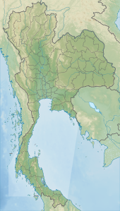
Surat Thani, often shortened to Surat, is the largest of the southern provinces (changwat) of Thailand. It lies on the western shore of the Gulf of Thailand. Surat Thani means 'city of good people', a title given to the city by King Vajiravudh ; Surat Thani is therefore the sole province in Southern Thailand for which the native name is in the Central Thai language.

Trang, also called Mueang Thap Thiang, is one of the southern provinces (changwat) of Thailand, on the west side of the Malay Peninsula facing the Strait of Malacca. Neighboring provinces are Krabi, Nakhon Si Thammarat, Phatthalung, and Satun.
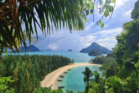
Ranong is one of Thailand's southern provinces (changwat), on the west coast along the Andaman Sea. It has the fewest inhabitants of all Thai provinces. Provinces neighboring Ranong are (clockwise) Chumphon, Surat Thani, and Phang Nga. To the west, it borders Kawthaung, Tanintharyi, Myanmar.

Phang Nga is one of the southern provinces (Changwat) of Thailand, on the shore of the Andaman Sea to the west and Phang Nga Bay to the south. Neighbouring provinces, from north and moving clockwise, are Ranong, Surat Thani, and Krabi. Towards the south of Phang Nga is the Phuket province, connected by the Sarasin Bridge.
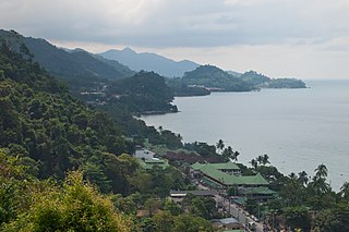
Ko Chang is an amphoe (district) in Trat province, Thailand. It is on the Gulf of Thailand's eastern seaboard, 300 km (190 mi) from Bangkok, near the border with Cambodia.

Ko Samet is one of the eastern seaboard islands of Thailand. It is in the Gulf of Thailand off the coastline of the Thai province of Rayong, approximately 220 kilometres (140 mi) southeast of Bangkok. Ko Samet is part of the Phe Subdistrict of the Amphoe Mueang Rayong, of Rayong Province. Ko Samet is the largest and westernmost of a cluster of islands not far from the coast. Ko Samet measures 6.8 kilometres (4.2 mi) from north to south. At its closest point to the mainland, the island is 2.6 kilometres (1.6 mi) south of mainland Rayong Province; however the actual travelling distance from the main commercial tourist pier in the town of Phe to the island's closest tourist beach is about 10 kilometres (6.2 mi).

The Surin Islands is a continental archipelago of five islands in the Andaman Sea, 55 kilometres (34 mi) from the Thai mainland. Administratively, the islands are part of Tambon Ko Phra Thong, Khura Buri district, in Phang Nga province, Thailand.
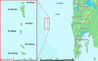
The Similan Islands is a continental archipelago in the Andaman Sea off the coast of, and part of, Phang Nga Province in southern Thailand. It is the maritime border between India and Thailand. It was established as Mu Ko Similan National Park in 1982 after a one-year assessment by the forestry department.

Tarutao National Park consists of 51 islands in the Strait of Malacca, off the coast of Satun Province of southern Thailand. The Tarutao National Park consists of two island groups: Tarutao and Adang-Rawi, which are scattered from 20 to 70 kilometres' distance from the south-westernmost point of mainland Thailand. The park covers an area of 931,250 rai ~ 1,490 square kilometres (580 sq mi) of which 1,260 square kilometres (490 sq mi) ocean and 230 square kilometres (89 sq mi) island. The southernmost end of the park lies on the border with Malaysia, just north of Langkawi. Tarutao became Thailand's second marine national park on 19 April 1974. The coastal Khao Sam Roi Yot National Park had been designated in 1966.
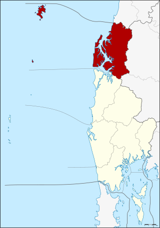
Khura Buri is a district (amphoe) in Phang Nga province in the south of Thailand.
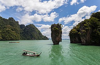
Khao Phing Kan or Ko Khao Phing Kan, commonly known in English as James Bond Island, is an island in Thailand, in Phang Nga Bay northeast of Phuket. About 40 metres (130 ft) from the shores of Khao Phing Kan lies a 20-metre (66 ft) tall islet called Ko Ta Pu or Ko Tapu.

Nong Chik is a district (amphoe) in Pattani province, southern Thailand.

Mu Ko Lanta National Park is a national park in the southern part of Krabi Province, Thailand, consisting of several islands. The two largest islands are Ko Lanta Noi and Ko Lanta Yai. Although both are inhabited, Ko Lanta Yai is the primary tourist destination. The park was established on 15 August 1990

Mueang Songkhla or Songkhla City is the capital district of Songkhla province, southern Thailand.

Khao Laem Ya–Mu Ko Samet is a Thai marine national park in the Gulf of Thailand off the coastline of Rayong, approximately 180 km southeast of Bangkok.

Ko Lipe is a small island in the Adang-Rawi Archipelago of the Strait of Malacca, in Satun Province of southwest Thailand, close to the Malaysian border. Its Thai name, the corrupted form of the original Malay name, Pulau Nipis is transliterated in many different ways into English. The most common names are "Koh Lipe", "Koh Lipeh", "Ko Lipey", and "Ko Lipe".

Ko Nom Sao are twin islands in Phang Nga Bay, and are part of the Ko Panyi (เกาะปันหยี) subdistrict (tambon), Phang Nga Province, Thailand.

The Khao Kho National park is located in Lom Kao, Lom Sak, Khao Kho and Mueang Phetchabun districts in Thailand's Phetchabun province. The national park covers an area of 483 square kilometres (186 sq mi) and was established in 2012.

Ko Khram, also known as Ko Khram Yai, is an island in Bangkok Bay about 24 km south southwest of Pattaya. It is the largest of the eastern seaboard islands of Thailand and the largest island in the bay.
Khao Yai–Khao Na Pha Tang and Khao Ta Phrom Non-hunting Area is a non-hunting area in Thong Saen Khan District of Uttaradit Province. It covers an area of 24 km2 (9.3 sq mi) and was established in 1984.

