
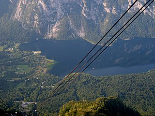
Matajur is a 1,642-meter (5,387 ft) mountain in the Julian Alps on the border between Italy and Slovenia. It is located on the border between the Soča Valley and the Italian mountainous region known as Venetian Slovenia, with views over the Adriatic Sea. Its prominence is 1,385 meters (4,544 ft).

Mount Ritter is the highest mountain in Madera County, California, in the Western United States, at an elevation of 13,149 feet (4,008 m). It is also the highest and most prominent peak of its namesake, the Ritter Range, a subrange of the Sierra Nevada in the Ansel Adams Wilderness of the Inyo and Sierra National Forests. Mount Ritter is the 15th highest mountain peak in California with at least 500 meters of topographic prominence.

Benton is a census-designated place (CDP) in Mono County, California, United States. It includes the unincorporated communities of Benton and Benton Hot Springs and is 32 miles (51 km) north of the community of Bishop, at an elevation of 5,387 feet (1,642 m). The population of the CDP was 279 at the 2020 census.
Ukanc is a settlement near Lake Bohinj in the Municipality of Bohinj in the Upper Carniola region of Slovenia. It is southwest of the lake. The majority of buildings in the settlement are either hotels or holiday houses.
Holt Canyon, originally called Meadow Canyon or Meadow Valley, is a valley in Washington County, Utah. Its mouth lies at an elevation of 5,387 feet (1,642 m) where it enters the Escalante Valley. Its head lies at an elevation of 5,600 feet at 37°32′32″N113°36′46″W west of the site of the ghost town of Hamblin, Utah.
Callville Wash is an ephemeral stream or wash in Clark County, Nevada. It was named for Callville the riverport settlement founded in 1866, at its mouth where it had its original confluence with the Colorado River.

Muddy Mountains Wilderness Area is a 48,154-acre wilderness area, which is a part of the Muddy Mountains in Clark County, Nevada. The area is a part of the Lake Mead National Recreation Area.
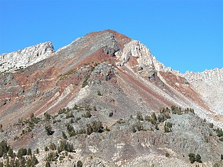
Herlihy Peak is an 11,758-foot-elevation (3,584 meter) mountain summit located in the Sierra Nevada mountain range in Mono County of northern California, United States. It is situated approximately four miles south of the community of Mammoth Lakes, in the John Muir Wilderness, on land managed by Inyo National Forest. Herlihy Peak is positioned midway between landmarks Crystal Crag and Bloody Mountain. Topographic relief is significant as the east aspect rises 2,060 feet above Valentine Lake in approximately one mile, and the west aspect rises 1,844 feet above Skelton Lake in 0.8 mile. Precipitation runoff from the peak drains to Mammoth Creek.

