
Udupi is a city in the Indian state of Karnataka. Udupi is situated about 55 km (34 mi) north of the educational, commercial and industrial hub of Mangalore and about 422 km (262 mi) west of state capital Bangalore by road.

Kundapur, also called Kundapura, is a coastal town situated in the Udupi district of the state of Karnataka, India. This town was known as Coondapoor while it was part of the erstwhile South Canara district (1862–1947) of the Madras Presidency of British India. Present-day Kundapur is administered by the Kundapur Town Municipal Council and serves as the headquarters of the Kundapur Taluk of Udupi district.
Puttur is a city in Dakshina Kannada district, in Karnataka state of India. It is the second largest and the fastest growing city in Dakshina Kannada district of Karnataka. The Puttur Shree Mahalingeshwara Temple is located here. Many Temples and Masjids are located here. Puttur central to the south eastern part of the district. Most people of the district depend on this city for their needs after Mangalore city.
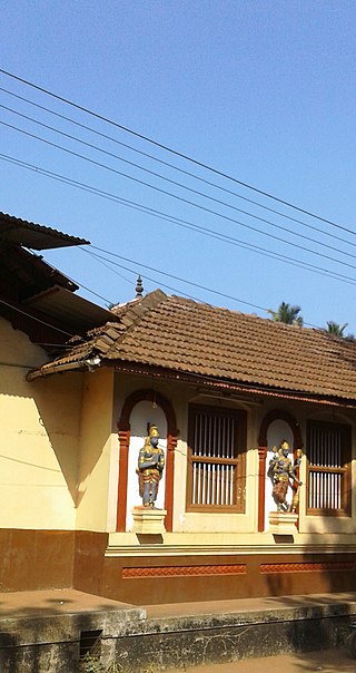
Bantwal is a taluk in Dakshina Kannada district, Karnataka, India. It is located 25 km (16 mi) East of Mangalore city center. BC Road-Kaikamba of Bantwal is one of the fastest developing areas in Dakshina Kannada district of Karnataka.
Ankola is a Town Municipal Council and a taluka in Uttara Kannada district of the Indian state of Karnataka. The name of the place is derived from a forest shrub Ankola grown on the coastal hill side and worshiped by the Halakki Vokkaligas as a totem. The town is around 33 km (21 mi) from Karwar and 86 km (53 mi) from Sirsi.

Udupi district is an administrative subdivision in the Karnataka state of India, with the district headquarters in the city of Udupi. It is situated in the Canara coastal region, there are seven taluks, 233 villages and 21 towns in Udupi district. The three northern tehsils of Udupi, Kundapur and Karkala, were partitioned from Dakshina Kannada district to form Udupi district on 25 August 1997. Moodabidri was officially declared as new tehsil (taluk), separated from Karkala with effect from 11 January 2018.
Kollur is a village in the southern state of Karnataka, India. It is located in the Byndoor taluk of Udupi district in Karnataka.
Bajpe is a locality in Mangalore city of Dakshina Kannada district in the state of Karnataka, now also known as Bajpe Town, India. It is around 18 km (11 mi) from the city of Mangalore. The Mangalore International Airport is located at Bajpe and was previously known as the Bajpe Aerodrome. City bus number 47 connects Bajpe to State Bank.There are a number of villages surrounding Bajpe, for which it serves as a hub. The nearby villages to which Bajpe serves as hub are Permude, Hosabettu, Kinnigoli, Kalamundkur and Kateel. Bajpe is derived from the Tulu word, Bija da Appe since it was famous for its agricultural market in olden days.

Mudigere is a Town Panchayath and Taluk in Chikkamagaluru district in the Indian state of Karnataka. It is 30 km from the district headquarters.
Mulki is a panchayat town located at Mangalore taluk in Dakshina Kannada district in the Indian state of Karnataka. It is on the banks of Shambhavi River. It was earlier known as Moolikapur, turned to Mulki. A small town with people of diverse religions, it is 10 km north of Suratkal. Karnad is a locality within Mulki. Nearest railway station is Mulki railway station
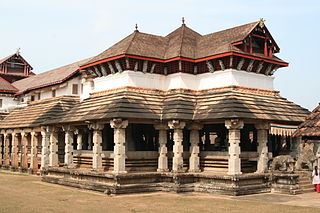
Moodabidri, is a town and taluk in Dakshina Kannada district. It lies 34 km northeast of the district headquarters, Mangalore, in Karnataka, India.

Koppa is a panchayat town in Chikkamagaluru district in the Indian state of Karnataka. It is the headquarters of Koppa sub-district. Koppa is located at 13.53°N 75.36°E.
Saligrama is a town on NH 66 in Brahmavara taluk of Udupi district in the Indian state of Karnataka. It is located between Kundapura and Brahmavar. It is 24 km north of Udupi and 81 km from Mangalore.

Uppala is a town and Headquarters of Manjeshwaram Taluk in Kasaragod district, Kerala, India. It is geographically located midway from Kasaragod to Mangalore. Easy geographical access and lack of major towns nearby are the key reasons for the town to develop exponentially, especially in the past decade. The population of Manjeshwaram Taluk alone was over 268,642 as of 2011. Uppala is 22 km north of Kasaragod and one of the fastest growing urban settlements in Kasaragod district. It is well known as an important trade hub in the northernmost part of Kerala state.

Kapu was renamed Kaup by the British. Kapu (Kaup) is a town situated in the Udupi district of Karnataka, India. It lies between the twin cities of Udupi and Mangalore, next to the National Highway 66. The villages Manchakal and Shirva are located near Kapu. It is 13 km south of Udupi and 40 km north of Mangalore. It is known for its lighthouse, the three Mariamman shrines, and the Kapu fort built by Tippu Sultan. Kapu was declared a taluk of the Udupi district by the Government of Karnataka.

Karkala also known as Karla in Tulu language, is a town and the headquarters of Karkala taluk in the Udupi district of Karnataka, India. Located about 60 km from Mangalore in the Tulu Nadu region of the state,it lies near the foothills of the Western Ghats.Karkala has a number of natural and historical landmarks, and is a major tourist and transit destination due to its strategic location along the way to Hebri, Sringeri, Kalasa, Horanadu, Udupi, Kollur, Subrahmanya and Dharmasthala.
Hejamadi or Hejamady is a village in the southern state of Karnataka, India.It is located on north banks of river Shambhavi, while Mulky is located on southern banks. There is an old road diverting from NH-66 leading to village. It is located in the Udupi taluk of Udupi district and 28 km north of Mangalore in Karnataka. Areas in Hejamady: Guddeyangadi, Shiv Nagar, Kannangar, Hejamady, Mattu Patna, Aache Mattu, Doddagundi, Sannagundi, Palimar, Kodi, Gundi, North Sultan Road, South Sultan Road, Maruthi Road and AmavaseKariya.
Uppunda (ಉಪ್ಪುಂದ) is a large village in Byndoor Taluk with west coast of the village on the Arabian sea in South India. The nearest city with an airport is Mangalore which is about 119 kilo-meters away. The town is reachable by water and road from Mangalore. Nearest railway station Byndoor Mookambika Road(BYNR) railway station. It is located in the Byndoor taluk of Udupi district in Karnataka.

Ajri is a village in Kundapura taluk, Udupi district, Karnataka, India.

Perla is an administrative capital of Enmakaje Panchayat, which is in Kasaragod district, Kerala, India.

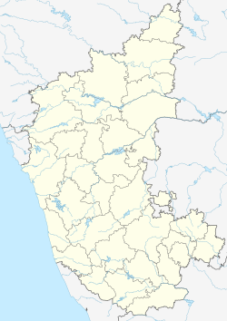

 India
India 