Munslow (hundred)

Last updated

Munslow
Hundred of Shropshire
Shropshire Munslow hundred.png
Munslow shown (in grey) within Shropshire
Area
  183184,500 acres (34,200 ha)
  1868103,750 acres (41,990 ha)
Area transferred
  c. 1200Places with Priory connection to Wenlock
  1836Five from Wenlock's detached parts
 - 1895Ludford (remainder) from Wolphy
History
  Preceded by Anglo-Saxon hundreds of Culvestan & Patton
  Origin 12th century reforms of the county's hundreds
  Createdc. 1100-35
  Succeeded byelected parish & district councils (Local Government Act 1894)
Status Hundred
(obsolete since 1895)
GovernmentHundred court
   HQ (Aston) Munslow
Contained within
   County Shropshire
Subdivisions
  Type Divisions
  UnitsUpper and Lower

Munslow is a hundred of Shropshire, England. It was formed with the amalgamation of the Anglo-Saxon hundreds of Patton and Culvestan during the reign of Henry I (1100 to 1135). Hundreds in England had various judicial, fiscal and other local government functions, their importance gradually declining from the end of manorialism to the latter part of the 19th century.

Contents

The hundred is named after the village of Munslow, where the hundred's judicial and administrative functions were mostly carried out. The 'hundred house' for Munslow hundred was originally located in neighbouring Aston Munslow, [1] but from the Tudor period was located in Munslow itself.
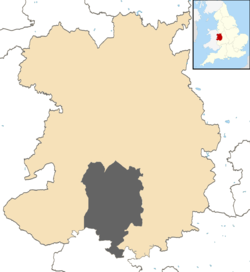
Geography

The hundred was divided into "upper" and "lower" divisions (the "lower" division being considerably larger). The hundred reached from All Stretton to the north, down the valleys of the rivers Onny, Corve and Teme, to the Herefordshire border south and west of Ludlow. [2]

Three towns came to exist in the hundred — Ludlow (established alongside Ludlow Castle in the early 12th century), Church Stretton (granted a market charter in 1214) and Craven Arms (which grew as a railway town in Victorian times).

The hundred has no detached parts, although the part consisting of Richard's Castle, Ashford Carbonell and Ashford Bowdler was practically detached, until the transfer of the remainder of Ludford in 1895. The liberty of Wenlock had three true enclaves within Munslow (the main part of the parish of Eaton together with Millichope, secondly the parish of Shipton, and a tiny third enclave being the township of Norncott) until reform of its borough in 1836 incorporated these parts into Munslow. [3]

Formation

The Domesday Book records that following the Norman conquest of England, many of the manors in the hundreds of Culvestan and Patton came to be owned by Roger de Montgomerie, 1st Earl of Shrewsbury, including the manors of Corfham and Aston. [4] Corfham was already by 1066 (when it was held by King Edward) the caput (the centre of administration) for both Culvestan and Patton. It is believed that by the 12th century the caput for both hundreds was moved to Aston, 1 mile (1.6 km) northwest from Corfham Castle on the other side of the River Corve. Aston was near the tumulus known as Munslow and the place later became known as Aston Munslow.

The hundreds of Shropshire were greatly reformed throughout the 12th century, and one of the earliest changes to be made was the formation of Munslow. During the reign of Henry I (1100 to 1135) the hundreds of Culvestan and Patton were formally merged (having been paired by a common caput for some time) and the new hundred formed was named Munslow. The new hundred included most of the manors of Culvestan (not Huntington, which went to Stottesdon) and Patton (not Madeley or Beckbury, both which went to Brimstree — nor Acton, which went to Stottesdon). In addition a number of manors from the hundred of Leintwardine (which was being dissolved) were transferred, with a boundary between the new hundreds of Munslow and Purslow taken to be the Roman road running from Wistanstow south to the Herefordshire border (and explains why Rowton and Shelderton were in different hundreds to the rest of their respective parishes). Also brought into Munslow was a part of the parish of Richard's Castle, causing a division between Shropshire and Herefordshire there that still exists.

Later transfers to Wenlock

The move to Munslow hundred was relatively short-lived for many places, with the growth of the franchise (or liberty) of Wenlock [5] beginning in the 1189-1199 reign of Richard I — see the section in the Patton article. The resulting hundred of Munslow (following the removal of places to Wenlock) resembled quite closely the former hundred of Culvestan (with for example the upper division based on the former hundred's detached part in the vicinity of the Strettondale) as around half of the Patton element was removed.

Parishes in 1824

Hundreds of Shropshire in 1832 Shropshire1832 Map.png
Hundreds of Shropshire in 1832

The following parishes, or parts, formed the hundred in 1824, as recorded by A Gazetteer of Shropshire. [2] This represents the area covered by the hundred for much of its history, from circa 1200 to 1836. The Saxon hundreds which these places originated from prior to the formation of Munslow is given (♦ from Culvestan hundred; ‡ from Patton hundred; ¤ from Leintwardine hundred; ◌ from Cutestornes hundred).

Upper Division

Lower Division

Borough of Ludlow

Ludlow was a borough from 1461 to 1974 (a municipal borough from 1835; a rural borough from 1967) which encompassed the same area as Ludlow's parish until the mid-late 19th century; its borough status meant it was largely autonomous from the hundred.

Hundred in 1831

The land area covered by the hundred of Munslow in 1831 was 84,500 acres (34,200 ha). [11]

Enlargement in 1836

The Municipal Corporations Act 1835 reformed the borough of Wenlock and several of its parishes, and parts of, which were detached parts of its liberty, were transferred to other hundreds in 1836.

Munslow gained Eaton-under-Heywood (two detached parts) and Shipton (though not its tiny detached part of Skimblescott) [12] to its Upper Division.

The remainders of Stoke St. Milborough (Cleestanton, Norncott, et al.) and Munslow (Millichope), as well as The Skirmage [13] [14] (a tiny extra-parochial place which bordered onto Stoke St. Milborough; also written as 'Scirmidge') transferred to its Lower Division. [3] [5]

These areas were returned to Munslow after having become part of the liberty of Wenlock in medieval times; they were in Munslow hundred upon its formation c. 1100 and derive from manors originally transferred to Munslow from Patton and Culverstan (only the manor of Cleestanton) hundreds.

Hundred in 1868

The land area covered by the hundred of Munslow was recorded in 1868 at 103,750 acres (41,990 ha) with the Lower Division having 69,670 acres (28,190 ha) and the Upper Division 34,080 acres (13,790 ha). [3]

Enlargement in 1895

In 1895, around the same time as the hundred became defunct, and as a result of the same 1894 Act of Parliament, the Herefordshire element of the parish of Ludford joined Shropshire, which also meant a transfer from Herefordshire's Wolphy hundred to that of Munslow. [15]

Present-day

The hundred in 2014, with the wide Corvedale on the right and the much narrower Onny valley seen on the left; the Teme flows left to right across the panorama, with Bromfield in the centre. Culvestan hundred Shropshire 2014.JPG
The hundred in 2014, with the wide Corvedale on the right and the much narrower Onny valley seen on the left; the Teme flows left to right across the panorama, with Bromfield in the centre.

Although never formally abolished, the hundreds of England have become obsolete. They lost their remaining administrative and judicial functions in the mid-to-late 19th century, with the last aspects removed from them in 1895 with the Local Government Act 1894.

The Act established a new system of local government within the counties, consisting of civil parishes and districts, both with elected councils. The districts steadily amalgamated and since 2009 Shropshire has only two, both unitary authorities, meaning the county currently has no level of local government between the county and the parish.

See also

Related Research Articles

<span class="mw-page-title-main">Ludlow</span> Town and civil parish in Shropshire, England

Ludlow is a market town and civil parish in Shropshire, England. It is located 28 miles (45 km) south of Shrewsbury and 23 miles (37 km) north of Hereford, on the A49 road which bypasses the town. The town is near the confluence of the rivers Corve and Teme.

<span class="mw-page-title-main">Much Wenlock</span> Town and parish in England

Much Wenlock is a market town and parish in Shropshire, England, situated on the A458 road between Shrewsbury and Bridgnorth. Nearby, to the northeast, is the Ironbridge Gorge and Telford. The civil parish includes the villages of Homer, Wyke, Atterley, Stretton Westwood and Bourton. The population of the civil parish, according to the 2001 census, was 2,605, increasing to 2,877 at the 2011 Census.

Shropshire was established during the division of Saxon Mercia into shires in the 10th century. It is first mentioned in 1006. After the Norman Conquest it experienced significant development, following the granting of the principal estates of the county to eminent Normans, such as Roger De Montgomery and his son Robert de Bellême.

<span class="mw-page-title-main">Ashford Bowdler</span> Human settlement in England

Ashford Bowdler is a small village and civil parish in south Shropshire, England, near the county border with Herefordshire.

<span class="mw-page-title-main">Ashford Carbonell</span> Human settlement in England

Ashford Carbonell is a village and civil parish in south Shropshire, England, near the county border with Herefordshire.

<span class="mw-page-title-main">Bromfield, Shropshire</span> Human settlement in England

Bromfield is a village and civil parish in Shropshire, England.

<span class="mw-page-title-main">Ludford, Shropshire</span> Village in Shropshire, England

Ludford is a small village and civil parish in south Shropshire, England. The parish is situated adjacent to the market town of Ludlow and was, until 1895, partly in Herefordshire.

<span class="mw-page-title-main">Sheet, Shropshire</span> Human settlement in England

Sheet is a small modern village in the parish of Ludford about 1 mile (1.6 km) from the town centre of Ludlow, Shropshire.

<span class="mw-page-title-main">Rushbury</span> Human settlement in England

Rushbury is a village and civil parish in Shropshire, roughly five miles from Church Stretton and eight miles from Much Wenlock.

<span class="mw-page-title-main">River Corve</span> River in Shropshire, England

The River Corve is a minor river in Shropshire, England. It is a tributary of the River Teme which it joins in the town of Ludlow, and which joins the River Severn at Powick near Worcester. The valley it flows through is known as the Corvedale, a term used as a general name for the area, and a name used for example by the primary school in Diddlebury. It is sometimes (archaically) spelled "Corf", which is its pronunciation.

<span class="mw-page-title-main">Richard's Castle</span> Village in Herefordshire and Shropshire, England

Richard's Castle is a village, castle and two civil parishes on the border of the counties of Herefordshire and Shropshire in England. The Herefordshire part of the parish had a population of 250 at the 2011 Census, the Shropshire part, 424.

<span class="mw-page-title-main">Munslow</span> Human settlement in England

Munslow is a small village and civil parish in Shropshire, England. It is situated on the B4368, 7 miles (11 km) northeast of the small town of Craven Arms, in the Corvedale, at around 140 metres (460 ft) above sea level.

Culvestan was a hundred of Shropshire, England. Formed during Anglo-Saxon England, it encompassed manors in central southern Shropshire, and was amalgamated during the reign of Henry I with the neighbouring hundred of Patton to form the Munslow hundred.

Patton was a hundred of Shropshire, England. Formed during Anglo-Saxon England, it encompassed manors in eastern central Shropshire, and was amalgamated during the reign of Henry I with the neighbouring hundred of Culvestan to form the Munslow hundred.

<span class="mw-page-title-main">Patton, Shropshire</span> Human settlement in England

Patton is a hamlet in Shropshire, England.

There are a number of listed buildings in Shropshire. The term "listed building", in the United Kingdom, refers to a building or structure designated as being of special architectural, historical, or cultural significance. Details of all the listed buildings are contained in the National Heritage List for England. They are categorised in three grades: Grade I consists of buildings of outstanding architectural or historical interest, Grade II* includes significant buildings of more than local interest and Grade II consists of buildings of special architectural or historical interest. Buildings in England are listed by the Secretary of State for Culture, Media and Sport on recommendations provided by English Heritage, which also determines the grading.

<span class="mw-page-title-main">Bourton, Shropshire</span> Human settlement in England

Bourton is a small village in Shropshire, England, 3 miles (5 km) southwest of Much Wenlock. It is part of the civil parish of Much Wenlock.

References

  1. Munslow historic parish registers
  2. 1 2 GENUKI Shropshire hundreds (Gregory, 1824)
  3. 1 2 3 GENUKI Miscellaneous, Shropshire The National Gazetteer of Great Britain and Ireland (1868)
  4. Open Domesday Archived 2014-07-14 at the Wayback Machine Aston
  5. 1 2 British History Online The Liberty and Borough of Wenlock
  6. GENUKI 1824 gazetteer - Cardington
  7. MELOCKI Registers of Wistanstow
  8. GENUKI Ditton Priors gazetteers
  9. GENUKI Ludford gazetteers
  10. Vision of Britain Ludlow Castle
  11. GB Historical GIS / University of Portsmouth, Munslow Hundred through time | Population Statistics | Area (acres), A Vision of Britain through Time (date accessed: 9 June 2014)
  12. British history online Shipton (...Skimblescott bordered onto Monkhopton, which remained part of Wenlock; in 1883 it was transferred to Monkhopton)
  13. GENUKI Extra-parochial areas (Shropshire)
  14. Vision of Britain Skirmage
  15. Vision of Britain Ludford CP

52°28′30″N2°42′00″W / 52.475°N 2.7°W / 52.475; -2.7