| Acton Round | |
|---|---|
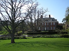 Acton Round Hall | |
 Acton Round Location within Shropshire | |
| OS grid reference | SO635955 |
| Civil parish |
|
| Unitary authority | |
| Ceremonial county | |
| Region | |
| Country | England |
| Sovereign state | United Kingdom |
| Post town | BRIDGNORTH |
| Postcode district | WV16 |
| Dialling code | 01746 |
| Police | West Mercia |
| Fire | Shropshire |
| Ambulance | West Midlands |
| UK Parliament | |
Acton Round is a village and civil parish in the English country of Shropshire. Acton Round was recorded in the Domesday Book as Achetune. [1] The civil parish includes the village of Muckley.