Del Norte County Regional Airport is a public airport three miles northwest of Crescent City, in Del Norte County, California, United States. It has one airline flight per day to and from Oakland under the Essential Air Service program. The National Plan of Integrated Airport Systems for 2011–2015 categorized it as a primary commercial service airport.

California Redwood Coast – Humboldt County Airport, also known as Arcata–Eureka Airport and Arcata Airport, is in Humboldt County, California, United States, 8 miles (13 km) north of Arcata and 15 miles (24 km) north of Eureka, in McKinleyville.

General William J. Fox Airfield is a county-owned, public airport in Los Angeles County, California, five miles northwest of Lancaster, California, United States. Locally known as Fox Field, the airport serves the Antelope Valley. The airport is named after Brigadier General William J. Fox, "a Marine war hero, a movie stunt man, the first Los Angeles County engineer and, for 20 years after his retirement, a cowboy."

North Las Vegas Airport is a public-use airport 3 mi (4.8 km) northwest of downtown Las Vegas in North Las Vegas, Nevada. It is owned by the Clark County Commission and operated by the Clark County Department of Aviation.

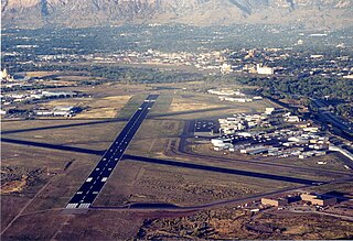
Ogden-Hinckley Airport is a public airport four miles southwest of Ogden, in Weber County, Utah. The National Plan of Integrated Airport Systems for 2019–2023 categorized it as a commercial service–primary nonhub airport. Formerly Ogden Municipal Airport, it is billed as Utah's busiest municipal airport for private planes.
Taunton Municipal Airport, also known as King Field, is a public use airport located three nautical miles (6 km) east of the central business district of Taunton, a city in Bristol County, Massachusetts. It is located in the East Taunton neighborhood of the city. The city-owned airport is maintained and operated by the Taunton Airport Commission. According to the FAA's National Plan of Integrated Airport Systems for 2009–2013, it is categorized as a general aviation airport.
North Palm Beach County Airport, also known as North County Airport, is an uncontrolled (non-towered) general aviation airport located 12 nautical miles northwest of West Palm Beach off the Bee Line Highway in Palm Beach Gardens, Florida. The airport is owned by Palm Beach County and operated by the Palm Beach County Airports Department.
Taos Regional Airport is a public use airport eight nautical miles (15 km) northwest of the central business district of Taos, in Taos County, New Mexico, United States. It is owned by the Town of Taos. FAA's National Plan of Integrated Airport Systems for 2009–2013 classifies it as a general aviation airport.

Stillwater Regional Airport is in Payne County, Oklahoma, United States, three miles (4.8 km) northwest of Stillwater.
Iowa City Municipal Airport, is two miles southwest of downtown Iowa City, in Johnson County, Iowa. It is the oldest civil airport west of the Mississippi River still in its original location.

Eastern Sierra Regional Airport is two miles east of Bishop, in Inyo County, California, United States. It is owned by the City of Los Angeles, Department of Public Works and operated by Inyo County.

Treasure Coast International Airport is a public airport located three miles (5 km) northwest of the central business district of Fort Pierce, a city in St. Lucie County, Florida, United States. It is owned by the St. Lucie Board of County Commissioners.

Felts Field is a public airport in the northwest United States, located five miles (8 km) northeast of downtown Spokane, in Spokane County, Washington. It is owned by Spokane City-County.

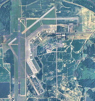
Northeast Alabama Regional Airport is five miles southwest of Gadsden, in Etowah County, Alabama. It is owned by Gadsden Airport Authority and it used to be Gadsden Municipal Airport. The FAA's National Plan of Integrated Airport Systems for 2009–2013 categorized as a general aviation facility.

Samoa Field Airport formerly Eureka Municipal Airport is a city-owned, public airport 2 miles (3.2 km) west of Eureka, on the northern peninsula of Humboldt Bay in Humboldt County, California, United States.

Darlington County Airport (Jetport) (ICAO: KUDG, FAA LID: UDG) is a county-owned, public-use airport located nine nautical miles (10 mi, 17 km) north of the central business district of Darlington, a city in Darlington County, South Carolina, United States. It is included in the National Plan of Integrated Airport Systems for 2011–2015, which categorized it as a general aviation facility. The airport does not have scheduled commercial airline service.

Greenwood–Leflore Airport is a public airport located seven miles east of Greenwood, the county seat of Leflore County, Mississippi, United States. It is owned by the City of Greenwood and Leflore County, but is geographically located in Carroll County.

Clinton Municipal Airport is seven miles southwest of Clinton, in Clinton County, Iowa. The FAA's National Plan of Integrated Airport Systems (2017-2021) categorizes it as a general aviation airport.

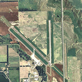
Mitchell Municipal Airport is three miles north of Mitchell, in Davison County, South Dakota. The National Plan of Integrated Airport Systems for 2011–2015 categorized it as a general aviation airport.

Everett–Stewart Regional Airport is in Obion County, Tennessee, five miles southeast of Union City, Tennessee, United States. The National Plan of Integrated Airport Systems for 2011–2015 categorized it as a general aviation facility.


