Mutorashanga

Last updated
Entrance of an adit of a chromite mine, Mutorashanga Mutorashanga.jpg
Entrance of an adit of a chromite mine, Mutorashanga

Mutorashanga is a small ferrochrome mining town in Mashonaland West province in Zimbabwe. Situated on Zimbabwe's Great Dyke mountain range, about 100 kilometers north of the capital, Harare. [1] The mines at Mutorashanga are largely owned by Zimasco, a chrome mining company owned in turn by Sinosteel Corporation, although some are operated by contractors. The area is well known for its abundant aloes, now threatened by mining, and other endemic flora. Aloe Ortholopha is endemic to the section of the Great Dyke mountain range in the Mutorashanga area.

Zimasco operates ferrochrome mines in Shurugwi and Lalapanzi in Zimbabwe's Midlands Province. It also operates Zimbabwe's largest ferrochrome smelter in the Midlands town of Kwekwe.

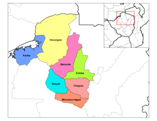
Muriel Gold Mine, south of Mutorashanga, also forms part of the sub-district. Mutorashanga falls under the administration of Lomagundi District in Mashonaland West Province and sits on the border of Mashonaland Central Province. The "town" consists of the mines, a police station, a post office, a Zimbabwe Electricity Supply Authority Office and small trading stores. Mutorashanga has no urban status. The town sits on the Lone Cow Farm and on Umvukwes Ranch and its extensions. Until 2000, when large-scale farmers were displaced, the area was a tobacco-growing district. Farmers also grew corn (maize), soy and winter wheat.

Ethel mine (Coordinates: 17°3′54″S30°42′24″E / 17.06500°S 30.70667°E / -17.06500; 30.70667 ) 10 km north of Mutorashanga is a flooded Asbestos quarry. The mine is used by diving clubs and swimmers (the water is very clear, and there are several 'wrecks' at the bottom). There was a Mutorashanga Triathlon held here for a few years (~2000). The quarry is known as the "Green Pool."

Water in the Green Pool is algae-free because of intense mineral content and it is unsuitable for agriculture. Water running in streams, mainly seasonal, off the Great Dyke is potable but not used for agriculture until it has passed through a granite range that runs adjacent to the Dyke. The chrome and salt content of the water keep the water clear, a rare occurrence in Zimbabwe outside of the Eastern Highlands. Chrome Fines, a black, shiny powder-like substance, lies freely on the ground in many parts of the town, particularly after it has rained. Few plants grow well on the mineralised soils of Mutorashanga, making it unsuitable for agriculture or grazing. Waterberry trees and phoenix palms are indigenous and grow on stream banks.

Ferrochrome mining in Mutorashanga began commercially in 1921 with the Rhodesian Chrome Corp. Ltd. Ownership has changed hands several times and has included, but not been limited to, Union Carbide.

The name derives from the Shona language spoken by 80 percent of Zimbabweans. Mutora - you take or carry, shanga - maize (corn) stalks. Residents say the name was incorrectly written by white administrators and that shanga should be shangu, or shoes, a reference to the stony ground that characterizes the area.

Most residents of the town are mineworkers and their families who live in a series of company-owned villages from Kutanga Village in the south to Ethel Village in the north. A single tarred road, owned by the mining companies in the area, runs through the town and all other roads are gravel. The mine road runs from Mapinga on the Harare-Chirundi Highway to the turn-off to the Victory Block, a former large-scale farming area developed after the end of World War II. The tar road makes it easier for miners to move ferrochrome ore to the Kildonan Railway Siding south of Mutorashanga.

Mutorashanga has several primary and one secondary school. A small hospital, owned by Zimasco, provides limited health care and maternity services.

Related Research Articles

Matabeleland North Province Province in Zimbabwe

Matabeleland North is a province in western Zimbabwe. With a population of 749,017 as of the 2012 census, it is the country's second-least populous province, after Matabeleland South, and is the country's least densely populated province. Matabeleland North was established in 1974, when the original Matabeleland Province was divided into two provinces, the other being Matabeleland South. In 1997, the province lost territory when the city of Bulawayo became its own province. Matabeleland North is divided into seven districts. Its capital is Lupane, and Victoria Falls and Hwange are its largest towns. The name "Matabeleland" is derived from the Matabele or Ndebele people, the province's largest ethnic group.

Chegutu is a town in Mashonaland West Province, Zimbabwe.

Shurugwi, formerly Selukwe, is a small town and administrative centre in Midlands Province, southern Zimbabwe, located about 350 km south of Harare, with a population of 22,900 according to the 2022 census. The town was established in 1899 on the Selukwe Goldfield, which itself was discovered in the early 1890s not long after the annexation of Rhodesia by the Pioneer Column.

Kwekwe City in Midlands, Zimbabwe

Kwekwe, known until 1983 as Que Que, is a city in the Midlands province of central Zimbabwe. The city has a population of 119,863 within the city limits, as of the 2022 census, making it the 7th-largest city in Zimbabwe and the second-most populous city in the Midlands, behind Gweru.

Great Dyke

The Great Dyke is a linear geological feature that trends nearly north-south through the centre of Zimbabwe passing just to the west of the capital, Harare. It consists of a band of short, narrow ridges and hills spanning for approximately 550 kilometres (340 mi). The hills become taller as the range goes north, and reach up to 460 metres (1,510 ft) above the Mvurwi Range. The range is host to vast ore deposits, including gold, silver, chromium, platinum, nickel and asbestos.

Bindura is a town in the province of Mashonaland Central province, Zimbabwe. It is located in the Mazowe Valley about 88 km north-east of Harare. According to the 1982 Population Census, the town had a population of 18,243. This rose to 21,167 in the 1992 census and in the 2012 census it had reached 46,275. It is the administrative capital of the province. Bindura Nickel, now called Trojan Nickel Mine, a subsidiary of Mwana Africa plc, mines nickel, copper and cobalt in the area and operates a smelter refinery just south of the town. Cotton and maize are grown intensely in the region. The first basic school in Bindura opened in 1912.

Caesar is a village in the Mazowe West District located within the province of Mashonaland west, Zimbabwe. It is situated in the Great Dyke about 12 km (7.5 mi) south of the Mutorashanga Pass. According to the 1982 Population Census, the village had a population of 2,674. The village grew up around the Caesar Mine which is a chromite mine.

Wedza is a district in the province of Mashonaland East, Zimbabwe. It is located about 50 kilometres (31 mi) south of Marondera, and 127 kilometres (79 mi) south of Harare. The area was sparsely inhabited by the Mbire people of the Soko Clan as early inhabitants who mined iron in the Hwedza hills during the 9th-12th centuries which means "a place of wealth". A village of Wedza was established in 1910 by Colonial administration. Gold, beryl, nickel, tungsten and grayite were mined in the hills around the village but deposits were too small to make further commercial mining viable.

Darwendale is a small town in southern Zvimba District of Mashonaland West, Zimbabwe, on the Gwebi River. It is located about 62 kilometres (39 mi) west of Harare. According to the 1982 census, the village had a population of 3,264. Darwendale is regarded as one of Zimbabwe's fastest growing towns.

Eiffel Flats is a village in the province of Mashonaland West, Zimbabwe. It is located about 7 km east of Kadoma.

Norton is a commuter town in the province of Mashonaland West, Zimbabwe near Harare. It is located about 40 km west of Harare on the main road and railway line connecting Harare and Bulawayo.

Kadoma, Zimbabwe Place in Mashonaland West, Zimbabwe

Kadoma, formerly known as Gatooma, is a town in Zimbabwe.

Harare Province Province in Zimbabwe

Harare Metropolitan Province is a province in northeastern Zimbabwe. It comprises Harare, the country's capital and most populous city, and two other municipalities. Originally part of Mashonaland Province, in 1983 the province was divided into three large provinces, Mashonaland Central, Mashonaland East, and Mashonaland West, while the city of Harare became its own metropolitan province, along with two nearby cities. Harare Province is divided into four districts. Oliver Chidawu is the current Minister of State for Provincial Affairs, Harare Metropolitan Province, since March 2019. provincial governor.

Sebakwe River

Sebakwe River or Zibagwe River is a river in Zimbabwe.

Steelpoort is a mining town on the R555 road in Sekhukhune District Municipality in the Limpopo province of South Africa. It is located on the border with Mpumalanga province.

Chegutu District Place in Mashonaland West, Zimbabwe

Chegutu District is a district of Mashonaland West Province, Zimbabwe.

Zvimba District Place in Mashonaland West, Zimbabwe

Zvimba District is a district of Mashonaland West Province, Zimbabwe.

Makonde District is a district in Zimbabwe.

Mudzi District is a district of Mashonaland East Province, Zimbabwe, in southern Africa. It is located in the far eastern part of Zimbabwe, and covers 4,075 square kilometres (1,573 sq mi), all of which is communal land. As of the 2012 census, the district had a population of 133,252, this is down from the 135,378 of the 2002 census and reflects emigration due to the poverty of the district. It has a single main road, A2, that runs from the town of Mutoko in Mutoko District in the southwest through the district, past the villages of Chifamba, Mudzi, Chingwena, Masarakufa, Nyamuwanga, the town of Kotwa, and the village of Muzezuru to the town of Nyamapanda before entering Mozambique to the northeast.

Empress Mine Township is a populated place in the area formerly known as Salakuhle in Zhombe Communal Land, Kwekwe District of the Midlands Province in Zimbabwe. It is Zhombe's largest growth point yet officially it is rated second after Zhombe Joel, the current Zhombe District capital.

References

Coordinates: 17°09′S30°40′E / 17.150°S 30.667°E / -17.150; 30.667