Related Research Articles

The Black Mountains are a group of hills spread across parts of Powys and Monmouthshire in southeast Wales, and extending across the England–Wales border into Herefordshire. They are the easternmost of the four ranges of hills that comprise the Brecon Beacons National Park, and are frequently confused with the westernmost, which is known as the Black Mountain. The Black Mountains may be roughly defined as those hills contained within a triangle defined by the towns of Abergavenny in the southeast, Hay-on-Wye in the north and the village of Llangors in the west. Other gateway towns to the Black Mountains include Talgarth and Crickhowell. The range of hills is well known to walkers and ramblers for the ease of access and views from the many ridge trails, such as that on the Black Hill (Herefordshire) at the eastern edge of the massif.

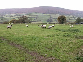
Blorenge, also called The Blorenge, is a prominent hill overlooking the valley of the River Usk near Abergavenny, Monmouthshire, southeast Wales. It is situated in the southeastern corner of the Brecon Beacons National Park. The summit plateau reaches a height of 1,841 feet (561 m).

Fan Brycheiniog is the highest peak at a height of 802.5 metres (2,633 ft) in the Black Mountain region of the Brecon Beacons National Park in southern Wales. There is a trig point at the peak and on the edge of the escarpment, and nearby, a stone shelter with an inner seat. It lies just inside the historic county of Brecknockshire which gives the mountain its Welsh name. A subsidiary top, less than a kilometre from the summit along the ridge to the northwest, is the highest point of the neighboring county of Carmarthenshire. Fan Brycheiniog is also within the Fforest Fawr Geopark designated in 2005 in recognition of the area's geological heritage. The views of the moorland and open country to the north are spectacular when the weather is clear, and reveals the isolation of the range, especially when compared with the more popular Pen y Fan range to the east.

Cefn yr Ystrad is a mountain in the Brecon Beacons National Park in Wales. It is an outlier of the Central Beacons group.

Pen Cerrig-calch is a subsidiary summit of Waun Fach in the Black Mountains in the Brecon Beacons National Park in southern Powys, Wales. Its summit, at a height of 701m (2,300 ft), is marked by a trig point. The peak sits high above the River Usk valley as it narrows above the small town of Crickhowell.The views from here are wide-ranging and extend as far as the Beacons themselves to the west. A ridge runs off to the northwest and the shoulder of Pen Gloch-y-pibwr then turns north to the secondary top of Pen Allt-mawr whose peak at 719m is also crowned by a trig point.

Mynydd Machen is a 362-metre-high (1,188 ft) hill lying between the town of Risca and the village of Machen in Caerphilly County Borough in south Wales. Its summit is crowned by a trig point and a mast.

Fforest Fawr is an extensive upland area in the county of Powys, Wales. Formerly known as the Great Forest of Brecknock in English, it was a royal hunting area for several centuries but is now used primarily for sheep grazing, forestry, water catchment and recreation. It lies within the Brecon Beacons National Park.

Mynydd Llangatwg or Llangattock Mountain is a hill in the Brecon Beacons National Park in the county of Powys, south Wales. It is named from the village of Llangatwg which sits in the valley of the River Usk to the north of it. It is essentially an undulating plateau rising in the west to a height of 530 metres (1,740 ft) at grid reference SO171157 and in the east to a height of 529 metres (1,736 ft) at Hen Dy-aderyn / Twr Pen-cyrn. This spot is marked by a trig point. The shallow pool of Pwll Gwy-rhoc sits in a broad depression towards the northern edge of the plateau whilst a smaller pool frequently occupies a large shakehole a few hundred metres to its west. The hill forms an impressive northern scarp overlooking the Usk valley and commonly referred to as the Llangattock Escarpment. Its southern margins are more subdued. Its eastern end is defined by the drops into the Clydach Gorge. Beyond the B4560 to the west the hill merges with Mynydd Llangynidr which has a similar character.
Mynydd Llangynidr is a mountain in the Brecon Beacons National Park largely in the county of Powys, south Wales. Its southern slopes extend into the northernmost parts of the county borough of Blaenau Gwent. It is named from the village of Llangynidr which sits in the valley of the River Usk to the north of it. It is essentially an undulating plateau rising in the west to a height of 557m at Garn Fawr at OS grid ref SO 123151. A secondary high point is achieved at a point marked by a trig point at SO 147159. To the north the hill overlooks the valleys of Dyffryn Crawnon and Cwm Claisfer, themselves tributary valleys of the Usk. The shallow upper valley of the Ebbw River reaches into the plateau in the southeast whilst the upper reaches of the Sirhowy Valley and its tributary the Nant Trefil define its western margins. A further tributary, the Nant Milgatw, reaches in from the south whilst the sharp edge of Rassau Industrial Estate also defines a part of its southern margin. Passing east across the B4560, the hill merges with Mynydd Llangatwg which has a similar character.

Foel Fraith is a hill in the Black Mountain in the county of Carmarthenshire, southwest Wales. It lies within the Brecon Beacons National Park and Fforest Fawr Geopark. Its plateau-like summit attains a height of 602 metres (1,975 ft) above sea level. To the north the subsidiary summit of Cefn y Cylchau reaches 556 feet (169 m), and to the southeast is the subsidiary summit of Carn Fadog or Cefn Carn Fadog, which reaches a height of 512 metres (1,680 ft).

Mynydd-y-glog is a hill just east of the village of Penderyn in the northern corner of the county borough of Rhondda Cynon Taff in south Wales. It lies within the Brecon Beacons National Park and Fforest Fawr Geopark. Its summit plateau rises to a height of 389m / 1277 ft at OS grid ref SN 982088, a spot marked by a trig point. To its north lies the partly dry valley of Pant Sychbant which forms the eastern extension of Cwm Cadlan. Its southern slopes are drained by various streams which feed into the Afon Cynon.
Penmoelallt or Onllwyn is a hill in the northern part of the county borough of Rhondda Cynon Taff in south Wales. It lies within the Brecon Beacons National Park and Fforest Fawr Geopark. To its east lies the deep valley of Cwm Taf and to its north a rather shallower valley in which the Nant Cadlan originates. To the west is the hill known as Mynydd-y-glog and to the south are slopes draining into the River Taff and the Afon Cynon. The hill culminates in a broken plateau with several knolls rising above the 420m contour. Its afforested nature makes it difficult to determine the precise location of its highest point but this probably lies somewhere around OS grid ref SO 003096. Older maps indicate a spot height of 1376 ft above sea level at SO 000090.
Hatterrall Hill is a rounded peak in the Black Mountains which sits on the Wales-England border, partly in Monmouthshire, Wales and partly in Herefordshire, England. Its summit at 531m is the high point of a peaty plateau which falls away steeply on all sides. Broad ridges run to the north, the southeast and southwest. To the north the ridge dips to a col at around 485m elevation before rising gradually over several kilometres towards Crib y Garth / Black Hill and Hay Bluff. The ridge to the southwest ends abruptly at the sheer cliff known as the Darren below which is a considerable landslipped area extending south to the hamlet of Cwmyoy with its mis-shapen church. The Welsh part of the hill falls within the Brecon Beacons National Park.

Gilwern Hill is a 441 m high hill in the Brecon Beacons National Park, south of the village of Gilwern in Monmouthshire, Wales. It lies west of the Blorenge. The hill is a Site of Special Scientific Interest.

The Marros Group is the name given to a suite of rocks of Namurian age laid down during the Carboniferous Period in South Wales. These rocks were formerly known as the Millstone Grit Series but are now distinguished from the similar but geographically separate rock sequences of the Pennines and Peak District of northern England and northeast Wales by this new name.

Mynydd Cilfach-yr-encil attains a height of 445m at OS grid reference SO 079033 making it the high point of the broad ridge of high ground between Taff Vale and Cwm Bargod in the Valleys region of South Wales. It lies within the unitary area of Merthyr Tydfil.
The geology of Monmouthshire in southeast Wales largely consists of a thick series of sedimentary rocks of different types originating in the Silurian, Devonian, Carboniferous, Triassic and Jurassic periods.

Mynydd y Drum is a hill on the border between the county of Powys and Neath Port Talbot County Borough, south Wales. The summit of the hill is in Neath Port Talbot at 298m and lies towards the western end of a broad curving ridge, the larger part of which is in Powys. The eastern half of the hill is currently being opencasted for coal. The hill is sometimes referred to simply as The Drum.
This article describes the geology of the Brecon Beacons National Park in mid/south Wales. The area gained national park status in 1957 with the designated area of 1,344 km2 (519 sq mi) including mountain massifs to both the east and west of the Brecon Beacons proper. The geology of the national park consists of a thick succession of sedimentary rocks laid down from the late Ordovician through the Silurian and Devonian to the late Carboniferous period. The rock sequence most closely associated with the park is the Old Red Sandstone from which most of its mountains are formed. The older parts of the succession, in the northwest, were folded and faulted during the Caledonian orogeny. Further faulting and folding, particularly in the south of the park is associated with the Variscan orogeny.
The bedrock geology of Carmarthenshire in west Wales consists largely of Palaeozoic age sedimentary rocks. Unconsolidated deposits of Quaternary age in Carmarthenshire include a dissected cover of glacial till, valley floor alluvium and some scattered peat deposits in both upland and lowland settings. There are extensive beach and tidal flat deposits along the Carmarthenshire coast. The exploitation of the county's mineral riches, particularly coal and limestone, was a key part of the local economy through much of the nineteenth and twentieth centuries.
References
- ↑ British Geological Survey 1:50,000 map sheet 232 'Abergavenny' & accompanying sheet memoir
- ↑ "Mynydd Garnclochdy, cairn (67653)". Coflein. RCAHMW . Retrieved 13 February 2020.
- ↑ Ordnance Survey Explorer map OL13 'Brecon Beacons National Park: eastern area'