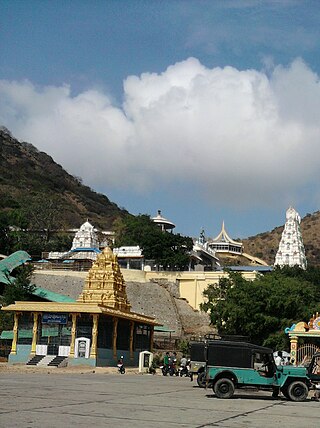
Guntur district is one of the twenty six districts in the Coastal Andhra region of the Indian state of Andhra Pradesh. The administrative seat of the district is located at Guntur, the largest city of the district in terms of area and with a population of 670,073. It has a coastline of approximately 100 km (62 mi) on the right bank of Krishna River, that separates it from Krishna district and NTR district. It is bounded on the south by Bapatla district and on the west by Palnadu district. It has an area of 2,443 km2 (943 sq mi), with a population of 20,91,075, as per 2011 census of India.
Macherla is a town in Palnadu district of the Indian state of Andhra Pradesh. It is the headquarters of Macherla mandal in Gurazala revenue division.

Durgi is a village in Palnadu district of the Indian state of Andhra Pradesh. It is the mandal headquarters of Durgi mandal in Gurazala revenue division. In 15th century, Durgi stone craft was originated in the village.

Gurazala is a town in Palnadu district in the Indian state of Andhra Pradesh. It is the headquarters of Gurazala mandal, Gurazala Assembly constituency and Gurazala revenue division.It was formed as a Nagar Panchayat combining panchayats of Gurazala and (J.M.Puram) Jangamaheswarapuram in 2020 by the government of Andhra Pradesh. The town has a history over 900+ years in the historical palnadu times and served as the headquarters/capital of the region during 11th century.
Dachepalle town is the Municipality in Palnadu District of the Indian State of Andhra Pradesh.Town is the second lime city of India.This place is surrounded by good limestone resource.
Ipur is a village in Palnadu district of the Indian state of Andhra Pradesh. It is the headquarters of Ipur mandal in Narasaraopet revenue division.
Karempudi is a village in Palnadu district of the Indian state of Andhra Pradesh. It is the headquarters of Karempudi mandal in Gurazala revenue division.
Muppalla (Muppalla) is a village palnadu district of the Indian state of Andhra Pradesh. It is located in Muppalla village ipur mondal of Guntur revenue division.
Cherlagudipadu is a village in Palnadu district of the Indian state of Andhra Pradesh. It is located in Gurazala mandal of Gurazala revenue division.
Rayavaram is a village in Palnadu district of the Indian state of Andhra Pradesh. It is located in Macherla mandal of Gurazala revenue division.
Vaddemgunta is a village in Palnadu district of the Indian state of Andhra Pradesh. It is the headquarters of Bollapalle mandal in Narasaraopet revenue division.
Adigoppula is a village in Palnadu district of the Indian state of Andhra Pradesh. It is located in Durgi mandal of Gurazala revenue division, and the distance from Adigoppila to Gurazala is 23 kilometers. The Gram Panchayat is Adigoppula. The mandal headquarters is Durgi, and the distance from Adigoppula to Durgi is 9 kilometers. The district headquarters is Guntur, and the distance from Adigoppula to Guntur is 99 kilometers. The nearest towns are Macherla and Karempudi, and the distance from Adigoppula to Macherla is 22 kilometers. Adigoppula's pincode is 522612.
Gottimukkala is a village in Palnadu district of the Indian state of Andhra Pradesh. It is located in Gurazala mandal of Gurazala revenue division.
Vijayapuri South is a village in Palnadu district of the Indian state of Andhra Pradesh. It is located in Macherla mandal of Gurazala revenue division.
Kambhampadu is a village in Palnadu district of the Indian state of Andhra Pradesh. It is located in Macherla mandal of Gurazala revenue division.
Pulipadu is a village in Palnadu district of the Indian state of Andhra Pradesh. It is located in Gurazala mandal of Gurazala revenue division.
Gogulapadu is a village in Palnadu district of the Indian state of Andhra Pradesh. It is located in Gurazala mandal of Gurazala revenue division.
Kothapalle is a village in Palnadu district of the Indian state of Andhra Pradesh. It is located in Macherla mandal of Gurazala revenue division.

Palnadu district is a district in coastal Andhra Region in the Indian state of Andhra Pradesh. With Narasaraopet as its administrative headquarters, it was formed on 4 April 2022 to become one of the resultant twenty-six districts The district was formed from Gurazala, Sattenapalli and Narasaraopet revenue divisions from Palnadu district. The district covers most of the Palnadu region.


