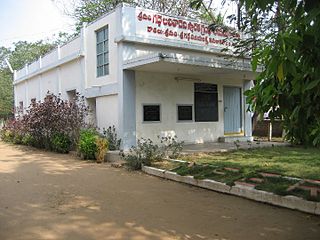
Nadimpalle

Last updated

Nadimpalle
Village
Nadimpalle
Dynamic map
India Andhra Pradesh location map (current).svg
Red pog.svg
Nadimpalle
Location in Andhra Pradesh, India
Coordinates: 16°04′00″N80°42′49″E / 16.0667872°N 80.7137338°E / 16.0667872; 80.7137338
Country India
State Andhra Pradesh
District Guntur
Mandal Cherukupalle
Government
[1]
  Type Panchayati raj
  BodyNadimpalle gram panchayat
Area
[2]
  Total520 ha (1,280 acres)
Population
 (2011) [3]
  Total2,653
  Density510/km2 (1,300/sq mi)
Languages
  Official Telugu
Time zone UTC+5:30 (IST)
PIN
522259 [4]
Area code +91–8644
Vehicle registration AP

Nadimpalle is a village in Guntur district of the Indian state of Andhra Pradesh. It is the located in Cherukupalle mandal of Tenali revenue division. [2]

Contents

Etymology

According Nadimpalli village kaifiyat (available in Village Kaifiyats of Guntur Vol-5) the name seems to have come from location of village lying in between Gudavalli and Ponnapalli. Naduma in Telugu means middle/ in between. Since the village lies in between the above villages it got the name Nadimpalli [5]

History

As per village kaifiyat, this village existed as far back as 1141 AD. The same fact was supported by village kaifiyats of Gudavalli, panchalavaram as well. [6]

As per village kaifiyat during 12th century the village was given as Mirasi (karanikam/inam) to certain Brahmins by Goparaju Ramanna the then prime minister to King Ganapati of Gajapathi dynasty

The kaifiyat also states there were some dilapidated shiva temple in the village and the pond east of it was called Kanchara Gutta as it was excavated by certain person named Kanchara

Mahasivaratri used to be celebrated in Saileswaraswamy temple for one day on Magha Bahula Chaturdasi (Jan-Feb) [7]

Geography

Nadimpalle is situated to the northwest of the mandal headquarters, Arumbaka, [8] at 16°04′00″N80°42′49″E / 16.0667872°N 80.7137338°E / 16.0667872; 80.7137338 . It is spread over an area of 520 ha (1,300 acres). [2]

Demographics

The village is home to 2,653 people with 808 households. The population consists of 12% schedule castes and 0% schedule tribes. It has healthy sex ratio of 1058 females per 1000 male in the village. The population of this village increased by 2.6% between 2001-11. [2]

Government and politics

Nadimpalle gram panchayat is the local self-government of the village. [1] It is divided into wards and each ward is represented by a ward member. [9]

Education

As per the school information report for the academic year 2018–19, the village has a total of 3 Mandal Parishad schools. [10]

See also

Related Research Articles

<span class="mw-page-title-main">Gudavalli, Guntur district</span> Village in Andhra Pradesh, India

Gudavalli is a village in Guntur district of the Indian state of Andhra Pradesh. It is the located in Cherukupalle mandal of Tenali revenue division.

Appikatla is a village in Bapatla district of the Indian state of Andhra Pradesh. It is located in Bapatla mandal of Tenali revenue division.

Amruthalur is a village in Guntur district of the Indian state of Andhra Pradesh. It is the headquarters of Amruthaluru mandal in Tenali revenue division. The village forms a part of Andhra Pradesh Capital Region and is under the jurisdiction of APCRDA.

Bollapalle is a village in Palnadu district of the Indian state of Andhra Pradesh. It is the headquarters of Bollapalle mandal in Narasaraopet revenue division. It is the headquarters of Bollapalle mandal.

Edlapadu is a village in Palnadu district of the Indian state of Andhra Pradesh. It is the headquarters of Edlapadu mandal in Narasaraopet revenue division.

Kakumanu is a village in Guntur district of the Indian state of Andhra Pradesh. It is the headquarters of Kakumanu mandal in Tenali revenue division.

Karlapalem is a village in Bapatla district of the Indian state of Andhra Pradesh. It is the headquarters of Karlapalem mandal in Tenali revenue division.

<span class="mw-page-title-main">Kollipara</span> Village in Andhra Pradesh, India

Kollipara is a village in Guntur district of the Indian state of Andhra Pradesh. It is the headquarters of Kollipara mandal in Tenali revenue division. And it was one of the capital for Pericchedi.

Poondla is a village in Guntur district of the Indian state of Andhra Pradesh. It is located in Bapatla mandal of Tenali revenue division.

<span class="mw-page-title-main">Vejendla</span> Village in Andhra Pradesh, India

Vejendla is a village in Guntur district of the Indian state of Andhra Pradesh. It is supposed to be the headquarters of Chebrolu mandal in Tenali revenue division. It is located in Chebrolu mandal of Tenali revenue division.

Rambhotlapalem is a village in Guntur district of the Indian state of Andhra Pradesh. It is the located in Cherukupalle mandal of Tenali revenue division. Piped Water Supply scheme under ARWSP, provides water to the residents.

Pedapalem is a village in Palnadu district of the Indian state of Andhra Pradesh. It is the headquarters of Atchampet mandal in Guntur revenue division. The village forms a part of Andhra Pradesh Capital Region and is under the jurisdiction of APCRDA.

Nemalikallu is a village in Palnadu district of the Indian state of Andhra Pradesh. It is located in Amaravathi mandal of Guntur revenue division. The village forms a part of Andhra Pradesh Capital Region, under the jurisdiction of APCRDA.

Chamarru is a village in Palnadu district of the Indian state of Andhra Pradesh. It is the headquarters of Atchampet mandal in Guntur revenue division. The village forms a part of Andhra Pradesh Capital Region and is under the jurisdiction of APCRDA.

Korrapadu is a village in Guntur district of the Indian state of Andhra Pradesh. It is located in Medikonduru mandal of Guntur revenue division.

Perali is a village in Guntur district of the Indian state of Andhra Pradesh. It is located in Karlapalem mandal of Tenali revenue division.

Pasumarru is a village in PalnaduGuntur district of the Indian state of Andhra Pradesh. It is the headquarters of Chilakaluripet mandal in Narasaraopet revenue division.

Garikapadu is a village in Guntur district of the Indian state of Andhra Pradesh. It is located in Kakumanu mandal of Tenali revenue division.

<span class="mw-page-title-main">Krishnayapalem</span> Neighbourhood in Guntur, Andhra Pradesh, India

Krishnayapalem is a village of the Indian state of Andhra Pradesh. It is a denotification as gram panchayat in Mangalagiri mandal of Guntur district.

Penumuli is a village in Guntur district of the Indian state of Andhra Pradesh. It is the mandal headquarters of Duggirala mandal in Tenali revenue division. Present sarpanch of penumuli was elected in the year of 2021 February 10 was Koritala Padmavathi.

References

  1. 1 2 "Gram Panchayat Identification Codes" (PDF). Saakshar Bharat Mission. National Informatics Centre. p. 99. Archived from the original (PDF) on 18 August 2017. Retrieved 9 May 2019.
  2. 1 2 3 4 "District Census Hand Book : Guntur (Part B)" (PDF). Census of India . Directorate of Census Operations, Andhra Pradesh. 2011. pp. 14, 480. Retrieved 2 June 2019.
  3. "Population". Census of India . Registrar General and Census Commissioner of India . Retrieved 9 May 2019.
  4. "Pin Code: Kanagala (guntur), Guntur, Andhra Pradesh is 522259". Pincode.org.in. Retrieved 9 December 2015.
  5. "GUNTURU ZILLA GRAMA KAIFIYYATHULU-1990 (VOL-5).pdf". Google Docs. Retrieved 4 July 2019.
  6. "GUNTURU ZILLA GRAMA KAIFIYYATHULU-1990 (VOL-5).pdf". Google Docs. Retrieved 4 July 2019.
  7. Sekhar, Chandra (1961). Census of India 1961 (PDF). Vol. 2.
  8. "District Census Handbook : Guntur (Part A)" (PDF). Census of India. Directorate of Census Operations, Andhra Pradesh. 2011. pp. 5, 794–795. Retrieved 4 June 2019.
  9. Seetharam, Mukkavilli (1 January 1990). Citizen Participation in Rural Development. Mittal Publications. p. 34. ISBN   9788170992271.
  10. "School Information". Commissionerate of School Education. Government of Andhra Pradesh. Retrieved 7 May 2019.