Nagalaphu

Last updated

Nagalaphu
India Uttarakhand relief map.svg
Red triangle with thick white border.svg
Nagalaphu
Location in northern India
Tibet loc rel map.svg
Red triangle with thick white border.svg
Nagalaphu
Nagalaphu (Tibet)
India relief location map.jpg
Red triangle with thick white border.svg
Nagalaphu
Nagalaphu (India)
Highest point
Elevation 6,410 m (21,030 ft)
Prominence 440 m (1,440 ft)
Listing List of mountains in India
Coordinates 30°14′24″N80°25′48″E / 30.24000°N 80.43000°E / 30.24000; 80.43000 Coordinates: 30°14′24″N80°25′48″E / 30.24000°N 80.43000°E / 30.24000; 80.43000
Geography
Location Pithoragarh, Uttarakhand, India
Parent range Kumaon Himalaya
Nagalaphu

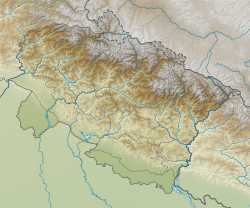
Nagalaphu is a Himalayan mountain peak located in the Pithoragarh district of Uttarakhand state in India. [1]
History

It is the part of Himalayan mountain massif that divides Lassar-Darma valley and Ralam-Gori Ganga valley. Its summit reaches an altitude of 6,410 metres (21,030 ft) above sea level.

South of the peak are the five peaks of Panchachuli. Sona and Meola glaciers (that together form the Panchchuli Glacier) are to the east of Nagalaphu. To the peak's west is the large Uttari Balati glacier.

Nagalaphu has yet to be scaled.

Related Research Articles

Kangchenjunga Third highest mountain in the world

Kangchenjunga, also spelled Kanchenjunga, is the third highest mountain in the world. It rises with an elevation of 8,586 m (28,169 ft) in a section of the Himalayas called Kangchenjunga Himal delimited in the west by the Tamur River, in the north by the Lhonak Chu and Jongsang La, and in the east by the Teesta River. It lies between India and Nepal, with three of the five peaks, namely Main, Central and South, directly on the border, and the peaks West and Kangbachen in Nepal's Taplejung District.

Himalayas Mountain range in Asia

The Himalayas, or Himalaya, are a mountain range in Asia separating the plains of the Indian subcontinent from the Tibetan Plateau. The range has some of the planet's highest peaks, including the highest, Mount Everest. Over 100 peaks exceeding 7,200 m (23,600 ft) in elevation lie in the Himalayas. By contrast, the highest peak outside Asia is 6,961 m (22,838 ft) tall.

Karakoram Major mountain range spanning the borders between India, Pakistan, and China

The Karakoram is a mountain range spanning the borders of China, India, and Pakistan, with the northwest extremity of the range extending to Afghanistan and Tajikistan. It begins in the Wakhan Corridor (Afghanistan) in the west, encompasses the majority of Gilgit-Baltistan, and extends into Ladakh and Aksai Chin. It is the second highest mountain range in the world and part of the complex of ranges including the Pamir Mountains, the Hindu Kush and the Himalayan Mountains. The Karakoram has eighteen summits over 7,500 m (24,600 ft) height, with four of them exceeding 8,000 m (26,000 ft): K2, the second highest peak in the world at 8,611 m (28,251 ft), Gasherbrum I, Broad Peak and Gasherbrum II.

Nanda Devi Second-highest mountain in India

Nanda Devi is the second-highest mountain in India, after Kangchenjunga, and the highest located entirely within the country. It is the 23rd-highest peak in the world.

Kamet Mountain in Uttarakhand, India

Kamet is the second highest mountain in the Garhwal region of Uttarakhand, India, after Nanda Devi. It lies in the Chamoli District of Uttarakhand. Its appearance resembles a giant pyramid topped by a flat summit area with two peaks.

Gangotri National Park Indian national park

Gangotri National Park is a national park in Uttarkashi District of Uttarakhand in India, covering about 2,390 km2 (920 sq mi). Its habitat consists of coniferous forests, alpine meadows and glaciers. Gaumukh at Gangotri glacier, the origin of river Ganga, is located inside the park. Gangotri National Park was established in 1989.

Burphu Dhura Mountain in Uttarakhand, India

Burphu Dhura is a Himalayan mountain peak situated in the Pithoragarh district of Uttarakhand, India. The altitude of the summit is 6,334 m. It is situated at the end ridge over the Kalabaland Glacier in the eastern part of the district, left to the Milam Glacier. Kalabaland Dhura (6,105 m) is situated to the west of this peak on the same massif. Burphu Dhura massif is the part of divide between Kalabaland and Goriganga valleys. This peak was first of all climbed to summit in 2000 from south on 27 September 2000 by Loveraj Dharmashaktu, Balwant Singh Kapkoti and Ramesh by an Indian team led by Wing Cdr S S Puri. The peak has two approaches—one from the Kalabaland glacier above the icefall and another from Burphu village in the Milam valley.

Nanda Devi National Park A national park situated around the peak of Nanda Devi in the state of Uttarakhand in northern India

The Nanda Devi National Park or Nanda Devi Biosphere Reserve, established in 1982 is a national park situated around the peak of Nanda Devi in Chamoli Garhwal district of Uttarakhand, in northern India. The entire park lies at an elevation of more than 3,500 m (11,500 ft) above mean sea level.

K6 (mountain) Mountain in Pakistan

Surveyed as K6, but also known as Baltistan Peak, it is a notable peak of the Masherbrum Mountains, a subrange of the Karakoram mountain range in the Gilgit Baltistan region of Pakistan. Despite being much lower than adjoining mountains, the Eight-thousanders and high 7000m peaks such as Masherbrum, K6 has huge, steep faces, and great relief above the nearby valleys.

Saltoro Mountains Subrange of the Karakoram located on the southwestern side of the Siachen Glacier in Kashmir

The Saltoro Mountains are a subrange of the Karakoram Range. They are located in the southeast Karakoram on the southwest side of the Siachen Glacier, one of the two longest glaciers outside the polar regions. The name given to this range is shared with the Saltoro Valley which is located to the west of this range, downslope on the Pakistan side of the Saltoro Range which generally follows the Actual Ground Position Line. Saltoro Kangri peak, Saltoro River, and Saltoro Valley are features on this range. The Actual Ground Position Line (AGPL) between Indian and Pakistan held area runs through this range, where the high peaks and passes of the Siachen area are held by India, whereas Pakistan occupies the lower peaks and valleys to the west.

Rimo I Rimo massif Located in Kashmir

Rimo I is the main summit of the Rimo massif with an elevation of 7,385 metres (24,229 ft). It lies in the northern part of the remote Rimo Muztagh, a subrange of the Karakoram range. It is located about 20 km northeast of the snout of the Siachen Glacier and is the world's 71st highest mountain. Rimo means "striped mountain". The Rimo Glacier, originating here, drains to the Shyok river.

Geography of Himachal Pradesh

The state of Himachal Pradesh is spread over an area 55,673 km2 (21,495 sq mi) and is bordered by Jammu and Kashmir and Ladakh on the north, Punjab on the southwest, Haryana on the south, Uttarakhand on the southeast, a small border with Uttar Pradesh in the south, and Tibet on the east. Entire Himachal Pradesh lies in the mountainous Himalaya region, rich in natural resources.

Nun Kun Mountain in the Jammu and Kashmir, India

The Nun Kun mountain massif consists of a pair of Himalayan peaks: Nun, 7,135 m (23,409 ft) and its neighbor peak Kun Peak, 7,077 m (23,218 ft). Nun is one of the highest peaks in the part of the Himalayan range lying on the Indian side of the Line of Control in Ladakh. The massif is located near Sankoo in the Suru valley, Kargil district about 250 km (160 mi) east of Srinagar, the capital of neighbouring Jammu and Kashmir. The Nun Kun massif is bounded to the north by the Suru valley and the Zanskar range. To the east, it is flanked by the Suru valley and the Pensila(4400m), a pass which separates Suru from the Zanskar Valley. To the South lies the Kishtwar National Park and the Krash Nai river. While to the southwest and to the south lie a maze of glaciers, peaks and rivers giving access to Kashmir, Kishtwar and Doda regions of the union territory of Jammu and Kashmir. The rocks predominantly are stratified sedimentary rocks composed of shale and sandstone. Metamorphic rocks and granite formations are also seen at places. The area is rich in minerals especially garnets.

Dras River

The Dras River, also spelt Drass River, is a river in the Kargil district in the Indian union territory of Ladakh. It originates below the Zoji La pas in the Great Himalayan range and flows northeast towards Kargil, where it joins the Suru River. The Shingo River, which flows in a parallel direction in Pakistan-administered Baltistan, also joins the Drass River. The combined river is alternatively called Suru, Drass and Shingo by various local groups.

Drang-Drung Glacier

The Drang-Drung Glacier is a mountain glacier near the Pensi La mountain pass at the Kargil - Zanaskar Road in the Kargil district of Ladakh in India.

Geography of Uttarakhand

Uttarakhand has a total geographical area of 53,483 km2, of which 86% is mountainous and 65% is covered by forest. Most of the northern parts of the state are part of Greater Himalayan ranges also known as Himadri, covered by the high Himalayan peaks and glaciers, while the lower foothills were densely forested till denuded by the British log merchants and later, after independence, by forest contractors. Recent efforts in afforestation, however, have been successful in restoring the situation to some extent. The unique Himalayan ecosystem plays host to many animals, plants and rare herbs. Two of the India's great rivers, the Ganges and the Yamuna take birth in the glaciers of Uttarakhand state, and are fed by myriad lakes, glacial melts and streams. It is fed by Ganges and Yamuna rivers.

Mountains of Bhutan Highlands of Bhutan

The mountains of Bhutan are some of the most prominent natural geographic features of the kingdom. Located on the southern end of the Eastern Himalaya, Bhutan has one of the most rugged mountain terrains in the world, whose elevations range from 160 metres (520 ft) to more than 7,000 metres (23,000 ft) above sea level, in some cases within distances of less than 100 kilometres (62 mi) of each other. Bhutan's highest peak, at 7,570 metres (24,840 ft) above sea level, is north-central Gangkhar Puensum, close to the border with China; the third highest peak, Jomolhari, overlooking the Chumbi Valley in the west, is 7,314 metres (23,996 ft) above sea level; nineteen other peaks exceed 7,000 metres (23,000 ft). Weather is extreme in the mountains: the high peaks have perpetual snow, and the lesser mountains and hewn gorges have high winds all year round, making them barren brown wind tunnels in summer, and frozen wastelands in winter. The blizzards generated in the north each winter often drift southward into the central highlands.

Kolahoi Peak Mountain in Anantnag district, Jammu & Kashmir (J&K), India

Kolahoi Peak is the highest mountain with a peak elevation of 17,799 ft, in Jammu and Kashmir, in the vicinity of Sonamarg in ganderbal district. Kolahoi Peak is part of the Himalaya Range, and is located between 15 km south of Sonamarg and 21 km north from Aru, Pahalgam. To its north flows the Sind River and the glacier of its name Kolahoi Glacier is the source of Lidder River. in the vicinity of Kashmir valley.

Machoi Peak

Machoi Peak is a mountain with a peak elevation of 17,907 ft, in Drass region of Ladakh and Ganderbal district of Jammu and Kashmir, India. Machoi Peak is part of the Himalaya Range, and is located between Amarnath cave and Zojila. It lies 105 km north east from Srinagar, 25 km from Sonamarg in the east and 30 km from Drass. It rises from the glacier of its name Machoi Glacier is the source of Dras River in Drass, Ladakh and Sind River in the vicinity of Kashmir valley. Machoi Peak rises from the Machoi glacier is a pyramid-shaped peak with ice falls and ice fields at its bottom and ridges.

Shafat Glacier

The Shafat Glacier/Parkachik Glacier is a 14 kilometres (9 mi) long glacier in the north eastern Himalayan Range.

References

  1. "Mountains of India" Maps of India. Retrieved 2014-7-21.