Related Research Articles
The Klinaklini River is one of the major rivers of the Pacific Ranges section of the Coast Mountains in the Canadian province of British Columbia. It originates in the Pantheon Range and empties into the head of Knight Inlet.
The Stuart River or Nak'alkoh is one of the largest tributaries of the Nechako River in northeastern British Columbia, Canada. The Nechako is in turn one the more important tributaries of the Fraser River. The Stuart River flows 187 kilometres (116 mi) from Stuart Lake to its junction with the Nechako River. The river drains a portion of the Nechako Plateau—a gently-rolling region characterized by small lakes and tributaries. Low but impressive ridges interact with the river, creating high bluffs and hoodoos.
The Taseko River or Dasiqox in the original Chilcotin, is a tributary of British Columbia's Chilko River, a tributary of the Chilcotin River which joins the Fraser near the city of Williams Lake.
The Kitwanga River is a tributary of the Skeena River near Hazelton in northwestern British Columbia, Canada, joining that stream at the community of Kitwanga (Gitwangak), which means "people of the place of rabbits".

The Kitlope River is a river in the Kitimat Ranges in the North Coast of British Columbia, Canada, flowing north for 100 km (62 mi), into the head of the Gardner Canal to the south of the smelter town of Kitimat. It is named for the Gitlope group of Haisla, now part of the Haisla Nation government and community at Kitamaat Village near Kitimat. The name is a Tsimshian language reference to the people, who call themselves Henaksiala, and means "people of the rocks" or "people of the opening in the mountains". The Haisla language name for the river is Xesduwaxwsdu.

The Cariboo River is a tributary of the Quesnel River, one of the main tributaries of the Fraser River, in the Canadian province of British Columbia. It flows through the Cariboo region of the British Columbia Interior, southeast of Prince George. Above Cariboo Lake it was formerly known as the Swamp River. The name was adopted, and replaced the former names, in 1936 in association with Cariboo Lake.

Kanaka Creek is a tributary of the Fraser River, in the Canadian province of British Columbia. It flows through Maple Ridge, a district municipality at the eastern edge of Metro Vancouver.
The Baezaeko River is a tributary of the West Road River, one of the main tributaries of the Fraser River, in the Canadian province of British Columbia. It flows through the Fraser Plateau to the West Road River.
The Morkill River is a tributary of the Fraser River in the Canadian province of British Columbia.
Barrière River is a tributary of the North Thompson River, one of the main tributaries of the Fraser River, in the Canadian province of British Columbia. It flows through the Shuswap Highland region north of Kamloops. Its name in Secwepemctsín is St́yelltsecwétkwe.
The Nazko River is a tributary of the West Road River, one of the main tributaries of the Fraser River, in the Canadian province of British Columbia. It flows through the Fraser Plateau region west of Quesnel.
The Raft River is a tributary of the North Thompson River, one of the main tributaries of the Fraser River, in the Canadian province of British Columbia. It flows through the Shuswap Highland region southeast of Wells Gray Provincial Park. Most of the Raft River's watershed lies outside the boundaries of Wells Gray, except for some of the headwaters of the West Raft River tributary.
The Ecstall River is a tributary of the Skeena River in the province of British Columbia, Canada. It originates in the Kitimat Ranges, and flows about 110 km (68 mi) to the lower tidal reach of the Skeena River at Port Essington, about 30 km (19 mi) southeast of Prince Rupert, 95 km (59 mi) southwest of Terrace, and 85 km (53 mi) northwest of Kitimat. Its drainage basin covers about 1,485 km2 (573 sq mi) and contains the largest blocks of unlogged land on the north coast of British Columbia, although large-scale industrial logging operations, both active and proposed, have been occurring in the watershed since the 1980s.
The Gitnadoix River is a tributary of the Skeena River in the province of British Columbia, Canada. It originates in the Kitimat Ranges, and flows about 38 km (24 mi) north to the Skeena River, about 45 km (28 mi) west of Terrace.
The Khyex River is a tributary of the Skeena River in the North Coast Regional District of the province of British Columbia, Canada. It originates in the Kitimat Ranges of the Coast Mountains, and flows south about 50 km (31 mi) to the lower tidal reach of the Skeena River, about 13 km (8.1 mi) upriver from Port Essington, 35 km (22 mi) southeast of Prince Rupert, and about 85 km (53 mi) southwest of Terrace. Its watershed covers 442 km2 (171 sq mi), and its mean annual discharge is 458.2 m3/s (16,180 cu ft/s).
The Zymagotitz River is a tributary of the Skeena River located in the North Coast Regional District of the province of British Columbia, Canada. It originates in the Kitimat Ranges of the Coast Mountains, and flows south and west about 45 km (28 mi) to the Skeena River, about 10 km (6.2 mi) downriver from Terrace and about 100 km (62 mi) east of Prince Rupert.
The Scotia River is a tributary of the Skeena River in the North Coast Regional District of the province of British Columbia, Canada. It originates in the Kitimat Ranges of the Coast Mountains, and flows north about 22 km (14 mi) to the tidally-influenced lower Skeena River, about 20 km (12 mi) upriver from Port Essington, 47 km (29 mi) southeast of Prince Rupert, and about 75 km (47 mi) southwest of Terrace.
The Khtada River is a tributary of the Skeena River in the North Coast Regional District of the province of British Columbia, Canada. It originates in the Kitimat Ranges of the Coast Mountains, and flows south about 26 km (16 mi) to the lower tidal reach of the Skeena River, about 24 km (15 mi) upriver from Port Essington, 48 km (30 mi) southeast of Prince Rupert, and about 74 km (46 mi) southwest of Terrace.
The Dudidontu River is a tributary of the Nahlin River in northwest part of the province of British Columbia, Canada. It joins the Nahlin River, which forms the Inklin River, one of the main tributaries of the Taku River. The Dudidontu River's watershed covers 964 km2 (372 sq mi), and its mean annual discharge is 15.4 m3/s (540 cu ft/s). Almost half of the Dudidontu's flow comes from its main tributary, Kakuchuya Creek, and Kakuchuya Creek's main tributary, Matsatu Creek. The mouth of the Dudidontu River is located about 150 km (93 mi) northeast of Juneau, Alaska and about 110 km (68 mi) northwest of Telegraph Creek, British Columbia.

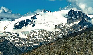
Kwoiek Peak is a 2,736-metre (8,976-foot) mountain summit located in British Columbia, Canada.
References
- ↑ "Canadian 1:50K topographic maps" (map). TopoQuest.com. Retrieved 21 August 2013.
- 1 2 Elevation derived from ASTER Global Digital Elevation Model, using GeoLocator, and BCGNIS coordinates
- 1 2 "Nahatlatch River". BC Geographical Names .
- 1 2 "Archived Hydrometric Data Search". Water Survey of Canada. Archived from the original on 24 December 2010. Retrieved 21 August 2013. Search for Station 08MF065 Nahatlatch River below Tachewana Creek
- ↑ "Nahatlatch Lake". BC Geographical Names .
- ↑ "Hannah Lake". BC Geographical Names .
- ↑ "Frances Lake". BC Geographical Names .
- ↑ Course information in part from "Nahatlatch River, Canadian 1:50K topographic maps" (map). TopoQuest.com. Retrieved 21 August 2013.
- ↑ "Mehatl Creek Provincial Park". BC Parks. Retrieved 21 August 2013.
- ↑ "Nahatlatch Provincial Park and Protected Area". BC Parks. Retrieved 21 August 2013.