Boston Bar, British Columbia

Last updated

Boston Bar
Unincorporated place
Boston Bar's welcome sign.JPG
Boston Bar's welcome sign
CountryFlag of Canada (Pantone).svg  Canada
Province Flag of British Columbia.svg  British Columbia
Elevation
166 m (546 ft)
Population
 (2016)
  Total190 [1]
Time zone PST
Highways BC-1 (TCH).svg Hwy 1 (TCH)

Boston Bar is an unincorporated community in the Fraser Canyon of the Canadian province of British Columbia.

Contents

Name

The name dates from the time of the Fraser Canyon Gold Rush (1858–1861). A "bar" is a gold-bearing sandbar or sandy riverbank, and the one slightly down river and opposite today's town was populated heavily by Americans, who were known in the parlance of the Chinook Jargon as "Boston men" or simply "Bostons". A settlement developed on the east bank of the river to the north of the confluence with Anderson River. This was later moved to the present site with the construction of Canadian Northern Pacific Railway. [2] [3]

The original Nlaka'pamuctsin (Thompson Salish) name of Boston Bar was rendered in English-style spelling as Quayome, which appears commonly on frontier-era maps and in diaries and newspapers of the day. The name originally referred to the other side of the river from today's town, but came into use for the present site after the original was renamed North Bend by the Canadian Pacific Railway.

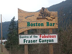
In June 2011, Boston Bar briefly unofficially changed its name to "Vancouver Bar", in an effort to support the nearby Vancouver Canucks hockey team of the NHL in the 2011 Stanley Cup Finals as they took on the Boston Bruins. This followed Canadian restaurant chain Boston Pizza unofficially changing their name to "Vancouver Pizza" during the same round of the playoffs. [4]

Boston Bar Boston Bar.JPG
Boston Bar

North Bend

Across the Fraser River is the small town of North Bend, which could only be accessed by rail or by aerial ferry until January 1986 when the two lane bridge was built. The Canadian Pacific Railway (CPR) has a small terminal here that is the half way point between Vancouver and Kamloops. The building of the railway played an important role in this region, first with the construction of the CPR line (1881–1885) then later the Canadian Northern Railway (today the Canadian National Railway) line on the Boston Bar side of the river. Boston Bar is a Canadian National Railway divisional point, where the Ashcroft Subdivision from Kamloops to Boston Bar joins the Yale Subdivision from Boston Bar to Vancouver. North Bend is also at the doorstep of the Nahatlatch Valley, a chain of three lakes and the Nahatlatch River.[ citation needed ]

Climate

Boston Bar sits in a pocket climate created by the confines of the canyon, and though on the edge of the coastal temperate zone just to the south, its climate is subject to the seasonal extremes of temperature common in the interior of the province. It enjoys 4 very distinct seasons with temperatures reaching up to 35-40 °C in the summer and down to -5 to -10 °C in the winter. It is notably the first place inland up the Fraser Canyon where rainfall levels are markedly lower than the rainier stretches from Yale and Spuzzum north to Hell's Gate.

The climate is transitional between marine west coast and continental. The heaviest precipitation occurs in winter, which also has the strongest marine influence in most years. The continental influence is most pronounced in summer, which is hot. The vegetation has a mixture of rain forest and dry interior plant species with bigleaf maple and western red cedar prominent among the rain forest species and ponderosa pine, more common northward, standing tall as one of the Interior species. Douglas-fir is the most common tree. Boston Bar is in the Interior Douglas-fir zone, wet warm subzone (IDFww).

One consequence of the climate is that Boston Bar is in the range of the northern Pacific rattlesnake, which is common in areas farther upstream along the Fraser and Thompson Rivers, such as Lytton. [5]

Boston Bar has a warm-summer mediterranean climate (Csb). [6]

Boston Bar experienced wildfires during the 2021 Western North America heat wave, with firefighters battling them. [7] The highway between the town and Spences Bridge was closed in early July 2021 and many residents of nearby Lytton were evacuated to Boston Bar after Lytton was almost completely destroyed by wildfires due to extreme temperatures. [8]

Climate data for Boston Bar 1981-2010 (49.863 -121.444)
MonthJanFebMarAprMayJunJulAugSepOctNovDecYear
Mean daily maximum °C (°F)2.0
(35.6)
5.4
(41.7)
10.7
(51.3)
16.2
(61.2)
20.6
(69.1)
24.1
(75.4)
28.3
(82.9)
28.3
(82.9)
22.8
(73.0)
13.8
(56.8)
5.8
(42.4)
1.2
(34.2)
14.9
(58.9)
Daily mean °C (°F)−0.4
(31.3)
1.9
(35.4)
5.9
(42.6)
10.1
(50.2)
14.1
(57.4)
17.5
(63.5)
20.9
(69.6)
20.8
(69.4)
15.9
(60.6)
9.5
(49.1)
3.3
(37.9)
−1.2
(29.8)
9.9
(49.7)
Mean daily minimum °C (°F)−2.8
(27.0)
−1.6
(29.1)
1.1
(34.0)
3.9
(39.0)
7.5
(45.5)
11.0
(51.8)
13.4
(56.1)
13.4
(56.1)
9.0
(48.2)
5.2
(41.4)
0.8
(33.4)
−3.6
(25.5)
4.8
(40.6)
Average precipitation mm (inches)103
(4.1)
76
(3.0)
64
(2.5)
38
(1.5)
35
(1.4)
32
(1.3)
17
(0.7)
19
(0.7)
36
(1.4)
89
(3.5)
137
(5.4)
112
(4.4)
758
(29.9)
Source: http://www.climatewna.com/ClimateBC_Map.aspx

See also

Related Research Articles

<span class="mw-page-title-main">British Columbia</span> Province of Canada

British Columbia is the westernmost province of Canada. Situated between the Pacific Ocean and the Rocky Mountains, the province has a diverse geography, with rugged landscapes that include rocky coastlines, sandy beaches, forests, lakes, mountains, inland deserts and grassy plains. British Columbia borders the province of Alberta to the east; the territories of Yukon and Northwest Territories to the north; the U.S. states of Washington, Idaho and Montana to the south, and Alaska to the northwest. With an estimated population of over 5.6 million as of 2024, it is Canada's third-most populous province. The capital of British Columbia is Victoria, while the province's largest city is Vancouver. Vancouver and its suburbs together make up the third-largest metropolitan area in Canada, with the 2021 census recording 2.6 million people in Metro Vancouver. British Columbia is Canada's third-largest province in terms of total area, after Quebec and Ontario.

<span class="mw-page-title-main">Fraser River</span> River in British Columbia, Canada

The Fraser River is the longest river within British Columbia, Canada, rising at Fraser Pass near Blackrock Mountain in the Rocky Mountains and flowing for 1,375 kilometres (854 mi), into the Strait of Georgia just south of the City of Vancouver. The river's annual discharge at its mouth is 112 cubic kilometres (27 cu mi) or 3,550 cubic metres per second (125,000 cu ft/s), and each year it discharges about 20 million tons of sediment into the ocean.

<span class="mw-page-title-main">Fraser Valley</span> Geographical region in British Columbia

The Fraser Valley is a geographical region in southwestern British Columbia, Canada and northwestern Washington State. It starts just west of Hope in a narrow valley encompassing the Fraser River and ends at the Pacific Ocean stretching from the North Shore Mountains, opposite the city of Vancouver BC, to just south of Bellingham, Washington.

<span class="mw-page-title-main">Kettle Valley Railway</span> Former subsidiary of the Canadian Pacific Railway on British Columbia

The Kettle Valley Railway was a subsidiary of the Canadian Pacific Railway (CPR) that operated across southern British Columbia, west of Midway running to Rock Creek, then north to Myra Canyon, down to Penticton over to Princeton, Coalmont, Brookmere, Coquihalla and finally Hope where it connected to the main CPR line.

<span class="mw-page-title-main">History of British Columbia</span>

The history of British Columbia covers the period from the arrival of Paleo-Indians thousands of years ago to the present day. Prior to European colonization, the lands encompassing present-day British Columbia were inhabited for millennia by a number of First Nations.

<span class="mw-page-title-main">Andrew Onderdonk</span> American construction contractor

Andrew Onderdonk was an American construction contractor who worked on several major projects in the West, including the San Francisco seawall in California and the Canadian Pacific Railway in British Columbia. He was born in New York City to an established ethnic Dutch family. He received his education at the Rensselaer Polytechnic Institute.

<span class="mw-page-title-main">Thompson River</span> River in British Columbia, Canada

The Thompson River is the largest tributary of the Fraser River, flowing through the south-central portion of British Columbia, Canada. The Thompson River has two main branches, the South Thompson River and the North Thompson River. The river is home to several varieties of Pacific salmon and trout. The area's geological history was heavily influenced by glaciation, and the several large glacial lakes have filled the river valley over the last 12,000 years. Archaeological evidence shows human habitation in the watershed dating back at least 8,300 years. The Thompson was named by Fraser River explorer, Simon Fraser, in honour of his friend, Columbia Basin explorer David Thompson. Recreational use of the river includes whitewater rafting and angling.

<span class="mw-page-title-main">Index of British Columbia–related articles</span>

The following is an alphabetical list of articles related to the Canadian province of British Columbia.

<span class="mw-page-title-main">Lytton, British Columbia</span> Village in British Columbia, Canada

Lytton is a village of about 250 residents in southern British Columbia, Canada, on the east side of the Fraser River and primarily the south side of the Thompson River, where it flows southwesterly into the Fraser. The community includes the Village of Lytton and the surrounding community of the Lytton First Nation, whose name for the place is Camchin, also spelled Kumsheen.

<span class="mw-page-title-main">Yale, British Columbia</span> Town in British Columbia, Canada

Yale is an unincorporated town in the Canadian province of British Columbia, which grew in importance during the Fraser Canyon Gold Rush.

<span class="mw-page-title-main">Fraser Canyon</span> Canyon in British Columbia, Canada

The Fraser Canyon is a major landform of the Fraser River where it descends rapidly through narrow rock gorges in the Coast Mountains en route from the Interior Plateau of British Columbia to the Fraser Valley. Colloquially, the term "Fraser Canyon" is often used to include the Thompson Canyon from Lytton to Ashcroft, since they form the same highway route which most people are familiar with, although it is actually reckoned to begin above Williams Lake at Soda Creek Canyon near the town of the same name.

<span class="mw-page-title-main">British Columbia Interior</span> Interior region of British Columbia, Canada

The British Columbia Interior, popularly referred to as the BC Interior or simply the Interior, is a geographic region of the Canadian province of British Columbia. While the exact boundaries are variously defined, the British Columbia Interior is generally defined to include the 14 regional districts that do not have coastline along the Pacific Ocean or Salish Sea, and are not part of the Lower Mainland. Other boundaries may exclude parts of or even entire regional districts, or expand the definition to include the regional districts of Fraser Valley, Squamish–Lillooet, and Kitimat–Stikine.

The Siska Indian Band is located in the Fraser Canyon region of the Canadian province of British Columbia. It was previously a member of the Scw’exmx Tribal Council, which is a tribal council of the Nlaka'pamux people. Other Nlaka'pamux governments belong either to the Fraser Canyon Indian Administration or the Nlaka'pamux Nation Tribal Council, although the large Lytton First Nation, north of Siska, does not belong to any of the three.

North Bend is an unincorporated community in the Fraser Canyon region of British Columbia, Canada, located across the Fraser River from the town of Boston Bar. North Bend was originally known as Boston Bar, but that name moved across the Fraser River when the site was renamed North Bend.

Boston Bar station is a railway station in Boston Bar, British Columbia, Canada, located at the border of CN's Ashcroft subdivision.

North Bend station is a railway station in North Bend, British Columbia, Canada, located at the border between CPR's Cascade and Thompson subdivision.

Boothroyd is a settlement in the Fraser Canyon region of British Columbia, just north of Boston Bar-North Bend. It sits on a flat, alluvial bench which is some of the only flat land in the Fraser Canyon. It was the site of a Cariboo Roadhouse, run by a man named Boothroyd. Later it was a camp for Canadian Pacific Railway Chinese construction workers from 1882 to 1884.

Keefers is a railway point in the lower Fraser Canyon area of southwestern British Columbia. The ghost town is on the west shore of the Fraser River and north of the mouth of the Nahatlatch River. The locality is by rail about 82 kilometres (50.8 mi) north of Hope and 26 kilometres (15.9 mi) south of Lytton.

<span class="mw-page-title-main">Cisco Bridges</span> Bridge in Siska, BC

The Cisco Bridges are a pair of railroad bridges at Siska near Lytton, British Columbia, Canada. The Canadian Pacific Railway and Canadian National Railway both follow the route of the Fraser River, one on each side, and the routes exchange sides at this point. The easier CPR route was laid first; when the CNR arrived later they needed to follow the more difficult route. The area is popular with railfans due to the proximity of the two bridges, and the easy access to the area is parallel to both bridges down the east bank of the river. Directional running in the Fraser Canyon means that both CPR and CNR trains may be seen on both bridges. Although this area is generally known as Cisco, the actual CN timetable station point of Cisco is approximately 4.0 km (2.5 mi) to the east of the bridges.

<span class="mw-page-title-main">Lytton wildfire</span> 2021 wildfire in Lytton, British Columbia

A wildfire began on June 30, 2021 just south of the village of Lytton in the interior of British Columbia, Canada. The fire destroyed much of Lytton and caused two civilian fatalities, announced July 3. Several missing residents, still unaccounted for at that time, were later located. The fire, one of the 2021 British Columbia wildfires throughout the province, was facilitated by the 2021 Western North America heat wave.

References

  1. "Census Profile, 2016 Census - Boston Bar, Unincorporated place [Designated place], British Columbia and British Columbia". Statistics Canada. Government of Canada. February 8, 2017. Retrieved September 24, 2020.
  2. "Boston Bar (community)". BC Geographical Names .
  3. "Boston Bar (bar)". BC Geographical Names .
  4. Luk, Vivian (June 11, 2011). "Boston Bar to become Vancouver Bar in show of support". The Globe and Mail . Retrieved August 11, 2021.
  5. "Rattlesnake warning issued for southern Interior of B.C.:Several dogs have been bitten and killed in recent years, says expert". CBC News. April 21, 2015.
  6. "ClimateBC_Map". www.climatewna.com. Retrieved January 27, 2019.
  7. "Canada: Firefighters battle 170 wildfires amid heat wave". Deutsche Welle . July 3, 2021. Retrieved July 3, 2021.
  8. Carrigg, David; Raptis, Mike; Bains, Camille; Brown, Scott (July 2, 2021). "B.C. Wildfires: Search underway for Lytton residents missing after village engulfed by fire". Vancouver Sun . Retrieved July 3, 2021.

49°51′50″N121°26′34″W / 49.86389°N 121.44278°W / 49.86389; -121.44278