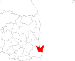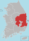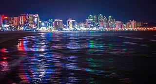
Pohang, formerly spelled Po-Hang, is the largest city in North Gyeongsang Province, South Korea, with a population of 499,363 as of 2022, bordering the Sea of Japan to the east, Yeongcheon to the west, Gyeongju to the south, and Cheongsong and Yeongdeok to the north.

Yeongju is a city in the far north region of North Gyeongsang province in South Korea, covering 668.84 km2 with a population of 113,930 people according to the 2008 census. The city borders Bonghwa county to the east, Danyang county of North Chungcheong province to the west, Andong city and Yecheon county to the south, and Yeongwol county of Gangwon province to the north.

South Korea is made up of 22 first-tier administrative divisions: 6 metropolitan cities, 1 special city, 1 special self-governing city, and 14 provinces, including three special self-governing provinces and five claimed by the ROK government. These are further subdivided into a variety of smaller entities, including cities, counties, districts, towns, townships, neighborhoods and villages.
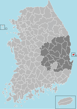
Ulleung County is a county in North Gyeongsang Province, South Korea.
Busan Institute of Science and Technology is a private college located in Buk District, Busan, South Korea. It was called Busan College of Information Technology until February 2012.

Buk District is a gu, or district, in north central Ulsan, South Korea. Its name literally means "North Ward". It stretches roughly from the Ring Road to Mohwa into the north and out to the coast in the east.
Buk-gu,, or "Northern District", is the name of a gu in several South Korean cities:

Nam District is a gu, or district, in south-central Busan, South Korea. Much of Nam-gu sticks out into the Sea of Japan, forming a peninsula which separates Suyeong Bay from Busan Harbor. It has an area of 25.91 km2. Nam-gu officially became a gu of Busan in 1975. In 1995 part of Nam-gu was divided to form Suyeong-gu.
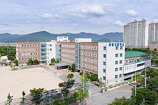
Buk District is a gu, or district, in north central Busan, South Korea. Buk-gu covers a surface of 38.30 km2 is home to about 335,000 people. It attained the status of gu in 1978.

Jung District is a gu, or district, covering the downtown area of Daegu, South Korea. It borders most of the other districts of Daegu, including Nam-gu to the south, Seo-gu to the west, Buk-gu to the north, and Dong-gu and Suseong-gu to the east. The northern border is formed by the Gyeongbu Line railroad, and the eastern border by the Sincheon stream.

Bupyeong District is one of the 10 administrative divisions that comprise Incheon, South Korea. Bupyeong District comprises an area of 12.35 square miles, and has a population of 508,587. It is located north of Namdong District, east of Seo District, and south of Gyeyang District. The city of Bucheon, in neighboring Gyeonggi Province, comprises its eastern limit.

Nam District (Nam-gu) is a district of Ulsan, South Korea. Its name literally means "South Ward".
Korea Polytechnics (Korean: 한국폴리텍대학) mean two or three-years public vocational school in South Korea. It has 11 colleges in 34 cities.

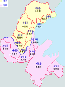
Buk-gu is a non-autonomous district, Pohang in North Gyeongsang Province, South Korea.

Seobuk-gu is a non-autonomous district in the city of Cheonan in South Chungcheong Province, South Korea.

Guryongpo is a town, or eup in Nam-gu, Pohang, North Gyeongsang Province, South Korea. The township Changju-myeon was upgraded to the town Guryongpo-eup in 1942. Guryongpo Town Office is located in Hudong-ri. One of the local specialties of Guryongpo is Gwamegi.
Yeonil is a town, or eup in Nam-gu, Pohang, North Gyeongsang Province, South Korea. The township Yeonil-myeon had been upgraded to the town Yeonil-eup in 1980. Yeonil Town Office is located in Geojeong-ri.
Ocheon is a town, or eup in Nam-gu, Pohang, North Gyeongsang Province, South Korea. The township Ocheon-myeon was upgraded to the town Ocheon-eup in 1980. Ocheon Town Office is located in Mundeok-ri.
Heunghae is a town, or eup in Buk-gu, Pohang, North Gyeongsang Province, South Korea. The township Uichang-myeon was upgraded to the town Uichang-eup in 1980, and it was renamed Heunghae-eup in 1983. Heunghae Town Office is located in Okseong-ri.
National Route 31 is a national highway in South Korea connects Gijang, Busan to Singosan, Anbyeon. Due to the separation of Korean peninsula, it de facto ends in Yanggu It established on 31 August 1971.
