Uiseong County

Last updated
Uiseong
의성군
Korean transcription(s)
  Hangul의성군
  Hanja
  Revised RomanizationUiseong-gun
  McCune-ReischauerŬisŏng-gun
Flag of Uiseong.svg
Uiseong logo.png
North Gyeongsang-Uiseong.svg
Location in South Korea
CountryFlag of South Korea.svg  South Korea
Region Yeongnam
Administrative divisions 1 eup, 17 myeon
Area
  Total1,175.89 km2 (454.01 sq mi)
Population
 (2002)
  Total71,216
  Density60.6/km2 (157/sq mi)
  Dialect
Gyeongsang

Uiseong County (Uiseong-gun) is a county in Gyeongsangbuk-do Province, South Korea. Located near the center of the province, it is bounded by Andong on the north, Cheongsong on the east, Gunwi County on the south, and Sangju and Yecheon on the west. As in most parts of Korea, most of the land is vacant and forested; only about 19% of the county's area is farmland. The county is largely rural, with an economy dominated by agriculture; the only urbanized area is the county seat, Uiseong-eup.

Contents

South Korean national treasure 77, a five-storied stone pagoda, lies in Geumseong-myeon. Also in Geumseong-myeon are a set of more than 300 dinosaur tracks from the early Cretaceous period. [1]

Uiseong is home to Gounsa, one of the 24 head temples of the Jogye Order of Korean Buddhism. This temple is located in Danchon-myeon.

Famous people from Uiseong include Yu Seong-ryong, prime minister and one of the best loyal contributors during the Japanese invasions of Korea (1592–98), and the "Garlic Girls", women's curling silver medalists at the 2018 Winter Olympics. [2] [3] [4]

Administrative divisions

Garlic Tower at Mancheon-ri, Geumseong-myeon Korea-Uiseong County-Garlic Tower-01.jpg
Garlic Tower at Mancheon-ri, Geumseong-myeon

Uiseong County is divided into 18 primary districts (1 eup and 17 myeon). These in turn are divided into 178 legal ri, which in turn are composed of a total of 399 administrative ri. The county's primary divisions are as follows:

Map of legal ri of Uiseong County in Korean Uiseong County Legal-status village produced with March 2017 information provided by National Geographic Information Institute (1).png
Map of legal ri of Uiseong County in Korean
Map of Uiseong County in Korean Uiseong-map.png
Map of Uiseong County in Korean
NameHangeulHanja
Uiseong-eup 의성읍義城邑
Danchon-myeon단촌면丹村面
Jeomgok-myeon점곡면點谷面
Oksan-myeon옥산면玉山面
Sagok-myeon사곡면舍谷面
Chunsan-myeon춘산면春山面
Gaeum-myeon가음면佳音面
Geumseong-myeon 금성면金城面
Bongyang-myeon봉양면鳳陽面
Bian-myeon비안면比安面
Gucheon-myeon구천면龜川面
Danmil-myeon단밀면丹密面
Danbuk-myeon단북면丹北面
Angye-myeon안계면安溪面
Dain-myeon다인면多仁面
Sinpyeong-myeon신평면新平面
Anpyeong-myeon안평면安平面
Ansa-myeon안사면安寺面

Climate

Uiseong has a monsoon-influenced humid continental climate (Köppen: Dwa) with cold, dry winters and hot, rainy summers.

Climate data for Uiseong (1991–2020 normals, extremes 1973–present)
MonthJanFebMarAprMayJunJulAugSepOctNovDecYear
Record high °C (°F)15.3
(59.5)
24.1
(75.4)
27.2
(81.0)
33.1
(91.6)
36.3
(97.3)
36.5
(97.7)
39.9
(103.8)
40.4
(104.7)
35.4
(95.7)
30.2
(86.4)
25.4
(77.7)
18.0
(64.4)
40.4
(104.7)
Mean daily maximum °C (°F)4.8
(40.6)
7.8
(46.0)
13.4
(56.1)
20.3
(68.5)
25.4
(77.7)
28.6
(83.5)
30.5
(86.9)
31.0
(87.8)
26.6
(79.9)
21.4
(70.5)
14.0
(57.2)
6.8
(44.2)
19.2
(66.6)
Daily mean °C (°F)−3.0
(26.6)
−0.3
(31.5)
5.3
(41.5)
11.7
(53.1)
17.1
(62.8)
21.6
(70.9)
24.8
(76.6)
25.1
(77.2)
19.8
(67.6)
12.7
(54.9)
5.5
(41.9)
−1.1
(30.0)
11.6
(52.9)
Mean daily minimum °C (°F)−9.6
(14.7)
−7.5
(18.5)
−2.2
(28.0)
3.3
(37.9)
9.0
(48.2)
15.2
(59.4)
20.3
(68.5)
20.5
(68.9)
14.4
(57.9)
6.0
(42.8)
−1.2
(29.8)
−7.5
(18.5)
5.1
(41.2)
Record low °C (°F)−23.3
(−9.9)
−22.1
(−7.8)
−12.7
(9.1)
−8.4
(16.9)
−1.1
(30.0)
4.1
(39.4)
10.7
(51.3)
10.3
(50.5)
2.1
(35.8)
−7.3
(18.9)
−13.7
(7.3)
−19.2
(−2.6)
−23.3
(−9.9)
Average precipitation mm (inches)15.5
(0.61)
22.6
(0.89)
41.5
(1.63)
73.6
(2.90)
78.6
(3.09)
115.8
(4.56)
221.4
(8.72)
229.6
(9.04)
124.3
(4.89)
41.5
(1.63)
30.5
(1.20)
16.3
(0.64)
1,011.2
(39.81)
Average precipitation days (≥ 0.1 mm)4.24.76.97.58.09.013.713.79.15.35.84.792.6
Average snowy days5.23.32.00.10.00.00.00.00.00.10.83.314.7
Average relative humidity (%)64.861.360.157.962.167.376.276.476.373.971.167.367.9
Mean monthly sunshine hours 177.9180.3202.2212.5234.6191.3155.0160.8149.8178.7160.2171.02,174.3
Percent possible sunshine 57.458.054.156.553.946.036.341.742.853.652.856.250.1
Source: Korea Meteorological Administration (snow and percent sunshine 1981–2010) [5] [6] [7]

Festival

Uiseong Sansuyu Festival

Hwajeon-ri, a 15-minute walk from Uiseong Town, is a spectacular place with Sansuyu. Starting from late March, yellow flowers will bloom and bloom until mid-April, and in October, red fruit will be produced and dyed red. The Hwajeon-ri area consists of more than 30,000 trees that have grown up since the Chosun Dynasty. [8]

Twin towns – sister cities

Uiseong is twinned with:

See also

Related Research Articles

<span class="mw-page-title-main">Yeongju</span> Municipal City in Yeongnam, South Korea

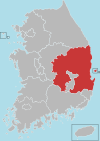
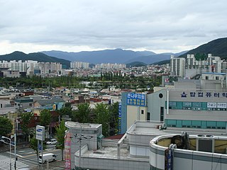
Yeongju is a city in the far north region of North Gyeongsang province in South Korea, covering 668.84 km2 with a population of 113,930 people according to the 2008 census. The city borders Bonghwa county to the east, Danyang county of North Chungcheong province to the west, Andong city and Yecheon county to the south, and Yeongwol county of Gangwon province to the north.

<span class="mw-page-title-main">Danyang County</span> County in Hoseo, South Korea

Danyang County is in North Chungcheong Province, South Korea.

<span class="mw-page-title-main">Boeun County</span> County in Hoseo, South Korea

Boeun County (Boeun-gun) is a county in North Chungcheong Province, South Korea.

<span class="mw-page-title-main">Jeongseon County</span> County in Gwandong, South Korea

Jeongseon (Jeongseon-gun) is a county in the province of Gangwon-do, South Korea. It is famous as the hometown of "Jeongseon Arirang," a traditional Korean folksong. It is also the hometown of actor Won Bin and footballer Seol Ki-hyeon.

<span class="mw-page-title-main">Damyang County</span> County in Honam, South Korea

Damyang County (Damyang-gun) is a county in Jeollanam-do, South Korea. Tourism is a major local industry. Notable local products include bamboo goods and strawberries.

<span class="mw-page-title-main">Buan County</span> County in Honam, South Korea

Buan County (Buan-gun) is a county in Jeonbuk Sate, South Korea. It is bounded by the city of Jeongeup on the east, the county of Gochang on the south, the city of Gimje on the north, and Yellow Sea on the west. Buan is divided into 1 eup, 12 myeon, and 510 ri. Buan had a 2001 estimated population of 74,716 people and a 2018 population of 54,441 people with an area of 493.35 km2. Famous people from Buan include Joseon Dynasty kisaeng and poet, Yi Mae-chang. Like many rural areas in southern Korea, it has seen shrinking population with many younger people moving north to larger cities such as Seoul. This county should not be confused with Muan, the new capital of South Jeolla Province.

<span class="mw-page-title-main">Namyangju</span> City in Gyeonggi Province, South Korea

Namyangju is a city in Gyeonggi Province, South Korea. To the east is Gapyeong County, to the west is Guri City, and to the north is Pocheon City. Namyangju-si was originally a southern part of Yangju-gun, but was separated into Namyangju-gun in April 1980. In 1995, Migeum-si and Namyangju-gun were merged to form an urban and rural complex. The city hall is located in Geumgok-dong and Dasan-dong, and the administrative districts are 6-eup, 3-myeon, and 7-dong.

<span class="mw-page-title-main">Seocheon County</span> County in Hoseo, South Korea

Seocheon County is a county in Chungcheongnam-do, South Korea. It is famous for its seafood and location near the mouth of the Geum River.

<span class="mw-page-title-main">Sangju</span> Municipal City in Yeongnam, South Korea

Sangju is a city in North Gyeongsang Province, central South Korea. Although Sangju is rather rural, it is very old and was once a key city. Along with Gyeongju, it gives rise to half of the name of the Gyeongsang provinces. Sangju is nicknamed Sam Baek, or "Three Whites", referring to three prominent agricultural products rice, silkworm cocoons, and dried persimmons from the area.

<span class="mw-page-title-main">Bonghwa County</span> County in Yeongnam, South Korea

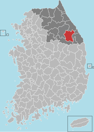
Bonghwa County (Bonghwa-gun) is a county in North Gyeongsang Province, South Korea. It lies inland, at the northern edge of the province, and borders Gangwon province to the north. To the east it is bounded by Yeongyang and Uljin counties, to the south by Andong, and to the west by Yeongju. The county is ringed by the Taebaek and Sobaek Mountains, the highest of which is Taebaeksan (1,566.7m). Because of its mountainous location, Bonghwa has a colder climate than most of the province, with an average annual temperature of 10 °C (50 °F).

<span class="mw-page-title-main">Cheongdo County</span> County in Yeongnam, South Korea

Cheongdo County (Cheongdo-gun) is a county in North Gyeongsang Province, South Korea. It is connected to the national transportation grid by the Gyeongbu Line railroad and the Daegu-Busan Expressway. The seat of government is located in the center of the county, in Hwayang-eup.

<span class="mw-page-title-main">Gunwi County</span> County in Yeongnam, South Korea

Gunwi County (Gunwi-gun) is a county in Daegu Metropolitan City, South Korea.

<span class="mw-page-title-main">Uljin County</span> County in South Korea

Uljin County is a county in North Gyeongsang Province, South Korea. Before 1963, Uljin was in Gangwon Province.

<span class="mw-page-title-main">Ulleung County</span> County in North Gyeongsang, South Korea

Ulleung County is a county in North Gyeongsang Province, South Korea.

<span class="mw-page-title-main">Yecheon County</span> County in Yeongnam, South Korea

Yecheon County is a county in the province of North Gyeongsang, South Korea. It is 661 km2 in area, and in 2004 had a population of 52,311. It has lost over 2/3 of its inhabitants since the mid-1960s. It consists of twelve administrative districts. The county borders Yeongju city to the northeast, Andong city to the east, Uiseong county to the southeast, Mungyeong city to the west, Sangju city to the southwest, and Danyang county of North Chungcheong province to the northwest.

<span class="mw-page-title-main">Gimhae</span> Specific city in Yeongnam, South Korea

Gimhae is a city in South Gyeongsang Province, South Korea, situated near the Nakdong River.

<span class="mw-page-title-main">Geochang County</span> County in Yeongnam, South Korea

Geochang County is a county in South Gyeongsang Province, South Korea. The Geochang International Festival of Theater, which was started in 1989, is renowned as the best play festival in Korea. The District Office is located in Geochang-eup, and has jurisdiction over 1 eup and 11 myeon.

<span class="mw-page-title-main">Goseong County, South Gyeongsang</span> County in Yeongnam, South Korea

Goseong County (Goseong-gun) is a county in South Gyeongsang Province, South Korea

Geumseong-myeon is a myeon in Uiseong, South Korea. It is well known for Uiseong garlic and Tap-ri dinosaur/dinosaur fossil.

Daegwallyeong-myeon is a myeon (township) in the county of Pyeongchang in the province of Gangwon-do, South Korea. It is located in the northeastern part of the county. The total area of Daegwallyeong-myeon is 221.63 square kilometers (85.57 sq mi), and, as of 2008, the population was 6,162 people. The myeon was named Doam-myeon until 2007. Daegwallyeong-myeon is named after the important mountain pass of Daegwallyeong. It has the coldest average temperature in South Korea.

References

  1. "Uiseong Dinosaur Tracks - North Gyeongsang Province - South Korea".
  2. "Sweden Wins Gold, South Korea's 'Garlic Girls' Win Silver Medal In Curling". NPR.org. Retrieved 2018-02-25.
  3. "Winter Olympics: Nine unlikely stars of Pyeongchang 2018". BBC Sport. 2018-02-25. Retrieved 2018-02-25.
  4. Wee, Sui-Lee; Young, Jin Yu (2022-02-09). "How the 'Garlic Girls' Overcame Abuse to Return to the Olympics". The New York Times. ISSN   0362-4331 . Retrieved 2022-02-09.
  5. "Climatological Normals of Korea (1991 ~ 2020)" (PDF) (in Korean). Korea Meteorological Administration. Archived from the original (PDF) on 29 January 2022. Retrieved 4 April 2022.
  6. 순위값 - 구역별조회 (in Korean). Korea Meteorological Administration. Retrieved 4 April 2022.
  7. "Climatological Normals of Korea" (PDF). Korea Meteorological Administration. 2011. Archived from the original (PDF) on 7 December 2016. Retrieved 8 December 2016.
  8. "의성산수유꽃피는마을&의성산수유꽃축제". ussansuyu.kr. Retrieved 2018-04-21.

36°21′00″N128°41′00″E / 36.35000001°N 128.683333343°E / 36.35000001; 128.683333343