Gunwi County

Last updated
Gunwi
군위군
Korean transcription(s)
  Hangul군위군
  Hanja
  Revised RomanizationGunwi-gun
  McCune-ReischauerKunwi-gun
Flag of Gunwi.svg
Gunwi logo.png
Map of Gunwi-gun in Deagu.svg
Location in Deagu
CountryFlag of South Korea.svg  South Korea
Region Yeongnam
Administrative divisions 1 eup, 7 myeon
Area
  Total
614.15 km2 (237.12 sq mi)
Population
  Total
34,293
  Density55/km2 (140/sq mi)
  Dialect
Gyeongsang

Gunwi County (Gunwi-gun) is a county in Daegu Metropolitan City, South Korea.

Contents

Incorporation into Daegu

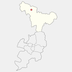
Prior to June 30, 2023, Gunwi County was part of the North Gyeongsang Province. As per legislation promulgated on January 3, 2023, the county was incorporated into Daegu Metropolitan City in July 1, 2023.

Incorporation into Daegu was made as per Gunwi County's demand in exchange for allowing Daegu International Airport to be moved to Sobo-myeon, Gunwi County.

Administrative divisions

Map of Gunwi County in Korean Gunwi-map.png
Map of Gunwi County in Korean

Gunwi County is divided into 1 eup and 7 myeon.

MapHangeulHanja
Gunwi-eup 군위읍軍威邑
Sobo-myeon소보면召保面
Hyoryeong-myeon효령면孝令面
Bugye-myeon부계면缶溪面
Ubo-myeon우보면友保面
Uiheung-myeon의흥면義興面
Sanseong-myeon산성면山城面
Samgugyusa-myeon삼국유사면三國遺事面

Climate

Gunwi has a humid continental climate (Köppen: Dwa), but can be considered a borderline humid subtropical climate (Köppen: Cwa) using the −3 °C (27 °F) isotherm.

Climate data for Gunwi (1993–2020 normals)
MonthJanFebMarAprMayJunJulAugSepOctNovDecYear
Mean daily maximum °C (°F)4.2
(39.6)
7.4
(45.3)
13.5
(56.3)
20.1
(68.2)
25.5
(77.9)
28.7
(83.7)
30.5
(86.9)
31.2
(88.2)
26.6
(79.9)
21.0
(69.8)
13.5
(56.3)
6.1
(43.0)
19.0
(66.2)
Daily mean °C (°F)−2.7
(27.1)
0.1
(32.2)
5.6
(42.1)
12.0
(53.6)
17.5
(63.5)
21.8
(71.2)
24.9
(76.8)
25.2
(77.4)
19.8
(67.6)
12.8
(55.0)
5.8
(42.4)
−1.0
(30.2)
11.8
(53.2)
Mean daily minimum °C (°F)−8.6
(16.5)
−6.4
(20.5)
−1.5
(29.3)
4.3
(39.7)
10.1
(50.2)
15.9
(60.6)
20.6
(69.1)
20.9
(69.6)
15.1
(59.2)
7.0
(44.6)
−0.3
(31.5)
−6.7
(19.9)
5.9
(42.6)
Average precipitation mm (inches)14.4
(0.57)
20.2
(0.80)
40.5
(1.59)
70.6
(2.78)
74.1
(2.92)
114.2
(4.50)
197.5
(7.78)
228.1
(8.98)
133.0
(5.24)
51.8
(2.04)
30.2
(1.19)
12.9
(0.51)
987.5
(38.88)
Average precipitation days (≥ 0.1 mm)2.93.55.86.86.98.312.312.18.04.94.82.979.2
Source: Korea Meteorological Administration [1]

Related Research Articles

<span class="mw-page-title-main">Yeongju</span> City in North Gyeongsang, South Korea

Yeongju is a city in North Gyeongsang Province, South Korea. It has an area of 668.84 km2 and a population of 113,930 people according to the 2008 census. The city borders Bonghwa county to the east, Danyang County of North Chungcheong Province to the west, Andong and Yecheon county to the south, and Yeongwol County of Gangwon Province to the north.

<span class="mw-page-title-main">Danyang County</span> County in Hoseo, South Korea

Danyang County is in North Chungcheong Province, South Korea.

<span class="mw-page-title-main">Boeun County</span> County in Hoseo, South Korea

Boeun County (Boeun-gun) is a county in North Chungcheong Province, South Korea.

<span class="mw-page-title-main">Muju County</span> County in Honam, South Korea

Muju County (Muju-gun), is a county in North Jeolla Province (Jeollabuk-do), South Korea. Muju is known for its Muju Firefly Festival and is a tourist area.

<span class="mw-page-title-main">Gapyeong County</span> County in Gyeonggi Province, South Korea

Gapyeong County (Korean: 가평군), alternatively Kapyong County, is a county in Gyeonggi Province, South Korea. It was the scene of the Battle of Kapyong, a major battle of the Korean War.

<span class="mw-page-title-main">Gwangju, Gyeonggi</span> City in Gyeonggi, South Korea

Gwangju is a city in Gyeonggi Province, South Korea, a suburb southeast of Seoul. The city is not to be confused with the much larger Gwangju, former capital of South Jeolla Province, or Guangzhou, the city of Guangdong, China in Hanja.

<span class="mw-page-title-main">Anseong</span> City in Gyeonggi, South Korea

Anseong is a city in Gyeonggi Province, South Korea, 80 kilometres (50 mi) south of Seoul. Its geographical location is 37°0′N127°16′E.

<span class="mw-page-title-main">Guri</span> City in Gyeonggi, South Korea

Guri is a city in Gyeonggi Province, South Korea. It is located immediately to the east of Seoul, in the heart of the Capital Metropolitan Area.

<span class="mw-page-title-main">Uiwang</span> City in Gyeonggi, South Korea

Uiwang is a city in Gyeonggi Province, South Korea. It is one of many satellite cities that ring Seoul, making up the Seoul Capital Area. Its largest immediate urban neighbor is Anyang. The low peaks of the Gwangju Mountains shape the local landscape.

<span class="mw-page-title-main">Geumsan County</span> County in South Chungcheong Province, South Korea

Geumsan County is a county in South Chungcheong Province, South Korea. It borders Muju County, North Jeolla Province (Jeollabuk-do), which is famous for its ski resort nearby.

<span class="mw-page-title-main">Gyeongsan</span> City in North Gyeongsang, South Korea

Gyeongsan is a satellite city in North Gyeongsang Province, South Korea. Its western border abuts the metropolitan city of Daegu, and much of Gyeongsan lies within the Daegu metropolitan area.

<span class="mw-page-title-main">Mungyeong</span> City in North Gyeongsang, South Korea

Mungyeong is a city in North Gyeongsang Province, South Korea. The local government, economy, and transportation networks are all centered in Jeomchon, the principal town. Mungyeong has a lengthy history, and is known today for its various historic and scenic tourist attractions. The city's name means roughly "hearing good news." Recently, development has been somewhat stagnant with the decline of the coal industry. Since the 1990s, the proportion of people who rely on the tourism industry through Mungyeong Saejae has gradually increased.

<span class="mw-page-title-main">Sangju</span> City in North Gyeongsang, South Korea

Sangju is a city in North Gyeongsang Province, South Korea. Although Sangju is rather rural, it is very old and was once a key city. Along with Gyeongju, it gives rise to half of the name of the Gyeongsang Provinces. Sangju is nicknamed Sam Baek, or "Three Whites", referring to three prominent agricultural products rice, silkworm cocoons, and dried persimmons from the area.

<span class="mw-page-title-main">Bonghwa County</span> County in Yeongnam, South Korea

Bonghwa County (Bonghwa-gun) is a county in North Gyeongsang Province, South Korea. It lies inland, at the northern edge of the province, and borders Gangwon province to the north. To the east it is bounded by Yeongyang and Uljin counties, to the south by Andong, and to the west by Yeongju. The county is ringed by the Taebaek and Sobaek Mountains, the highest of which is Taebaeksan (1,566.7m). Because of its mountainous location, Bonghwa has a colder climate than most of the province, with an average annual temperature of 10 °C (50 °F).

<span class="mw-page-title-main">Cheongsong County</span> County in Yeongnam, South Korea

Cheongsong County is a county in North Gyeongsang Province, South Korea.

<span class="mw-page-title-main">Chilgok County</span> County in Yeongnam, South Korea

Chilgok County (Chilgok-gun) is located at south-west part of North Gyeongsang Province. It is close by Gunwi County on the east while adjoins with Gimchon-si, Seongju County on the west. It is also a transportation hub where the Nakdong river flows through and an Urban-Farming complex that adjoins with Gumi City and Daegu Metropolitan city.

<span class="mw-page-title-main">Uiseong County</span> County in Yeongnam, South Korea

Uiseong County (Uiseong-gun) is a county in Gyeongsangbuk-do Province, South Korea. Located near the center of the province, it is bounded by Andong on the north, Cheongsong on the east, Gunwi County on the south, and Sangju and Yecheon on the west. As in most parts of Korea, most of the land is vacant and forested; only about 19% of the county's area is farmland. The county is largely rural, with an economy dominated by agriculture; the only urbanized area is the county seat, Uiseong-eup.

<span class="mw-page-title-main">Gimhae</span> City in South Gyeongsang, South Korea

Gimhae is a city in South Gyeongsang Province, South Korea, situated near the Nakdong River.

<span class="mw-page-title-main">Geochang County</span> County in Yeongnam, South Korea

Geochang County is a county in South Gyeongsang Province, South Korea. The Geochang International Festival of Theater, which was started in 1989, is renowned as the best play festival in Korea. The District Office is located in Geochang-eup, and has jurisdiction over 1 eup and 11 myeon.

<span class="mw-page-title-main">Palgongsan</span> Mountain

Palgongsan, also Palgong Mountain, and previously called Gongsan, also Gong Mountain during the Later Three Kingdoms period, is a mountain in southeastern South Korea, lying on an outlier of the Taebaek range. It stands on the northeastern border between Daegu metropolitan city and North Gyeongsang province. Its peak is 1193 m above sea level.

References

  1. "Climatological Normals of Korea (1991 ~ 2020)" (PDF) (in Korean). Korea Meteorological Administration. Archived from the original (PDF) on 29 January 2022. Retrieved 7 June 2023.

36°14′05″N128°34′22″E / 36.2347222322°N 128.572777788°E / 36.2347222322; 128.572777788