Bonghwa County

Last updated
Bonghwa
봉화군
Korean transcription(s)
  Hangul봉화군
  Hanja
  Revised RomanizationBonghwa-gun
  McCune-ReischauerPonghwa-gun
Flag of Bonghwa.svg
Bonghwa logo.png
North Gyeongsang-Bonghwa.svg
Location in South Korea
CountryFlag of South Korea.svg  South Korea
Region Yeongnam
Administrative divisions 1 eup, 9 myeon
Area
  Total1,201 km2 (464 sq mi)
Population
  Total41,452
  Density34.5/km2 (89/sq mi)
  Dialect
Gyeongsang

Bonghwa County (Bonghwa-gun) is a county in North Gyeongsang Province, South Korea. It lies inland, at the northern edge of the province, and borders Gangwon province to the north. To the east it is bounded by Yeongyang and Uljin counties, to the south by Andong, and to the west by Yeongju. The county is ringed by the Taebaek and Sobaek Mountains, the highest of which is Taebaeksan (1,566.7m). Because of its mountainous location, Bonghwa has a colder climate than most of the province, with an average annual temperature of 10 °C (50 °F).

Contents

Bonghwa is connected to the national rail grid by the Yeongdong Line, which stops at Bonghwa station on its way between Yeongju and Gangneung. The Yeongdong Line, which is not known for its speed, stops at a total of 13 stations as it winds through Bonghwa, before ambling north into the next province.

Korean National Treasure No. 201, a rock-carved seated Buddhist statue, is located in Bukji-ri, Murya-myeon.

Famous people from Bonghwa include director Kim Ki-duk. The county is also the setting of the 2008 documentary film Old Partner, which has won numerous awards for its portrayal of rural life.

Administrative divisions

Administrative divisions of Bonghwa-gun Bonghwa-gun divisions map.png
Administrative divisions of Bonghwa-gun
Cheongnyang Temple in Myeongho-myeon. Korea-Bonghwa County-Cheongnyangsa-02.jpg
Cheongnyang Temple in Myeongho-myeon.

Bonghwa is divided into ten primary divisions: one eup (large village) and nine rural districts (myeon).

NameHangeulHanja
Bonghwa-eup 봉화읍奉化邑
Beopjeon-myeon 법전면法田面
Bongseong-myeon 봉성면鳳城面
Chunyang-myeon 춘양면春陽面
Jaesan-myeon 재산면才山面
Murya-myeon 물야면物野面
Myeongho-myeon 명호면明湖面
Sangun-myeon 상운면祥雲面
Seokpo-myeon 석포면石浦面
Socheon-myeon 소천면小川面

The eup and myeon are further divided into numerous small villages (ri).

eup/myeonriHangeul
Bonghwa-eup Samgye-ri삼계리
Yugok-ri유곡리
Geochon-ri거촌리
Seokpyeong-ri석평리
Haejeo-ri해저리
Jeokdeok-ri적덕리
Hwacheon-ri화천리
Dochon-ri도촌리
Mundan-ri문단리
Naeseong-ri내성리
Beopjeon-myeon Beopjeon-ri법전리
Pongjeong-ri풍정리
Cheokgok-ri척곡리
Socheon-ri소천리
Nulsan-ri눌산리
Eoji-ri어지리
Soji-ri소지리
Bongseong-myeon Bongseong-ri봉성리
Oesam-ri외삼리
Changpyeong-ri창평리
Dongyang-ri동양리
Geumbong-ri금봉리
Ugok-ri우곡리
Bongyang-ri봉양리
Chunyang-myeon Uiyang-ri의양리
Haksan-ri학산리
Seodong-ri서동리
Seokhyeon-ri석현리
Aedang-ri애당리
Dosim-ri도심리
Seobyeok-ri서벽리
Uguchi-ri우구치리
Soro-ri소로리
Jaesan-myeon Hyeondong-ri현동리
Nammyeon-ri남면리
Dongmyeon-ri동면리
Galsan-ri갈산리
Sang-ri상리
Murya-myeon Orok-ri오록리
Gapyeong-ri가평리
Gaedan-ri개단리
Ujan-ri오전리
Apdong-ri압동리
Dumun-ri두문리
Susik-ri수식리
Bukji-ri북지리
Myeongho-myeon Docheon-ri도천리
Samdong-ri삼동리
Yangguk-ri양곡
Gogam-ri고감리
Pungho-ri풍호리
Gogye-ri고계리
Bokgok-ri북곡리
Gwanchang-ri관창리
Sangun-myeon Gagok-ri가곡리
Ungye-ri운계리
Munchon-ri문촌리
Hanul-ri하눌리
Toil-ri토일리
Gocheon-ri구천리
Seolmae-ri설매리
Sinra-ri신라리
Seokpo-myeon Seokpo-ri석포리
Daehyeon-ri대현리
Seungbu-ri승부리
Socheon-myeon Hyeondong-ri현동리
Goseon-ri고선리
Imgi-ri임기리
Dueum-ri두음리
Seocheon-ri서천리
Namhoeryong-ri남회룡리
Buncheon-ri분천리

Climate

Bonghwa has a monsoon-influenced humid continental climate (Köppen: Dwa) with cold, dry winters and hot, rainy summers.

Climate data for Bonghwa (1991–2020 normals, extremes 1988–present)
MonthJanFebMarAprMayJunJulAugSepOctNovDecYear
Record high °C (°F)13.2
(55.8)
19.5
(67.1)
25.2
(77.4)
31.2
(88.2)
33.0
(91.4)
34.6
(94.3)
36.6
(97.9)
37.8
(100.0)
33.8
(92.8)
27.8
(82.0)
24.4
(75.9)
16.2
(61.2)
37.8
(100.0)
Mean daily maximum °C (°F)3.0
(37.4)
5.9
(42.6)
11.2
(52.2)
18.1
(64.6)
23.3
(73.9)
26.6
(79.9)
28.0
(82.4)
28.6
(83.5)
24.5
(76.1)
19.5
(67.1)
12.1
(53.8)
5.1
(41.2)
17.2
(63.0)
Daily mean °C (°F)−4.0
(24.8)
−1.6
(29.1)
3.7
(38.7)
9.9
(49.8)
15.5
(59.9)
19.6
(67.3)
22.8
(73.0)
22.9
(73.2)
17.8
(64.0)
11.1
(52.0)
4.2
(39.6)
−2.1
(28.2)
10.0
(50.0)
Mean daily minimum °C (°F)−10.6
(12.9)
−8.4
(16.9)
−3.2
(26.2)
1.9
(35.4)
7.7
(45.9)
13.4
(56.1)
18.5
(65.3)
18.5
(65.3)
12.4
(54.3)
4.4
(39.9)
−2.2
(28.0)
−8.3
(17.1)
3.7
(38.7)
Record low °C (°F)−25.0
(−13.0)
−27.7
(−17.9)
−16.2
(2.8)
−9.1
(15.6)
−1.0
(30.2)
1.2
(34.2)
8.2
(46.8)
7.5
(45.5)
1.9
(35.4)
−7.3
(18.9)
−14.6
(5.7)
−21.4
(−6.5)
−27.7
(−17.9)
Average precipitation mm (inches)16.5
(0.65)
25.9
(1.02)
46.6
(1.83)
80.7
(3.18)
101.5
(4.00)
143.2
(5.64)
277.7
(10.93)
246.8
(9.72)
135.1
(5.32)
48.1
(1.89)
33.2
(1.31)
20.3
(0.80)
1,175.6
(46.28)
Average precipitation days (≥ 0.1 mm)5.25.17.68.08.710.315.414.59.25.56.65.4101.5
Average snowy days6.55.54.00.20.00.00.00.00.00.21.64.122.3
Average relative humidity (%)63.862.062.059.965.271.079.779.978.074.770.966.469.5
Mean monthly sunshine hours 187.3183.8203.5215.4234.5196.0145.1155.8152.8176.9164.2182.52,197.8
Percent possible sunshine 59.158.653.556.752.444.832.638.942.454.256.160.249.9
Source: Korea Meteorological Administration (snow and percent sunshine 1981–2010) [1] [2] [3]

Twin towns – sister cities

Bonghwa is twinned with:

See also

Related Research Articles

<span class="mw-page-title-main">Yeongju</span> Municipal City in Yeongnam, South Korea

Yeongju is a city in the far north region of North Gyeongsang province in South Korea, covering 668.84 km2 with a population of 113,930 people according to the 2008 census. The city borders Bonghwa county to the east, Danyang county of North Chungcheong province to the west, Andong city and Yecheon county to the south, and Yeongwol county of Gangwon province to the north.

<span class="mw-page-title-main">Danyang County</span> County in Hoseo, South Korea

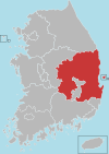
Danyang County is in North Chungcheong Province, South Korea.

<span class="mw-page-title-main">Yeongdong County</span> County in Hoseo, South Korea

Yeongdong County (Korean: 영동군) is a county in North Chungcheong Province, South Korea. The county should not be confused with the similarly named Yeongdong region.

<span class="mw-page-title-main">Boeun County</span> County in Hoseo, South Korea

Boeun County (Boeun-gun) is a county in North Chungcheong Province, South Korea.

<span class="mw-page-title-main">Icheon</span> Municipal City in Sudogwon, South Korea

Icheon is a city in Gyeonggi Province, South Korea.

<span class="mw-page-title-main">Yeoncheon County</span> County in Sudogwon, South Korea

Yeoncheon County (Yeoncheon-gun) is a county in Gyeonggi Province, South Korea. The county seat is Yeoncheon-eup (연천읍) and sits on Gyeongwon Line, the Korail railroad line connecting Seoul, South Korea (ROK), with North Korea (DPRK).

<span class="mw-page-title-main">Mungyeong</span> Municipal City in Yeongnam, South Korea

Mungyeong is a city in North Gyeongsang Province, South Korea. The local government, economy, and transportation networks are all centered in Jeomchon, the principal town. Mungyeong has a lengthy history, and is known today for its various historic and scenic tourist attractions. The city's name means roughly "hearing good news." Recently, development has been somewhat stagnant with the decline of the coal industry. Since the 1990s, the proportion of people who rely on the tourism industry through Mungyeong Saejae has gradually increased.

<span class="mw-page-title-main">Sangju</span> Municipal City in Yeongnam, South Korea

Sangju is a city in North Gyeongsang Province, central South Korea. Although Sangju is rather rural, it is very old and was once a key city. Along with Gyeongju, it gives rise to half of the name of the Gyeongsang provinces. Sangju is nicknamed Sam Baek, or "Three Whites", referring to three prominent agricultural products rice, silkworm cocoons, and dried persimmons from the area.

<span class="mw-page-title-main">Cheongdo County</span> County in Yeongnam, South Korea

Cheongdo County (Cheongdo-gun) is a county in North Gyeongsang Province, South Korea. It is connected to the national transportation grid by the Gyeongbu Line railroad and the Daegu-Busan Expressway. The seat of government is located in the center of the county, in Hwayang-eup.

<span class="mw-page-title-main">Goryeong County</span> County in Yeongnam, South Korea

Goryeong County is a county in North Gyeongsang Province, South Korea.

<span class="mw-page-title-main">Gunwi County</span> County in Yeongnam, South Korea

Gunwi County (Gunwi-gun) is a county in Daegu Metropolitan City, South Korea.

<span class="mw-page-title-main">Seongju County</span> County in Yeongnam, South Korea

Seongju County (Seongju-gun) is a county in North Gyeongsang Province, South Korea. This largely agricultural area is located immediately west of the metropolitan city of Daegu. The capital of the county is the town of Seongju.

<span class="mw-page-title-main">Uiseong County</span> County in Yeongnam, South Korea

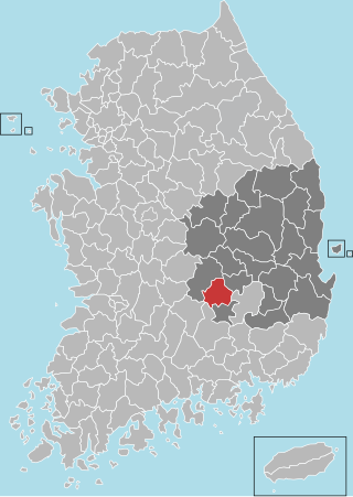
Uiseong County (Uiseong-gun) is a county in Gyeongsangbuk-do Province, South Korea. Located near the center of the province, it is bounded by Andong on the north, Cheongsong on the east, Gunwi County on the south, and Sangju and Yecheon on the west. As in most parts of Korea, most of the land is vacant and forested; only about 19% of the county's area is farmland. The county is largely rural, with an economy dominated by agriculture; the only urbanized area is the county seat, Uiseong-eup.

<span class="mw-page-title-main">Uljin County</span> County in South Korea

Uljin County is a county in North Gyeongsang Province, South Korea. Before 1963, Uljin was in Gangwon Province.

<span class="mw-page-title-main">Ulleung County</span> County in North Gyeongsang, South Korea

Ulleung County is a county in North Gyeongsang Province, South Korea.

<span class="mw-page-title-main">Yecheon County</span> County in Yeongnam, South Korea

Yecheon County is a county in the province of North Gyeongsang, South Korea. It is 661 km2 in area, and in 2004 had a population of 52,311. It has lost over 2/3 of its inhabitants since the mid-1960s. It consists of twelve administrative districts. The county borders Yeongju city to the northeast, Andong city to the east, Uiseong county to the southeast, Mungyeong city to the west, Sangju city to the southwest, and Danyang county of North Chungcheong province to the northwest.

<span class="mw-page-title-main">Yeongyang County</span> County in Yeongnam, South Korea

Yeongyang County (Yeongyang-gun) is an inland county in the north-eastern area of North Gyeongsang Province, South Korea.

<span class="mw-page-title-main">Geochang County</span> County in Yeongnam, South Korea

Geochang County is a county in South Gyeongsang Province, South Korea. The Geochang International Festival of Theater, which was started in 1989, is renowned as the best play festival in Korea. The District Office is located in Geochang-eup, and has jurisdiction over 1 eup and 11 myeon.

<span class="mw-page-title-main">Haman County</span> County in Yeongnam, South Korea

Haman County (Haman-gun) is a county in South Gyeongsang Province, South Korea. The local government is seated in Gaya-eup. The county magistrate is Seok Gyu Jin.

Chupungnyeong is a mountain pass between Yeongdong-gun, Chungcheongbuk-do and Gimcheon-si, Gyeongsangbuk-do in South Korea.

References

  1. "Climatological Normals of Korea (1991 ~ 2020)" (PDF) (in Korean). Korea Meteorological Administration. Archived from the original (PDF) on 29 January 2022. Retrieved 4 April 2022.
  2. 순위값 - 구역별조회 (in Korean). Korea Meteorological Administration. Retrieved 4 April 2022.
  3. "Climatological Normals of Korea" (PDF). Korea Meteorological Administration. 2011. Archived from the original (PDF) on 7 December 2016. Retrieved 8 December 2016.

36°53′26″N128°44′11″E / 36.89057°N 128.736455°E / 36.89057; 128.736455