Namutumba, Uganda

Last updated
Namutumba
Uganda location map.svg
Red pog.svg
Namutumba
Location in Uganda
Coordinates: 00°50′06″N33°41′06″E / 0.83500°N 33.68500°E / 0.83500; 33.68500
Country Flag of Uganda.svg Uganda
Region Eastern Region of Uganda
Sub-region Busoga sub-region
District Namutumba District
Elevation
3,724 ft (1,135 m)
Population
 (2020 Estimate)
  Total22,600 [1]

Namutumba is a town in the Namutumba District of the Eastern Region of Uganda. It is the main municipal, administrative, and commercial centre of the district. [2]

Contents

Location

Namutumba is approximately 75 kilometres (47 mi), by road, northeast of Jinja, the largest city in the Busoga sub-region. [3] This is approximately 38 kilometres (24 mi), by road, northeast of Iganga, the nearest large town. [4] The town of Busembatya in Iganga District, about 10 kilometres (6 mi) [5] to the southwest of Namutumba, is the closest neighboring trading center and has the nearest post office. To the northeast of Namutumba is Tirinyi in Kibuku District, another small town on the main Iganga–Tirinyi–Kamonkoli–Mbale Road. The coordinates of Namutumba are 0°50'06.0"N, 33°41'06.0"E (Latitude:0.8350; Longitude:33.6850). [6] Namutumba Town sits at an average elevation of 1,135 metres (3,724 ft) above mean sea level. [7]

Population

In 2014, the national population census and household survey put the population of Namutumba Town, at 18,736. In 2020, the Uganda Bureau of Statistics (UBOS) estimated the mid-year population of the town at 22,600. The population agency calculated the average annual growth rate of Namutumba's population at 3.31 percent, between 2014 and 2020. [1]

Points of interest

The following additional points of interest lie within the town limits or close to the edges of the town: [6]

1. The offices of Namutumba Town Council

2. The offices of Namutumba District Administration Headquarters

3. Namutumba Central Market

4. Namutumba Community Hospital [8]

5. The Iganga–Mbale Road also Tirinyi Road: the road passes through the middle of town, in a general southwest to northeast direction.

6. Namutumba Islamic Hospital, a 60-bed hospital under development since 2016. [9]

International relations

Namutumba is twinned with the town of Ross-on-Wye, England. [10]

See also

Related Research Articles

Bugiri District District in Eastern Uganda, Uganda

Bugiri District is a district in Eastern Uganda. Like most other Ugandan districts, it is named after its 'chief town', Bugiri, where the district headquarters are located.

Iganga District District in Eastern Uganda, Uganda

Iganga District is a district in the Eastern Region of Uganda. The town of Iganga is the site of the district headquarters.

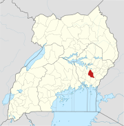
Pallisa is a town in Pallisa District of the Eastern Region of Uganda.

Bugiri is a town in the Eastern Region of Uganda. It is the chief town of Bugiri District, and the district headquarters are located there. The town was elevated to Municipal Council status in 2019.

Iganga is a town in the Eastern Region of Uganda. It is the main municipal, administrative, and commercial center of Iganga District.

Kamuli is a town in the Eastern Region of Uganda. It is the main municipal, administrative, and commercial centre of Kamuli District, and the district headquarters are located there. The district is named after the town.

Mayuge is a town in the Eastern Region of Uganda. It is the location of the headquarters of Mayuge District.

Buwenge is a town in the Eastern Region of Uganda. It was proposed as the headquarters of Jinja District in 2009 when local district leaders were lobbying government to grant Jinja city status. However, when the district headquarters were relocated 10 years later, Kagoma, a smaller community in Buwenge sub-county was selected as the new district headquarters.

Namutumba District District in Eastern Uganda, Uganda

Namutumba District, sometimes referred to as Busiki District is a district in Eastern Uganda. It is named after its 'chief town', Namutumba, where the district headquarters are located.

Busembatya, sometimes spelled Busembatia, is a town in the Eastern Region of Uganda.

Buyende District District in Eastern Uganda, Uganda

Buyende District is a district in Eastern Uganda. It is named after Buyende, the 'chief town' in the district and the location of the district headquarters.

Buyende is a town in the Eastern Region of Uganda. It is the main municipal, administrative, and commercial centre of Buyende District.

Luuka Town, also known as Luuka Municipality, but often referred to simply as Luuka, is a town in Eastern Uganda. Prior to 1 July 2010, Luuka Town was known as "Kiyunga". It is the principal political, administrative and commercial center of Luuka District.

Musita is a town in Mayuge District, in the Eastern Region of Uganda.

Tirinyi is a town in the Kibuku District in the Eastern Region of Uganda.

Kamonkoli is a town in Budaka District, in the Eastern Region of Uganda.

Iganga General Hospital, also, Iganga District Hospital or Iganga Main Hospital, commonly known as Nakavule Hospital is a hospital in Iganga, Eastern Uganda.

The Iganga–Tirinyi–Kamonkoli–Mbale Road, also known as the Nakalama–Tirinyi–Kamonkoli–Mbale Road, is a road in the Eastern Region of Uganda, connecting the towns of Iganga in Iganga District, Namutumba in Namutumba District, Tirinyi in Kibuku District, Kamonkoli in Budaka District, and Mbale in Mbale District.

The Jinja–Iganga–Bugiri–Tororo Road is a road in the Eastern Region of Uganda, connecting the towns of Jinja and Tororo. Sometimes referred to as Tororo–Jinja Road, it is a busy transport corridor, connecting traffic from neighboring Kenya, and northeastern Uganda to Jinja, a major commercial and industrial center, and ultimately to Kampala, the country's capital and points beyond.

Kadama is a town in Kibuku District, in the Eastern Region of Uganda.

References

  1. 1 2 Uganda Bureau of Statistics (14 June 2020). "The population of all Ugandan cities and towns with more than 15,000 inhabitants according to census results and latest official projections". Citypopulation.de Quoting Uganda Bureau of Statistics . Retrieved 10 January 2021.
  2. Namutumba District (11 June 2020). "Namutumba District, Uganda: Location And Size". Namutumba, Uganda: Namutumba District . Retrieved 10 January 2021.
  3. Google (10 January 2021). "Road Distance Between Jinja, Uganda And Namutumba, Uganda" (Map). Google Maps . Google. Retrieved 10 January 2021.
  4. Google (10 January 2021). "Road Distance Between Namutumba, Eastern Region, Uganda And Iganga, Eastern Region, Uganda" (Map). Google Maps . Google. Retrieved 10 January 2021.
  5. Google (10 January 2021). "Road Distance Between Namutumba, Namutumba District And Busembatya, Iganga District In Uganda" (Map). Google Maps . Google. Retrieved 10 January 2021.
  6. 1 2 Google (10 January 2021). "Location of Namutumba, Eastern Region, UG" (Map). Google Maps . Google. Retrieved 10 January 2021.
  7. Floodmap (10 January 2021). "Elevation of Namutumba, Uganda". Elevationmap.net. Retrieved 10 January 2021.
  8. Denis Olaka (25 December 2012). "Two Bank Managers Killed in Fatal Accident On Christmas Eve". Kampala: Uganda Radio Network . Retrieved 10 January 2021.
  9. Ronald Seebe (8 December 2020). "Namutumba Islamic Hospital needs UGX 400M to Start Operating". Kampala: Uganda Radio Network . Retrieved 10 January 2021.
  10. "Twinning". Ross-on-Wye Town Council. Retrieved 25 May 2022.

Coordinates: 00°14′04″N33°23′06″E / 0.23444°N 33.38500°E / 0.23444; 33.38500