Nanay River

Last updated
Nanay River
The Amazon meets Rio Nanay.jpg
The Nanay River (black) meets the Amazon River (light brownish; in background)
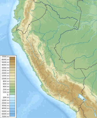
Peru physical map.svg
Red pog.svg
Location of mouth
Location
Country Peru
Region Loreto Region
Physical characteristics
Mouth Amazon River
  coordinates
3°42′S73°15′W / 3.700°S 73.250°W / -3.700; -73.250
Length315 km (196 mi)
Basin size16,673.4 km2 (6,437.6 sq mi) [1] 19,413 km2 (7,495 sq mi) [2]
Discharge 
  location Iquitos (near mouth)
  average930 m3/s (33,000 cu ft/s)

1,072.655 m3/s (37,880.5 cu ft/s) [3]

1,284 m3/s (45,300 cu ft/s) [4]

The Nanay River is a river in northern Peru. It is a tributary of the Amazon River, merging into this river at the city of Iquitos. The lower part of the Nanay flows to the north and west of the city, while the Itaya River flows to the south and east. Other nearby settlements on the Nanay River include the villages of Santo Tomás, Padre Cocha, and Santa Clara. During periods when the river is low, the many beaches along the Nanay are popular destinations. The Nanay belongs entirely to the lowlands, and is very crooked, has a slow current and divides into many canos [lower-alpha 1] and strings of lagoons which flood the flat, low areas of country on either side. It is simply the drainage ditch of districts which are extensively overflowed in the rainy season. Captain Archibald Butt USN, ascended it 195 mi (314 km), to near its source. [5] A part of the Nanay River flows through the Allpahuayo-Mishana National Reserve.

The Nanay is a blackwater river and it has a high fish species richness, including several that are well known from the aquarium industry. Some of these, notably green discus, are the result of accidental introductions that happened in the 1970s. [6] [7]

The river is the location of hundreds of illegal artisanal mines digging for gold. [8]

The 2012 floods of the Amazon, Itaya, and Nanay rivers, amid the heaviest rains the region had faced in 40 years, left approximately 80,000 people homeless. [9]

Notes

  1. A cano is a kind of natural canal; it forms a lateral discharge for surplus water from a river.

Related Research Articles

<span class="mw-page-title-main">Amazon River</span> Major river in South America

The Amazon River in South America is the largest river by discharge volume of water in the world, and the longest or second-longest river system in the world, a title which is disputed with the Nile.

<span class="mw-page-title-main">Juruá River</span> River in Brazil, Peru

The Juruá River is a southern affluent river of the Amazon River west of the Purus River, sharing with this the bottom of the immense inland Amazon depression, and having all the characteristics of the Purus as regards curvature, sluggishness and general features of the low, half-flooded forest country it traverses.

<span class="mw-page-title-main">Marañón River</span> River in Peru

The Marañón River is the principal or mainstem source of the Amazon River, arising about 160 km to the northeast of Lima, Peru, and flowing northwest across plateaus 3,650 m high, it runs through a deeply eroded Andean valley, along the eastern base of the Cordillera of the Andes, as far as 5° 36′ southern latitude; from where it makes a great bend to the northeast, and cuts through the jungle Ande in its midcourse, until at the Pongo de Manseriche it flows into the flat Amazon basin. Although historically, the term "Marañón River" often was applied to the river all the way to the Atlantic Ocean, nowadays the Marañón River is generally thought to end at the confluence with the Ucayali River, after which most cartographers label the ensuing waterway the Amazon River.

The Morona River is a tributary to the Marañón River in Peru and Ecuador, and flows parallel to the Pastaza River and immediately to the west of it, and is the last stream of any importance on the northern side of the Amazon before reaching the Pongo de Manseriche.

<span class="mw-page-title-main">Napo River</span> River in Ecuador, Peru

The Napo River is a tributary to the Amazon River that rises in Ecuador on the flanks of the east Andean volcanoes of Antisana, Sincholagua and Cotopaxi.

<span class="mw-page-title-main">Pastaza River</span> River in the Amazon Basin of South America

The Pastaza River also known as the Patate, flowing in Ecuador and Peru is a large tributary to the Marañón River in the northwestern Amazon Basin of South America.

<span class="mw-page-title-main">Tigre River</span> River in Ecuador, Peru

The Tigre River is a Peruvian tributary of the Marañón River west of the Nanay River. It is navigable for 125 mi (201 km) from its confluence with the Marañón. It forms from the confluence of the Ecuadorian rivers Cunambo and Pintoyacu at the Peruvian border. Like the Nanay, it flows entirely on the plains. Its mouth is 42 mi (68 km) west of the junction of the Ucayali River with the Marañón. Continuing west from the Tigre along the Marañón River we have the Parinari, Chambira, and Nucuray, all short lowland streams, resembling the Nanay in character. Tigre is Spanish for "tiger" the vernacular name in the region for the Jaguar.

<span class="mw-page-title-main">Iquitos</span> City in Loreto, Peru

Iquitos is the capital city of Peru's Maynas Province and Loreto Region. It is the largest metropolis in the Peruvian Amazon, east of the Andes, as well as the ninth-most populous city in Peru. Iquitos is the largest city in the world that cannot be reached by road that is not on an island; it is only accessible by river and air.

<span class="mw-page-title-main">Department of Loreto</span> Departments of Peru

Loreto is Peru's northernmost department and region. Covering almost one-third of Peru's territory, Loreto is by far the nation's largest department, slightly larger than Japan; it is also one of the most sparsely populated regions due to its remote location in the Amazon Rainforest. Its capital is Iquitos.

<span class="mw-page-title-main">Japurá River</span> River in Brazil, Colombia

The Japurá River or Caquetá River is a 2,820 kilometres (1,750 mi) long river in the Amazon basin. It rises in Colombia and flows eastward through Brazil to join the Amazon River.

<span class="mw-page-title-main">Apure River</span> River in Colombia, Venezuela

The Apure River is a river of southwestern Venezuela, formed by the confluence of the Sarare and Uribante near Guasdualito, in Venezuela, at 7°15′N70°40′W, and flowing across the Llanos into the Orinoco. It provides significant transportation in the area.

<span class="mw-page-title-main">Curaray River</span> River in South America

The Curaray River is a river in eastern Ecuador and Peru. It is a tributary of the Napo River, which is part of the Amazon basin. The land along the river is home to several indigenous people groups, including the Kichwa and Huaorani. The river itself is home to caimans and piranhas.

<i>Itaya</i> Species of plant

Itaya amicorum is a medium-size fan palm that is native to Brazil, Colombia and Peru. It is the only species in the genus Itaya. It was unknown to science until 1972, when it was discovered on the bank of the Itaya River in the Peruvian Amazon.

Water resources and irrigation infrastructure in Peru vary throughout the country. The coastal region, an arid but fertile land, has about two-thirds of Peru’s irrigation infrastructure due to private and public investment aimed at increasing agricultural exports. The Highlands and Amazon regions, with abundant water resources but rudimentary irrigation systems, are home to the majority of Peru's poor, many of whom rely on subsistence or small-scale farming.

While Peru accounts for about four per cent of the world's annual renewable water resources, over 98% of its water is available east of the Andes, in the Amazon region. The coastal area of Peru, with most of economic activities and more than half of the population, receives only 1.8% of the national freshwater renewable water resources. Economic and population growth are taking an increasing toll on water resources quantity and quality, especially in the coastal area of Peru.

<span class="mw-page-title-main">Allpahuayo-Mishana National Reserve</span>

Allpahuayo-Mishana National Reserve is a protected area in Peru located southwest of Iquitos in the region of Loreto. It was established in 2004 to protect the diverse forest types in the area, especially the rainforests on white sandy soil and watercourses which provide drinking water to the city of Iquitos.

<span class="mw-page-title-main">2012 Loreto floods</span> 2012 floods in Loreto, Peru

The 2012 Loreto floods were an orange-alert weather event that affected Loreto Region, Peru that took place in the first months of 2012. February and March were the wettest months along the Peruvian Amazon. The area most affected in Loreto were villages, towns and coasts of the provincial capital, Iquitos. It was the first and strongest historical flood series in the history of Loreto, preceding the floods in 1986.

<span class="mw-page-title-main">Itaya River</span> River in Iquitos, Peru

The Itaya River is a tributary of the Amazon River via the Nanay River in northern Peru. The Itaya flows alongside the city of Iquitos and the district of Belén.

<span class="mw-page-title-main">Zaña River</span> River in Peru

The Zaña River is a small river in northern Peru. The river is 119 kilometres (74 mi) in length and begins in the Andes of Cajamarca Region and ends at the Pacific Ocean in Lambayeque Region. In the lower part of the river valley, where the river flows through the coastal desert of Peru, the cultivation of irrigated crops is extensive and the Zaña is usually dry near its mouth. Upriver, at higher elevations in the Andes, precipitation is much greater and downstream floods are common. One such flood wiped out the important city of Zaña in 1720. Zaña has been rebuilt, but has never regained its former prominence as an urban center. Other towns in the lower valley are Mocupe, Cayalti, Nueva Arica, and Oyotun.

References

  1. "Rivers Network". 2020.
  2. "Oficina Nacional de Evaluación de Recursos Naturales (ONERN)". 1980.
  3. "Rivers Network". 2020.
  4. "Oficina Nacional de Evaluación de Recursos Naturales (ONERN)". 1980.
  5. Wikisource-logo.svg One or more of the preceding sentences incorporates text from a publication now in the public domain :  Chisholm, Hugh, ed. (1911). "Amazon". Encyclopædia Britannica (11th ed.). Cambridge University Press.
  6. Ricketts, M.; and Schlese, D: The Peruvian Altum... it's NOT an Altum, it's Scalare. Retrieved 1 June 2014.
  7. Aquatechnics: Rio Nanay. Retrieved 1 June 2014.
  8. Gabay, Aimee (22 December 2023). "'This river is doomed': Peru's gold rush threatens waterways and the people who depend on them". The Guardian. Retrieved 25 December 2023.
  9. "Inundaciones afectan a unos 80 mil pobladores" [Flooding affects some 80,000 poor]. Perú.21 (in Spanish). 7 April 2012. Archived from the original on 2014-07-31. Retrieved 2016-06-27.