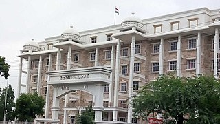
Amravati is the second largest city in the Vidarbha region and ninth largest city in Maharashtra, India. It is administrative headquarters of Amravati district and Amravati division which includes Akola, Buldhana, Washim, and Yavatmal districts. It is one of the Maharashtra's nominated city under Smart Cities Mission.

Yavatmal district, [jəʋət̪maːɭ] formerly known as Yeotmal, is a district of the Indian state of Maharashtra. It is located in the region of Vidarbha, in the east-central part of the state. It is Vidarbha's third-largest district by population, after Nagpur and Amravati. Yavatmal city is the administrative headquarters of the district.

Amravati district is a district of Maharashtra state in central India. It is the administrative headquarter of Amravati division, which is one of the two divisions in Vidarbha, out of total 6 regions in state of Maharashtra.
Pusad is a city in the Yavatmal district located in Vidarbha region of Maharashtra state of India. It is named after the Pus river. Its ancient name was 'Pushpawanti'. Pusad is second largest city of Yavatmal district. For last 20 years Pusad is being tried to be promoted to the stature of district but due to lack of administration of governing bodies it is only a dream of the people.
Anjangaon is a city and a municipal council in Amravati district in the state of Maharashtra, India. Anjangaon City got the status of Municipal Council in 1930. It is the first municipal council established in Amravati district and the second biggest council as well. Anjangaon Surji Tehsil was established in 1981. It is technically made up of two main zones, Anjangaon and Surji, on either side of Shahanur River, and is called Anjangaon-Surji in combination. It is called a "Banana Hub of Vidarbha" as it is a large producer of bananas and a hub of medicinal plants - Piper longum and Safed musali.
Bhainsdehi is a city and a Nagar Parishad in Betul district in the state of Madhya Pradesh, India. Kukru is the second highest point of Mahadeo hills. Bhainsdehi is the originating place of the river Purna. It is predominantly a tribal tehsil. Bhainsdehi is surrounded by the mountain ranges of Satpura. Prachin Shiv mandir one of the most beautiful place in Bhainsdehi city
Chandur Railway is a city and a municipal council in Amravati district in the state of Maharashtra, India. Chandur Railway is one of the three talukas of Chandur Railway subdivision in Amravati district.
Chandur bazar is a City governed by a Municipal Council in Amravati district in the state of Maharashtra, India.
Dhamangaon is a town and a municipal council in Amravati district in the state of Maharashtra, India. Dhamangaon is one of the three talukas in Chandur (Railway) subdivision in Amravati district. The municipal council is named as Dattapur-Dhamangaon Municipal council.
Morshi is the second largest town in the Amravati district of Maharashtra, India. It is located 55 km north-east of Amravati, situated very close to the border with Madhya Pradesh, in the scenic southern foothills of the Satpura ranges. Morshi and the surrounding region is also known for the cultivation of Nagpur oranges and the prominent Nal Damayanti Dam. Salbardi is very near from morshi.
Narkhed is a town and a municipal council in Nagpur district in the Indian state of Maharashtra. It is about 87 km north-west of Nagpur. It is the administrative headquarters of Narkhed taluka, one of the 14 talukas of this district. It is located in the "orange belt" and is a major center for orange-trading.
Warud is a town and municipal council in Amravati district in the Indian state of Maharashtra. It is known as the "Orange City".
Bhatakuli is a town and a taluka in Amravati subdivision of Amravati district in Amravati revenue Division in the Berar region in the state of Maharashtra, India. Bhatkuli has an ancient shiv temple for Vishwamitra, Waki Raipur, Nirul Gangamai, Himmatpur, Purna Nagar, Marki, Makarampur, Ashti, Hathkheda, Kholapur, Chinchkhed, Dhangarkhed, Wathoda Shukleshwar, sayat and many more villages. Also available various ancient temple like Ram mandir, Jain mandir etc.
Nandgaon is a historical town and a nagar panchayat in Mathura district in the Indian state of Uttar Pradesh. Nandgaon is a religious centre in Braj region. It is believed that Krishna in his childhood resided in Nandgaon with his family. Nandgaon, named after Nand Baba, father of Krishna has many famous temples related to lord krishna times, eg the Ancient temple of Lord Narsimha Dev. Afraid of demons of Kansha, Nand Maharaj established Lord Narsimha Dev Vigraha, on countcil of Shandilya Rishi, to protect Lord Krishna from Kansha demons. Nandgaon is the most pious Place in the world.

Ellichpur District is a former district of British India. It encompassed the western portion of present-day Amravati District in Maharashtra state. Ellichpur (Achalpur) was the administrative headquarters of the district.
Dhamangaon Railway Assembly constituency is one of the 288 Vidhan Sabha constituencies in Maharashtra state in western India. This constituency is part of the eight constituencies located in the Amravati district.
Teosa Assembly constituency is one of the 288 constituencies of Maharashtra Vidhan Sabha and one of the eight present in Amravati district.
Jhangirpur, also written Jahangirpur, is a small town in the Chandur (Railway) sub-division of Amravati district, Maharashtra, India, located about 40 km from Amravati and about 3 km from Kaundinyapur. It is well-connected by road.

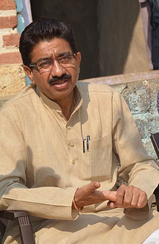
Virendra Jagtap is a member of the Indian National Congress Party, he was elected continuously for the third time as the member of Maharashtra Vidhan Sabha representing the erstwhile Chandur Constituency & Dhamangaon constituency. He was previously the president of Amravati District Congress Committee (Rural) and served as the Chairperson of the Employment Guarantee Scheme (EGS) Committee of the Maharashtra Legislature.

The Narkhed–Badnera line, officially known as the Narkhed–Amravati line, is a single electric branch line which connects Narkhed in Nagpur district to Badnera near Amravati by Indian Railways in the state of Maharashtra. The line is under the administrative jurisdiction of the Central Railway.


