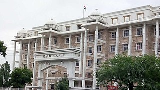
Amravati is a city in Maharashtra located in the Vidarbha region. It is the ninth largest city in Maharashtra, India & second largest city in the Vidarbha region in terms of population. It is the administrative headquarter of Amravati district as well as Amravati Division which includes Amravati District, Akola District, Buldhana District, Washim District & Yavatmal District. It is one of Maharashtra's nominated cities under Smart Cities Mission.

Yavatmal district, [jəʋət̪maːɭ] formerly known as Yeotmal, is a district of the Indian state of Maharashtra. It is located in the region of Vidarbha, in the east-central part of the state. It is Vidarbha's third-largest district by population, after Nagpur and Amravati. Yavatmal city is the administrative headquarters of the district.
Paithan ['pəɪ.ʈʰaɳ], historically Pratiṣṭhāna [pɾə'tɪʂʈʰana], is a town with municipal council in Aurangabad district, Maharashtra, Maharashtra, India. Paithan is located 56 kilometres (35 mi) south of present-day Aurangabad on the banks of the Godavari River. It was the capital of the Satavahana dynasty, which ruled from the second century BCE to the second century CE. It is one of the few inland towns mentioned in the famous first-century Greek book, the Periplus of the Erythraean Sea.

Buldhana district is located in the Amravati division of Maharashtra, India. It is situated at the western border of Vidarbha region and is 500 km away from the state capital, Mumbai. The district has towns and cities like deulghat, dhad, mehakar, Shegaon, Malkapur, Khamgaon, Lonar and Chikhli. It is surrounded by Madhya Pradesh in the north, Akola, Washim, and Amravati districts on the east, Jalna district on the south, and Jalgaon and Aurangabad districts on the west. Khamgaon is the largest city in the district.

Shegaon is a city and municipal council in the Buldhana district in the Indian state of Maharashtra. Shegaon has become a pilgrimage centre due to the influence of Shri Sant Gajanan Maharaj, who is a Hindu saint.
Mehkar is a tabletop tehsil and a municipal council situated in Buldhana district of the Indian state of Maharashtra. Located at the bank of Painganga River, Mehkar falls in the Vidarbha region of Maharashtra.

Amravati district is a district of Maharashtra state in central India. It is the administrative headquarter of Amravati division, which is one of the two divisions in Vidarbha, out of total 6 regions in state of Maharashtra.
Murtijapur is a Municipal council and one of the taluka of district of Akola of the Amravati division of the Vidarbha region of Maharashtra.
Sillod is a city and a taluka in the Aurangabad district of the Indian state of Maharashtra. Sillod is represented in the Maharashtra Vidhan Sabha through the Sillod Vidhan Sabha constituency. MLA OF SILLOD IS Abdul sattar

Achalpur, formerly known as Ellichpur and Illychpur, is a city and a municipal council in Amravati District in the Indian state of Maharashtra. It is the second most populous city in Amravati District after Amravati and seventh most populous city in Vidarbha. Achalpur camp is known as Paratwada.
Anjangaon is a city and a municipal council in Amravati district in the state of Maharashtra, India. Anjangaon City got the status of Municipal Council in 1930. It is the first municipal council established in Amravati district and the second biggest council as well. Anjangaon Surji Tehsil was established in 1981. It is technically made up of two main zones, Anjangaon and Surji, on either side of Shahanur River, and is called Anjangaon-Surji in combination. It is called a "Banana Hub of Vidarbha" as it is a large producer of bananas and a hub of medicinal plants - Piper longum and Safed musali.
Bhainsdehi is a city and a Nagar Parishad in Betul district in the state of Madhya Pradesh, India. Kukru is the second highest point of Mahadeo hills. Bhainsdehi is the originating place of the river Purna. It is predominantly a tribal tehsil. Bhainsdehi is surrounded by the mountain ranges of Satpura. Prachin Shiv mandir one of the most beautiful place in Bhainsdehi city
Daryapur is a city located in the Amravati District of Maharashtra State, India. It belongs to the Vidarbha region of the Amravati Division. It is located 52 km (32.31m) west of the District headquarters of Amravati.
Ghatanji is a very old city and municipal council in Yavatmal district in the state of Maharashtra, India. It is also known as 'Cotton City', because in this area farmer produces a fine quality of cotton. It is also a place of pilgrimage of 'Brahmalin Shree Sant Maroti Maharaj' having Devasthan near the bank of river 'Waghadi'. Every year, in January–February, a fair in the name of 'Brahmalin Shree Sant Maroti Maharaj' takes place at the 'Azad Maidan'. The day on which 'Dahi Handi' is being celebrated, is the main occasion in one month fair.
Ghatanji is a composition of name 'Ghati' and 'Anji', nearby suburbs, and is one of the main towns in Yavatmal District. There is a historical temple of 'Lord Nrusimha', which was built in Hemadpanti architecture. People from all the corners of Maharashtra, Andhra Pradesh, Telangana, and other nearby states come here to pay homage."
Loha is a town with municipal council in Nanded district in the Indian state of Maharashtra. Malegaon Yatra, is held every year in honour of Lord Khandoba in Malegoan, a village situated in Loha Taluka that is located 35 km from Nanded. Being on national highway 361 and 361F this is very well connected for the transportation for Mumbai,Goa-Raypur and Hyderabad.
Morshi is the second largest town in the Amravati district of Maharashtra, India. It is located 55 km north-east of Amravati, situated very close to the border with Madhya Pradesh, in the scenic southern foothills of the Satpura ranges. Morshi and the surrounding region is also known for the cultivation of Nagpur oranges and the prominent Nal Damayanti Dam. Salbardi is very near from morshi.
Multai is a town and a Nagar Palika in Betul district in the Indian state of Madhya Pradesh. Multai is one of the southern cities of Madhya Pradesh, occupying almost half of the Satpura plateau. Considering the small villages around, it occupies a large area in width of the Satpura range between the valley of the Narmada on the north and the barer plains on the south. Forests lie to the west of the city between the districts of East Nimar and Amaraoti. It lies on the Northern bank of the Tapti and the place is also known for being the origin of the Tapti river.
Dharni (CT) is a Nagar Panchayat and Census Town city in Amravati district in the Indian state of Maharashtra. The Dharni Census Town has population of 15,761 of which 8,075 are males while 7,686 are females as per report released by Census of India 2011. It is the headquarters of Dharni tehsil and forms the terminus of the high road through the hills from Paratwada to Burhanpur. It is 97 km (60 mi) distant from Paratwada and 148 km (92 mi) from Amravati.
Sirsoli is a village in Telhara tehsil of Akola district and is known for the Battle of Argaon. The Battle of Argaon took place on 28 November 1803, between the British under the command of General Arthur Wellesley and the forces of The Rajah of Berar under Sindhia of Gwalior. The battlefield was located between Argaon and Sirsoli.
Mahagaon is a town in Gadhinglaj Taluka, Kolhapur district, situated in the southwest corner of the state of Maharashtra, India, on the banks of the Hiranyakeshi river. It is about 10 kilometres (6.2 mi) south of Gadhinglaj and 14 kilometres (8.7 mi) from the city of Kadgaon. It is managed by a town council. In 2011, it had a population of about 20,108.


