| Nandkar | |
|---|---|
| village | |
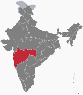
 Nandkar Location in Maharashtra, India  Nandkar Nandkar (India) | |
| Coordinates: 19°16′56″N73°10′03″E / 19.2822375°N 73.1674128°E Coordinates: 19°16′56″N73°10′03″E / 19.2822375°N 73.1674128°E | |
| Country | India |
| State | Maharashtra |
| District | Thane |
| Taluka | Bhiwandi |
| Elevation | 18 m (59 ft) |
| Population (2011) | |
| • Total | 1,603 |
| Time zone | IST (UTC+5:30) |
| 2011 census code | 552637 |
Nandkar is a village in the Thane district of Maharashtra, India. It is located in the Bhiwandi taluka. [1] The Bhatsa River joins the Kalu River (a tributary of Ulhas River near this village.

Thane District ([]) is a district in the Indian state of Maharashtra in Konkan Division. At the 2011 Census it was the most populated district in the nation, with 11,060,148 inhabitants; however, in August 2014 the district was split into two with the creation of a new Palghar district, leaving the reduced Thane district with a 2011 Census population of 8,070,032. The headquarters of the district is the city of Thane. Other major cities in the district are Navi Mumbai, Kalyan-Dombivli, Mira-Bhayander, Bhiwandi, Ulhasnagar, Ambarnath, Badlapur, Murbad and Shahapur.
Maharashtra is a state in the western peninsular region of India occupying a substantial portion of the Deccan plateau. It is the second-most populous state and third-largest state by area in India. Spread over 307,713 km2 (118,809 sq mi), it is bordered by the Arabian Sea to the west, the Indian states of Karnataka and Goa to the south, Telangana and Chhattisgarh to the east, Gujarat and Dadra and Nagar Haveli to the north west, and Madhya Pradesh to the north. It is also the world's second-most populous subnational entity. It was formed by merging the western and south-western parts of the Bombay State, Berar and Vidarbha, and the north-western parts of the Hyderabad State and splitting Saurashtra by the States Reorganisation Act. It has over 112 million inhabitants and its capital, Mumbai, has a population around 18 million making it the most populous urban area in India. Nagpur hosts the winter session of the state legislature. Pune is known as 'Oxford of the East' due to the presence of several well-known educational institutions.

India, also known as the Republic of India, is a country in South Asia. It is the seventh largest country by area and with more than 1.3 billion people, it is the second most populous country as well as the most populous democracy in the world. Bounded by the Indian Ocean on the south, the Arabian Sea on the southwest, and the Bay of Bengal on the southeast, it shares land borders with Pakistan to the west; China, Nepal, and Bhutan to the northeast; and Bangladesh and Myanmar to the east. In the Indian Ocean, India is in the vicinity of Sri Lanka and the Maldives, while its Andaman and Nicobar Islands share a maritime border with Thailand and Indonesia.
