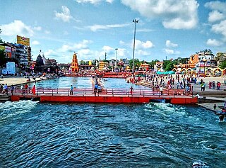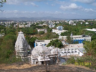
Nashik is an ancient city and the largest city in the northern region of the Indian state of Maharashtra. Situated on the banks of river Godavari, Nashik is the fourth largest city in Maharashtra, after Mumbai, Pune and Nagpur. Nashik is well known for being one of the Hindu pilgrimage sites of the Kumbh Mela, which is held every 12 years. Nashik is located about 190 km north of state capital Mumbai. The city is called the "Wine Capital of India" as more than half of India's vineyards and wineries are located here. Around 90% of all wine produced in India comes from the Nashik Valley.

Nanded is a city in Maharashtra state, India. It is the eighth largest urban agglomeration of the state and the seventy-ninth most populous city in India. It is the second largest city in Marathwada region. Nanded is the centre of governance of Nanded district. Nanded is a major destination for Sikh pilgrims, because the 10th Sikh Guru made Nanded his permanent abode and passed his guruship to the Guru Granth Sahib before his death in 1708.

Kandali Tarf Rahur is a village in the Thane district of Maharashtra, India. It is located in the Bhiwandi taluka. It is situated between AH47 and the Bhatsa River.

NandkarKoliwada is a village in the Thane district of Maharashtra, India. It is located in the Bhiwandi taluka. The Bhatsa River joins the Kalu River (a tributary of Ulhas River near this village.

Chiradpada is a village in the Thane district of Maharashtra, India. It is located in the Bhiwandi taluka. It lies on the bank of Bhatsa River.

Bordi is a coastal village in the Palghar district of Maharashtra, India. It is located in Dahanu taluka. It is a tourist destination due to its beach and natural environment. It is also famous for the Chickoo fruit and has many Chikoo farms. A festival named Chikoo Festival also takes place in Bordi.

Khunavade is a village in the Palghar district of Maharashtra, India. It is located in the Dahanu taluka.

Junnarpada is a village in the Palghar district of Maharashtra, India. It is located in the Dahanu taluka.

Kosbad is a village in the Palghar district of Maharashtra, India. It is located in the Dahanu taluka.

Dhamanagaon is a village in the Palghar district of Maharashtra, India. It is located in the Dahanu taluka.

Asave is a village in the Palghar district of Maharashtra, India. It is located in the Dahanu taluka.

Alkapur is a village in the Palghar district of Maharashtra, India. It is located in the Dahanu taluka.

Kasara is a village in the Palghar district of Maharashtra, India. It is located in the Dahanu taluka.

Bahare is a village in the Palghar district of Maharashtra, India. It is located in the Dahanu taluka.

Bapugaon is a village in the Palghar district of Maharashtra, India. It is located in the Dahanu taluka.

Dhamatane is a village in the Palghar district of Maharashtra, India. It is located in the Dahanu taluka.

Dhumket is a village in the Palghar district of Maharashtra, India. It is located in the Dahanu taluka.

Charoti is a village in the Palghar district of Maharashtra, India. It is located in the Dahanu taluka.

Bhavadi is a village in the Palghar district of Maharashtra, India. It is located in the Dahanu taluka.

Kosesari is a village in the Palghar district of Maharashtra, India. It is located in the Dahanu taluka. It is in rural part of Palghar, and it is one of the 173 villages of Dahanu Block of Palghar district.


