This article needs additional citations for verification .(January 2007) (Learn how and when to remove this template message) |
Nandnee Nandani | |
|---|---|
village | |
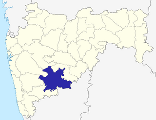
 Nandnee Location in Maharashtra, India  Nandnee Nandnee (India) | |
| Coordinates: 17°27′18″N75°50′44″E / 17.45500°N 75.84556°E Coordinates: 17°27′18″N75°50′44″E / 17.45500°N 75.84556°E | |
| State | Maharashtra |
| District | Solapur |
| Elevation | 439 m (1,440 ft) |
| Population (2011) | |
| • Total | 1,590 |
| Languages | |
| • Official | Marathi |
| Time zone | UTC+5:30 (IST) |
Nandnee, also spelleda as Nandani, is a village in the Solapur district in Pune division of Desh region of Maharashtra state in India.
Solapur District is a district in Maharashtra state of India. The city of Solapur is the district headquarters. It is located on the south east edge of the state and lies entirely in the Bhima and Seena basins. The entire district is drained by the Bhima River.
Desh is a region in India bounded on the west by the Western Ghats or Sahyadri range, on the north by the Khandesh and on the east by the Marathwada regions of Maharashtra and on the south by Karnataka. The region is hilly and slopes towards the east, and is drained by the upper reaches of the Godavari and Krishna rivers and their tributaries.

Maharashtra is a state in the western peninsular region of India occupying a substantial portion of the Deccan Plateau. It is the second-most populous state and third-largest state by area in India. Spread over 307,713 km2 (118,809 sq mi), it is bordered by the Arabian Sea to the west, the Indian states of Karnataka and Goa to the south, Telangana to the southeast and Chhattisgarh to the east, Gujarat and Madhya Pradesh to the north, and the Indian union territory of Dadra and Nagar Haveli to the north west. It is also the world's second-most populous subnational entity.


