Related Research Articles

Buxar district is one of the 38 districts of Bihar, India. Located in the southwestern part of the state, it is a primarily agricultural district. The district headquarters is at the town of Buxar.
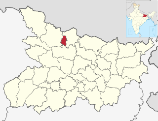
Sheohar is an administrative district in the state of Bihar in India. The district headquarters are located at Sheohar, and the district is a part of Tirhut Division. This district was carved out of Sitamarhi district in 1994 due to the extreme efforts of Raghunath Jha, former Union Minister. Eminent Hindi Novelist, Dr. Bhagwati Sharan Mishra was the first District magistrate of Sheohar . Sivas used to have a guest house in the Mehsi town of his time, which is still located in the name of Raja Bazar in East Champaran.The district occupies an area of 349 km2 and has a population of 656,246. Sheohar is known for its greenery and cleanliness. Cadamba and teak are the principal trees of this district. Nilgai or blue bull is the regional animal of this area.
Araria district is one of the thirty-eight districts of Bihar state, India. Araria district is a part of Purnia division. The district occupies an area of 2,830 km2 (1,090 sq mi). Araria town is the administrative headquarters of this district. Distance from Nepal border is only about 8 km from Forbesganj head quarter.

Purnia District is one of the thirty-eight districts of the Indian state of Bihar. The city of Purnia is the administrative headquarters of this district. The city of Purnia has continued its tradition of hoisting the national flag at 12:07 am on every Independence Day since 1947. Purnia district is a part of Purnia Division. The district extends northwards from the Ganges river.

Madhepura district is one of the thirty-eight districts of Bihar state, India, and Madhepura town is the administrative headquarters of this district. Madhepura district is a part of Kosi division.

Madhubani district is one of the thirty-eight districts of Bihar, India, and is a part of Darbhanga division. Its administrative headquarters are located in Madhubani. The district has an area of 3,501 square kilometres (1,352 sq mi) and has a population of 4,487,379.

Katihar district is one of the thirty-eight districts of Bihar state in India, and Katihar city is the administrative headquarters of this district. The district is a part of Purnia Division. It is prominently known for its Katihar Junction Railway Station, which is a Category A station on the Barauni–Guwahati line. It has been included in the Aspirational Districts Program of the Government of India since 2018, to improve its socio-economic indicators.

Kaimur district is one of the 38 districts of Bihar, India. The district headquarters are at Bhabua. Before 1991, it was part of Rohtas District. Till 1764 the region was a part of Ghazipur District and was a part of Kamsaar Raj and later it was a part of Chainpur Estate till 1837.

Munger district is one of the thirty-eight districts of Bihar state in eastern India. The city of Munger is the administrative headquarters of this district. The district is a part of Munger Division. Its literacy rate of 73.3% is higher than the state literacy rate of 63.8%, but lower than national rate of 74.04%.

Bhagalpur district is one of the thirty-eight districts of Bihar state, India. Bhagalpur is the oldest district of Bihar. Bhagalpur city is the administrative headquarters of this district.

Saharsa is one of the thirty-eight districts of Bihar, India. Saharsa city is the administrative headquarters of this district. Saharsa district is a part of the Kosi Division and it became a district on 1 April 1954 and has subsequently become smaller with other districts being carved from it, most notably Madhepura in 1981.

Jamtara district is one of the twenty-four districts of Jharkhand state in eastern India. Jamtara town is the administrative headquarters of this district. The district is situated between 23°10′ and 24°05′ north latitudes and 86°30′ and 87°15′ east longitudes.

Bhagalpur division is one of the nine administrative units of Bihar, a state in the east of India. Bhagalpur city is the headquarters of the division. Established in 1765, it is oldest division of the state.

Narayanpur district is one of the 33 districts of Chhattisgarh State in Central India. It is one of the two districts created on May 11, 2007. It was carved out from the erstwhile Bastar district. This district occupies an area of 6640 km2 and it had a population of 110,800 in 2001. Narayanpur town is the administrative headquarters of this district. This district comprises 366 villages. It is currently a part of the Red Corridor.
Naugachhia Block is a community development block in the Bhagalpur district of the Indian state of Bihar. It is situated in the eastern part of Bihar and is known for its rich cultural heritage and historical significance. It lies in the Anga Region of Bihar,IndiaIt comes under Naugachhia subdivision.
Gopalpur is a block in Bhagalpur district of Bihar, India. It is one of sixteen blocks under Bhagalpur district.According to census 2011 information the sub-district code of Gopalpur Block (CD) is 01334. It lies in the Anga region of India.It comes under Naugachhia subdivision of the District.
Ismailpur Block is block within the Bhagalpur District of Bihar, India. The pin code for Ismailpur is 853205, and the postal head office is S.T. Goriar.It comes under Naugachhia subdivisionIt is a part of Anga region of Bihar.
Rangra Chowk or Rangrachowk is a community development block in Bhagalpur District of Bihar,India. It is a part of Anga Region of India.The Block-code for Rangra Chowk is 01333It comes under Naugachhia subdivision.

Naugachhia subdivision is an administrative subdivision out of three subdivisions of Bhagalpur district in the state of Bihar, India. It comprises 7 Blocks of Bhagalpur .The headquarter of the subdivision is in Naugachhia Town.
Kharik Block is an administrative region located within the Bhagalpur district of Bihar. It is situated in the northeastern part of Bihar. It is a community development block under Naugachhia subdivision in Bhagalpur district. It lies in the Anga Region of Bihar.
References
- ↑ "Subdivision & Blocks | Bhagalpur | India" . Retrieved 2024-03-16.
- ↑ "Demography of Bihar Blockwise". Census of India 2011.
- ↑ "Table C-01 Population by Religion: Bihar". Registrar General and Census Commissioner of India .
- ↑ "Table C-01 Population by Religion: Bihar". censusindia.gov.in. Registrar General and Census Commissioner of India. 2011.
- ↑ Prakash, Om; Kumar, Rajesh (2020-11-02). Linguistic Foundations of Identity: Readings in Language, Literature and Contemporary Cultures. Routledge. ISBN 978-1-000-21796-4.
- ↑ Linguistic Survey of India - Bihar. 2020-12-01.