Naugachhia subdivision

Last updated
Naugachhia subdivision
subdivision
Naugachhia
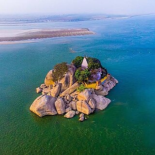
Jagatpur lake.png
Jagatpur Lake (Bird sanctuary)
Nickname: 
North Bhagalpur
CountryFlag of India.svg  India
State Bihar
Region Anga [1]
District Bhagalpur
Parliamentary constituency Bhagalpur
Assembly constituency Bihpur,Gopalpur
Headquarters Naugachhia Town
Area
  subdivision339 sq mi (878 km2)
  Urban
4.34 sq mi (11.24 km2)
  Rural
334.66 sq mi (866.76 km2)
Population
 (2011)
  subdivision746,089
  Density2,200/sq mi (850/km2)
   Urban
49,082
   Rural
697,007
Language
  Regional Angika
Time zone UTC+5.30 (IST)
Vehicle registration BR-

Naugachhia subdivision is an administrative subdivision out of three subdivisions of Bhagalpur district in the state of Bihar, India. It comprises 7 Blocks of Bhagalpur .The headquarter of the subdivision is in Naugachhia Town. [2] [3]

Contents

History

Historically it comes under Anga Region.

Initially Bhagalpur district was created in 1765 and was the second oldest district of Bihar. In the year 1954, the entire area north of the Ganges, with the exception of Bihpur, Naugachhia and Gopalpur Police Stations was constituted into the new Saharsa district followed by Banka in 1991. As presently constituted, contains three subdivisions, viz., Bhagalpur Sadar, Naugachhia and Kahalgaon consisting of 16 Community Development Block-cum-Anchals. Naugacihia subdivisions thus constitute the entire north of Bhagalpur constituting the Bihpur and Gopalpur Vidhansabha. Sometimes Naugachhia subdivision is referred as North Bhagalpur. This part makes Bhagalpur, the only district in Bihar to have its territory in both side of Ganges. [4]

Etymology

The word "Naugachhia" is derived from Angika Language . It consists of Nau and Gachhia, Nau means Nine, Gachhia means Tree. Naugachhia means Land of Nine trees.

Geography

Naugachhia Subdivision possess a great geographical location surrounded by Kosi in the north and Ganges in the south. Naugachhia is located at approximately 25.3°N latitude and 87.8°E longitude. [5] It is located 141 ft above sea level. The area is very prone to floods .The total area of Naugachhia subdivision is 878 km2.

Economy

The economy of the subdivision is primarily agrarian, with agriculture being the main occupation of the majority of its population. The fertile land along the banks of the Ganges river supports the cultivation of various crops, including rice, wheat, sugarcane, and pulses.There have been new industries like Ethanol Industry introduced in the subdivision to fight against the growing unemployment. In February 2022, the state industries minister of Bihar, Syed Shahnawaz Hussain, laid the foundation for a 95 crore rupee ethanol production unit in Naugachhia, Bhagalpur. [6] [7]

Blocks in Naugachhia

Area

The total area of Naugachhia subdivision is 878 km2.

Demographics

Population Distribution

Naugachhia Subdivision is home to 746,089 people, with a notable mix of urban and rural inhabitants. Urban centers within the subdivision like Naugachhia town, the only town present in the subdivision, contribute significantly to its population, while the rural hinterlands maintain the demographic presence. About 93.4% of Naugachhia Subdivision's population lies in the rural area and only 6.6% of the population lie in the urban area.

Ethnic Composition

The demographic makeup of Naugachhia Subdivision is characterized by a mosaic of ethnicities, castes, and communities.Prominent castes here are Gangota followed by Yadav, Koiri,Brahmin,Rajput ,Paswan and Bhumihar.All of the people belong to Indo-Aryan group.

Gender and Sex ratio

Males constitute about 3,97,991 whereas females constitute about 3,48,098.The sex ratio is 875 which is lower than the national average.

Language

Angika is the primary language in Naugachhia subdivision. Hindi is the official language and Urdu is the additional official language. [8] [9]

Religion [10]

By Percentage

Religion in Naugachhia Subdivision(2011) [11]
ReligionPercent
Hinduism
88.6%
Islam
11.2%
Other or not stated
0.2%

Hinduism is the majority religion in Naugachhia Subdivision with 88.6% of the total population.It is followed by Islam with 11.2% followers.Other religions constititute about 0.2% following it including Jainism and Christianity.

By Numbers

ReligionAdherents
Hinduism 6,60,771
Islam 83,586
Others1,705

By C.D. Block [12]

CD block Hinduism

Islam

Others
Naugachhia 89.75%10.05%0.20%
Gopalpur 93.75%6.25%0.10%
Ismailpur 96.23%3.5%0.43%
Bihpur 81.66%17.98%0.35%
Rangrachowk 89.64%9.91%0.45%
Kharik 87.26%12.57%0.17%
Narayanpur 88.16%11.69%0.13%

Distribution in the District

About 24.6%population of Bhagalpur District lives in Naugachhia Subdivision and about 34.2% of the total area of district lies in Naugachhia Subdivision.

Related Research Articles

<span class="mw-page-title-main">Bhagalpur district</span> District of Bihar in India

Bhagalpur district is one of the thirty-eight districts of Bihar state, India. Bhagalpur is the oldest district of Bihar. Bhagalpur city is the administrative headquarters of this district.
<span class="mw-page-title-main">Bhagalpur division</span> Division of Bihar in India

Bhagalpur division is one of the nine administrative units of Bihar, a state in the east of India. Bhagalpur city is the headquarters of the division. Established in 1765, it is oldest division of the state.

Bihpur is a block in Bhagalpur district of Bihar, India. It is one of sixteen blocks under Bhagalpur district.According to Census 2011, the sub-district code of Bihpur Block (CD) is 01330.It lies in the Anga Region of Bihar.

Naugachhia is a town in the Bhagalpur district of Bihar, situated within the Anga region of India. It comes under the Naugachhia block in the Bhagalpur district.It is also the headquarters of Naugachhia subdivision of Bhagalpur. In the 2011 census of India, its population was recorded as 49,069. Naugachhia has an average literacy rate of 62%, lower than the national average of 74%: male literacy is 69% and female literacy is 55%. 18% of the population is under 9 years of age.

Dharhara is a village in the Gopalpur block of Bhagalpur district of Bihar, India. There is a tradition of plantation when a girl is born in any family of this village. The main source of income of the village is agriculture but with time people also have showed their interest in the business field for example, setting up of some industries.

Most of the languages of Bihar, the third most populous state of India, belong to the Bihari subgroup of the Indo-Aryan family. Chief among them are Bhojpuri, spoken in the west of the state, Maithili in the north, Magahi in center around capital Patna and in the south of the state. Maithili has official recognition under the Eighth Schedule to the Constitution of India. The official language of Bihar is Modern Standard Hindi, with Standard Urdu serving as a second official language in 15 districts.

<span class="mw-page-title-main">Angika</span> Bihari language of India and Nepal

Angika is an Eastern Indo-Aryan language spoken in some parts of the Indian states of Bihar and Jharkhand, as well as in parts of Nepal.

<span class="mw-page-title-main">Gopalpur, Bihar Assembly constituency</span> Constituency of the Bihar legislative assembly in India

Gopalpur Assembly constituency is one of 243 legislative assembly constituencies of the legislative assembly of Bihar. It is a part of the Bhagalpur Lok Sabha constituency along with other assembly constituencies viz Bihpur, Pirpainti, Kahalgaon, Bhagalpur and Nathnagar. The town of Gopalpur, Bihar is part of this constituency.

<span class="mw-page-title-main">Nathnagar Assembly constituency</span> Assembly constituency in Bihar

Nathnagar Assembly constituency is one of 243 constituencies of legislative assembly of Bihar. It comes under Bhagalpur Lok Sabha constituency along with other assembly constituencies viz. Gopalpur, Pirpainti, Kahalgaon, Bhagalpur and Bihpur.

Tarar is a village located in Sonhaula subdivision of Bhagalpur district in Bihar, India. It is situated 12km away from sub-district headquarter Sonhaula and 25km away from district headquarter Bhagalpur. As per 2009 stats, Tarar is also a village panchayat.

Kaharpur is a village located in the Bihpur block of Bhagalpur district in Bihar, India. It is situated 5 km away from sub-district headquarter Bihpur and 37 km away from district headquarter Bhagalpur.

List of cities and towns in Bhagalpur district in the Indian state of Bihar.

Partapnagar is a village in Naugachhia Block, Bhagalpur District, Bihar, India. It is located on the north of Bhagalpur District, about 20 kilometres northeast of the district capital Bhagalpur, and 2 kilometres northwest of the block capital Naugachhia. In the year 2011, it had a population of 35,878.

Naugachhia Block is a community development block in the Bhagalpur district of the Indian state of Bihar. It is situated in the eastern part of Bihar and is known for its rich cultural heritage and historical significance. It lies in the Anga Region of Bihar,IndiaIt comes under Naugachhia subdivision.

Gopalpur is a block in Bhagalpur district of Bihar, India. It is one of sixteen blocks under Bhagalpur district.According to census 2011 information the sub-district code of Gopalpur Block (CD) is 01334. It lies in the Anga region of India.It comes under Naugachhia subdivision of the District.

Ismailpur Block is block within the Bhagalpur District of Bihar, India. The pin code for Ismailpur is 853205, and the postal head office is S.T. Goriar.It comes under Naugachhia subdivision.It is a part of Anga region of Bihar.

Rangra Chowk or Rangrachowk is a community development block in Bhagalpur District of Bihar,India. It is a part of Anga Region of India.The Block-code for Rangra Chowk is 01333It comes under Naugachhia subdivision.

Narayanpur is a Community development block in Bhagalpur district of Bihar, India. It is one of sixteen blocks under Bhagalpur district. According to the Census of 2011, the sub-district code of Narayanpur (CD) is 01329. It lies in the Anga region of India. It lies under Naugachhia subdivision. The area of Narayanpur is 157 km2 and has a population of 1,06,701 people. Narayanpur has a population density of 681 inhabitants per square kilometre. There are about 19,680 houses in Narayanpur.

Zabtaili is a village located in Naugachhia Block of Bhagalpur district in Bihar, India. It is situated 6km away from subdivision headquarter (Naugachhia) and 20km away from district headquarter (Bhagalpur). Zabtaili villages comes under the administrative Jagatpur Panchayat.The census code of this village is 238959.

Kharik Block is an administrative region located within the Bhagalpur district of Bihar. It is situated in the northeastern part of Bihar. It is a community development block under Naugachhia subdivision in Bhagalpur district. It lies in the Anga Region of Bihar.

References

  1. language and dialect based place name. Anu Kapur. March 2019. ISBN   978-0-429-61421-7 . Retrieved 12 October 2023.
  2. "Administrative Setup | Bhagalpur | India" . Retrieved 2024-03-06.
  3. "Subdivision & Blocks | Bhagalpur | India" . Retrieved 2024-03-06.
  4. "History | Bhagalpur | India" . Retrieved 2024-03-06.
  5. "Naugachhia Subdivision Location".
  6. "Min lays stone for ₹95 crore ethanol unit in Naugachhia". The Times of India. 2022-02-19. ISSN   0971-8257 . Retrieved 2024-03-06.
  7. "Bhagalpur: नवगछिया के केले की बिहार-यूपी समेत कई राज्‍यों में धूम, नेपाल के लोग भी दीवाने". News18 हिंदी (in Hindi). 2022-09-29. Retrieved 2024-03-06.
  8. Masica, Colin P. (1993). Indo-Aryan Languages. Cambridge Language Surveys (New ed.). Cambridge: Cambridge University Press. ISBN   978-0-521-29944-2.
  9. ""Language by mother tongue in Bihar"". Census of India .
  10. "Religion in Bihar". Census of India .
  11. "Table C-01 Population by Religion: Bihar". censusindia.gov.in. Registrar General and Census Commissioner of India. 2011.
  12. "Subdivision & Blocks | Bhagalpur | India" . Retrieved 2024-03-06.