Neendoor

Last updated

Neendoor

Kottayam
town
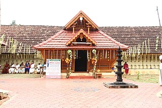
Pattaramma -moozhikulangara devi temple,.JPG
Devi Temple,Neendoor
Coordinates: 9°40′42″N76°30′20″E / 9.67833°N 76.50556°E / 9.67833; 76.50556 Coordinates: 9°40′42″N76°30′20″E / 9.67833°N 76.50556°E / 9.67833; 76.50556
CountryFlag of India.svg  India
State Kerala
District Kottayam
Languages
  Official Malayalam, English
Time zone UTC+5:30 (IST)
PIN
686601
Moozhikulangara temple Moozhikulangara devi temple view.JPG
Moozhikulangara temple
Onamthuruth Temple Onamthuruth krishana temple.JPG
Onamthuruth Temple
St.Michael Church St. Michael's church Neendoor.jpg
St.Michael Church
Subramanya Temple Neendoor Subrahmanya Swami temple.JPG
Subramanya Temple
Krishna Temple Gopuram onamthuruth krishana temple.JPG
Krishna Temple

Neendoor is a very small town in the Kottayam district in Kerala, India. The town is located 8 km south of Kottayam town, and is bordered by the towns of Kaipuzha, Athirampuzha, Kallara, Manjoor, Vechoor, and Onamthuruthu.

Kottayam district District in Kerala, India

Kottayam is one of the fourteen districts in the state of Kerala, India. Kottayam comprises six municipal towns: Kottayam, Changanassery, Pala, Erattupetta, Ettumanoor, and Vaikom. The district is 65 kilometers south of Kochi. It is also the only district in Kerala that does not border the Arabian Sea or any other states.

Kerala State in southern India

Kerala is a state on the southwestern Malabar Coast of India. It was formed on 1 November 1956, following passage of the States Reorganisation Act, by combining Malayalam-speaking regions. Spread over 38,863 km2 (15,005 sq mi), Kerala is the twenty-third largest Indian state by area. It is bordered by Karnataka to the north and northeast, Tamil Nadu to the east and south, and the Lakshadweep Sea to the west. With 33,387,677 inhabitants as per the 2011 Census, Kerala is the thirteenth-largest Indian state by population. It is divided into 14 districts with the capital being Thiruvananthapuram. Malayalam is the most widely spoken language and is also the official language of the state.

India Country in South Asia

India, officially the Republic of India, is a country in South Asia. It is the seventh-largest country by area, the second-most populous country, and the most populous democracy in the world. Bounded by the Indian Ocean on the south, the Arabian Sea on the southwest, and the Bay of Bengal on the southeast, it shares land borders with Pakistan to the west; China, Nepal, and Bhutan to the north; and Bangladesh and Myanmar to the east. In the Indian Ocean, India is in the vicinity of Sri Lanka and the Maldives; its Andaman and Nicobar Islands share a maritime border with Thailand and Indonesia.

Contents

Geography

Needoor is on the northern border of "Kuttanadu," 16 km from Kottayam and 7.5 km from Ettumanoor. In old days, say up until the early 1990s, the "punchapadam" (rice fields) gave a distinct Kuttandu look for Neendoor. The greenery is still there, what are missing are rice fields and farming. The income comes now mostly from non-farming.

Economy

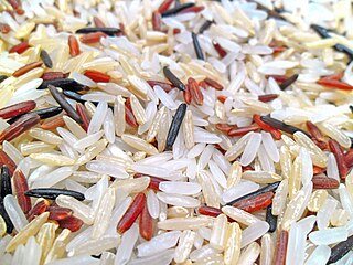
In terms of pure currency in-flow, money sent by ex-pats play a huge role (Middle East, USA, UK, Australia etc.) . Rubber is Neendoor's major cash crop. Up until the late 1970s, rice was a major cash crop as well. However, in the last several decades, the local economy has increasingly been bolstered by cash sent by Indian expatriates living in the Middle East, the United States, the United Kingdom, and Australia. This foreign support has contributed to the town's development in recent years - for example, with large mansions replacing the existing small houses. For whatever reason, many expatriates who worked out of state or out of country all their working life come back to Neendoor at retirement and prefer to build a house in the already crowded neighborhood.

Cash crop an agricultural crop which is grown to sell for profit

A cash crop or profit crop is an agricultural crop which is grown to sell for profit. It is typically purchased by parties separate from a farm. The term is used to differentiate marketed crops from subsistence crops, which are those fed to the producer's own livestock or grown as food for the producer's family. In earlier times cash crops were usually only a small part of a farm's total yield, while today, especially in developed countries, almost all crops are mainly grown for revenue. In the least developed countries, cash crops are usually crops which attract demand in more developed nations, and hence have some export value.

Rice cereal grain and seed of different Oryza and Zizania species

Rice is the seed of the grass species Oryza sativa or Oryza glaberrima. As a cereal grain, it is the most widely consumed staple food for a large part of the world's human population, especially in Asia. It is the agricultural commodity with the third-highest worldwide production, after sugarcane and maize.

A decade is a period of 10 years. The word is derived from the Ancient Greek: δεκάς, romanized: dekas, which means a group of ten. Other words for spans of years also come from Latin: biennium, triennium, quadrennium, lustrum, century, millennium.

Education

Nearly 100% of the young adults will graduate from high school and a big majority will get some college education or a degree. Although English is rarely spoken, most college level students can understand and write in English.

Demographics

The population of Neendoor is primarily of Hindus and Knanaya Catholics. The famous lord Muruga temple Neendoor Subrahmanya Swami Temple is located in this place. The patron saint of the area is St. Michael, after whom the local parish church is named. With the increase in automobile population, gone are the days of quite streets and all people walking to church for Sunday masses. A significant percentage of Neendoor's residents of Kna heritage has migrated to the US, Australia and the UK in the last few decades. With the privatization of professional colleges many and attending engineering and other technical schools lately. One of the recent trent seen among the younger generation is to get into a medical career (such as nursing, or X-ray technician) and to find a job abroad.

Knanaya

The Knanaya, also known as the Southists or Tekkumbhagar, are an endogamous group in the Saint Thomas Christian community of Kerala, India. They are differentiated from another part of the community, known in this context as the Northists. Today there are about 300,000 Knanaya in India and elsewhere.

Neendoor Subrahmanya Swami Temple

Neendoor Subrahmanya Swami Temple is an ancient lord Murugan temple located in the Neendoor, Kottayam district. The Neendoor Subrahanya Swami Temple is a historic site which has brought glory and fame to the local area. Myths say that the Pandavas and the sage Vyasa worshipped at this temple. The deity of the temple is Lord Muruga. Neendoor Subrahmanya Swami Temple hosts the arattu festival, which is celebrated on a grand scale on the Medashasti day in April–May every year. The Ottanarangamala Samarppanam is one of the important rituals of this temple.

Patron saint saint regarded as the tutelary spirit or heavenly advocate of a nation, place, craft, activity, class, clan, family, or person

A patron saint, patroness saint, patron hallow or heavenly protector is a saint who in Roman Catholicism, Anglicanism or Eastern Orthodoxy, is regarded as the heavenly advocate of a nation, place, craft, activity, class, clan, family or person.

Related Research Articles

Alappuzha district District in Kerala, India

Alappuzha is one of the 14 districts in the state of Kerala in India. It was formed as Alleppey District on 17 August 1957. The name of the district was officially changed to Alappuzha in 1990. Alleppey town was renamed Alappuzha in 2012, even though the anglicised name is still commonly used to describe the town as well as the district.
Vaikom Municipality/Historical Town in Kerala, India

Vaikom is a muncipal town and a capital town of Vaikom Taluk, situated in the northwest of Kottayam district in the state of Kerala, India. The town is also noted for its role in the Indian independence movement for being the venue of Vaikom Satyagraha, a civil rights movement aimed at securing freedom of movement for all sections of society through the public roads leading to The famous Shiva temple situated here.

Kanjirappally Town in Kerala, India

Kanjirappally is a taluk and a town in Kottayam district situated about 38 km (24 mi) away from the district capital, in the state of Kerala, India. National Highway connects Kanjirapally to major nearest cities. Kanjirappally, also known as the Gateway of Highrange since it is the geographic entrance to the 'Malanad' or the Hill country of Kerala, which extends to Idukki district and then to Tamil Nadu. Kanjirapally is one of the most busiest towns in kottayam district. It is a part of the Palai city metro. A new airport has been proposed which is near to kanjirapally in Erumeli.

Ettumanoor Municipality in Kerala, India

Ettumanoor, sometimes spelled Ettumanur, is a major town and municipality in the Kottayam district of Kerala, India, located 11 kilometers north-east of Kottayam city, 50 kilometers south of Cochin, and 70 kilometers south of Cochin International Airport. The SH-1 popularly known as the Main Central (MC) Road, passes through Ettumanoor, and is a major connecting link between Palai and beyond, to the Western Ghats and to the commercial capital of Kerala - Kochi. Ettumanoor is en route to the tourist destinations at Wagamon and Poonjar.

Kaipuzha village in Kerala, India

Kaipuzha is a small village in Kottayam District and sub-district in the Indian state of Kerala. As of the 2001 census, it had a population of 6,991 in 1,565 households.

Kouroussa Prefecture Prefecture in Kankan Region, Guinea

Kouroussa is a prefecture located in the Kankan Region of Guinea. The capital is Kouroussa. The prefecture covers an area of 14,050 km.² and has a population of 268,630. With Kouroussa town by far the largest in the Prefecture numbering only 10,000, the vast majority of the Prefecture's population live in small rural communities, making their living from subsistence and small scale cash crop agriculture, as well as small scale trade and mining. The majority of the population are members of the Malinke ethnic group or related Mande speakers. The eastern portion of the prefecture is formed from the Niger River valley, while most of the area characterized by low rolling hills and dry savanna grasslands or scrub-like forest.

Mallapally Town in Kerala, India

Mallappally is a taluk in Kerala state in India. It is one of the five taluks that make up the Pathanamthitta district. Historically a part of the kingdom of Travancore and called "Land of the BA graduates" due to English education imparted by Anglican missionaries in the 19th century, Mallappally is the original home of many Non-resident Indians, and has one of the lowest population growth and highest literacy rates in India.It is the taluk which has higher literacy in India.It is the place of the legand Sreehari Rajeev.

Athirampuzha Place in Kerala, India

Athirampuzha is a town in Kottayam district of Kerala state, South India. It is famous because the Mahatma Gandhi University is situated here. Athirampuzha is situated 10 km north of Kottayam town, 3 km from Ettumanoor and from Main Central Road S.H.1 of Kerala.

Alappuzha City in Kerala, India

Alappuzha, also known by its former name Alleppey, is the administrative headquarters of Alappuzha District in the Indian State of Kerala. Alappuzha is a city and a municipality in Kerala with an urban population of 174,164 and ranks third among the districts in literacy rate in the State of Kerala. In 2016, the Centre for Science and Environment rated Alappuzha as the cleanest town in India. Alappuzha is considered to be the oldest planned city in this region and the lighthouse built on the coast of the city is the first of its kind along the Laccadive Sea coast.

Belsand Town in Bihar, India

Belsand is a town and a notified area in Sitamarhi district in the state of Bihar, India. The place is located in a plain which is prone to floods, and on account of this ample amount of alluvium is there. This geographic position gives the place good agricultural prospects. Main market areas are around Kothi Bazaar and Belsand Chauraha. It is a flood-prone area. There are 53 villages and 10 panchayats in Belsand. Chandauli is the famous village of Belsand. Kansar is the smallest village and Bhorahar Mal is the biggest village. It is 65 m above sea level.

Vallakam town in Kerala, India

Vallakam, is a village in Vaikom Taluk of Kottayam district in the southern Indian state of Kerala.

Nedumkandam Town in Kerala, India

Nedumkandam is the headquarters of Udumbanchola taluk which is situated in Idukki district of the Indian state of Kerala. Nedumkandam is among the fastest growing towns in the Idukki district. Nedumkandam is well known for its spices production and is a major contributor to the production of spices like cardamom and pepper. This town situated an average elevation of 900 meter above sea level and maximum elevation respectively 1190 meter 1100 meter and 975 meter and is a destination for economical stay and shopping for tourists in the popular Kumily-Munnar tourist route.
Pallippad village in Kerala, India

Pallippad is a village in Alappuzha district in the Indian state of Kerala. The name Pallipad is believed to be derived from the Buddhist terminology. The famous River Achankovil Aar pass by Pallipad before it reaches veeyapuram. the village has abundant water resource, small lakes and water paths which connects to Alapuzha.

Elanji village in Kerala, India

Elanji is a village in Ernakulam district, Muvattupuzha Taluk in the Indian state of Kerala.

Rajakkad Town in Kerala, India

Rajakkad is a town in the Idukki district in the Indian state of Kerala situated in the Western Ghats. It is one of Kerala's fastest growing towns.

Chengalam South village in Kerala, India

Chengalam is a small hamlet located in Thiruvarpu panchayath in Kottayam town of Kerala, India.

Elamgulam village in Kerala, India

Elangulam is a large village in Kottayam district in the state of Kerala, India under the Palai Assembly constituency. The village comes under the local jurisdiction of Elikkulam Grama Panchayat.
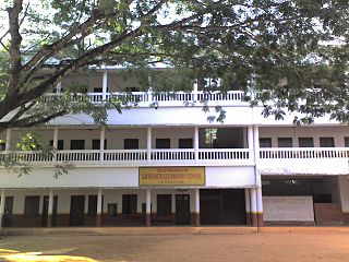
Njeezhoor village in Kerala, India

Njeezhoor is a village in Kottayam district in the state of Kerala, India. Njeezhoor is also spelled as Neezhoor. Njeezhoor is situated at the northern end of Kottayam (30 km).Distance to Cochin is only 45 km. The nearest railhead is piravom road Railway Station (12 km). Even though it’s a remote village in Kerala, the population has 98% Literacy, Good Educational institutions, cellular phone coverage, Telephone exchange, internet facilities, good transportation systems, irrigation systems etc. Njeezhoor grama panchyat has been awarded two time "The best panchyat in Kottayam district".

Anakkara (Idukki) Village in Kerala, India

Anakkara bus station

References

    Onamthuruth is the nearby village of neendoor, in which most of people are farmers.