
Southwark is a district of Central London situated on the south bank of the River Thames, forming the north-western part of the wider modern London Borough of Southwark. The district, which is the oldest part of South London, developed due to its position at the southern end of the early versions of London Bridge, the only crossing point for many miles.

Bermondsey is a district in South East London in the London Borough of Southwark, England, 2.5 miles (4.0 km) southeast of Charing Cross. To the west of Bermondsey lies Southwark, to the east Rotherhithe and Deptford, to the south Walworth and Peckham, and to the north is Wapping across the River Thames. It lies within the historic county boundaries of Surrey.

The London Borough of Southwark in south London forms part of Inner London and is connected by bridges across the River Thames to the City of London and London Borough of Tower Hamlets. It was created in 1965 when three smaller council areas amalgamated under the London Government Act 1963. All districts of the area are within the London postal district. It is governed by Southwark London Borough Council.

Deptford is an area on the south bank of the River Thames in southeast London, within the London Borough of Lewisham. It is named after a ford of the River Ravensbourne. From the mid 16th century to the late 19th it was home to Deptford Dockyard, the first of the Royal Dockyards. This was a major shipbuilding dock and attracted Peter the Great to come and study shipbuilding. Deptford and the docks are associated with the knighting of Sir Francis Drake by Queen Elizabeth I aboard the Golden Hind, the legend of Sir Walter Raleigh laying down his cape for Elizabeth, Captain James Cook's third voyage aboard HMS Resolution, and the mysterious apparent murder of Christopher Marlowe in a house along Deptford Strand.
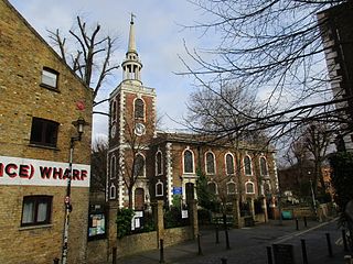
Rotherhithe is a residential district in south-east London, England, and part of the London Borough of Southwark. Historically the area was the most northeastern settlement in the county of Surrey. It is located on a peninsula on the south bank of the Thames, facing Wapping. Shadwell and Limehouse on the north bank, as well as the Isle of Dogs to the east of the Thames and is a part of the Docklands area. It borders Bermondsey to the west and Deptford to the south east.

The Metropolitan Borough of Bermondsey was a Metropolitan borough in the County of London, created in 1900 by the London Government Act 1899. It was abolished and its area became part of the London Borough of Southwark in 1965.

The River Neckinger is a reduced subterranean river that rises in Southwark and flows approximately 2.5 kilometres through that part of London to St Saviour's Dock where it enters the Thames. What remains of the river is enclosed and runs underground and most of its narrow catchment has been diverted into other combined and surface water sewers, flowing into the Southern Outfall Sewer and the Thames respectively.
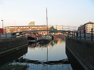
The Grand Surrey Canal was a canal constructed in south London, England during the early 19th century. It opened to the Old Kent Road in 1807, to Camberwell in 1810, and to Peckham in 1826. Its main purpose was to transport cargo, primarily timber from the Surrey Commercial Docks.

Bermondsey and Old Southwark is a constituency in the House of Commons of the UK Parliament. Since 2015, it has been represented by Neil Coyle of the Labour Party.
Southwark and Bermondsey was an inner city constituency in London, United Kingdom. Its sole Member of Parliament was Simon Hughes, in the first stage of his career in the house, as a Liberal then Liberal Democrat after the party's founding in 1988. It was replaced with the North Southwark and Bermondsey seat in 1997.

Alfred Salter was a British medical practitioner and Labour Party politician.
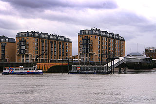
Nelson Dock Pier is the official name of a pier on the south bank of the River Thames in Rotherhithe, London, UK. It lies to the south of Columbia Wharf.

St Olave's Church, Southwark was a church in Southwark, England which is believed to be mentioned in the Domesday Book. It was located on Tooley Street which is named after the church, i.e. 't'olous'. It became redundant in 1926 and was demolished. It is now the location of St Olaf House, which houses part of the London Bridge Hospital.
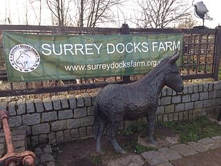
Surrey Docks Farm is a working city farm in the heart of London. It occupies a 2.2-acre (8,900 m2) site on the south bank of the River Thames in Rotherhithe.

Coldharbour is a street and wider conservation area in Blackwall, lying on the north bank of the River Thames, east of Canary Wharf. The area is said to be "[t]he sole remaining fragment of the old hamlet of Blackwall" and "one of the last examples of the narrow streets which once characterised the river's perimeter".
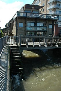
Odessa Wharf is an early 19th-century warehouse located on the south bank of the River Thames at Rotherhithe, London. The warehouse has been converted into apartments and townhouses, some of which are operated as holiday lets by Odessa Club Management with the remainder as private residences. It is situated directly on the Thames Path national trail, north of Greenland Dock, with distinctive timber box "lanterns" on its roof.

Lavender Pond is a 2.5 acre local nature reserve in Rotherhithe in the London Borough of Southwark. It is owned by Southwark Council and managed by The Conservation Volunteers. The nature reserve has an area of woodland as well as the pond.

Columbia Wharf, on the south bank of the River Thames in London, was the first grain silo in a British port. Built in 1864, it was designed by architect and hymnwriter James Edmeston for G & I L Green's Patent Ventilating Grain Company. It is in Rotherhithe, south of Cuckold's Point and north of Nelson Dock Pier. Canada Wharf was added to the complex in 1870–1. Used for storage of foodstuffs until 1976, the complex, including a former engine house and boiler to the south, was listed as a Grade II building in 1983, and is now used for accommodation.
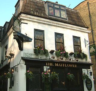
Rotherhithe Street is a road in the London Borough of Southwark on the Thames Path. At a length of around 1.5 miles (2.4 km), it is one of the longest street in London. Notable buildings on the street include the Grade II* listed Nelson House, St Mary's Church, Rotherhithe and Surrey Docks Farm.


