This article has multiple issues. Please help improve it or discuss these issues on the talk page . (Learn how and when to remove these messages)
|
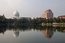
| View of RBI (Kolkata) from Netaji Subhas Road | |
Interactive map of Netaji Subhas Road | |
| Former name | Clive Street |
|---|---|
| Maintained by | Kolkata Municipal Corporation |
| Location | Kolkata, India |
| Postal code | 700001 |
| Nearest Kolkata Metro station | Mahakaran |
| Coordinates | 22°34′34″N88°20′56″E / 22.5761°N 88.3489°E |
| North end | Jorabagan |
| South end | Fort William |
Netaji Subhas Road (N. S. Road; previously known as Clive Street) is a main thoroughfare in Central Kolkata that runs predominantly north to south in the B. B. D. Bagh neighborhood.
The road is named after Netaji Subhas Chandra Bose, a leader of the Indian independence movement. The road was previously known as Clive Road, after Robert Clive, the first British Governor of the Bengal Presidency.
The street starts near the Kolkata General Post Office and crosses Canning Street, a major market, and another arterial road Brabourne Road (near the Brabourne Road Flyover), and finally ends at an intersection with another arterial road, MG Road. Strand Road runs parallel to Netaji Subhas Road on its east side, along Hooghly River.
The road has several buildings from the British Raj era which are examples of Victorian colonial architecture. Landmarks on the street include:
Other government offices on Netaji Subhas Road include the West Bengal State Election Commission. The Calcutta Stock Exchange is located at Lyons Range, a few meters off the street behind the Writer's Building.
Due to its location in the center of Kolkata's business district, most corporate insurance companies have either main, liaison or branch offices in and around Netaji Subhas Road, and many major banks of India have their main or commercial branch on the road. The main markets in Kolkata for machinery, other hardware materials, and scrap metal are located on the street.