Gariahat Road

Last updated

Gariahat Road
Neighbourhood in Kolkata (Calcutta)
Gariahat Flyover.jpg
Gariahat Road, Golpark
Kolkata location map EN.svg
Red pog.svg
Gariahat Road
Location in Kolkata
Coordinates: 22°30′59″N88°21′59″E / 22.516363°N 88.366498°E / 22.516363; 88.366498
CountryIndia
State West Bengal
District Kolkata
City Kolkata
Metro Station Kalighat and Hemanta Mukherjee(under construction)
KMC Wards 68, 86
BoroughsKolkata Taluk
Government
  BodyKolkata Municipal Corporation
Languages
  Official Bengali, English
Time zone UTC+5:30 (IST)
PIN
700019
Lok Sabha constituency Kolkata Dakshin
Vidhan Sabha constituency Ballygunge
Planning agency KMDA
Civic agency Kolkata Municipal Corporation
Website www.kmcgov.in

Gariahat Road connects Ballygunge Phari with Prince Anwar Shah Road and Raja SC Mullick Road near Jadavpur Police station in the southern part of Kolkata, India. The space under Gariahat Flyover hosts one of the most prominent open air public chess playing areas in Kolkata. [1] It is also a part of SH 1.

Contents

Localities

Gariahat falls under Ballygunge area and is a Retail Market for saris (not only from typical Bengal but from all across India), electronics, good restaurants & all together provide a very long stretch for window shopping too. It is the hub and shopping capital of South Kolkata.

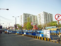
It is one of the main roads of South Kolkata that starts from Ballygunge Phari-Hazra Road crossing and from there travels southwards towards the Gariahat market. The Ballygunge AC market and the Dakshinapan shopping center are two of the main attractions that one will find on the Gariahat Road. A newly built mall named Mukti World, came up near Ballygunge Phari joining the bandwagon of malls in Kolkata. Many handicraft and textiles emporium of government can also be seen here. A huge number of jewellery shops are also located here. Gariahat is also famous for its fish market. It connects to / intersects some of the most important roads of the city namely Ballygunge Circular Road, Hazra Road, Rashbehari Avenue, Southern Avenue and Prince Anwar Shah Road. Smaller roads like Garcha Road, Dover Lane, Hindustan Road, Ekdalia Road, South End Park, etc. all originate from Gariahat Road.

Gariahat Road and Flyover at Rashbehari Avenue crossing Gariahat Road - Kolkata 2011-09-18 00591.jpg
Gariahat Road and Flyover at Rashbehari Avenue crossing

One of the most important stretch of South Kolkata starts from Park Circus Crossing (where it is known as Syed Amir Ali Avenue), and heads south through Ashutosh Chowdhury Avenue (known as Old Ballygunge Road) with Birla Mandir, Calcutta Cricket and Football Club (CCFC), Birla Industrial and Technological Museum on its sides. The famous Gurusaday Dutta Road joins here. Then bears the name Gariahat Road from Ballygunge Phari and passes by Gol Park, and moves on to Dhakuria Bridge after which it is known as Gariahat Road (South), having Jodhpur Park to its right and Dhakuria/Selimpur to its left (East). The road eventually connects to Raja SC Mullick Road (which goes down further south up to Garia) at the intersection of Prince Anwar Shah Road and Jadavpur Police station. Jadavpur University happens to be one of the major landmarks at one end of this road as it winds its way down from Park Circus, Ballygunge, Gariahat Crossing, Gol Park [Ramakrishna Mission Institute of Culture, Kankulia/Keyatala], Dhakuria & Jodhpur Park.

The stretch from the Gariahat crossing to the Park Circus crossing, passes through the Ballygunge area.

Chess playing

After the Gariahat flyover was built, the local government in collaboration with the police converted the area under the flyover into a public chess playing arena. Lit by floodlights, it consists of a series of chess tables and chairs, where people can come freely and play chess with each other. The spot quickly turned into a popular championship spot for new as well as existing chess talent and aficionados. It was covered on NDTV by the journalist Ravish Kumar in January 2019, when he accidentally noticed this on a trip to Kolkata. [1]

Landmarks

Gariahat Road 'Pantaloons' Gariahat Road 'Pantaloons'.jpg
Gariahat Road 'Pantaloons'

Restaurants & Eateries

Mukti World night view Mukti World night view (1).JPG
Mukti World night view

See also

Related Research Articles

<span class="mw-page-title-main">Ballygunge</span> Neighbourhood in Kolkata in West Bengal, India

Ballygunge is a locality of South Kolkata in Kolkata district, West Bengal, India.

<span class="mw-page-title-main">Tollygunge</span> Neighbourhood in Kolkata in West Bengal, India

Tollygunge is a locality of South Kolkata, in West Bengal, India. It is famed as the centre of the Indian film industry, known as Tollywood, Marathi Cinema, South Indian Cinema and Bollywood.

<span class="mw-page-title-main">Dhakuria</span> Neighbourhood in Kolkata in West Bengal, India

Dhakuria is a locality in the city of Kolkata, in West Bengal, India. It is located in the southern part of the city and is surrounded by Ballygunge and Kasba in the north, Haltu in the east, Jadavpur/ Garia in the south and Lake Gardens/ Jodhpur Park in the west. It has a Postal Index Number (PIN) code of 700031. Some localities adjacent to Golpark and Jodhpur Park also have Postal Index Number (PIN) code of 700029 and 700068 respectively.

Jodhpur Park is a neighbourhood of South Kolkata, in Kolkata district, West Bengal, India.

<span class="mw-page-title-main">Kasba, Kolkata</span> Neighbourhood in Kolkata in West Bengal, India

Kasba is an upscale and standard locality of South Kolkata, in Kolkata District, West Bengal, India. It is situated in the southern part of the city encircled by the Sealdah South section of the Eastern Railways to the west, Dhakuria and Haltu to the south, the Eastern Metropolitan Bypass to the east and the locality of Tiljala to the north.

<span class="mw-page-title-main">Prince Anwar Shah Road</span>

Prince Anwar Shah Road is a busy road of South Kolkata. It is named after Prince Gulam Mohammed Anwar Ali Shah, one of Tipu Sultan's 12 sons.

<span class="mw-page-title-main">Rashbehari Avenue</span> Road in Kolkata, India

Rashbehari Avenue is one of the most prestigious and important east–west avenues of Kolkata, India. A major portion of this road is often commonly referred to as Gariahat, the prime shopping and aristocratic residential neighbourhood of south Kolkata. Rashbehari Avenue falls in the posh residential neighbourhood of Ballygunge. The road is named after Sir Rash Behari Ghosh who was an Indian politician, lawyer, social worker and philanthropist.

<span class="mw-page-title-main">Southern Avenue, Kolkata</span> Road in Kolkata, India

Southern Avenue, now renamed Dr. Meghnad Saha Sarani, is an avenue in South Kolkata connecting Gol Park with Kalighat. It falls under the Ballygunge area. It is a 3-kilometre-long (1.9 mi) road with a centre boulevard that runs from Gariahat Road on the east to Shyama Prasad Mukherjee Road on the west, crossing Sarat Bose Road-Deboki Kumar Bose Sarani on its way. The road is renamed after Dr. Meghnad Saha, a famous Indian scientist.

Gariahat Road becomes Raja SC Mullick road from the intersection of Prince Anwar Shah Road Connector and traverses mainly through Jadavpur and then the inner parts of South Kolkata and ends at Garia, where it meets the Netaji Subash Chandra Bose Road.

<span class="mw-page-title-main">Park Circus</span> Neighbourhood in Kolkata in West Bengal, India

Park Circus is a neighbourhood of Central-South Kolkata in Kolkata district, West Bengal, India.

<span class="mw-page-title-main">Sarat Bose Road</span> Road in Kolkata, India

Sarat Bose Road, previously known as Lansdowne Road, is a 3.5 km long stretch of road that connects Southern Avenue with AJC Bose Road and separates two major localities of Ballygunge and Bhawanipore in South Kolkata, India. South of Southern Avenue crossing, Sarat Bose Road becomes Deboki Kumar Bose Sarani.

<span class="mw-page-title-main">AJC Bose Road & APC Road</span> Road in Kolkata, India

Acharya Jagadish Chandra Bose Road and its continuation northwards called Acharya Prafulla Chandra Road, are together the longest and the most important north-south thoroughfare in Kolkata, India.

<span class="mw-page-title-main">Picnic Garden</span> Neighbourhood in Kolkata in West Bengal, India

Picnic Garden is a neighbourhood of South Kolkata, in West Bengal, India.

Tiljala is a neighbourhood of South Kolkata, in West Bengal, India.

Ward No. 93, Kolkata Municipal Corporation is an administrative division of Kolkata Municipal Corporation in Borough No. 10, covering parts of Dhakuria (Dakshinapan), Jodhpur Park, Lake Gardens and Jadavpur neighbourhoods in South Kolkata, in the Indian state of West Bengal.

Nandy Bagan or Nandi Bagan is a neighbourhood of South Kolkata in the Indian city of Kolkata in West Bengal. It is a residential area surrounded with Kasba, Haltu, Garfa, Jadavpur, Babu Bagan, Dhakuria, Naskarpara, Shahid Nagar, Bosepukur and Selimpur. It is traditionally an upper-middle-class neighbourhood, situated around the Nandi Bagan community playground. However, with the newly constructed Prince Anwar Shah Road connector with the Eastern Metropolitan Bypass, property prices have increased in the area. The area is covered by the Garfa Police Station of the Kolkata Police Force. The Haltu Post Office serves the area.

Katjunagar is a neighbourhood located in South Kolkata in the city of Kolkata, West Bengal, India. The adjacent neighbourhoods to the locality include Jadavpur, South City, Poddar Nagar, Jodhpur Park, Lake Gardens, Bikramgarh and Golf Green.

Lake Gardens is a neighbourhood of South Kolkata, in Kolkata district, West Bengal, India. It has Kalighat to the north, Jodhpur Park to the east, Prince Anwar Shah Road or Tollygunge to the south and Charu Market to the west.

References

  1. 1 2 "Prime Time with Ravish Kumar". NDTV. 17 January 2019.