Neu-Seeland

Last updated
Neu-Seeland
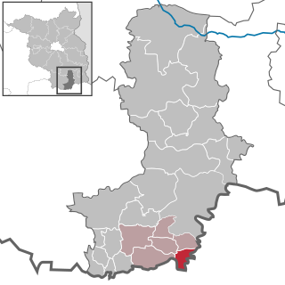
Location of Neu-Seeland within Oberspreewald-Lausitz district
Neu-Seeland in OSL.svgGrünewaldHermsdorfLindenauSchwarzbachTettau
Germany adm location map.svg
Red pog.svg
Neu-Seeland
Brandenburg location map.svg
Red pog.svg
Neu-Seeland
Coordinates: 51°37′00″N14°05′59″E / 51.61667°N 14.09972°E / 51.61667; 14.09972 Coordinates: 51°37′00″N14°05′59″E / 51.61667°N 14.09972°E / 51.61667; 14.09972
Country Germany
State Brandenburg
District Oberspreewald-Lausitz
Municipal assoc. Altdöbern
Government
   Mayor (201924) Simone Abt [1] (Ind.)
Area
  Total56.18 km2 (21.69 sq mi)
Elevation
117 m (384 ft)
Population
 (2020-12-31) [2]
  Total599
  Density11/km2 (28/sq mi)
Time zone UTC+01:00 (CET)
  Summer (DST) UTC+02:00 (CEST)
Postal codes
01983 03103
Dialling codes 035751
Vehicle registration OSL

Neu-Seeland (Upper Sorbian : Nowa Jazorina) is a municipality in the Oberspreewald-Lausitz district, in Lower Lusatia, Brandenburg, Germany.

Contents

History

From 1815 to 1947, the constituent localities of Neu-Seeland (Bahnsdorf, Lindchen, Lubochow and Ressen) were part of the Prussian Province of Brandenburg. From 1952 to 1990, they were part of the Bezirk Cottbus of East Germany. On 1 February 2002, the municipality of Neu-Seeland was formed by merging the municipalities of Bahnsdorf, Lindchen, Lubochow and Ressen.

Demography

Development of Population since 1875 within the Current Boundaries (Blue Line: Population; Dotted Line: Comparison to Population Development of Brandenburg state; Grey Background: Time of Nazi rule; Red Background: Time of Communist rule) Bevolkerungsentwicklung Neu-Seeland-OSL.pdf
Development of Population since 1875 within the Current Boundaries (Blue Line: Population; Dotted Line: Comparison to Population Development of Brandenburg state; Grey Background: Time of Nazi rule; Red Background: Time of Communist rule)
Neu-Seeland: Population development
within the current boundaries (2013) [3]
YearPop.±% p.a.
1875 1,944    
1890 1,940−0.01%
1910 2,122+0.45%
1925 2,160+0.12%
1933 2,038−0.72%
1939 1,870−1.42%
1946 2,512+4.31%
1950 2,481−0.31%
1964 1,687−2.72%
1971 1,572−1.00%
1981 1,124−3.30%
1985 1,000−2.88%
1989 841−4.24%
1990 814−3.21%
1991 781−4.05%
1992 1,443+84.76%
1993 1,043−27.72%
1994 1,125+7.86%
1995 1,157+2.84%
1996 1,235+6.74%
YearPop.±% p.a.
1997 1,169−5.34%
1998 1,081−7.53%
1999 1,199+10.92%
2000 1,112−7.26%
2001 1,153+3.69%
2002 1,098−4.77%
2003 1,098+0.00%
2004 999−9.02%
2005 929−7.01%
2006 817−12.06%
2007 801−1.96%
2008 785−2.00%
2009 607−22.68%
2010 573−5.60%
2011 630+9.95%
2012 614−2.54%
2013 606−1.30%
2014 602−0.66%
2015 585−2.82%
2016 591+1.03%

Related Research Articles

Oberspreewald-Lausitz is a Kreis (district) in the southern part of Brandenburg, Germany. Neighboring districts are Dahme-Spreewald, Spree-Neiße, the districts Bautzen and Meissen in Saxony, and the district Elbe-Elster.

<span class="mw-page-title-main">Lauchhammer</span> Town in Brandenburg, Germany

Lauchhammer is a town in the Oberspreewald-Lausitz district, in southern Brandenburg, Germany. It is situated on the Black Elster river, approx. 17 km west of Senftenberg, and 50 km north of Dresden.
<span class="mw-page-title-main">Ortrand</span> Town in Brandenburg, Germany

Ortrand is a town in the Oberspreewald-Lausitz district, in southern Brandenburg, Germany. It is situated 24 km southwest of Senftenberg, and 36 km north of Dresden.

<span class="mw-page-title-main">Ruhland</span> Town in Brandenburg, Germany

Ruhland  is a town in the Oberspreewald-Lausitz district, in Upper Lusatia, Brandenburg, Germany. It is situated on the river Schwarze Elster, 12 km southwest of Senftenberg.

<span class="mw-page-title-main">Grünewald, Germany</span> Municipality in Brandenburg, Germany

Grünewald is a municipality in the Oberspreewald-Lausitz district, in Upper Lusatia, Brandenburg, Germany.

<span class="mw-page-title-main">Altdöbern</span> Municipality in Brandenburg, Germany

Altdöbern is a municipality in the Oberspreewald-Lausitz district, in southern Brandenburg, Germany.
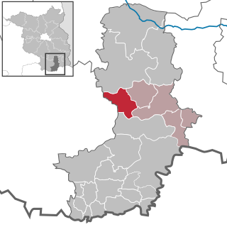
<span class="mw-page-title-main">Bronkow</span> Municipality in Brandenburg, Germany

Bronkow is a municipality in the Oberspreewald-Lausitz district, in southern Brandenburg, Germany.
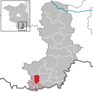
<span class="mw-page-title-main">Frauendorf</span> Municipality in Brandenburg, Germany

Frauendorf is a municipality in the Oberspreewald-Lausitz district, in Upper Lusatia, Brandenburg, Germany.
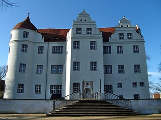
<span class="mw-page-title-main">Großkmehlen</span> Municipality in Brandenburg, Germany

Großkmehlen is a municipality in the Oberspreewald-Lausitz district, in southern Brandenburg, Germany.

<span class="mw-page-title-main">Guteborn</span> Municipality in Brandenburg, Germany

Guteborn is a municipality in the Oberspreewald-Lausitz district of Upper Lusatia, Brandenburg, Germany.

<span class="mw-page-title-main">Hermsdorf, Brandenburg</span> Municipality in Brandenburg, Germany

Hermsdorf is a municipality in the Oberspreewald-Lausitz district, in Upper Lusatia, Brandenburg, Germany.

<span class="mw-page-title-main">Hohenbocka</span> Municipality in Brandenburg, Germany

Hohenbocka is a municipality in the Oberspreewald-Lausitz district, in Upper Lusatia, Brandenburg, Germany.
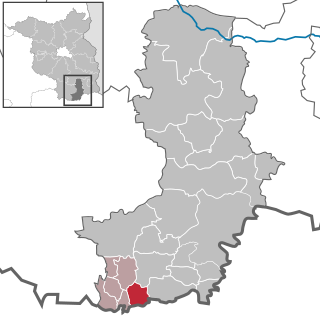
<span class="mw-page-title-main">Kroppen</span> Municipality in Brandenburg, Germany

Kroppen is a municipality in the Oberspreewald-Lausitz district, in Upper Lusatia, Brandenburg, Germany.

<span class="mw-page-title-main">Lindenau, Germany</span> Municipality in Brandenburg, Germany

Lindenau is a municipality in the Oberspreewald-Lausitz district, in Upper Lusatia, Brandenburg, Germany. Since 1992, it is part of the Amt of Ortrand.

<span class="mw-page-title-main">Luckaitztal</span> Municipality in Brandenburg, Germany

Luckaitztal is a municipality in the Oberspreewald-Lausitz district, in Lower Lusatia, Brandenburg, Germany.

<span class="mw-page-title-main">Neupetershain</span> Municipality in Brandenburg, Germany

Neupetershain is a municipality in the Oberspreewald-Lausitz district, in Lower Lusatia, Brandenburg, Germany.
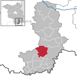
<span class="mw-page-title-main">Schipkau</span> Municipality in Brandenburg, Germany

Schipkau is a municipality in the Oberspreewald-Lausitz district, in Lower Lusatia, Brandenburg, Germany.

<span class="mw-page-title-main">Schwarzbach, Brandenburg</span> Municipality in Brandenburg, Germany

Schwarzbach is a municipality in the Oberspreewald-Lausitz district, in Upper Lusatia, Brandenburg, Germany.
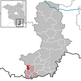
<span class="mw-page-title-main">Tettau, Brandenburg</span> Municipality in Brandenburg, Germany

Tettau is a municipality in the Oberspreewald-Lausitz district, in Upper Lusatia, Brandenburg, Germany.

<span class="mw-page-title-main">Amt Altdöbern</span>

Amt Altdöbern is an Amt in the district of Oberspreewald-Lausitz, in Brandenburg, Germany. Its seat is in Altdöbern.

References

  1. Landkreis Oberspreewald-Lausitz Wahl der Bürgermeisterin / des Bürgermeisters, accessed 2 July 2021.
  2. "Bevölkerung im Land Brandenburg nach amtsfreien Gemeinden, Ämtern und Gemeinden 31. Dezember 2020". Amt für Statistik Berlin-Brandenburg (in German). June 2021.
  3. Detailed data sources are to be found in the Wikimedia Commons.Population Projection Brandenburg at Wikimedia Commons