Luckaitztal

Last updated
Luckaitztal
Location of Luckaitztal within Oberspreewald-Lausitz district
Luckaitztal in OSL.svgGrünewaldHermsdorfLindenauSchwarzbachTettau
Germany adm location map.svg
Red pog.svg
Luckaitztal
Brandenburg location map.svg
Red pog.svg
Luckaitztal
Coordinates: 51°42′00″N14°01′00″E / 51.70000°N 14.01667°E / 51.70000; 14.01667 Coordinates: 51°42′00″N14°01′00″E / 51.70000°N 14.01667°E / 51.70000; 14.01667
Country Germany
State Brandenburg
District Oberspreewald-Lausitz
Municipal assoc. Altdöbern
Subdivisions4 Ortsteile
Government
   Mayor (201924) Roland Schneider [1]
Area
  Total41.72 km2 (16.11 sq mi)
Elevation
100 m (300 ft)
Population
 (2020-12-31) [2]
  Total767
  Density18/km2 (48/sq mi)
Time zone UTC+01:00 (CET)
  Summer (DST) UTC+02:00 (CEST)
Postal codes
03229
Dialling codes 03541
Vehicle registration OSL
Website www.amt-altdoebern.de

Luckaitztal (Lower Sorbian Lukajca Dolk) is a municipality in the Oberspreewald-Lausitz district, in Lower Lusatia, Brandenburg, Germany.

Contents

History

From 1815 to 1947, the constituent localities of Luckaitztal (Buchwäldchen, Muckwar, Gosda and Schöllnitz) were part of the Prussian Province of Brandenburg.

From 1952 to 1990, they were part of the Bezirk Cottbus of East Germany.

On 31 March 2002, the municipality of Luckaitztal was formed by merging the municipalities of Buchwäldchen, Muckwar, Gosda and Schöllnitz.

Demography

Development of Population since 1875 within the Current Boundaries (Blue Line: Population; Dotted Line: Comparison to Population Development of Brandenburg state; Grey Background: Time of Nazi rule; Red Background: Time of Communist rule) Bevolkerungsentwicklung Luckaitztal.pdf
Development of Population since 1875 within the Current Boundaries (Blue Line: Population; Dotted Line: Comparison to Population Development of Brandenburg state; Grey Background: Time of Nazi rule; Red Background: Time of Communist rule)
Luckaitztal: Population development
within the current boundaries (2013) [3]
YearPop.±% p.a.
1875 1,257    
1890 1,126−0.73%
1910 1,353+0.92%
1925 1,339−0.07%
1933 1,250−0.86%
1939 1,254+0.05%
1946 1,548+3.05%
1950 1,611+1.00%
1964 1,262−1.73%
1971 1,329+0.74%
1981 1,150−1.44%
1985 1,061−1.99%
1989 965−2.34%
1990 949−1.66%
1991 918−3.27%
1992 897−2.29%
1993 891−0.67%
1994 891+0.00%
1995 903+1.35%
1996 893−1.11%
YearPop.±% p.a.
1997 891−0.22%
1998 918+3.03%
1999 928+1.09%
2000 957+3.12%
2001 948−0.94%
2002 970+2.32%
2003 968−0.21%
2004 969+0.10%
2005 961−0.83%
2006 958−0.31%
2007 936−2.30%
2008 904−3.42%
2009 893−1.22%
2010 875−2.02%
2011 876+0.11%
2012 864−1.37%
2013 848−1.85%
2014 845−0.35%
2015 822−2.72%
2016 811−1.34%

Related Research Articles

Oberspreewald-Lausitz is a Kreis (district) in the southern part of Brandenburg, Germany. Neighboring districts are Dahme-Spreewald, Spree-Neiße, the districts Bautzen and Meissen in Saxony, and the district Elbe-Elster.

<span class="mw-page-title-main">Lauchhammer</span> Town in Brandenburg, Germany

Lauchhammer is a town in the Oberspreewald-Lausitz district, in southern Brandenburg, Germany. It is situated on the Black Elster river, approx. 17 km west of Senftenberg, and 50 km north of Dresden.

<span class="mw-page-title-main">Ortrand</span> Town in Brandenburg, Germany

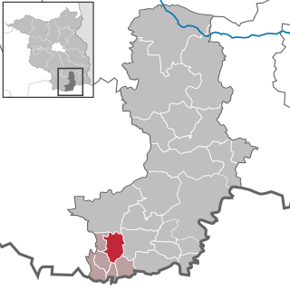
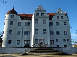
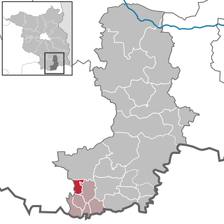
Ortrand is a town in the Oberspreewald-Lausitz district, in southern Brandenburg, Germany. It is situated 24 km southwest of Senftenberg, and 36 km north of Dresden.
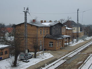
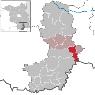
<span class="mw-page-title-main">Ruhland</span> Town in Brandenburg, Germany

Ruhland  is a town in the Oberspreewald-Lausitz district, in Upper Lusatia, Brandenburg, Germany. It is situated on the river Schwarze Elster, 12 km southwest of Senftenberg.

<span class="mw-page-title-main">Vetschau</span> Town in Brandenburg, Germany

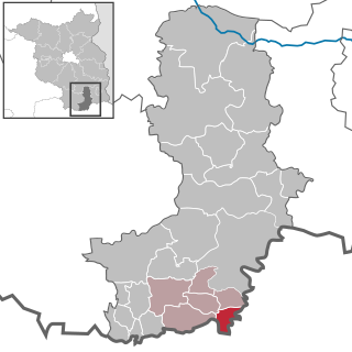
Vetschau/Spreewald is a town in the Oberspreewald-Lausitz district, in Lower Lusatia, Brandenburg, Germany. It is situated in the Spreewald, 18 km west of Cottbus.

<span class="mw-page-title-main">Grünewald, Germany</span> Municipality in Brandenburg, Germany

Grünewald is a municipality in the Oberspreewald-Lausitz district, in Upper Lusatia, Brandenburg, Germany.

<span class="mw-page-title-main">Altdöbern</span> Municipality in Brandenburg, Germany

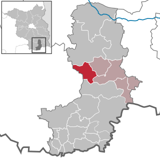
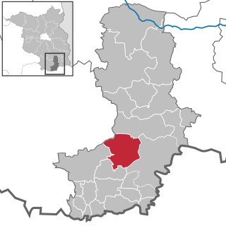
Altdöbern is a municipality in the Oberspreewald-Lausitz district, in southern Brandenburg, Germany.

<span class="mw-page-title-main">Bronkow</span> Municipality in Brandenburg, Germany

Bronkow is a municipality in the Oberspreewald-Lausitz district, in southern Brandenburg, Germany.

<span class="mw-page-title-main">Frauendorf</span> Municipality in Brandenburg, Germany

Frauendorf is a municipality in the Oberspreewald-Lausitz district, in Upper Lusatia, Brandenburg, Germany.

<span class="mw-page-title-main">Großkmehlen</span> Municipality in Brandenburg, Germany

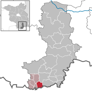
Großkmehlen is a municipality in the Oberspreewald-Lausitz district, in southern Brandenburg, Germany.

<span class="mw-page-title-main">Guteborn</span> Municipality in Brandenburg, Germany

Guteborn is a municipality in the Oberspreewald-Lausitz district of Upper Lusatia, Brandenburg, Germany.

<span class="mw-page-title-main">Hermsdorf, Brandenburg</span> Municipality in Brandenburg, Germany

Hermsdorf is a municipality in the Oberspreewald-Lausitz district, in Upper Lusatia, Brandenburg, Germany.

<span class="mw-page-title-main">Hohenbocka</span> Municipality in Brandenburg, Germany

Hohenbocka is a municipality in the Oberspreewald-Lausitz district, in Upper Lusatia, Brandenburg, Germany.

<span class="mw-page-title-main">Kroppen</span> Municipality in Brandenburg, Germany

Kroppen is a municipality in the Oberspreewald-Lausitz district, in Upper Lusatia, Brandenburg, Germany.

<span class="mw-page-title-main">Lindenau, Germany</span> Municipality in Brandenburg, Germany

Lindenau is a municipality in the Oberspreewald-Lausitz district, in Upper Lusatia, Brandenburg, Germany. Since 1992, it is part of the Amt of Ortrand.

<span class="mw-page-title-main">Neu-Seeland</span> Municipality in Brandenburg, Germany

Neu-Seeland is a municipality in the Oberspreewald-Lausitz district, in Lower Lusatia, Brandenburg, Germany.

<span class="mw-page-title-main">Neupetershain</span> Municipality in Brandenburg, Germany

Neupetershain is a municipality in the Oberspreewald-Lausitz district, in Lower Lusatia, Brandenburg, Germany.

<span class="mw-page-title-main">Schipkau</span> Municipality in Brandenburg, Germany

Schipkau is a municipality in the Oberspreewald-Lausitz district, in Lower Lusatia, Brandenburg, Germany.

<span class="mw-page-title-main">Schwarzbach, Brandenburg</span> Municipality in Brandenburg, Germany

Schwarzbach is a municipality in the Oberspreewald-Lausitz district, in Upper Lusatia, Brandenburg, Germany.

<span class="mw-page-title-main">Tettau, Brandenburg</span> Municipality in Brandenburg, Germany

Tettau is a municipality in the Oberspreewald-Lausitz district, in Upper Lusatia, Brandenburg, Germany.

References

  1. Landkreis Oberspreewald-Lausitz Wahl der Bürgermeisterin / des Bürgermeisters, accessed 2 July 2021.
  2. "Bevölkerung im Land Brandenburg nach amtsfreien Gemeinden, Ämtern und Gemeinden 31. Dezember 2020". Amt für Statistik Berlin-Brandenburg (in German). June 2021.
  3. Detailed data sources are to be found in the Wikimedia Commons.Population Projection Brandenburg at Wikimedia Commons