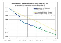
Elbe-Elster is a Kreis (district) in the southern part of Brandenburg, Germany. Neighboring districts are Teltow-Fläming, Dahme-Spreewald, Oberspreewald-Lausitz, Meißen, Nordsachsen and Wittenberg. The district has a partnership with the Märkischer Kreis.
Oberspreewald-Lausitz is a Kreis (district) in the southern part of Brandenburg, Germany. Neighboring districts are Dahme-Spreewald, Spree-Neiße, the districts Bautzen and Meissen in Saxony, and the district Elbe-Elster.
Spree-Neiße is a Kreis (district) in the southern part of Brandenburg, Germany. Neighboring districts are the districts Niederschlesischer Oberlausitzkreis and Kamenz in Saxony, the districts Oberspreewald-Lausitz, Dahme-Spreewald and Oder-Spree. The district-free city Cottbus is surrounded by the district. To the east is Poland.

Großräschen is a town in Lower Lusatia, in Germany. Administratively, it is part of the district of Oberspreewald-Lausitz, in the state of Brandenburg.

Lübbenau is a town in the Upper Spree Forest-Lusatia District of Brandenburg, Germany. It is located in the bilingual German/Sorbian region of (Lower) Lusatia, on the river Spree, where this forms a large inland delta surrounded by woodland, called "Spree Forest", about 82 km (51 mi) southeast of Berlin. The town is best known through the incorporated villages of Lehde/Lědy and Leipe/Lipje, villages where there just exist anabranches of the Spree River instead of streets.

Forst (Lausitz) (German) or Baršć (Łužyca) (Lower Sorbian, pronounced[ˈbarɕtɕˈwuʒɨtsa]) is a town in Lower Lusatia, Brandenburg, in eastern Germany. It lies east of Cottbus, on the Lusatian Neisse river which is also the German-Polish border. It is the capital of the Spree-Neiße district. It is known for its rose garden and textile museum. The town's population is 18,651. In Forst, there is a railway bridge across the Neiße belonging to the line Cottbus–Żary which is serviced by regional trains and a EuroCity train between Hamburg and Kraków (2011). There is also a road bridge across the river north of Forst.

Finsterwalde is a town in the Elbe-Elster district, in Lower Lusatia, Brandenburg, Germany.

Senftenberg (German) or Zły Komorow is a town in Lower Lusatia, Brandenburg, in eastern Germany, capital of the Oberspreewald-Lausitz district.
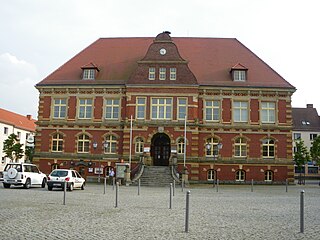
Calau is a small town in the Oberspreewald-Lausitz district, in southern Brandenburg, in eastern Germany. It is situated 14 km south of Lübbenau, and 27 km west of Cottbus. Calau is also called the home of the Kalauer.
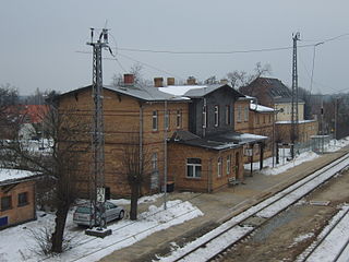
Ortrand is a town in the Oberspreewald-Lausitz district, in southern Brandenburg, Germany. It is situated 24 km southwest of Senftenberg, and 36 km north of Dresden.

Schönewalde is a town in the Elbe-Elster district, in southwestern Brandenburg, Germany. It is situated in the Fläming Heath, 30 km south of Luckenwalde, and 40 km east of Wittenberg.
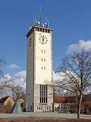
Schwarzheide or Carny Gózd is a town in the Oberspreewald-Lausitz district, in Lower Lusatia, Brandenburg, Germany. It is situated on the river Schwarze Elster, 11 km southwest of Senftenberg, 110 km south of Berlin and 40 km north of Dresden. The little river Pössnitz runs through the eastern part of Schwarzheide.

Uebigau-Wahrenbrück is a town in the Elbe-Elster district, in southwestern Brandenburg, Germany. It is situated on the river Schwarze Elster, 11 km northwest of Bad Liebenwerda, and 21 km east of Torgau.

Vetschau/Spreewald is a town in the Oberspreewald-Lausitz district, in Lower Lusatia, Brandenburg, Germany. It is situated in the Spreewald, 18 km west of Cottbus.
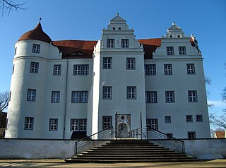
Großkmehlen is a municipality in the Oberspreewald-Lausitz district, in southern Brandenburg, Germany. The places of the municipality Großkmehlen belong to the few places in the southern part of the district Oberspreewald-Lausitz, which are not located in Lusatia.
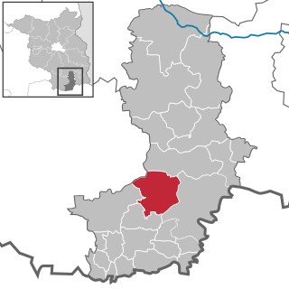
Schipkau is a municipality in the Oberspreewald-Lausitz district, in Lower Lusatia, Brandenburg, Germany.

Neuhausen/Spree is a municipality in the district of Spree-Neiße, in Lower Lusatia, Brandenburg, Germany.
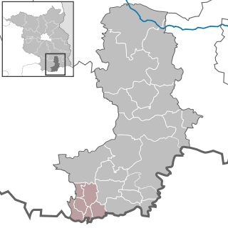
Amt Ortrand is an Amt in the district of Oberspreewald-Lausitz, in Brandenburg, Germany. Its seat is in Ortrand.

Amt Altdöbern is an Amt in the district of Oberspreewald-Lausitz, in Brandenburg, Germany. Its seat is in Altdöbern.

Amt Ruhland is an Amt in the district of Oberspreewald-Lausitz, in Brandenburg, Germany. Its seat is in Ruhland.


