
Route 93 is a state highway in the U.S. state of New Jersey. It is a north–south highway that runs 3.50 miles (5.63 km) from an intersection with U.S. Route 1/9 in Ridgefield on Grand Avenue in Ridgefield, Palisades Park, Leonia, and Englewood before ending at an intersection with Van Nostrand Avenue just north of Route 4. The route originated as Route S5 in 1927, running along the Bergen Turnpike until 1929, when it was moved onto the southern portion of Grand Avenue. It remained the same until 1954, after the alignment of Route 93 had been designated that the route was extended along Grand Avenue.

State Route 157, also known as Kyle Canyon Road, is a U.S. state highway in Clark County, Nevada. The highway connects the Las Vegas area to the recreational areas of Mount Charleston in the Spring Mountains.

State Route 156, also known as Lee Canyon Road, is a state highway in Clark County, Nevada. The road is one of two highways connecting U.S. Route 95 to the Humboldt-Toiyabe National Forest and Spring Mountains area northwest of Las Vegas and its entire length is designated a Nevada Scenic Byway.
State Route 599 is a 7.049-mile (11.344 km) state highway in Clark County, Nevada. The route follows Rancho Drive, a major arterial connecting downtown Las Vegas to the northwest part of the city. Much of SR 599 was previously designated as U.S. Route 95 prior to completion of the Las Vegas Expressway. The route is also designated as U.S. Route 95 Business.

State Route 401 is a state highway in Pershing County, Nevada. The route, known as Rye Patch Road, serves the Rye Patch State Recreation Area.

State Route 116 is a state highway in Churchill County, Nevada, United States. Known as Stillwater Road, it connects the small town of Stillwater to U.S. Route 50 east of Fallon. The road was established by 1940 as SR 42, and was renumbered to SR 116 in 1976.

State Route 360 is a 23.245-mile-long (37.409 km) state highway in the southern portion of Mineral County, Nevada, United States. The route connects the former town of Basalt to the rest of Mineral County. A road has been in the place of SR 360 since 1919, and became State Route 10 by 1929.

State Route 372 is a short state highway in Nye County, Nevada, United States. The route connects the town of Pahrump to the southeast side of Death Valley National Park via California State Route 178. The route was formerly a part of State Route 52 until being renumbered in 1976.
State Route 374 is a state highway in Nye County, Nevada, United States. It serves as Nevada's gateway to Death Valley National Park, connecting the park to Beatty. The highway was known as State Route 58 prior to 1976.

State Route 376 is a 100-mile (160 km) state highway in Nye and Lander counties in central Nevada, United States. It connects U.S. Route 6 near Tonopah north to U.S. Route 50 near Austin. The Tonopah–Austin Road existed as early as 1919, and was designated the southernmost segment of State Route 8A before being renumbered to SR 376 in 1976.

State Route 397 is a state highway in the U.S. state of Nevada. It runs from State Route 860 near Derby Field east on Westergard Road and north on Meridian Road into Lovelock. After passing under Interstate 80/U.S. Route 95, it turns northeast on Amherst Avenue and ends at State Route 398, two blocks southeast of State Route 396.
State Route 856 is a state highway in Pershing County, Nevada serving Lovelock. The western portion of the route is also signed as Interstate 80 Business.
State Route 854 is a state highway in Pershing County, Nevada serving the vicinity of Lovelock. The route comprised a portion of former State Route 48.

State Route 513 was a short state highway in Carson City, Nevada. The route was originally part of State Route 65, a longer highway that served the eastern outskirts of the city. SR 513 was turned over to Carson City in phases, and completely removed from the state highway system in 2011.
State Route 445 is a 41.890-mile-long (67.415 km) state highway in Washoe County, Nevada. The route follows Pyramid Way, a major thoroughfare in the city of Sparks, and connects the Reno metropolitan area to Pyramid Lake. The route is designated a Nevada Scenic Byway.
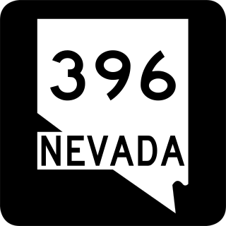
State Route 396 is a state highway in Pershing County, Nevada serving the city of Lovelock. The highway forms a portion of Interstate 80 Business within the city of Lovelock, and previously carried the alignment of former U.S. Route 40 and U.S. Route 95.

State Route 399 is an 18.18-mile (29.26 km) state highway in Pershing County, Nevada. It connects Eagle-Picher Mine to Lovelock, the nearest town.

Interstate 80 Business (BL-80) is an interstate business route in Pershing County, Nevada. Serving the city of Lovelock along Cornell Avenue, BL-80 is also cosigned along portions of two other state highways through the city, State Route 396 (SR 396) from I-80 exit 105 to SR 856 at Airport Road and SR 856 from SR 396 at Upper Valley Road to I-80 exit 107.


