New Dundee, Ontario

Last updated

New Dundee
Unincorporated community
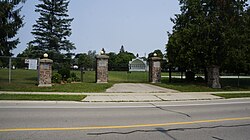
New Dundee Community Park - New Dundee, Ontario.jpg
New Dundee Community Park
Coordinates: 43°21′4″N80°32′12″W / 43.35111°N 80.53667°W / 43.35111; -80.53667
CountryCanada
Province Ontario
Regional municipality Waterloo
Township Wilmot
Area
  Land1.52 km2 (0.59 sq mi)
Population
 (2016)
  Total1,119
  Density734.0/km2 (1,901/sq mi)
Time zone UTC-5 (EST)
  Summer (DST) UTC-4 (EDT)
Forward sortation area
Area code(s) 519 and 226
NTS Map040P07
GNBC CodeFEAPA

New Dundee is a small community of 1,119 people at the time of the 2016 Census, in the township of Wilmot, Ontario, Canada. It is located southwest of Kitchener. [1]

Contents

History

The land grants to New Dundee's early settlers were largely in Concessions 2 and 3, Block A, Wilmot Township. [2] The township was opened to settlement in 1824 and was not part of the German Company Tract purchased out of Haldimand Tract land, [3] but lay to the west of it. Wilmot was divided into three blocks arranged latitudinally: Block A in the south, Block B in the north, and the German Block in the centre. [3] While the German Block was largely settled by Germans, Blocks A and B were acquired by the Canada Land Company, and were settled by a mix of German, Irish, Scottish, and English people, along with others. [3] One of the Company's goals was to promote English, Scottish, and Irish settlement in the township; however, only a small number of these peoples ever did settle in the area, and they were largely concentrated within Block A. [3] While the German Block was connected to Waterloo Township by three major thoroughfares (Erb's Road, Snyder's Road, and Bleam's Road), each leading to an established mill, Block A only had one: the Huron Road, which unlike the others, was a long-distance route connecting as far west as Goderich and as far east as Guelph. It became the dominant roadway in the Waterloo County area until the arrival of the railways in the 1850s lessened its importance, and was a major transportation corridor within Upper Canada as a whole for many years. [3]

New Dundee itself was founded by the Millar pioneer family. The Millars emigrated from Scotland around 1825, and originally settled in the Niagara area. Arriving in Waterloo Township, several of them at first moved to the Sand Hills area which would later become Berlin and finally, Kitchener, where they established the first general store in that community. [4] John Millar was the first member of the family to settle in the New Dundee area; in 1826 he dammed Alder Creek and built the first sawmill and general store there. [5] John named the community New Dundee after his home town of Dundee, Scotland. [5] The settlement was located off the Huron Road, at the far southeast corner of Block A, requiring settlers to construct a connecting road in order to access the outside world conveniently. [3]

Frederick Gourlay Millar later bought John's sawmill, house, and store, and also constructed a gristmill. The Millars were soon joined by other pioneer families: the Reichard family in 1829, who opened their own sawmill on the creek on land granted to them in lieu of payment for their work on the Huron Road, [6] and the Bettschen family, who cleared the dense forest on the southern half of Lot 5, Concession 3 and built a farm and blacksmith shop. [7] Another early settler was a squatter, Dan Schafer, who lived alone in a trapper's cabin on the northern half of Lot 5, Concession 3. [7] Frederick Millar, who was civic-minded and had played a role in the early growth of Berlin, had a village plan drawn up in the 1850s. [8] The planned-for village never truly materialized as shortly after, New Dundee, already located a distance from the Huron Road, was bypassed by the Grand Trunk Railway, which passed through the German Block communities of Petersburg, Baden, and New Hamburg instead. [3]

The Post Office was opened in 1852. By 1870, there were two churches, two hotels, a school, the sawmill and the flour mill, and factories that produced shingles, rakes and flax, as well as two stores and two hotels. The population was 250. [9]

In 1904, Ezra H. Thamer opened New Dundee's first Bell Telephone exchange, the New Dundee Rural Telephone Company, and started a small home-based creamery. By 1908, other investors joined the group, and the creamery became a larger operation, initially as the New Dundee Farmer’s Cooperative Creamery Company Ltd.; it was later renamed to the New Dundee Co-Operative Creamery Ltd. The operation became the community's largest industry, processing 140 million pounds of milk in 1964, for example. The business closed in 1998 and the factory was dismantled in 2005. [10] [11]

The current New Dundee Public School was built in 1928, with additions in 2008 and 2013. [12]

The Dundee Country Club golf course opened in 1970. Many small businesses are located within the community on Alder Lake and some historic buildings are still standing.

William J. Wintemberg, called by some the "Father of Canadian Archaeology", and an expert on Iroquioan prehistory, was born in the village. [13]
Geography

New Dundee is situated along the Grand River watershed. The local stream is called Alder Creek. Alder Creek flows into the Nith River a few kilometres downstream. The original settlers built the town because of its creek.

See also

Related Research Articles

<span class="mw-page-title-main">Waterloo, Ontario</span> City in Ontario, Canada

Waterloo is a city in the Canadian province of Ontario. It is one of three cities in the Regional Municipality of Waterloo. Waterloo is situated about 94 km (58 mi) west-southwest of Toronto. Due to the close proximity of the city of Kitchener to Waterloo, the two together are often referred to as "Kitchener–Waterloo", "K-W", or "The Twin Cities".

<span class="mw-page-title-main">Kitchener, Ontario</span> City in Ontario, Canada

Kitchener is a city in the Canadian province of Ontario, about 100 km (62 mi) west of Toronto. It is one of three cities that make up the Regional Municipality of Waterloo and is the regional seat. Kitchener was known as Berlin until a 1916 referendum changed its name. The city covers an area of 136.86 km2, and had a population of 256,885 at the time of the 2021 Canadian census.

<span class="mw-page-title-main">Regional Municipality of Waterloo</span> Upper-tier regional municipality in Ontario, Canada

The Regional Municipality of Waterloo is a metropolitan area of Southern Ontario, Canada. It contains the cities of Cambridge, Kitchener and Waterloo, and the townships of North Dumfries, Wellesley, Wilmot and Woolwich. Kitchener, the largest city, is the seat of government.

<span class="mw-page-title-main">Elmira, Ontario</span> Unincorporated community in Ontario, Canada

Elmira is the largest community in the township of Woolwich, Ontario, Canada. It is 15 kilometres (9 mi) north of the city of Waterloo near the Regional Municipality of Waterloo's northern border with Wellington County. The community was listed in the 2016 Canadian census as having a population of 10,161.

<span class="mw-page-title-main">Wilmot, Ontario</span> Township in Ontario, Canada

The Township of Wilmot is a rural township in the Regional Municipality of Waterloo in southwestern Ontario, Canada.

<span class="mw-page-title-main">Woolwich, Ontario</span> Township in Ontario, Canada

The Township of Woolwich is a rural township in Southwestern Ontario, Canada, considered as a municipality. The Township is located in the northeast part of Waterloo Region and is made up of 10 small communities, with Elmira, Ontario the largest and St. Jacobs, Ontario the second largest. The population at the time of the 2021 Census was 26,999, up from the 2016 population of 25,006. Waterloo Region is still home to the largest population of Old Order Mennonites in Canada, particularly in the areas around St Jacobs and Elmira. They are often seen on the local roads using their traditional horse and buggy transportation; many also use horses to pull the implements in their farm fields.

<span class="mw-page-title-main">Waterloo County, Ontario</span> Former county in Ontario, Canada

Waterloo County was a county in Canada West in the United Province of Canada from 1853 until 1867, then in the Canadian province of Ontario from 1867 until 1973. It was the direct predecessor of the Regional Municipality of Waterloo.

<span class="mw-page-title-main">Baden, Ontario</span> Suburban Community in Waterloo, Ontario, Canada

Baden is a suburban community and unincorporated place in Township of Wilmot, Regional Municipality of Waterloo in Southwestern Ontario, Canada. It was named after Baden-Baden, Germany; the approximate population as of 2015, as per township statistics, is 4,940.

<span class="mw-page-title-main">New Hamburg, Ontario</span> Unincorporated community in Ontario, Canada

New Hamburg is a community of approximately 11,953 in the township of Wilmot, Ontario, Canada. It is in the far western part of the Regional Municipality of Waterloo, near the regional border with Perth County. It is adjacent to the community of Baden, which sits to its east and is also a part of the township of Wilmot. The nearest cities are Kitchener, Waterloo, and Stratford.

Galt is a community in Cambridge, Ontario, Canada, in the Regional Municipality of Waterloo, Ontario on the Grand River. Prior to 1973, it was an independent city, incorporated in 1915, but amalgamation with the village of Hespeler, the town of Preston and the village of Blair formed the new municipality of Cambridge. Being the largest constituent community in the city, it is also seen as the downtown core of Cambridge. The first mayor of Cambridge was Claudette Millar.

<span class="mw-page-title-main">Preston, Ontario</span> Neighbourhood in Waterloo, Ontario, Canada

Preston is a community in Cambridge, Ontario, Canada in the Regional Municipality of Waterloo, Ontario. Prior to 1973 it was an independent town, incorporated in 1915, but amalgamation with the town of Hespeler, Ontario, the city of Galt, Ontario and the village of Blair formed the new municipality of Cambridge. Parts of the surrounding townships were also included. No population data is available for the former Preston since the Census reports cover only the full area of Cambridge, though the combined population of the census tracts covering the majority of Preston reported a population of 20,008 as of the 2016 Canada Census. The first mayor of Cambridge was Claudette Millar.

<span class="mw-page-title-main">Ayr, Ontario</span> Unincorporated community in Ontario, Canada

The community of Ayr, Ontario, Canada is located within the Township of North Dumfries in the Regional Municipality of Waterloo in Southwestern Ontario. Ayr is located south of Kitchener and west of Cambridge.

<span class="mw-page-title-main">Haysville, Ontario</span> Unincorporated community in Ontario, Canada

Haysville is a village in Wilmot Township in the Regional Municipality of Waterloo, Ontario, Canada. The Nith River flows through the village. Local students go to Waterloo-Oxford District Secondary School in Baden and Forest Glen Public School in New Hamburg.

<span class="mw-page-title-main">Winterbourne, Ontario</span> Unincorporated community in Ontario, Canada

Winterbourne is a village located to the east of the Grand River in the township of Woolwich in the Regional Municipality of Waterloo, Ontario, Canada. It is located just northeast of the city of Waterloo. The fine stonework of the Scottish stonemasons can be seen in many of the older buildings throughout the settlement.

<span class="mw-page-title-main">West Perth, Ontario</span> Municipality in Ontario, Canada

West Perth is a municipality in Ontario, Canada, situated in Western Perth County, just west of the city of Stratford. In 2016, its population was 8,865 in a land area of 579.36 square kilometers. The former town of Mitchell and townships of Logan, Hibbert, and Fullarton all amalgamated into this single large municipality on January 1, 1998. Municipal offices, administration, and services are based in Mitchell. Its mayor is Walter McKenzie.

<span class="mw-page-title-main">Roseville, Ontario</span> Unincorporated community in Ontario, Canada

Roseville is a community in Ontario, Canada located at 43°20′35″N80°28′31″W. It is within the rural township of North Dumfries, which forms part of the Region of Waterloo, and is located between Ayr, Kitchener and Highway 401.

<span class="mw-page-title-main">Breslau, Ontario</span> Unincorporated community in Ontario, Canada

Breslau is a community located within the township of Woolwich, part of the Waterloo Regional Municipality in Ontario Canada. Separated from the city of Kitchener by the Grand River, Breslau is named after the former German city of Breslau, now Wrocław, capital of Poland's Lower Silesia.

<span class="mw-page-title-main">Conestogo, Ontario</span> Unincorporated community in Ontario, Canada

Conestogo is a community in the Canadian province of Ontario, located in the township of Woolwich in Waterloo Region. The population in 2016 was 1,270.

<span class="mw-page-title-main">Hespeler, Ontario</span> Place in Ontario, Canada

Hespeler is a neighbourhood and former town within Cambridge, Ontario, located along the Speed River in the Regional Municipality of Waterloo, Ontario, Canada. In 1973, Hespeler, Preston, Galt, and the hamlet of Blair were amalgamated to form the City of Cambridge. The first mayor of Cambridge was Claudette Millar.

<span class="mw-page-title-main">Doon, Ontario</span> Suburban community in Kitchener, Ontario, Canada

Doon is a suburban community and former village which is now a part of the city of Kitchener, Ontario, Canada. Doon was settled around 1800 by German Mennonites from Pennsylvania, and after 1830 by Scottish immigrants. The area is located at the confluence of Schneider Creek and the Grand River. The post office was opened in 1845. A large flour mill, oatmeal mill, distillery and sawmill were built on the Doon River over the following years. The Perine brothers established extensive linen works and flax mills near the settlement. By 1870, there was a single church, Presbyterian, a variety of tradesmen and a population of 200.

References

Citations

  1. "Census Profile, 2016 Census: New Dundee [Population centre], Ontario". Statistics Canada . Retrieved May 27, 2019.
  2. Bauer 1939.
  3. 1 2 3 4 5 6 7 "Wilmot Township". Ken Seiling Waterloo Regional Museum. Retrieved May 27, 2019. Section: History of Wilmot Township
  4. Bauer 1939, p. 71.
  5. 1 2 Bauer 1939, p. 70.
  6. Bauer 1939, p. 72–73.
  7. 1 2 Bauer 1939, p. 72.
  8. Mills, Rych (12 May 2017). "A brother team founds New Dundee". Waterloo Region Record. Retrieved 9 September 2018.
  9. County of Waterloo Gazetteer and General Business Directory, For 1864 (PDF). Mitchell & Co. 1864. p. 161.
  10. Mills, Rych (7 September 2018). "Flash from the Past: RFC flyer in training visits hometown 'by mistake'". Waterloo Region Record. Retrieved 9 September 2018.
  11. "New Dundee Walking Tour" (PDF). Wilmot.ca. 2010. Retrieved 9 September 2018.
  12. "About". New Dundee Public School. Retrieved May 27, 2019.
  13. "William J. Wintemberg 1876-1941". OntarioPlaques.com. Alan L. Brown. Retrieved May 27, 2019.

Bibliography