
Route 29 is a state highway in the U.S. state of New Jersey. Signed north-south, it runs 34.76 mi (55.94 km) from an interchange with Interstate 295 (I-295) in Hamilton Township in Mercer County, where the road continues east as I-195, northwest to Route 12 in Frenchtown, Hunterdon County. Between the southern terminus and I-295 in Ewing Township, the route is a mix of freeway and expressway that runs along the Delaware River through Trenton. This section includes a truck-restricted tunnel that was built along the river near historic houses and Riverview Cemetery. North of I-295, Route 29 turns into a scenic and mostly two-lane highway. North of the South Trenton Tunnel, it is designated the Delaware River Scenic Byway, a New Jersey Scenic Byway and National Scenic Byway, that follows the Delaware River in mostly rural sections of Mercer County and Hunterdon County. The obsolete Delaware & Raritan Canal usually stands between the river and the highway. Most sections of this portion of Route 29 are completely shaded due to the tree canopy. Route 29 also has a spur, Route 129, which connects Route 29 to U.S. Route 1 (US 1) in Trenton.

Route 26 is a state highway in New Jersey, United States, running 2.54 miles (4.09 km) along Livingston Avenue from U.S. Route 1 (US 1) in North Brunswick Township northeast to Nassau Street at the border of New Brunswick. Prior to the 1953 renumbering, the route continued southwest along US 1 to Trenton. Livingston Avenue inside New Brunswick, southwest of Suydam Street, is the 1.08-mile (1.74 km) County Route 691 (CR 691). The 0.39 miles (0.63 km) from Suydam Street to its end at George Street is part of Route 171, also maintained by Middlesex County.

Route 37 is a state highway located in Ocean County, New Jersey, United States. The route runs 13.43 mi (21.61 km) from a traffic circle with Route 70 in Lakehurst east to an interchange with Route 35 in Seaside Heights. A two– to six–lane divided highway its entire length, Route 37 serves as the major east–west route through the Toms River area as well as a main route to the Barnegat Peninsula, crossing the Barnegat Bay on the Thomas A. Mathis and J. Stanley Tunney Bridges. The route through Toms River Township is lined with many businesses and named Little League World Champions Boulevard in honor of Toms River East Little League's victory in the 1998 Little League World Series. Route 37 intersects many major roads in the Toms River area, including County Route 527 (CR 527), the Garden State Parkway/U.S. Route 9 (US 9), Route 166, CR 549, and CR 571. The route experiences congestion from both development in the area and from traffic bound for the barrier islands in the summer.

Route 54 is a state highway located in Atlantic County in New Jersey, United States. It is considered to be a southern extension of U.S. Route 206, running 11.86 mi (19.09 km) from an intersection with US 206 and US 30 in Hammonton south to an intersection with US 40 in Buena Vista Township. The road passes through the center of Hammonton before running into rural areas. It intersects US 322 and Route 73 in Folsom and the Atlantic City Expressway in Hammonton.

U.S. Route 130 is a U.S. Highway that is a spur route of US 30, located completely within the state of New Jersey. It is signed with north and south cardinal directions, following a general northeast–southwest diagonal path, with north corresponding to the general eastward direction and vice versa. The route runs 83.46 mi (134.32 km) from Interstate 295 (I-295) and US 40 at Deepwater in Pennsville Township, Salem County, where the road continues south as Route 49, north to US 1 in North Brunswick Township, Middlesex County, where Route 171 continues north into New Brunswick. The route briefly runs concurrent with US 30 near Camden, about one-third of the way to New Brunswick. The road runs within a close distance of I-295 south of Bordentown and a few miles from the New Jersey Turnpike for its entire length, serving as a major four- to six-lane divided local road for most of its length. US 130 passes through many towns including Penns Grove, Bridgeport, Westville, Camden, Pennsauken, Burlington, Bordentown, Hightstown, and North Brunswick.

Route 129 is a major arterial boulevard state highway in the capital city of Trenton, New Jersey. The highway runs along Canal Boulevard, a four-lane arterial through portions of Trenton, serving as an alternative highway to its parent, Route 29. The route begins at an intersection with Lamberton Road in Hamilton Township, heads northward along NJ Transit's River Line until terminating at an interchange with U.S. Route 1.

U.S. Route 206 is a 130.23-mile-long (209.58 km) north–south United States highway in New Jersey and Pennsylvania, United States. Only about a half a mile of its length is in Pennsylvania; the Milford–Montague Toll Bridge carries it over the Delaware River into New Jersey, where it connects to the remainder of the route. Its southern terminus is at an intersection with US 30 and Route 54 in Hammonton. The highway's northern terminus is at an intersection with US 209 near Milford, Pennsylvania; some sources and signs show an overlap with US 209 to end at its parent route US 6. For much of its length, US 206 is a rural two-lane undivided road that passes through the Pine Barrens, agricultural areas, and the Appalachian Mountains of northwestern New Jersey, with some urban and suburban areas. The route connects several cities and towns, including Bordentown, Trenton, Princeton, Somerville, Roxbury, Netcong, and Newton. The road is known as the Disabled American Veterans Highway for much of its length.

Route 94 is a state highway in the northwestern part of New Jersey, United States. It runs 45.94 mi (73.93 km) from the Portland–Columbia Toll Bridge over the Delaware River in Knowlton Township, Warren County, where it connects to Pennsylvania Route 611, northeast to the New York state line in Vernon Township, Sussex County. At the New York border, New York State Route 94 continues to Newburgh, New York. Route 94 is mostly a two-lane undivided road that runs through mountain and valley areas of Warren and Sussex counties, serving Columbia, Blairstown, Newton, and Hamburg. The route intersects several roads, including U.S. Route 46 and Interstate 80 (I-80) in Knowlton Township, US 206 in Newton, Route 15 in Lafayette Township, and Route 23 in Hamburg.
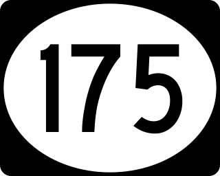
Route 175 is a short, 2.95-mile (4.75 km) long state highway in Mercer County, New Jersey, United States. The route runs along a former alignment of Route 29 before the construction of the John Fitch Parkway in the 1960s. The route begins at Route 29 in the capital city of Trenton, running along Sanhican Road, River Road, and West Upper Ferry Road into Ewing Township. The route serves primarily as a frontage road for Route 29. The northernmost portion of Route 175 is parallel to the Delaware and Raritan Canal until coming to an end at a merge with Route 29 in Ewing Township.

Interstate 295 (I-295) in Delaware, New Jersey, and Pennsylvania is an auxiliary Interstate Highway, designated as a bypass around Philadelphia, Pennsylvania, and a partial beltway of Trenton, New Jersey.

Interstate 95 (I-95) is a major Interstate Highway that runs along the East Coast of the United States from Miami, Florida, north to the Canada–United States border at Houlton, Maine. In New Jersey, it runs along much of the mainline of the New Jersey Turnpike, as well as the Pearl Harbor Memorial Turnpike Extension, and the New Jersey Turnpike's I-95 Extension to the George Washington Bridge for a total of 77.96 miles (125.46 km). Located in the northeastern part of the state near New York City, the 11.03-mile (17.75 km) Western Spur of the New Jersey Turnpike, considered to be Route 95W by the New Jersey Department of Transportation (NJDOT), is also part of I-95.

U.S. Route 1 Business is a four-lane surface road that provides an alternate route to the Trenton Freeway (US 1) northeast of Trenton in Mercer County, New Jersey. The route is 2.73 miles (4.39 km) long and runs between US 1 in Trenton and Lawrence Township. On the border of Trenton and Lawrence Township, US 1 Bus. intersects the northbound direction of US 206 at the Brunswick Circle. The route was once part of a longer U.S. Route 1 Alternate, which continued southwest through downtown Trenton and into Morrisville, Pennsylvania.
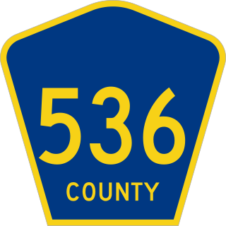
County Route 536 is a county highway in the U.S. state of New Jersey. The highway extends 39 miles (63 km) from the Commodore Barry Bridge crossing the Delaware River at Chester at the Pennsylvania state line and Logan Township, to U.S. Route 206 (US 206) in Hammonton. Much of the western portion of the route is concurrent with US 322 though it is unsigned along this portion.

County Route 535 is a county highway in the U.S. state of New Jersey. The highway extends 32.31 miles (52.00 km) from Logan Avenue, at the boundary between Trenton and Hamilton Township in Mercer County to an interchange with U.S. Route 9 (US 9) and Route 35 in South Amboy, Middlesex County.
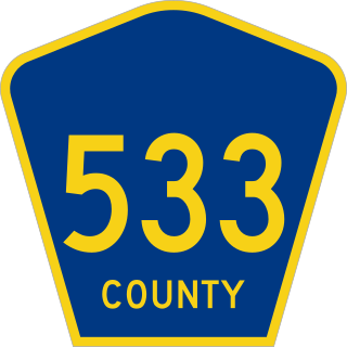
County Route 533 is a county highway in the U.S. state of New Jersey. The highway extends 32.78 miles (52.75 km) from the White Horse Circle, in Hamilton Township to Middlesex CR 607 on the border of Bound Brook and Middlesex Borough. CR 533 shares a long concurrency with U.S. Route 206 through Princeton and Montgomery Township, while portions of the roadway in Somerset County are part of the Millstone River Valley Scenic Byway.

County Route 524 is a county highway in the U.S. state of New Jersey. The highway extends 39.90 miles (64.21 km) from the White Horse Circle in Hamilton Township to Route 71 in Spring Lake Heights.

U.S. Route 30 is a U.S. highway running from Astoria, Oregon east to Atlantic City, New Jersey. In the U.S. state of New Jersey, US 30 runs 58.26 miles (93.76 km) from the Benjamin Franklin Bridge at the Delaware River in Camden, Camden County, while concurrent with Interstate 676 (I-676), southeast to Virginia Avenue in Atlantic City, Atlantic County. Most of the route in New Jersey is known as the White Horse Pike and is four lanes wide. The road runs through mostly developed areas in Camden County, with surroundings becoming more rural as the road approaches Atlantic County. US 30 runs through several towns including Collingswood, Berlin, Hammonton, Egg Harbor City, and Absecon.

Route 170 was a short, 0.79-mile (1.27 km) state highway in Burlington County, New Jersey, United States. The route was a former alignment of U.S. Route 206 and New Jersey Route 39 in the downtown portions of Mansfield Township and Columbus. Route 170 began at an intersection with U.S. Route 206 in Mansfield Township, headed northward along Atlantic Avenue and New York Avenue in Columbus before merging with U.S. Route 206 at a wye connection further north.
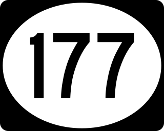
Route 177 was the shortest state highway recorded in Somerset County, New Jersey and the second shortest around the entire state of New Jersey. Route 177 went for a short, 0.24 miles (0.39 km) state-maintained portion of Bridge Street in Somerville. One of only three state highways in Somerset County after the 1953 state highway renumbering, Route 177 was the only one to be decommissioned later on. The short-lived designation went from U.S. Route 206 (US 206) in Somerville, up Bridge Street near the Old Cemetery to Fifth Street, where state maintenance terminated. In 1974, the Department of Transportation turned maintenance of this short highway over to the borough of Somerville for future use.
Route 160 was a short, 0.47-mile (0.76 km) state highway in Bordentown Township, Burlington County, New Jersey, United States. The highway ran along a former alignment of Route 39 and U.S. Route 206 (US 206) called Mission Road in Bordentown Township. The route began at an intersection with US 206, paralleling the four-lane highway to the east and serving local residences before turning to the northwest and serving a strip mall. The highway merged with US 206 further north past an intersection with Hilltop Road.

