1927 New Jersey state highway renumbering

Last updated
This article is part of the
highway renumbering series.
Alabama 1928, 1957
Arkansas 1926
California 1964
Colorado 1953, 1968
Connecticut 1932, 1963
Florida 1945
Indiana 1926
Iowa 1926, 1969
Louisiana 1955
Maine 1933
Massachusetts 1933
Minnesota 1934
Missouri 1926
Montana 1932
Nebraska 1926
Nevada 1976
New Jersey 1927, 1953
New Mexico 1988
New York 1927, 1930
North Carolina 1934, 1937, 1940, 1961
Ohio 1923, 1927, 1962
Pennsylvania 1928, 1961
Puerto Rico 1953
South Carolina 1928, 1937
South Dakota 1927, 1975
Tennessee 1983
Texas 1939
Utah 1962, 1977
Virginia 1923, 1928, 1933, 1940, 1958
Washington 1964
Wisconsin 1926
Wyoming 1927
1927 New Jersey state highway renumbering
Routes of the original system as laid out in 1927; realignments and additions (whether realized or not) in pink

In 1927, New Jersey's state highways were renumbered. The old system, which had been defined in sequence by the legislature since 1916, was growing badly, as several routes shared the same number, and many unnumbered state highways had been defined. A partial renumbering was proposed in 1926, but instead a total renumbering was done in 1927.

Contents

Some amendments were made in 1929, including the elimination of Route 18N (by merging it into Route 1), and the addition of more spurs, as well as Route 29A, but the system stayed mostly intact until the 1953 renumbering.

Proposed 1926 Renumbering

A partial renumbering was proposed in 1926 to get rid of the duplicates and assigning numbers to many of the unnumbered routes. The proposed 1926 renumbering would have:

It was eventually determined that an entire overhaul of the numbering system was necessary.

Design

Chapter 319 of the 1927 public laws defined the new system of routes. Major roads received numbers from 1 to 12 and 21 to 50, as follows:

Spurs were also defined, being assigned a prefix of S. For example, Route S26 was a short spur of Route 26 connecting to Route 25 south of New Brunswick. A second spur of Route 4 was assigned Route S4A, but two separate spurs of Route 24 both received the Route S24 designation.

While the majority of already-acquired routes were included in the new system, four sections of pre-1927 routes were not. The law authorizing the renumbering indicated that these were to remain, and so the State Highway Commission added a suffix of N to distinguish them from the new routes of the same number:

List of new routes

New RouteFromThroughToOld Designation [n 2] Modern Designation (Rough) [n 3]
Route 1 NJ 1 (1926).svg Rockleigh Fort Lee - Alpine - Cresskill - Englewood - Fort Lee - Palisades Park - Ridgefield - North Bergen - Jersey City - Bayonne Bayonne Bridge CR 501
Route S1 NJ S1 (1926).svg Fort Lee Ridgefield - Fairview North Bergen 63
Route 2 NJ 2 (1926).svg Suffern, New York Ridgewood - Hackensack - Hasbrouck Heights - Rutherford - Lyndhurst North Arlington Route 17N (proposed to be Route 17 in 1926), Suffern - North Arlington 17
Route 3 NJ 3 (1927).svg Greenwood Lake, New York Hewitt - Midvale - Haskell - Pompton - Haledon - Prospect Park - Hawthorne - Paterson - Clifton - Wallington - East Rutherford - Secaucus North Bergen L. 1926 c. 140, Wallington - North Bergen CR 511, 208, 20, 3
Route 4 NJ 4 (1926).svg George Washington Bridge Fort Lee - Riverside - Fair Lawn - Paterson - Clifton - Bloomfield - East Orange - Irvington - Roselle - Linden - Rahway - Woodbridge - Perth Amboy - South Amboy - Rose's Corner - Cheesequake - White Brown's Corner - Matawan - Freehold - Lakewood - Toms River - Tuckerton - Absecon - Pleasantville - Somer's Point - Beesley's Point - Seaville Cape May Route 4, Rahway - South Amboy
L. 1925 c. 235, South Amboy - Matawan
Route 7 (Spur), Freehold - Lakewood
Route 4, Lakewood - Absecon
Route 19 (proposed to be part of Route 4 in 1926), Absecon - Seaville
Route 14, Seaville - Cape May
109, US 9, 166, 79, Garden State Parkway, 4
Route S4 NJ S4 (1926).svg Outerbridge Crossing Perth Amboy 440 (South)
Route S4A NJ S4A (1926).svg Tuckerton Little Beach N/A
Route 5 NJ 5 (1926).svg Paterson Maywood - Hackensack - Little Ferry - Ridgefield - Fort Lee Edgewater Route 10, Paterson - Edgewater I-80, 5
Route S5 NJ S5 (1926).svg Little Ferry Ridgefield Bergen Turnpike
Route 6 NJ 6 (1926).svg George Washington Bridge Fort Lee - Palisades Park - Ridgefield Park - Little Ferry - Hasbrouck Heights - Paterson - Caldwell Township - Denville - Dover - Netcong - Hackettstown - Buttzville Darlington's Bridge Route 12, Paterson - Hackettstown
Route 5, Denville - Delaware Bridge
US 46, 159
Route 7 NJ 7 (1926).svg Paterson Clifton - Passaic - Nutley - Belleville - Kearny Jersey City Route 11, Paterson - Belleville
L. 1926 c. 124, Belleville - Jersey City
7
Route 8 NJ 8 (1926).svg Delaware Bridge Columbia - Hainesburg - Blairstown Newton 94
Route 9 NJ 9 (1926).svg Belleville Bloomfield - Montclair - Verona - Caldwell Pine Brook BridgeL. 1926 c. 124, Belleville - Pine Brook Bridge CR 506
Route 10 NJ 10 (1926).svg Jersey City Kearny - Harrison - Newark - Hanover - Whippany - Littleton Dover L. 1926 c. 126, Jersey City - Dover 10, I-280
Route 11 NJ 11 (1926).svg Whitehouse Pluckemin - Martinsville North Plainfield I-78
Route 12 NJ 12 (1926).svg Frenchtown Baptisttown - Croton - Flemington - Voorhees Corner - Three Bridges - Centreville Somerville-Raritan lineL. 1926 c. 104, Flemington - Somerville 12, US 202
Route 21 NJ 21 (1926).svg Belleville Newark Route 11, Belleville - Newark 21
Route 22 NJ 22 (1926).svg Pine Brook BridgeWest Caldwell - Livingston - Millburn - Springfield Rahway 59
Route 23 NJ 23 (1926).svg Verona Cedar Grove - Pequannock - Bloomingdale - Oak Ridge - Franklin - Sussex - High Point Port Jervis, New York Route 8, Verona - Sussex
L. 1925 c. 158, Sussex - Port Jervis
23
Route 24 NJ 24 (1926).svg Newark Irvington - Maplewood - Springfield - Morristown - Chester - Long Valley - Stephensburg - Washington Phillipsburg Route 5, Newark - Morristown
L. 1925 c. 230 (proposed to be Route 29 in 1926), Morristown - Schooleys Mountain
Route 12, Stephensburg - Phillipsburg
82, 124, Old 24, 57
Route S24 NJ S24 (1926).svg Stephensburg Hackettstown Route 12, Stephensburg - Hackettstown 57
Springfield Elizabeth 82
Route 25 NJ 25 (1926).svg Holland Tunnel Jersey City - Kearny - Newark - Elizabeth - Rahway - Woodbridge - North Brunswick - Deans - Dayton - Cranbury - Hightstown - Robbinsville - Bordentown - Burlington - Camden Benjamin Franklin Bridge Route 1 (Extension), Holland Tunnel - Elizabeth
Route 1, North Brunswick - Robbinsville
Route 2, Bordentown - Ben Franklin Bridge
US 1, US 130, US 30
Route 26 NJ 26 (1926).svg Trenton Adams New Brunswick L. 1926 c. 14, Trenton - New Brunswick 26, US 1
Route S26 NJ S26 (1926).svg Adams North Brunswick US 1
Route 27 NJ 27 (1926).svg Newark Elizabeth - Rahway - Metuchen - New Brunswick - Princeton Trenton Route 1, Elizabeth - New Brunswick
Route 13, New Brunswick - Trenton
27, US 206
27-28 LinkElizabethWestfield Ave
Route 28 NJ 28 (1926).svg Goethals Bridge Elizabeth - Cranford - Westfield - Plainfield - Bound Brook - Somerville - Clinton Phillipsburg Route 9, Elizabeth - Phillipsburg 28, US 22, 173, 122
Route S28 NJ S28 (1926).svg Middlesex Highland Park - New Brunswick - Weston Mills - Tanners Corner - Old Bridge - Browntown Matawan 18
Route 29 NJ 29 (1926).svg Newark Hillside - Union - Springfield - Mountainside - North Plainfield - Bound Brook - Ringoes - Lambertville - Washington's Crossing Trenton L. 1924 c. 233 (proposed to be Route 21 in 1926), Ringoes - Lambertville US 22, US 206, US 202, 179, 29, 129
Route 30 NJ 30 (1926).svg Trenton Pennington - Ringoes - Flemington - Clinton - Washington Buttzville L. 1924 c. 233 (proposed to be Route 21 in 1926), Trenton - Buttzville 31
Route 31 NJ 31 (1926).svg Princeton Somerville - Bedminster - Chester - Netcong - Newton - Lafayette - Hamburg - Vernon New Milford, New York Route 16, Princeton - Bedminster
L. 1925 c. 225 (proposed to be Route 30 in 1926), Bedminster - Newton
Route 8 (Spur), Lafayette - North Church
US 206, 94
Route S31 NJ S31 (1926).svg Newton Branchville - Montague Milford, Pennsylvania L. 1925 c. 225 (proposed to be Route 30 in 1926), Newton - Montague US 206
Route 32 NJ 32 (1926).svg Bedminster Bernardsville - Morristown - Morris Plains - Littleton - Boonton Mountain View Route 16, Bedminster - Morristown
Route 5, Morristown - Morris Plains
US 202
Route 33 NJ 33 (1926).svg Trenton Robbinsville - Hightstown - Freehold Asbury Park Route 1, Trenton - Hightstown
Route 7, Hightstown - Asbury Park
33
Route 34 NJ 34 (1926).svg Matawan Holmdel - Vanderburg - Colt's Neck - Shark River Station - Allenwood Laurelton 34, 70
Route 35 NJ 35 (1926).svg South Amboy Keyport - Eatontown - Belmar - Manasquan - Point Pleasant - Laurelton Lakewood Route 4, South Amboy - Eatontown
Route 4, Belmar - Lakewood
35, 88
Route 36 NJ 36 (1926).svg Keyport Keanesburg - Belford Atlantic Highlands L. 1925 c. 224 (proposed to be part of Route 28 in 1926), Keyport - Atlantic Highlands 36
Route 37 NJ 37 (1926).svg Trenton White Horse - Allentown - Lakehurst - Toms River - Seaside Heights Point Pleasant Route 2, Trenton - White Horse
Route 18, Lakehurst - Toms River
US 206, 37, 35
Route 38 NJ 38 (1926).svg Camden Merchantville - Moorestown - Mount Holly Eastampton Route 18 (proposed to be Route 23 in 1926), Camden - Mount Holly
L. 1925 c. 222 (proposed to be Route 24 in 1926), Mount Holly - Eastampton
38, 41
Route 39 NJ 39 (1926).svg Yardley Bridge Ewing - Bakersville - Mercerville - White Horse - Bordentown - Columbus - Vincentown - Red Lion - Indian Mills - Atsion Da Costa Route 2, White Horse - Bordentown
L. 1923 c. 202 (proposed to be part of Route 26 in 1926), Indian Mills - Da Costa
I-295, US-206
Route 40 NJ 40 (1926).svg Camden Marlton - Red Lion - Four Mile - Whitesbog - Whitings - Lakehurst - Lakewood Route 18 (proposed to be Route 23 in 1926), Whitesbog - Lakehurst 70
Route S40 NJ S40 (1926).svg Four Mile Manahawkin 72
Route 41 NJ 41 (1926).svg Moorestown Haddonfield Fairview 41, 47
Route S41 NJ S41 (1926).svg Tacony-Palmyra Bridge Palmyra - Moorestown - Evesboro - Marlton Berlin L. 1923 c. 202 (proposed to be part of Route 26 in 1926), Palmyra - Evesboro 73
Route 42 NJ 42 (1926).svg Camden Mt Ephraim - Chews Landing - Blackwood - Grenloch - Williamstown - Cecil - Weymouth McKee City L. 1925 c. 240 (proposed to be Route 27 in 1926), Camden - McKee City 168, 42, US 322
Route 43 NJ 43 (1926).svg Camden Berlin - Hammonton - Egg Harbor City Absecon Route 3, Camden - Absecon US 30
Route 44 NJ 44 (1926).svg Westville Paulsboro - Bridgeport Penns Grove Route 17S (proposed to be Route 22 in 1926), Paulsboro - Penns Grove 44, US 130
Route 45 NJ 45 (1926).svg Camden Woodbury - Mullica Hill - Woodstown Salem Route 6, Ben Franklin Bridge - Salem Route 45
Route 46 NJ 46 (1926).svg Mullica Hill Upper Pittsgrove Bridgeton Route 6, Mullica Hill - Bridgeton 77
Route 47 NJ 47 (1926).svg Brooklawn Glassboro - Malaga - Vineland - Millville Tuckahoe Route 20, Brooklawn - Millville 47, 49
Route 48 NJ 48 (1926).svg Penns Grove Woodstown - Elmer - Malaga - Mays Landing - Pleasantville Atlantic City Route 18S (proposed to be Route 19 in 1926), Penns Grove - Atlantic City US 40
Route 49 NJ 49 (1926).svg Salem Bridgeton - Millville - Port Elizabeth - Dennisville - South Dennis Ocean View Route 6, Salem - Bridgeton
Route 15, Bridgeton - South Dennis
49, 47, 83
Route S49 NJ S49 (1926).svg South Dennis Goshen Rio Grande Route 15, South Dennis - Rio Grande 47
Route 50 NJ 50 (1926).svg Egg Harbor City Mays Landing - Oakville - Tuckahoe Seaville Route 14, Egg Harbor City - Seaville 50

Additions

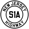
NJ S1A (1926).svg
NJ S3 (1926).svg
NJ S4B (1926).svg
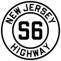
NJ S6 (1926).svg

1929 Amendment

Chapter 126 of the 1929 public law amended the 1927 act, removing redundant designations and creating entirely new roads in the New York Metropolitan Area. The amendments included

Other Additions

RouteFromToLegislatedModern

Designation

Notes
Route 2N NJ 2N (1926).svg LyndhurstNutley1938 c. 269Kingsland and Park Ave
Route S3 SpurRoute S3Clifton1942 c. 77

Named 1948 c. 221

161
Route 4A NJ 4A (1926).svg Old BridgeWest Freehold1942 34, 79 Replaced realigned section of Route 4
Route S4C NJ S4C (1926).svg BennetCape May 162, Beach Ave, Broadway, Seashore Road
Route S4D NJ S4D (1926).svg TeaneckTappan, NY1938 c. 134Designated as Route 303 in 1953 renumbering to connect to NY equivalent; cancelled shortly after
Route 6A NJ 6A (1926).svg DoverFrankford1938 c. 47 15
Route 6M NJ 6M (1926).svg MontvilleFairfield1941 159 Replaced realigned section of Route 6
Route 10N NJ 10N (1926).svg PatersonRidgefield1929 Hackensack Plank Road Replaced realigned section of Route 5; eliminated by 1930s
Route 11N NJ 11N (1926).svg PassaicPaterson1929Main AveReplaced truncated section of Route 7
Route 13E NJ 13E (1926).svg Point PleasantBay Head1938 c. 238 13
Route 17 NJ 17 (1926).svg Suffern, New York North Arlington 1942 17 Route 2 renumbered to Route 17 to create one single route from the Great Lakes to the New York City area for WWII caravans
Route 18 NJ 18 (1926).svg Old BridgeEatontown1939 c. 243 18 New freeway designated.
Route 19 NJ 19 (1926).svg PatersonBelleville1939 c. 200Marshall Street, Hazel Street, Paulison Avenue, River Drive (old routing of 21)Became part of Route 21 in 1948.
Route 24-28 LinkPhilipsburg1940Morris StWhen Route 24 was rerouted onto a freeway north of Morris St, the remnants were still state-maintained to link Routes 24 and 28
Route 25A NJ 25A (1926).svg NewarkHarrison1939 c. 198 I-280 Renumbered to Route 58 in 1953; in 1997, the designation was dropped in favour of I-280
Route 25AD NJ 25AD (1926).svg NewarkHarrison 158 Locally called the Center Street Bridge; designation removed 1960, bridge demolished in 1979
Route 25B NJ 25B (1926).svg Newark1939 c. 317Port Street, Doremus AveRenumbered to Route 65 in 1953; removed from state highway system in 1963
Route 25M NJ 25M (1926).svg North BrunswickNew Brunswick1940 171 A former alignment of US-130
Route S25 NJ S25 (1926).svg Bristol, PABurlington1929 c. 57 413
Route 25T NJ 25T (1926).svg East FerryJersey City US 1/9 Truck Truck route of Route 25, due to ban of trucks on Pulaski Skyway of the time
Route 26A NJ 26A (1926).svg AdamsNew Brunswick1941 91
Route 28A NJ 28A (1926).svg The only evidence of this route is the fact that it was later absorbed into US-22; possibly 24-28 link
Route 28-29 LinkNorth BranchBridgewater1938 c. 17 US-22 US-22 Bypass of Route 28
Route 29A NJ 29A (1926).svg New HopeFrenchtown1929 c. 241 29
Route 29B NJ 29B (1926).svg FrenchtownPhilipsburg1938 c. 183 CR 519
Route S29 NJ S29 (1926).svg LambertvilleNew Hope, PA1949 179
Route 31A NJ 31A (1926).svg PrincetonHightstown1941 c. 105Princeton-Hightstown Street, 64
Route 33-35 LinkTinton FallsNeptune Township 66
Route S41A NJ S41A (1926).svg BerlinFolsom1938 c. 299 73
Route S41N NJ S41N (1926).svg WrightsvillePalmyra1941 155
Route S43 NJ S43 (1926).svg GermaniaNorthfield1938 c. 216 CR 563
Route S44 NJ S44 (1926).svg BridgeportBridgeport Ferry1938 c. 374 324
Route S44A NJ S44A (1926).svg EllisburgBrooklawn1938 c. 374 CR 551 Spur Also known locally as Kings Highway
Route 44T NJ 44T (1926).svg PaulsboroDeptford1938 c. 367Designed to form a connection from a Paulsboro-Essington Bridge; never built
Route 51 NJ 51 (1926).svg BridgeportWilliamstown1939 US-322
Route 52 NJ 52 (1926).svg Somers PointMays Landing1937Somers Point Road
Route 54 NJ 54 (1926).svg HammontonVineland1938 c. 43 54, Lincoln Avenue
Route 55 NJ 55 (1926).svg PleasantvilleAtlantic City1938 c. 83 US 40 Replaced truncated section of Route 48; became part of Route 48 again in 1948
Route 55 NJ 55 (1926).svg New YorkTeaneck1948 [2] unbuilt northern extension of the New Jersey Turnpike; deleted by 1964
Route 56 NJ 56 (1926).svg AbsecomAtlantic City1938 c. 177 US 30, Absecon Blvd
Route S56 NJ S56 (1926).svg Atlantic City1941 87, 187
Route 84 NJ 84 (1926).svg SussexUnionville, NY1942284Renumbering of 8N; renumbered 284 to avoid confusion with nearby I-84
Route 100 NJ 100 (1926).svg New BrunswickFort Lee1938 c. 50 New Jersey Turnpike Originally planned to extend to Route 26
Route S100 NJ S100 (1926).svg Elizabeth (Route 100)Elizabeth (Route 25)1938 c. 50 81
Route 101 NJ 101 (1926).svg KearnyHackensack1939 c. 10521, 17Never built
Route S101 NJ S101 (1926).svg HackensackMontvale1951 c. 289 444
Route 151 NJ 151 (1926).svg Camden1946 c. 115S10, S11 Aves, Memorial Ave, Flanders BlvdAdministration given back to Camden after 1969
Route 300 NJ 300 (1926).svg Delaware Memorial BridgeNew Brunswick1947 c. 259 New Jersey Turnpike
Route 700Delaware Memorial BridgeUS 46 in Ridgefield1952 New Jersey Turnpike

Notes

  1. This route was cancelled in the final 1927 numbering
  2. Lines marked "L" indicate the year and chapter of the legislation marking the route.
  3. Many routes have since been rerouted off of local roads and onto freeways, especially near New York City, Trenton, and Philadelphia. The designations listed below show the modern route that serves the corridor of the original route

See also

Related Research Articles

In the U.S. state of New Jersey, the New Jersey Department of Transportation (NJDOT) maintains a system of state highways. Every significant section of roadway maintained by the state is assigned a number, officially State Highway Route X. Interstate Highways and U.S. Highways are included in the system. State Routes are signed with the circular highway shield.

<span class="mw-page-title-main">New Jersey Route 4</span> Highway in New Jersey

Route 4 is a state highway in Bergen County and Passaic County, New Jersey, United States. The highway stretches 10.83 mi (17.43 km) from Route 20 in Paterson east to an interchange with Interstate 95 (I-95), U.S. Route 1/9 (US 1/9), US 46, and US 9W at the George Washington Bridge approach in Fort Lee.

<span class="mw-page-title-main">New Jersey Route 26</span> State highway in New Jersey, US

Route 26 is a state highway in New Jersey, United States, running 2.54 miles (4.09 km) along Livingston Avenue from U.S. Route 1 (US 1) in North Brunswick Township northeast to Nassau Street at the border of New Brunswick. Prior to the 1953 renumbering, the route continued southwest along US 1 to Trenton. Livingston Avenue inside New Brunswick, southwest of Suydam Street, is the 1.08-mile (1.74 km) County Route 691 (CR 691). The 0.39 miles (0.63 km) from Suydam Street to its end at George Street is part of Route 171, also maintained by Middlesex County.

<span class="mw-page-title-main">New Jersey Route 67</span> State highway in Bergen County, New Jersey, US

Route 67 is a short state highway entirely within the community of Fort Lee in Bergen County, New Jersey. It is part of the original alignment of U.S. Route 9W (US 9W). The road runs 1.86 miles (2.99 km) from an intersection with Central Boulevard in Fort Lee up Palisade Avenue in downtown Fort Lee. There it becomes known as Lemoine Avenue, terminating at an interchange with US 9W, the Palisades Interstate Parkway and Route 445S in Fort Lee. The route was designated originally as a portion of State Highway Route 18N in 1923, and was split up in 1929 as part of present-day Route 63, US 9W and Route 67 for Routes S-1, 1 and Route S1A. Route S-1-A remained intact on Palisades and Lemoine Avenue until the 1953 state highway renumbering when it was switched over to Route 67. The route has remained virtually intact since.

<span class="mw-page-title-main">New Jersey Route 87</span> State highway in Atlantic County in New Jersey, U. S.

Route 87 is a state highway located in Atlantic County in the U.S. state of New Jersey. It runs 1.70 mi (2.74 km), heading north from Atlantic City at an intersection with U.S. Route 30 to Brigantine, where it terminates at the end of the Brigantine Bridge over the Absecon Inlet, continuing as County Route 638. In Atlantic City, the route runs through the Marina District, which contains a few casinos, along Huron Avenue and Brigantine Boulevard. Here, Route 87 intersects with Route 187 and the Atlantic City–Brigantine Connector, the latter providing a limited-access route between Route 87 and the Atlantic City Expressway. Route 87 is the only road to and from Brigantine.

<span class="mw-page-title-main">New Jersey Route 91</span> State highway in New Jersey, US

Route 91 is a 2.26-mile-long (3.64 km) spur state highway in Middlesex County, New Jersey. The route runs as a spur of U.S. Route 1 (US 1) along Jersey Avenue in North Brunswick Township to Van Dyke Avenue in the city of New Brunswick. At Van Dyke Avenue, Route 91 ends as a state route, and Jersey Avenue continues as County Route 693 (CR 693) to Route 27 in the center of New Brunswick. The mainline of Route 91 officially ends at the ramps to and from US 1 southbound and Orchard Street; the 0.37-mile-long (0.60 km) connector constructed from US 1 northbound is designated as Route 91 Connector.

<span class="mw-page-title-main">New Jersey Route 154</span> State highway in Camden County, New Jersey, US

Route 154 is a 1.70 miles (2.74 km) long state highway in Cherry Hill Township, Camden County, New Jersey. The route begins at an intersection with County Route 561 (CR 561) in Cherry Hill, heading northward to the site of the former Ellisburg Circle, where Route 154 reaches its northern terminus at Route 41 and Route 70. The route ends concurrent with Route 41 for the short distance from the junction between the two routes. Brace Road is the local name for Route 154 for its entire length.

<span class="mw-page-title-main">New Jersey Route 171</span> State highway in Middlesex County, New Jersey, United States

Route 171 is a state highway in New Jersey, United States. It runs just under one mile (1.6 km) as an extension of U.S. Route 130 (US 130) past its northern terminus at US 1 in North Brunswick Township. The state highway ends along Georges Road near the border of North Brunswick Township and the city of New Brunswick. The route formerly extended into downtown New Brunswick ending at an intersection with Route 27, though the route was mostly unsigned inside New Brunswick. The route is a major thoroughfare in North Brunswick. The route originated as an alignment of pre-1927 Route 1 and later of US 130. After US 130 was truncated, the alignment, which had also been designated Route 25M, was later re-designated as Route 171.

<span class="mw-page-title-main">New Jersey Route 182</span> State highway in Hackettstown, New Jersey, United States

Route 182 is a 0.96-mile (1.54 km) state highway in Hackettstown, New Jersey, United States. The highway serves as a connector of Route 57 to U.S. Route 46 (US 46). The southern end of Route 182 is at a three-way intersection, where Route 57 heads westbound towards Phillipsburg. Also present at this intersection is County Route 517 (CR 517), which is signed as Route 24, but not maintained by the state. CR 517 runs concurrent with Route 182 to its north end at US 46, and turns west with US 46 before splitting in downtown Hackettstown.

<span class="mw-page-title-main">New Jersey Route 187</span> State highway in New Jersey, US

Route 187 is a state highway in the state of New Jersey, in the United States. The route is only 0.40 miles (0.64 km) long, running along Brigantine Boulevard in Atlantic City. The route's southern terminus is at the Atlantic City–Brigantine Connector (Route 446X) off-ramp to U.S. Route 30 and terminates at its parent, New Jersey Route 87 nearby. Route 187 is not maintained by the New Jersey Department of Transportation, but instead the South Jersey Transportation Authority, which maintains the Brigantine Connector nearby.

<span class="mw-page-title-main">New Jersey Route 25</span>

Route 25 was a major state highway in New Jersey, United States prior to the 1953 renumbering, running from the Benjamin Franklin Bridge in Camden to the Holland Tunnel in Jersey City. The number was retired in the renumbering, as the whole road was followed by various U.S. Routes: US 30 coming off the bridge in Camden, US 130 from the Camden area north to near New Brunswick, US 1 to Tonnele Circle in Jersey City, and US 1 Business to the Holland Tunnel.

<span class="mw-page-title-main">U.S. Route 9W</span> U.S. Numbered Highway in New York/New Jersey

U.S. Route 9W (US 9W) is a north–south United States Numbered Highway in the states of New Jersey and New York. It begins in Fort Lee, New Jersey, as Fletcher Avenue crosses the US 1/9, US 46, and Interstate 95 (I-95) approaches to the George Washington Bridge, and heads north up the west side of the Hudson River to US 9 in Albany, New York. As its "W" suffix indicates, US 9W is a westerly alternate route of US 9 between the two locations. US 9W directly serves three cities—Newburgh, Kingston, and Albany—and enters the vicinity of several others. As the route heads north, it connects to several highways of regional importance, including I-84, US 209, New York State Route 23 (NY 23), and US 20. Much of US 9W parallels the New York State Thruway and NY 32; additionally, the latter overlaps with US 9W in four different locations.

<span class="mw-page-title-main">New Jersey Route 18N</span>

Route 18N was a state highway in New Jersey from 1923 to 1929, when it was renumbered as Route 1 and Route S1A. Route 18-N was defined in 1923 to run "from Hoboken to New York State line by way of Weehawken, West Hoboken, town of Union, North Bergen, Fairview, Ridgefield, Palisade Park, Fort Lee, Englewood-Cliffs, Tenafly and Alpine." The part from Hoboken to Fort Lee was not built or taken over as Route 18-N; it seems to follow the old Bergen Turnpike to Ridgefield and then Route 5 east. Route 18-N's south end was at pre-1927 Route 10, now Route 5.

Route 1 was a state highway in the U.S. state of New Jersey prior to the 1953 renumbering. Created in the 1927 renumbering, it was designated to run from Rockleigh to Bayonne, along the Hudson River. That same year, Route S1 was created as a spur along Bergen Boulevard, now signed Route 63. The Route 1 designation was placed on a new route north of Fort Lee in 1929, replacing the existing Route 18N; the old section of Route 1 still survives as County Route 501, and Route S1A, now Route 67, was created from the remnants of Route 18N not taken over by the realignment of Route 1. By the 1953 renumbering, the entirety of the route was occupied by various U.S. Routes, and the New Jersey Route 1 designation was abandoned. Its sections are now parts of U.S. Route 9W, U.S. Route 1/9, U.S. Route 1/9 Truck, and Route 440.

In January 1930, the U.S. state of New York implemented a major renumbering of its state highways. Many previously existing numbered routes were renumbered or realigned. At the same time, many state highways that were previously unnumbered received designations. Most of the highways with numbers in the 100s to 300s were assigned at this time. Route numbers were assigned in clusters based on their general location. Because some of these route numbers are no longer in use, the pattern of clusters is not fully apparent today.

<span class="mw-page-title-main">New Jersey Route 39</span>

Route 39 was a major state highway in the southwestern portions of the U.S. state of New Jersey. It was fully concurrent with U.S. Route 206 from its southern terminus at U.S. Route 30/State Highway Route 43/State Highway Route 54 in Hammonton to the current-day intersection with County Route 524 in Hamilton Township. Route 39 originally continued westward, crossing the Yardley–Wilburtha Bridge in the community of Wilburtha, New Jersey near State Highway Route 29.

<span class="mw-page-title-main">U.S. Route 30 in New Jersey</span> Highway in New Jersey

U.S. Route 30 is a U.S. highway running from Astoria, Oregon east to Atlantic City, New Jersey. In the U.S. state of New Jersey, US 30 runs 58.26 miles (93.76 km) from the Benjamin Franklin Bridge at the Delaware River in Camden, Camden County, while concurrent with Interstate 676 (I-676), southeast to Virginia Avenue in Atlantic City, Atlantic County. Most of the route in New Jersey is known as the White Horse Pike and is four lanes wide. The road runs through mostly developed areas in Camden County, with surroundings becoming more rural as the road approaches Atlantic County. US 30 runs through several towns including Collingswood, Berlin, Hammonton, Egg Harbor City, and Absecon.

<span class="mw-page-title-main">New Jersey Route 160</span>

Route 160 was a short, 0.47-mile (0.76 km) state highway in Bordentown Township, Burlington County, New Jersey, United States. The highway ran along a former alignment of Route 39 and U.S. Route 206 (US 206) called Mission Road in Bordentown Township. The route began at an intersection with US 206, paralleling the four-lane highway to the east and serving local residences before turning to the northwest and serving a strip mall. The highway merged with US 206 further north past an intersection with Hilltop Road.

<span class="mw-page-title-main">New Jersey Route 166</span> Highway in New Jersey, United States

Route 166 is a short, 3.73-mile (6.00 km) state highway in Ocean County, New Jersey. The route provides an alternate alignment of U.S. Route 9 through South Toms River and Toms River. The southern terminus is at an intersection with U.S. Route 9 northbound in Beachwood, where it heads northward along Atlantic City Boulevard. The route continues until ending where U.S. Route 9 leaves the Parkway north of Toms River. US 9 itself uses the Garden State Parkway to bypass Toms River.

References

  1. "NJ's First Renumbering (1927)". jimmyandsharonwilliams.com.
  2. Central NJ Home News, page 2, October 19, 1948