Three Bridges, New Jersey

Last updated

Three Bridges, New Jersey
Three Bridges NJ.jpg
The center of Three Bridges, seen from the Norfolk Southern Railway's Lehigh Line (former Lehigh Valley Railroad main line) tracks in August 2014
Location map of Hunterdon County, New Jersey.svg
Red pog.svg
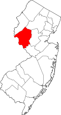
Three Bridges
Location in Hunterdon County
USA New Jersey relief location map.svg
Red pog.svg
Three Bridges
Location in New Jersey
Usa edcp relief location map.png
Red pog.svg
Three Bridges
Location in the United States
Coordinates: 40°31′11″N74°47′58″W / 40.51972°N 74.79944°W / 40.51972; -74.79944
Country Flag of the United States.svg  United States
State Flag of New Jersey.svg  New Jersey
County Flag placeholder.svg Hunterdon
Township Readington
Area
[1]
  Total0.54 sq mi (1.39 km2)
  Land0.53 sq mi (1.36 km2)
  Water0.01 sq mi (0.03 km2)
Elevation
[2]
121 ft (37 m)
Population
 (2020) [3]
  Total321
  Density611.43/sq mi (235.96/km2)
Time zone UTC−05:00 (Eastern)
  Summer (DST) UTC−04:00 (Eastern)
FIPS code 34-72870 [4]
GNIS feature ID881171 [2]

Three Bridges is an unincorporated community and census-designated place (CDP) [5] located within Readington Township in Hunterdon County, in the U.S. state of New Jersey, [6] on the South Branch Raritan River. It is named for the three original bridges which crossed the river.

Farmers John Vlerebone and Harriet Foster Cline were original land owners in the area of Three Bridges. They eventually sold some land to the Central Railroad of New Jersey for its South Branch Line which passed on to the Black River and Western Railroad. Vlerebone and Kline subdivided their land along Old York Road after 1864.

In 1875 the Lehigh Valley Railroad built the New Jersey extension of its main line through Three Bridges using its Easton and Amboy Railroad subsidiary where it still runs today now owned by Norfolk Southern Railway. [7] Numerous lines for shipping produce and a number of daily passenger lines stopped in the village in its heyday. Many of the businesses left along with the passenger lines. Today the village houses a post office, bank,a branch of the Hunterdon County Library System and several other businesses.

Demographics

Historical population
CensusPop.Note
2020 321
U.S. Decennial Census [8]

Related Research Articles

<span class="mw-page-title-main">Hunterdon County, New Jersey</span> County in New Jersey, United States

Hunterdon County is a county located in the western section of the U.S. state of New Jersey. At the 2020 census, the county was the state's 18th-most populous county, with a population of 128,947, its highest decennial count ever and an increase of 598 (+0.5%) from the 2010 census count of 128,349, which in turn reflected an increase of 6,360 (5.2%) from the 121,989 counted in the 2000 census. Its county seat is Flemington.

<span class="mw-page-title-main">Bethlehem Township, New Jersey</span> Township in Hunterdon County, New Jersey, United States

Bethlehem Township is a township in Hunterdon County, in the U.S. state of New Jersey. It is part of the New York metropolitan area. As of the 2020 United States census, the township's population was 3,745, a decrease of 234 (−5.9%) from the 2010 census count of 3,979, which in turn reflected an increase of 159 (+4.2%) from the 3,820 counted in the 2000 census.

<span class="mw-page-title-main">Califon, New Jersey</span> Borough in Hunterdon County, New Jersey, United States

Califon is a borough in Hunterdon County, in the U.S. state of New Jersey. As of the 2020 United States census, the borough's population was 1,005, a decrease of 71 (−6.6%) from the 2010 census count of 1,076, which in turn reflected an increase of 21 (+2.0%) from the 1,055 counted in the 2000 census.

<span class="mw-page-title-main">Clinton Township, New Jersey</span> Township in Hunterdon County, New Jersey, United States

Clinton Township is a township in Hunterdon County, in the U.S. state of New Jersey. As of the 2020 United States census, the township's population was 13,505, an increase of 27 (+0.2%) from the 2010 census count of 13,478, which in turn reflected an increase of 521 (+4.0%) from the 12,957 counted in the 2000 census.

<span class="mw-page-title-main">Delaware Township, Hunterdon County, New Jersey</span> Township in Hunterdon County, New Jersey, United States

Delaware Township is a township in Hunterdon County, in the U.S. state of New Jersey. Part of the township is on the Hunterdon Plateau, while the southern portions are in the Amwell Valley. As of the 2020 United States census, the township's population was 4,560, a decrease of three people (−0.1%) from the 2010 census count of 4,563, which in turn reflected an increase of 85 (+1.9%) from the 4,478 counted in the 2000 census.

<span class="mw-page-title-main">East Amwell Township, New Jersey</span> Township in Hunterdon County, New Jersey, United States

East Amwell Township is a township in Hunterdon County, in the U.S. state of New Jersey. As of the 2020 United States census, the township's population was 3,917, a decrease of 96 (−2.4%) from the 2010 census count of 4,013, which in turn reflected a decline of 442 (−9.9%) from the 4,455 counted in the 2000 census.

<span class="mw-page-title-main">Flemington, New Jersey</span> Borough in Hunterdon County, New Jersey, United States

Flemington is a borough in and the county seat of Hunterdon County, in the U.S. state of New Jersey. Most of the borough is located in the Amwell Valley, a low-lying area of the Newark Basin, and the Raritan Valley, the South Branch of the Raritan River, which flows through the center of Flemington. Northwestern portions of the borough sit on the Hunterdon Plateau. As of the 2020 United States census, the borough's population was 4,876, its highest decennial count ever and an increase of 295 (+6.4%) from the 2010 census count of 4,581, which in turn reflected an increase of 381 (+9.1%) from the 4,200 counted in the 2000 census.

<span class="mw-page-title-main">Frenchtown, New Jersey</span> Borough in Hunterdon County, New Jersey, United States

Frenchtown is a borough in Hunterdon County, in the U.S. state of New Jersey. Frenchtown is located along the banks of the Delaware River on the Hunterdon Plateau, 32 miles (51 km) northwest of the state capital of Trenton. As of the 2020 United States census, the borough's population was 1,370, a decrease of three people (−0.2%) from the 2010 census count of 1,373, which in turn reflected a decline of 115 (−7.7%) from the 1,488 counted in the 2000 census.

<span class="mw-page-title-main">High Bridge, New Jersey</span> Borough in Hunterdon County, New Jersey, United States

High Bridge is a borough in Hunterdon County, in the U.S. state of New Jersey. As of the 2020 United States census, the borough's population was 3,546, a decrease of 102 (−2.8%) from the 2010 census count of 3,648, which in turn reflected a decline of 128 (−3.4%) from the 3,776 counted in the 2000 census.

<span class="mw-page-title-main">Lambertville, New Jersey</span> City in Hunterdon County, New Jersey, United States

Lambertville is a city within Hunterdon County in the U.S. state of New Jersey. As of the 2020 United States census, the city's population was 4,139, an increase of 233 (+6.0%) from the 3,906 recorded at the 2010 census, which in turn had reflected an increase of 38 (1.0%) from the 3,868 counted at the 2000 census.

<span class="mw-page-title-main">Lebanon Township, New Jersey</span> Township in Hunterdon County, New Jersey, United States

Lebanon Township is the northernmost township in Hunterdon County, in the U.S. state of New Jersey. As of the 2020 United States census, the township's population was 6,195, a decrease of 393 (−6.0%) from the 2010 census count of 6,588, which in turn reflected an increase of 772 (+13.3%) from the 5,816 counted in the 2000 census.

<span class="mw-page-title-main">Raritan Township, New Jersey</span> Township in Hunterdon County, New Jersey, United States

Raritan Township is a township in Hunterdon County, in the U.S. state of New Jersey. As of the 2020 United States census, the township's population was 23,447, an increase of 1,262 (+5.7%) from the 2010 census count of 22,185, which in turn reflected an increase of 2,376 (+12.0%) from the 19,809 counted in the 2000 census. The township is located within the heart of the Amwell Valley and Raritan Valley regions, as the South Branch of the Raritan River flows through the center of the township. The northwestern portion of the township is located on the Hunterdon Plateau.

<span class="mw-page-title-main">Readington Township, New Jersey</span> Township in Hunterdon County, New Jersey, United States

Readington Township is a township located in the easternmost portion of Hunterdon County, in the U.S. state of New Jersey. As of the 2020 United States census, the township's population was 16,128, an increase of two people (+0.0%) from the 2010 census count of 16,126, which in turn reflected an increase of 323 (+2.0%) from the 15,803 counted in the 2000 census.

<span class="mw-page-title-main">Stockton, New Jersey</span> Borough in Hunterdon County, New Jersey, United States

Stockton is a borough in Hunterdon County, in the U.S. state of New Jersey. The borough sits on the Delaware River at the western end of Amwell Valley. As of the 2020 United States census, the borough's population was 495, a decrease of 43 (−8.0%) from the 2010 census count of 538, which in turn reflected a decline of 22 (−3.9%) from the 560 counted in the 2000 census.

<span class="mw-page-title-main">Union Township, Hunterdon County, New Jersey</span> Township in Hunterdon County, New Jersey, United States

Union Township is a township in Hunterdon County, in the U.S. state of New Jersey. The southwest half of the township lies on what is known as the Hunterdon Plateau, the northwest corner consists of the Musconetcong Ridge and the northeast section is part of the lower-lying Newark Basin around Spruce Run Reservoir. As of the 2020 United States census, the township's population was 6,507, its highest ever decennial count and an increase of 599 (+10.1%) from the 2010 census count of 5,908, which in turn reflected a decline of 252 (−4.1%) from the 6,160 counted in the 2000 census.

<span class="mw-page-title-main">Whitehouse Station, New Jersey</span> Populated place in Hunterdon County, New Jersey, US

Whitehouse Station, also spelled White House Station, is an unincorporated community and census-designated place (CDP) located within Readington Township, in Hunterdon County, New Jersey. At the 2010 United States Census, the CDP's population was 2,089. Whitehouse Station takes its name from Whitehouse and Abraham Van Horne's 18th century tavern.

<span class="mw-page-title-main">Richland, New Jersey</span> Populated place in Atlantic County, New Jersey, US

Richland is an unincorporated community and census-designated place (CDP) located within Buena Vista Township in Atlantic County, in the U.S. state of New Jersey. The area is served as United States Postal Service ZIP Code 08350.

<span class="mw-page-title-main">Pottersville, New Jersey</span> Populated place in Hunterdon and Somerset counties, New Jersey, US

Pottersville is an unincorporated community and census-designated place (CDP) split between Bedminster Township in Somerset County and Tewksbury Township in Hunterdon County, in the U.S. state of New Jersey. The area is served as United States Postal Service ZIP Code 07979. As of the 2010 United States Census, the population for ZIP Code Tabulation Area 07979 was 589. In 1990, most of the village was listed on the National Register of Historic Places as the Pottersville Village Historic District.

<span class="mw-page-title-main">Neshanic Station, New Jersey</span> Place in Somerset County, New Jersey, United States

Neshanic Station is an unincorporated community and census-designated place (CDP) located within Branchburg and extending into Hillsborough Township, Somerset County, in the U.S. state of New Jersey. In 2016 most of the village was listed on the National Register of Historic Places as the Neshanic Station Historic District.

<span class="mw-page-title-main">Rockefellows Mills, New Jersey</span> Populated place in Hunterdon County, New Jersey, US

Rockefellows Mills is an unincorporated community located within Raritan Township in Hunterdon County, in the U.S. state of New Jersey. The settlement is located along the South Branch Raritan River near Three Bridges. The river is spanned in the area by the historic Rockafellows Mill Bridge built in 1900 and part of the Raritan–Readington South Branch Historic District. Most of the area within the Raritan Township side of the river is forested however on the north side of the river in Readington Township, some farmland dots the area.

References

  1. "ArcGIS REST Services Directory". United States Census Bureau. Retrieved October 11, 2022.
  2. 1 2 "Three Bridges". Geographic Names Information System . United States Geological Survey, United States Department of the Interior.
  3. "Census Population API". United States Census Bureau. Retrieved October 11, 2022.
  4. Geographic Codes Lookup for New Jersey, Missouri Census Data Center. Accessed June 9, 2023.
  5. State of New Jersey Census Designated Places - BVP20 - Data as of January 1, 2020, United States Census Bureau. Accessed December 1, 2022.
  6. Locality Search, State of New Jersey. Accessed January 31, 2015.
  7. Readington Township Historic Preservation. "Readington Township: Images of America". Mount Pleasant, SC: Arcadia Publishing, 2008.
  8. "Census of Population and Housing". Census.gov. Retrieved June 4, 2016.