West Portal, New Jersey

Last updated

West Portal, New Jersey
Old Town Hall West Portal NJ1.jpg
The old town hall, West Portal in 2016
Location map of Hunterdon County, New Jersey.svg
Red pog.svg
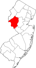
West Portal, New Jersey
West Portal's location in Hunterdon County (Inset: Hunterdon County in New Jersey)
USA New Jersey location map.svg
Red pog.svg
West Portal, New Jersey
West Portal, New Jersey (New Jersey)
Usa edcp location map.svg
Red pog.svg
West Portal, New Jersey
West Portal, New Jersey (the United States)
Coordinates: 40°39′44″N75°2′0″W / 40.66222°N 75.03333°W / 40.66222; -75.03333
Country Flag of the United States.svg  United States
State Flag of New Jersey.svg  New Jersey
County Hunterdon
Township Bethlehem
Elevation
[1]
133 m (436 ft)
Time zone UTC−05:00 (Eastern (EST))
  Summer (DST) UTC−04:00 (EDT)
GNIS feature ID881725 [1]

West Portal is an unincorporated community located within Bethlehem Township, in Hunterdon County, in the U.S. state of New Jersey. [1] [2] [3]

The community is centered at the intersection of Route 173 and County Route 643, approximately 5.1 miles (8.2 km) southwest of Hampton. [4]

The namesake West Portal of the Pattenburg Tunnel LVRR West Portal.jpg
The namesake West Portal of the Pattenburg Tunnel

The Norfolk Southern Railway's Lehigh Line (formerly the mainline of the Lehigh Valley Railroad), runs through West Portal and Lehigh Line's north entrance to the Pattenburg Tunnel (which goes underneath Musconetcong Mountain) is located in West Portal.

Related Research Articles

<span class="mw-page-title-main">Interstate 78</span> Interstate Highway in Pennsylvania, New Jersey, and New York

Interstate 78 (I-78) is an east–west Interstate Highway in the Northeastern United States, running 144 miles (232 km) from I-81 northeast of Harrisburg, Pennsylvania, through Allentown to western and northern New Jersey and terminating at the Holland Tunnel entrance to Lower Manhattan in New York City. Major metropolitan areas along its route include the Lehigh Valley in Pennsylvania, the Gateway Region in New Jersey, and the New York metropolitan area.

<span class="mw-page-title-main">Warren County, New Jersey</span> County in northwestern New Jersey, United States

Warren County is a county located in the U.S. state of New Jersey. According to the 2020 census, the county was the state's 19th-most populous county, with a population of 109,632, its highest decennial count ever and an increase of 940 (+0.9%) from the 2010 census count of 108,692, which in turn reflected an increase of 6,255 (+6.1%) from 102,437 counted at the 2000 census.

<span class="mw-page-title-main">Pennsylvania Route 145</span> State highway in Pennsylvania, US

Pennsylvania Route 145 is a 20.89 mi (33.62 km) long north–south state highway in the Lehigh Valley area of eastern Pennsylvania. It connects Interstate 78 (I-78) and PA 309 in Lanark, Lehigh County, north to PA 248 in Lehigh Gap, Northampton County.

<span class="mw-page-title-main">Pennsylvania Route 248</span> State highway in Pennsylvania, US

Pennsylvania Route 248 is a 31.3 mi (50.4 km) long state highway in the eastern part of the U.S. state of Pennsylvania. The western terminus of the route is at U.S. Route 209 in Weissport East, a CDP in Franklin Township. The eastern terminus is at PA 611 in Easton. The route begins at US 209 in Carbon County and heads southeast parallel to the Lehigh River as a four-lane divided highway to Bowmanstown, where it becomes a freeway and heads through Palmerton. Upon crossing Lehigh Gap in Blue Mountain, PA 248 enters Northampton County and becomes a two-lane undivided highway that heads southeast through rural areas, serving Bath and Nazareth. From here, the route runs southeast through suburban areas to Wilson, where it turns east and follows city streets through Easton.

<span class="mw-page-title-main">Pennsylvania Route 29</span> State highway in Pennsylvania, US

Pennsylvania Route 29 is a 118-mile-long (190 km) north–south state highway that runs through most of eastern Pennsylvania.

<span class="mw-page-title-main">Interstate 78 in New Jersey</span> Highway in New Jersey

Interstate 78 (I-78) is an east–west route stretching from Union Township, Lebanon County, Pennsylvania, to New York City. In New Jersey, I-78 is called the Phillipsburg–Newark Expressway and the Newark Bay–Hudson County Extension of the New Jersey Turnpike. The highway runs for 67.83 miles (109.16 km) in the northern part of the state of New Jersey from the I-78 Toll Bridge over the Delaware River at the Pennsylvania state line in Phillipsburg, Warren County, east to the Holland Tunnel under the Hudson River at the New York state line in Jersey City, Hudson County. The Phillipsburg–Newark Expressway portion of I-78, formally called the Lightning Division Memorial Highway, runs from the Phillipsburg area east across rural areas of western New Jersey before entering suburban areas in Somerset County. The road crosses the Watchung Mountains, widening into a local–express lane configuration at Route 24 as it continues through urban areas to Newark. Here, I-78 intersects the mainline of the New Jersey Turnpike (I-95) and becomes the Newark Bay Extension, crossing the Newark Bay Bridge and continuing to Jersey City. The route, along with Route 139, follows a one-way pair of surface streets to the Holland Tunnel.

<span class="mw-page-title-main">Pennsylvania Route 611</span> State highway in Pennsylvania, United States

Pennsylvania Route 611 is a state highway in eastern Pennsylvania running 109.7 mi (176.5 km) from Interstate 95 (I-95) in the southern part of the city of Philadelphia north to I-380 in Coolbaugh Township in the Pocono Mountains. Through most of Philadelphia, PA 611 follows Broad Street, the main north-south street in the city. The route continues north through the northern suburbs of Philadelphia and serves Jenkintown, Willow Grove, and Doylestown, the latter of which it bypasses on a freeway. North of Doylestown, PA 611 heads through rural areas and runs along the west bank of the Delaware River to the city of Easton in the Lehigh Valley. The route continues back into rural land and passes through the Delaware Water Gap, at which point it enters the Pocono Mountains region. Here, PA 611 heads northwest through Stroudsburg and Mount Pocono toward its northern terminus.

<span class="mw-page-title-main">Pennsylvania Route 873</span> State highway in Pennsylvania, US

Pennsylvania Route 873 is a north-south, two-lane road in the Lehigh Valley region of Pennsylvania, mainly located in northern Lehigh County with a small section in Northampton County. Its southern terminus is at PA 309 in Schnecksville. Its northern terminus is at PA 248 in the Lehigh Township hamlet of Weiders Crossing. The route runs through rural areas in northern Lehigh County, intersecting the western terminus of PA 329 in Neffs. PA 873 passes through Slatington as Main Street before it crosses the Lehigh River into Northampton County and immediately reaches its northern terminus south of Lehigh Gap in Blue Mountain.

<span class="mw-page-title-main">Pennsylvania Route 378</span> State highway in Pennsylvania, US

Pennsylvania Route 378 (PA 378) is a north-to-south road in Lehigh and Northampton counties in the Lehigh Valley region of the U.S. state of Pennsylvania. The southern terminus is at PA 309 in Center Valley. Its northern terminus is at U.S. Route 22 (US 22) in Bethlehem. The route heads north from PA 309 as a two-lane undivided road through Upper Saucon Township and Lower Saucon Township before crossing South Mountain into the city of Bethlehem. Here, PA 378 follows city streets through Bethlehem's South Side, intersecting the northern terminus of PA 412. The route crosses the Lehigh River and becomes a four-lane freeway that continues north to US 22. PA 378 is the only highway from US 22 to Center City Bethlehem, and a quick route for visitors traveling to the Wind Creek Bethlehem casino resort on the city's South Side.

<span class="mw-page-title-main">County Route 523 (New Jersey)</span>

County Route 523 is a county highway in the U.S. state of New Jersey. The highway extends 29.55 miles (47.56 km) from Route 29 in Stockton to U.S. Route 202 (US 202) in Bedminster Township.

<span class="mw-page-title-main">Pennsylvania Route 412</span> State highway in Pennsylvania, US

Pennsylvania Route 412 is a 17.75-mile-long (28.57 km) north–south state route located in Northampton and Bucks counties in southeastern Pennsylvania. Its southern terminus is at PA 611 in the Nockamixon Township community of Harrow. Its northern terminus is at PA 378 in Bethlehem.

<span class="mw-page-title-main">Pennsylvania's 15th congressional district</span> U.S. House district for Pennsylvania

Pennsylvania's 15th congressional district has been located in western and central Pennsylvania since 2019. Since 2023, the district includes all of Armstrong, Cameron, Centre, Clarion, Clearfield, Clinton, Elk, Forest, Jefferson, McKean, Potter, Snyder, Tioga, Union, and Warren counties, as well as parts of Indiana, Lycoming, and Venango counties.

<span class="mw-page-title-main">Interstate 78 in Pennsylvania</span> Highway in Pennsylvania, US

Interstate 78 (I-78) is an east–west Interstate Highway stretching from Union Township, Lebanon County, Pennsylvania, in the west to the Holland Tunnel and New York City in the east. In Pennsylvania, I-78 runs for about 78 miles (126 km) from the western terminus at I-81 in Union Township east to the New Jersey state line near Easton in Northampton County.

<span class="mw-page-title-main">Pennsylvania Route 413</span> State highway in Bucks County, Pennsylvania, United States

Pennsylvania Route 413 is a 31-mile-long (50 km), north–south state highway in Bucks County, Pennsylvania. The route runs from the New Jersey state line on the Burlington–Bristol Bridge over the Delaware River outside Bristol, where the road continues as Route 413 into New Jersey, north to PA 611 in Bedminster Township. The route passes through the lower and central portions of Bucks County, serving Bristol, Levittown, Langhorne, Newtown, and Buckingham. The route intersects U.S. Route 13 and Interstate 95 (I-95) near Bristol, I-295 near Penndel, US 1 in Langhorne Manor, and US 202 in Buckingham.

<span class="mw-page-title-main">Pennsylvania Route 863</span> State highway in Lehigh County, Pennsylvania, US

Pennsylvania Route 863 is a state highway in Lehigh County, Pennsylvania, in the Lehigh Valley region of the state. The route runs 13.99 mi (22.51 km) from U.S. Route 222 in Upper Macungie Township north to PA 143 in the community of Lynnport in Lynn Township. The route is a two-lane undivided road that runs southeast–northwest through rural areas in western Lehigh County. Along the way, PA 863 has an interchange with Interstate 78 (I-78)/US 22 in Weisenberg Township. The road was originally unpaved, being improved to a bituminous road by the 1940s and a paved road by 1950. PA 863 was designated on March 8, 1962.

<span class="mw-page-title-main">Pennsylvania Route 895</span> State highway in Pennsylvania, US

Pennsylvania Route 895 is a 47.37 mi (76.23 km) state highway in the U.S. state of Pennsylvania. It is an east–west route, running from PA 443 in Pine Grove in Schuylkill County east to and PA 248 in Bowmanstown in Carbon County. PA 895 is a two-lane undivided road that passes through rural areas in the southern sections of Schuylkill and Carbon counties, serving Auburn, Deer Lake, and New Ringgold. The entire course is close to the north flank of Blue Mountain. PA 895 was designated in 1928 between Auburn and U.S. Route 120 in Pinedale. In the 1930s, the route was extended west to PA 443 in Pine Grove and east to US 309 at White Street in Bowmanstown. In 1961, the east end was moved to an interchange with the PA 29/PA 45 freeway in Bowmanstown.

<span class="mw-page-title-main">U.S. Route 22 in New Jersey</span> Highway in New Jersey

U.S. Route 22 is a U.S. highway stretching from Cincinnati, Ohio in the west to Newark, New Jersey in the east. In New Jersey, the route runs for 60.53 mi (97.41 km) from the Easton–Phillipsburg Toll Bridge over the Delaware River in Phillipsburg, Warren County to Interstate 78 (I-78), US 1/9, and Route 21 at the Newark Airport Interchange in Newark, Essex County. The road first heads through the Phillipsburg-Alpha area as a surface divided highway before running concurrent with I-78 through mountainous and agricultural sections of western New Jersey between Alpha and east of Clinton in Hunterdon County. For the remainder of the route, US 22 runs to the south of I-78 through mostly suburban areas as a four- to six-lane surface divided highway, passing through Hunterdon, Somerset, Union, and Essex counties. Along this portion, it intersects US 202 and US 206 in Somerville, I-287 in Bridgewater Township, and the Garden State Parkway in Union.

Rowland's Mills or Rowland Mills is an unincorporated community located on the western edge of Readington Township in Hunterdon County, in the U.S. state of New Jersey. In 1760, a gristmill was erected at this site, followed by a sawmill around the time of the American Revolutionary War. A hamlet grew up around the mill complex in the early 19th century along the road connecting Flemington and Clinton. In 1838, Rynear Rowland (1798-1862), whom the village was later named after, purchased the mills. At its peak the settlement had a store, a blacksmith shop owned by Oliver Hart Ewing and numerous houses. In the later part of the 19th century the community diminished in size and was all but abandoned in the 1920s when the road through it was widened and designated as State Route 30, the predecessor of modern New Jersey Route 31.

<span class="mw-page-title-main">Lehigh Line (Norfolk Southern)</span> Railroad line in central New Jersey and northeastern Pennsylvania

The Lehigh Line is a railroad line in central New Jersey, Northeastern Pennsylvania, and the Lehigh Valley region of eastern Pennsylvania. It is owned and operated by the Norfolk Southern Railway. The line runs west from the vicinity of the Port of New York and New Jersey via Conrail's Lehigh Line to the Susquehanna River valley at the south end of the Wyoming Valley Coal Region. Administratively, it is part of Norfolk Southern's Keystone Division and is part of the Crescent Corridor. As of 2021 the line is freight-only, although there are perennial proposals to restore passenger service over all or part of the line.

References

  1. 1 2 3 Feature Detail Report for: West Portal, Geographic Names Information System. Accessed January 1, 2015.
  2. Locality Search, State of New Jersey. Accessed January 1, 2015.
  3. Areas covering the point (-75.033333,40.662222), MapIt. Accessed January 1, 2015.
  4. N 40.66222 W 75.03333, ACME Mapper. Accessed January 1, 2015.