Bethlehem Township is a township in Hunterdon County, in the U.S. state of New Jersey. It is part of the New York metropolitan area. As of the 2020 United States census, the township's population was 3,745, a decrease of 234 (−5.9%) from the 2010 census count of 3,979, which in turn reflected an increase of 159 (+4.2%) from the 3,820 counted in the 2000 census.
Califon is a borough in Hunterdon County, in the U.S. state of New Jersey. As of the 2020 United States census, the borough's population was 1,005, a decrease of 71 (−6.6%) from the 2010 census count of 1,076, which in turn reflected an increase of 21 (+2.0%) from the 1,055 counted in the 2000 census.

Clinton is a town in Hunterdon County, in the U.S. state of New Jersey. It is located on the South Branch of the Raritan River in the Raritan Valley region. As of the 2020 United States census, the town's population was 2,773, an increase of 54 (+2.0%) from the 2010 census count of 2,719, which in turn reflected an increase of 87 (+3.3%) from the 2,632 counted in the 2000 census. Despite its relatively small population, Clinton is the predominant control city for Interstate 78 traveling westbound from Newark.

Clinton Township is a township in Hunterdon County, in the U.S. state of New Jersey. As of the 2020 United States census, the township's population was 13,505, an increase of 27 (+.2%) from the 2010 census count of 13,478, which in turn reflected an increase of 521 (+4.0%) from the 12,957 counted in the 2000 census.

Franklin Township is a township in central Hunterdon County, in the U.S. state of New Jersey. As of the 2020 United States census, the township's population was 3,267, an increase of 72 (+2.3%) from the 2010 census count of 3,195, which in turn reflected an increase of 205 (+6.9%) from the 2,990 counted in the 2000 census. Most of the township lies on the Hunterdon Plateau with only the eastern section along the South Branch Raritan River being on the lower part of the Newark Basin.

High Bridge is a borough in Hunterdon County, in the U.S. state of New Jersey. As of the 2020 United States census, the borough's population was 3,546, a decrease of 102 (−2.8%) from the 2010 census count of 3,648, which in turn reflected a decline of 128 (−3.4%) from the 3,776 counted in the 2000 census.

Lebanon is a borough in Hunterdon County,in the U.S. state of New Jersey. As of the 2020 United States census, the borough's population was 1,665, the highest ever in any decennial census and an increase of 307 (+22.6%) from the 2010 census count of 1,358, which in turn reflected an increase of 293 (+27.5%) from the 1,065 counted in the 2000 census.
Lebanon Township is a township located at the northernmost point of Hunterdon County, in the U.S. state of New Jersey. As of the 2020 United States census, the township's population was 6,195, a decrease of 393 (−6.0%) from the 2010 census count of 6,588, which in turn reflected an increase of 772 (+13.3%) from the 5,816 counted in the 2000 census.

Tewksbury Township is a township located in Hunterdon County, in the U.S. state of New Jersey and is located within the New York Metropolitan Area. As of the 2020 United States census, the township's population was 5,870, a decrease of 123 (−2.1%) from the 2010 census count of 5,993, which in turn reflected an increase of 452 (+8.2%) from the 5,541 counted in the 2000 census. It is located within the Raritan Valley region.

Union Township is a township in Hunterdon County, in the U.S. state of New Jersey. The southwest half of the township lies on what is known as the Hunterdon Plateau, the northwest corner consists of the Musconetcong Ridge and the northeast section is part of the lower-lying Newark Basin around Spruce Run Reservoir. As of the 2020 United States census, the township's population was 6,507, an increase of 599 (+10.1%) from the 2010 census count of 5,908, which in turn reflected a decline of 252 (−4.1%) from the 6,160 counted in the 2000 census.

County Route 513 is a county highway in the U.S. state of New Jersey. The highway extends 66.83 miles (107.55 km) from Kingwood Avenue in Frenchtown to Lakeside Road in West Milford. South of Frenchtown, the road continues as Route 29. It is the third longest county route in New Jersey, following CR 519 and CR 527.
The Lebanon Township Schools is a community public school district that serves students in pre-kindergarten through eighth grade from Lebanon Township, in Hunterdon County, New Jersey, United States.
The Lebanon Borough School District is a community public school district that serves students in pre-kindergarten through sixth grade from Lebanon Borough, in Hunterdon County, New Jersey, United States.
The Califon School District is a community public school district that serves students in pre-kindergarten through eighth grade from Califon, in Hunterdon County, New Jersey, United States.

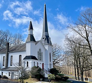
Fairmount is an unincorporated community located along County Route 517 in Tewksbury Township of Hunterdon County, New Jersey. The community was first known as Parkersville, named after proprietor James Parker (1725–1797). The southern section of the community is known as Lower Fairmount.

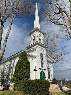
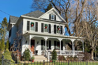
The Fairmount Historic District is a 409-acre (166 ha) historic district located along County Route 517 in the Fairmount section of Tewksbury Township, near Califon, in Hunterdon County, New Jersey. It was added to the National Register of Historic Places on December 20, 1996 for its significance in architecture, exploration/settlement, and industry. The district includes 72 contributing buildings that were deemed to be contributing to the historic character of the area, plus five contributing structures, nine contributing sites, and one contributing object. One contributing building is located in Washington Township, Morris County.
Mount Pleasant is an unincorporated community located along County Route 519 on the border of Alexandria Township and Holland Township, in Hunterdon County, New Jersey. The Mount Pleasant Historic District was listed on the National Register of Historic Places in 1987.

Hoffmans, also known as Hoffman's Crossing, is an unincorporated community located along Hoffman's Crossing Road and the South Branch Raritan River within Lebanon Township in Hunterdon County, New Jersey. It is about 1.5 miles (2.4 km) from Califon. The main road in the community is County Route 513. The Hunterdon County Educational Services Commission (HCESC) has a campus here.

Reaville is an unincorporated community located along the border of East Amwell and Raritan townships in Hunterdon County, New Jersey. By the 1830s, it was known as Greenville. It was later renamed after Runkle Rea, the first postmaster in 1850.
Spruce Run is an unincorporated community located along County Route 628 and Spruce Run Road within Lebanon Township in Hunterdon County, New Jersey. It is about 1 mile (1.6 km) northwest of Glen Gardner.