
Hunterdon County is a county located in the western section of the U.S. state of New Jersey. As of the 2018 Census estimate, the county's population was 124,714, making it the state's 18th-most populous county, representing a 2.6% decrease from the 128,349 enumerated in the 2010 United States Census, in turn increasing by 6,360 (+5.2%) from the 121,989 counted in the 2000 Census. Its county seat is Flemington.

Bethlehem Township is a township in Hunterdon County, New Jersey, United States. It is part of the New York metropolitan area. As of the 2010 United States Census, the township's population was 3,979, reflecting an increase of 159 (+4.2%) from the 3,820 counted in the 2000 Census, which had in turn increased by 716 (+23.1%) from the 3,104 counted in the 1990 Census.

Glen Gardner is a borough in Hunterdon County, New Jersey, United States. At the time of the 2010 United States Census, the borough's population was 1,704, reflecting a decline of 198 (-10.4%) from the 1,902 counted in the 2000 Census, which had in turn increased by 237 (+14.2%) from the 1,665 counted in the 1990 Census.

Lebanon Township is a township located at the northernmost point of Hunterdon County, New Jersey, United States. As of the 2010 United States Census, the township's population was 6,588, reflecting an increase of 772 (+13.3%) from the 5,816 counted in the 2000 Census, which had in turn increased by 137 (+2.4%) from the 5,679 counted in the 1990 Census.

Union Township is a township in Hunterdon County, New Jersey, United States. As of the 2010 United States Census, the township's population was 5,908, reflecting a decline of 252 (-4.1%) from the 6,160 counted in the 2000 Census, which had in turn increased by 1,082 (+21.3%) from the 5,078 counted in the 1990 Census. The southwest half of the township lies on what is known as the Hunterdon Plateau, the northwest corner consists of the Musconetcong Ridge and the northeast section is part of the lower-lying Newark Basin around Spruce Run Reservoir.
The Hunterdon County Vocational School District is a technical and vocational public school district serving students in ninth through twelfth grades and adult learners, located in Flemington, and serving the entire Hunterdon County, New Jersey, United States community.

West Portal is an unincorporated community located within Bethlehem Township, in Hunterdon County, New Jersey, United States.

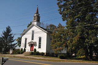
Palmyra is an unincorporated community located within Alexandria Township, in Hunterdon County, New Jersey, United States.
Swinesburg is an unincorporated community located along the border of Alexandria and Bethlehem townships in Hunterdon County, New Jersey, United States.
Valley is an unincorporated community located within Bethlehem Township, in Hunterdon County, New Jersey, United States.
Allerton is an unincorporated community located within Clinton Township, in Hunterdon County, New Jersey, United States.
Hamden is an unincorporated community located within Clinton Township, in Hunterdon County, New Jersey, United States.
McPherson is an unincorporated community located within Clinton Township, in Hunterdon County, New Jersey, United States.

Readingsburgh is an unincorporated community located within Clinton Township, in Hunterdon County, New Jersey, United States.
Allens Corner is an unincorporated community located within Franklin Township in Hunterdon County, New Jersey, United States.

Barbertown is an unincorporated community located within Kingwood Township in Hunterdon County, New Jersey, United States.
Larisons Corners is an unincorporated community located along the border of East Amwell and Raritan townships in Hunterdon County, New Jersey, United States. Its location is at the corner of Old York Road and where New Jersey Route 30 split from Old York Road and headed north towards Flemington. Today, Old York Road is a part of Route 179 to the southwest and County Route 514/Amwell Road northeast of the point. U.S. Route 202 and Route 31 comprise the main road to Flemington though the highway was built on a new alignment to the south of this point after US 202 bypassed Ringoes in the 1960s. A gas station and some small businesses line US 202 in the area and some churches, Larison's Corner Cemetery, and houses make up the remainder of the area.
Reaville is an unincorporated community located along the border of East Amwell and Raritan townships in Hunterdon County, New Jersey, United States.

Snydertown is an unincorporated community located within East Amwell Township in Hunterdon County, New Jersey, United States. The settlement is located on the southern face of Sourland Mountain at the intersection of Linvale Road and Snydertown Road. In the past, a mill operated in Snydertown.

Mount Airy is an unincorporated community located within West Amwell Township in Hunterdon County, New Jersey, United States.


