
Mount Joy is a borough in Lancaster County, Pennsylvania, United States. The population was 7,410 at the 2010 census.

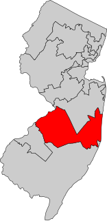
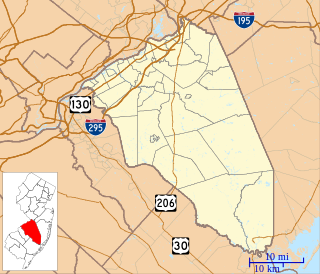
Burlington County is a county in the U.S. state of New Jersey. The county is the largest in New Jersey by area. Its county seat is Mount Holly. As of the 2018 Census Bureau estimate, the county's population was 445,384, making it the 11th-largest of the state's 21 counties, representing a 0.4% decrease from the 2010 United States Census, when the population was enumerated at 448,734, in turn an increase of 25,340 (6.0%) from the 423,394 enumerated in the 2000 Census. The most-populous place was Evesham Township, with 45,538 residents at the time of the 2010 Census, while Washington Township covered 102.71 square miles (266.0 km2), the largest area of any municipality in Burlington County.
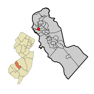
Mount Holly is a township in Burlington County, New Jersey, United States. It is the county seat of Burlington County as well as an eastern suburb of Philadelphia. As of the 2010 United States Census, the township's population was 9,536, reflecting a decline of 1,192 (−11.1%) from the 10,728 counted in the 2000 Census, which had in turn increased by 89 (+0.8%) from the 10,639 counted in the 1990 Census. Mount Holly also gives its name to the National Weather Service's Weather Forecast Office for the Philadelphia metropolitan area, though the office is actually located in adjacent Westampton.

Mount Laurel Township is a township in Burlington County, New Jersey, United States, and is an edge city suburb of Philadelphia. As of the 2010 United States Census, the township's population was 41,864, reflecting an increase of 1,643 (+4.1%) from the 40,221 counted in the 2000 Census, which had in turn increased by 9,951 (+32.9%) from the 30,270 counted in the 1990 Census. It is the home of NFL Films.
Mount Ephraim is a borough in Camden County, New Jersey, United States. As of the 2010 United States Census, the borough's population was 4,676, reflecting an increase of 181 (+4.0%) from the 4,495 counted in the 2000 Census, which had in turn declined by 22 (-0.5%) from the 4,517 counted in the 1990 Census.

Mount Arlington is a borough in Morris County, New Jersey, United States. As of the 2010 United States Census, the borough's population was 5,050, reflecting an increase of 387 (+8.3%) from the 4,663 counted in the 2000 Census, which had in turn increased by 1,033 (+28.5%) from the 3,630 counted in the 1990 Census. It is located on the southeast shore of Lake Hopatcong, New Jersey's largest lake and a major recreational resource.

Mount Olive Township is a township in Morris County, New Jersey, United States. As of the 2010 United States Census, the township's population was 28,117, reflecting an increase of 3,924 (+16.2%) from the 24,193 counted in the 2000 Census, which had in turn increased by 2,911 (+13.7%) from the 21,282 counted in the 1990 Census.
New Jersey's Third Congressional District is represented by Democrat Andy Kim.

Vincentown is an unincorporated community located within Southampton Township in Burlington County, New Jersey, United States. The area is served as United States Postal Service ZIP code 08088.

Barneys Joy Point Military Reservation was a World War II coastal defense site located in Dartmouth, Massachusetts.
Brian Aitken is an American marketing consultant, entrepreneur, and writer.
Masonville is an unincorporated community located within Mount Laurel Township, Burlington County, New Jersey, United States. Located east of Moorestown, the community of Masonville was developed when a highway was built in 1794. Major roads in Masonville include County Route 537 and Route 38.

Mount Salem is an unincorporated community located along the border of Alexandria and Union townships in Hunterdon County, New Jersey, United States.

Mount Airy is an unincorporated community located within West Amwell Township in Hunterdon County, New Jersey, United States.
Mount Lebanon is an unincorporated community located within Lebanon Township in Hunterdon County, New Jersey, United States.

Mounts Mills is an unincorporated community located within Monroe Township in Middlesex County, New Jersey, United States.

Mount Pleasant is an unincorporated community located within Marlboro Township in Monmouth County, New Jersey, United States. It is named for a hill of the same name, one of the highest points in Marlboro Township. The settlement is located at the intersection of Reids Hill Road and Beacon Hill Road.

Arneys Mount is an unincorporated community located within Springfield Township in Burlington County, New Jersey, United States. It shares its name with an adjacent hill, Arneys Mount, the highest point in Burlington County.
Birchfield is an unincorporated community located within Mount Laurel Township in Burlington County, New Jersey, United States.


