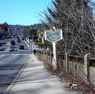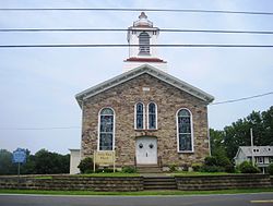
The Newark-Pompton Turnpike, is a roadway in northern New Jersey that was originally a tolled turnpike. The roadway was first laid out in the mid-18th century and given its name in 1806. As originally designed, it connected Newark with the area north and west of the Pompton River in what is now Riverdale. Its south end is Broadway in Newark; its north end is the Paterson-Hamburg Turnpike. As such, it was part of an alternate route between Newark and Paterson.

In the U.S. state of New Jersey, county routes exist in all 21 counties. They are typically the fourth type of roadway classified below the Interstate Highway, the U.S. Route numbered highway and the state highway. The County Route system is defined by two types in New Jersey. First, 500 Series County Routes, also called state secondary routes, are county highways numbered in a statewide system with three-digit numbers that begin with 5. These roads form a second network of routes that supplement the facilitation of the State Routes. Each 500 Series route is unique and is not permitted to be duplicated in another county for a separate route. The second category is defined as Non-500 Series County Routes. Non-500 Series County Routes include 1-digit, 2-digit, 600 Series, 700 Series and 800 Series. These, by definition, are discontinuous across county borders and must be contained entirely within that county. Unlike 500 Series County routes, these route numbers are unique to each county, and are typically assigned to more local routes than the statewide 500-series county route system. They are typically of a lesser classification of streets like minor arterials or collector roadways rather than major arterials or thoroughfares. In the counties that use 600-series numbers, the selection of this range was coordinated within the state, gradually replacing older systems of mainly one- and two-digit routes.
County Route 579, abbreviated CR 579, is a county highway in the U.S. state of New Jersey. The highway extends 37.24 miles (59.93 km) from John Fitch Parkway in Trenton to Route 173 in Greenwich Township.
County Route 575, abbreviated CR 575, is a county highway in the U.S. state of New Jersey. The highway extends 20.96 miles (33.73 km) from Somers Point-Mays Landing Road in Egg Harbor Township to New York Road in Port Republic.

County Route 569, abbreviated CR 569, is a county highway in the U.S. state of New Jersey. The highway extends 8.53 miles (13.73 km) from Quakerbridge Road in Lawrence Township to Broad Street in Hopewell Borough.
County Route 567, abbreviated CR 567, is a county highway in the U.S. state of New Jersey. The highway extends 10.02 miles (16.13 km) from Amwell Road in Hillsborough Township to Union Avenue in Raritan Borough.
County Route 565, abbreviated CR 565, is a county highway in the U.S. state of New Jersey. The highway extends 17.86 miles (28.74 km) from U.S. Route 206 / Route 15 in Frankford Township to McAfee Glenwood Road in Vernon Township.
County Route 561, abbreviated CR 561, is a county highway in the U.S. state of New Jersey. The highway extends 50.95 miles (82.00 km) from New York Road in Galloway Township to Federal Street in Camden.
County Route 559, abbreviated CR 559, is a county highway in the U.S. state of New Jersey. The highway extends 30.84 miles (49.63 km) from the former Somers Point Circle at MacArthur Boulevard in Somers Point to Egg Harbor Road in Hammonton.
County Route 557, abbreviated CR 557, is a county highway in the U.S. state of New Jersey. The highway extends 36.00 miles (57.94 km) from Delsea Drive in Dennis Township to Main Street in Franklin Township. It is also referred to as Tuckahoe Road.
County Route 552, abbreviated CR 552, is a county highway in the U.S. state of New Jersey. The highway extends 27.48 miles (44.22 km) from Laurel Street in Bridgeton to Harding Highway in Hamilton Township.
County Route 551, abbreviated CR 551, is a county highway in the U.S. state of New Jersey. The highway extends 34.57 miles (55.64 km) from Pennsville-Salem Road in Pennsville Township to Penn Street in Camden.
County Route 550, abbreviated CR 550, is a county highway in the U.S. state of New Jersey. The highway extends 15.92 miles (25.62 km) from Delsea Drive in Maurice River Township to Shore Drive in Dennis Township. The road travels through Maurice River Township, Dennis Township and Woodbine.
County Route 549, abbreviated CR 549, is a county highway in the U.S. state of New Jersey. The highway extends 17.82 miles (28.68 km) from Main Street at County Route 527 in Toms River to County Route 547 at Monmouth CR 21 in Howell. The highway has the distinction of being the only 500-series route left with two separate spur routes.
County Route 548, abbreviated CR 548, is a county highway in the U.S. state of New Jersey. The highway extends 9.18 miles (14.77 km) from Delsea Drive (Route 47 in Maurice River Township to Route 49 in Upper Township.
County Route 531, abbreviated CR 531, is a county highway in the U.S. state of New Jersey. The highway extends 13.61 miles from Woodbridge Avenue in Edison, Middlesex County, through Somerset County to Passaic Valley Road in Long Hill Township, Morris County.
County Route 528, abbreviated CR 528, is a county highway in the U.S. state of New Jersey. The highway is designated 39.89 miles (64.20 km) from Farnsworth Avenue in Bordentown to Ocean Avenue in Mantoloking. The eastern end of the highway sustained extensive damage in 2012 when an inlet opened between Barnegat Bay and the Atlantic Ocean during Hurricane Sandy, scouring away the road east of the Mantoloking Bridge. The bridge and Route 35 intersection fully reopened in February 2013.
County Route 524, abbreviated CR 524, is a county highway in the U.S. state of New Jersey. The highway extends 39.90 miles (64.21 km) from the White Horse Circle in Hamilton Township to Route 71 in Spring Lake Heights.
County Route 508 is a county highway in the U.S. state of New Jersey. The highway extends 16.14 miles (25.97 km) from Mount Pleasant Avenue in Livingston to Belleville Turnpike in Kearny.


