
Alexandria Township is a township in Hunterdon County, New Jersey, United States. As of the 2010 United States Census, the township's population was 4,938, reflecting an increase of 240 (+5.1%) from the 4,698 counted in the 2000 Census, which had in turn increased by 1,104 (+30.7%) from the 3,594 counted in the 1990 Census.
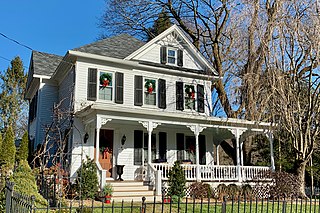
Califon is a borough in Hunterdon County, New Jersey, United States. As of the 2010 United States Census, the borough's population was 1,076, reflecting an increase of 21 (+2.0%) from the 1,055 counted in the 2000 Census, which had in turn declined by 18 (-1.7%) from the 1,073 counted in the 1990 Census.

Kingwood Township is a township in Hunterdon County, New Jersey, United States, located on the Hunterdon Plateau. As of the 2010 United States Census, the township's population was 3,845, reflecting an increase of 63 (+1.7%) from the 3,782 counted in the 2000 Census, which had in turn increased by 457 (+13.7%) from the 3,325 counted in the 1990 Census.

Pittstown is an unincorporated community located at the intersection of the boundaries of Alexandria, Franklin and Union townships in Hunterdon County, New Jersey, United States. The area is named after William Pitt. The area is served as United States Postal Service ZIP Code 08867. The area was named Hofftown in the 18th century after landowner Lawrence Hoff. The Pittstown Historic District was listed on the state and national registers of historic places in 1990.

Quakertown is an unincorporated community located within Franklin Township in Hunterdon County, New Jersey. It was once known as Fairview. The area was settled by Quakers from Burlington County, who organized a meeting house here in 1733. The Quakertown Historic District was listed on the state and national registers of historic places in 1990.

Whitehouse, also spelled White House, is an unincorporated community located within Readington Township in Hunterdon County, New Jersey. The community lies along the former Jersey Turnpike, just west of Mechanicsville. The Whitehouse–Mechanicsville Historic District, which includes historic places in both Whitehouse and Mechanicsville, was added to the National Register of Historic Places on March 17, 2015.

Fairmount is an unincorporated community located along County Route 517 in Tewksbury Township of Hunterdon County, New Jersey. The community was first known as Parkersville, named after proprietor James Parker (1725–1797). The southern section of the community is known as Lower Fairmount.

The Pleasant Hill Presbyterian Church, originally known as Mount Carmel Presbyterian Church, is a historic Greek Revival church in Pleasant Hill, Alabama. The current structure was built between 1851 and 1852. It features a distyle-in-antis type portico with simple box columns, a bell tower topped by a small domed cupola, and a second-floor balcony around three sides of the interior. It was placed on the Alabama Register of Landmarks and Heritage on the November 2, 1990 and on the National Register of Historic Places on April 22, 1999.
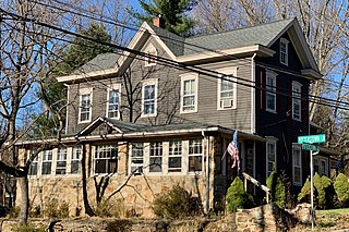
Potterstown is an unincorporated community along the border of Clinton and Readington townships in Hunterdon County, New Jersey.

The Fairmount Historic District is a 409-acre (166 ha) historic district located along County Route 517 in the Fairmount section of Tewksbury Township, near Califon, in Hunterdon County, New Jersey. It was added to the National Register of Historic Places on December 20, 1996 for its significance in architecture, exploration/settlement, and industry. The district includes 72 contributing buildings that were deemed to be contributing to the historic character of the area, plus five contributing structures, nine contributing sites, and one contributing object. One contributing building is located in Washington Township, Morris County.
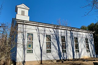
Cokesbury, historically known as Cokesburg, is an unincorporated community located on the border of Clinton and Tewksbury townships in Hunterdon County, New Jersey. It was named after two Methodist bishops, Coke and Asbury. The Cokesbury Historic District was listed on the state and national registers of historic places in 1997.

Everittstown is an unincorporated community located within Alexandria Township, in Hunterdon County, New Jersey, United States. The Everittstown Historic District was listed on the National Register of Historic Places in 1980.
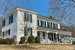
Amsterdam is an unincorporated community located within Holland Township in Hunterdon County, New Jersey. Located on the southern flank of the Musconetcong Mountain, the area was settled in the first half of the 18th century. It was later named after Amsterdam, Netherlands. The Amsterdam Historic District, encompassing the community, was listed on the state and national registers of historic places in 1995.

Cloverhill is an unincorporated community located at the intersection of the boundaries of East Amwell and Raritan townships in Hunterdon County and Hillsborough Township in Somerset County, in New Jersey, United States. The Clover Hill Historic District was listed on the state and national registers of historic places in 1980.
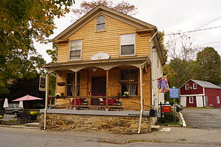
Mountainville is an unincorporated community located within Tewksbury Township in Hunterdon County, New Jersey. The Mountainville Historic District was listed on the National Register of Historic Places in 1993.

Reaville is an unincorporated community located along the border of East Amwell and Raritan townships in Hunterdon County, New Jersey. By the 1830s, it was known as Greenville. It was later renamed after Runkle Rea, the first postmaster in 1850.
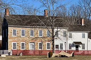
Van Syckel is an unincorporated community located within Union Township in Hunterdon County, New Jersey. The Van Syckel Corner District was listed on the National Register of Historic Places in 1979.

The Whitehouse–Mechanicsville Historic District is a historic district located along old New Jersey Route 28, Mill, Lamington and School Roads in Whitehouse and Mechanicsville, unincorporated communities in Readington Township, Hunterdon County, New Jersey. It was added to the National Register of Historic Places on March 17, 2015 for its significance in architecture and community development. The district includes 140 contributing buildings.

The Old Stone Church is a historic sandstone church located in Kingwood Township in Hunterdon County, New Jersey. It was built in 1837 and is now owned by the First Unitarian Universalist Fellowship of Hunterdon County. The church, described using its historic name, Old Stone Presbyterian Church in Kingwood, was added to the National Register of Historic Places on January 25, 2018 for its significance in architecture. The earlier church located here was a smaller stone building built in 1755, called the Old Stone Meetinghouse. The stones from this church were probably used to build the current one. The Kingwood congregation was established in 1728 and grew during the First Great Awakening, with Gilbert Tennent and George Whitefield preaching here in 1739.
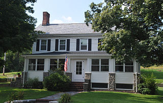
The Miller Farmstead is a historic district encompassing the main farm complex on Route 57, at Watters Road, in Mansfield Township, Warren County, New Jersey and extending into Lebanon Township, Hunterdon County. The farmstead is near the community of Penwell and overlooks the Musconetcong River, arranged linearly along the upper edge of the river's flood plain. It was added to the National Register of Historic Places on September 11, 1989, for its significance in agriculture, architecture, and transportation from 1830 to 1924. The listing is a 108 acres (44 ha) area that includes eight contributing buildings, seven contributing structures, and a contributing site.


