
Hunterdon County is a county located in the western section of the U.S. state of New Jersey. As of the 2018 Census estimate, the county's population was 124,714, making it the state's 18th-most populous county, representing a 2.6% decrease from the 128,349 enumerated in the 2010 United States Census, in turn increasing by 6,360 (+5.2%) from the 121,989 counted in the 2000 Census. Its county seat is Flemington.
Route 31 is a state highway in New Jersey, United States. It runs 48.93 mi (78.75 km) from U.S. Route 1 Business /US 206 in Trenton, Mercer County, north to an intersection with US 46 in Buttzville in White Township, Warren County. Along the way, Route 31 heads through the communities of Flemington, Clinton and Washington. Most of the highway is state-maintained; however, the section within the city limits of Trenton is maintained by the city. Much of Route 31 is a two-lane highway that passes through farmland, woodland, and mountainous areas. Two portions of the route—from Trenton to Pennington and from Ringoes to Clinton—consist of more development.
Route 57 is a state highway located in Warren County in the U.S. state of New Jersey. It runs 21.10 mi (33.96 km) from an interchange with U.S. Route 22 (US 22) in Lopatcong Township to an intersection with Route 182 and County Route 517 (CR 517) in Hackettstown. The route passes through mostly rural areas of farmland and mountains in Warren County. It also passes through Washington, where Route 57 crosses Route 31. The route is designated a scenic byway, the Warren Heritage Scenic Byway, by the state of New Jersey due to the physical environments it passes through as well as from historical sites along the way such as the Morris Canal.

Bethlehem Township is a township in Hunterdon County, New Jersey, United States. It is part of the New York metropolitan area. As of the 2010 United States Census, the township's population was 3,979, reflecting an increase of 159 (+4.2%) from the 3,820 counted in the 2000 Census, which had in turn increased by 716 (+23.1%) from the 3,104 counted in the 1990 Census.

Califon is a borough in Hunterdon County, New Jersey, United States. As of the 2010 United States Census, the borough's population was 1,076, reflecting an increase of 21 (+2.0%) from the 1,055 counted in the 2000 Census, which had in turn declined by 18 (-1.7%) from the 1,073 counted in the 1990 Census.

Clinton is a town in Hunterdon County, New Jersey, United States, located on the South Branch of the Raritan River. As of the 2010 United States Census, the town's population was 2,719, reflecting an increase of 87 (+3.3%) from the 2,632 counted in the 2000 Census, which had in turn increased by 578 (+28.1%) from the 2,054 counted in the 1990 Census. Despite its relatively small population, Clinton is the predominant control city for Interstate 78 heading west from Newark.
Clinton Township is a township in Hunterdon County, New Jersey, United States. As of the 2010 United States Census, the township's population was 13,478, reflecting an increase of 521 (+4.0%) from the 12,957 counted in the 2000 Census, which had in turn increased by 2,141 (+19.8%) from the 10,816 counted in the 1990 Census.

Franklin Township is a township in central Hunterdon County, New Jersey, United States. As of the 2010 United States Census, the township's population was 3,195, reflecting an increase of 205 (+6.9%) from the 2,990 counted in the 2000 Census, which had in turn increased by 139 (+4.9%) from the 2,851 counted in the 1990 Census. Most of the township lies on the Hunterdon Plateau with only the eastern section along the South Branch Raritan River being on the lower part of the Newark Basin.

Hampton is a borough in Hunterdon County, New Jersey, United States. As of the 2010 United States Census, the borough's population was 1,401, reflecting a decline of 145 (-9.4%) from the 1,546 counted in the 2000 Census, which had in turn increased by 31 (+2.0%) from the 1,515 counted in the 1990 Census.

High Bridge is a borough in Hunterdon County, New Jersey, United States. As of the 2010 United States Census, the borough's population was 3,648, reflecting a decline of 128 (-3.4%) from the 3,776 counted in the 2000 Census, which had in turn declined by 110 (-2.8%) from the 3,886 counted in the 1990 Census.

Holland Township is a township in Hunterdon County, New Jersey, United States. As of the 2010 United States Census, the township's population was 5,291, reflecting an increase of 167 (+3.3%) from the 5,124 counted in the 2000 Census, which had in turn increased by 232 (+4.7%) from the 4,892 counted in the 1990 Census.

Lebanon Township is a township located at the northernmost point of Hunterdon County, New Jersey, United States. As of the 2010 United States Census, the township's population was 6,588, reflecting an increase of 772 (+13.3%) from the 5,816 counted in the 2000 Census, which had in turn increased by 137 (+2.4%) from the 5,679 counted in the 1990 Census.

Tewksbury Township is a township located in Hunterdon County, New Jersey and is located within the New York Metropolitan Area. As of the 2010 United States Census, the township's population was 5,993, reflecting an increase of 452 (+8.2%) from the 5,541 counted in the 2000 Census, which had in turn increased by 738 (+15.4%) from the 4,803 counted in the 1990 Census.

Union Township is a township in Hunterdon County, New Jersey, United States. As of the 2010 United States Census, the township's population was 5,908, reflecting a decline of 252 (-4.1%) from the 6,160 counted in the 2000 Census, which had in turn increased by 1,082 (+21.3%) from the 5,078 counted in the 1990 Census. The southwest half of the township lies on what is known as the Hunterdon Plateau, the northwest corner consists of the Musconetcong Ridge and the northeast section is part of the lower-lying Newark Basin around Spruce Run Reservoir.

Raven Rock is an unincorporated community and hamlet along the Delaware River approximately three miles (4.8 km) north of Stockton along New Jersey Route 29. The hamlet was known earlier as Saxtonville. It is located within Delaware Township in Hunterdon County, New Jersey, United States. It is the site of Bull's Island Recreation Area. The rock outcrop for which it is named is the southwest corner of the Hunterdon Plateau.
Miller Farm or Miller Farmstead may refer to:

New Hampton is an unincorporated community located within Lebanon Township in Hunterdon County, New Jersey, United States.
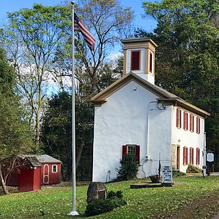
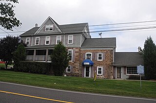
The New Hampton Historic District is a historic district in the village of New Hampton, Lebanon Township, Hunterdon County, New Jersey. The district was added to the National Register of Historic Places on April 6, 1998 for its significance in architecture, commerce, education, transportation, and community development from c. 1780 to 1929. It includes 42 contributing buildings, six contributing sites, and four contributing structures located along Musconetcong River Road.

The New Hampton Pony Pratt Truss Bridge is a historic pony Pratt truss bridge on Shoddy Mill Road in New Hampton, Lebanon Township, Hunterdon County, New Jersey. It crosses the Musconetcong River between Lebanon Township, Hunterdon County and Washington Township, Warren County. It was built in 1868 by William Cowin of Lambertville, New Jersey. The bridge was added to the National Register of Historic Places on July 26, 1977 for its significance in engineering, industry and transportation. It was documented by the Historic American Engineering Record in 1991. It was added as a contributing property to the New Hampton Historic District on April 6, 1998.
The Miller Farmstead is a historic site in New Jersey, United States, located in Mansfield Township in Warren County and Lebanon Township in Hunterdon County, near the community of Penwell, was listed on the National Register of Historic Places in 1989.


