County Route 534, abbreviated CR 534, is a county highway in the U.S. state of New Jersey. The highway extends 22.86 miles (36.79 km) from Cooper Street on the border of Woodbury and Deptford Township to Indian Mills Road in Shamong Township.

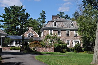
Millhurst is an unincorporated community located within Manalapan Township in Monmouth County, New Jersey, United States. Route 33 and County Route 527 pass through the center of Millhurst. Much of the area consists of businesses along the aforementioned arterial roads with the Millhurst Mill at the CR 527 crossing of Manalapan Brook. The mill is a former grist mill built in the 1700s, rebuilt in the 1800s as a more efficient mill, and turned into a family business by Bernard Hochberg in 1925.

Harts Corner is an unincorporated community located within Hopewell Township in Mercer County, New Jersey, United States. The center of the settlement is located about the intersection of Washington Crossing-Pennington Road and Scotch Road. Three of the four quadrants of the intersection contain farmland and Hopewell Township Municipal Offices, township public works, and recreational facilities occupy the remaining quadrant.

Alexauken is an unincorporated community located within West Amwell Township in Hunterdon County, New Jersey, United States. The community is located along Alexauken Creek Road between an interchange with U.S. Route 202 and Queen Road and is mostly made up of residential homes.

Alvater Corner is an unincorporated community located within Franklin Township in Hunterdon County, New Jersey, United States.
Bartles Corner is an unincorporated community located within Raritan Township in Hunterdon County, New Jersey, United States.
Cushetunk is an unincorporated community located within Readington Township in Hunterdon County, New Jersey, United States.
Cedar Heights is an unincorporated community located within Clinton Township in Hunterdon County, New Jersey, United States.

Furmans Corner is an unincorporated community located within East Amwell Township in Hunterdon County, New Jersey, United States. The area is very sparsely populated with only a few homes located along the two roads in the area, Wertsville Road and North Hill Road. The remainder of the area consists of the Union Cemetery of Wertsville and farmland.
Gary Corner is an unincorporated community located within Raritan Township in Hunterdon County, New Jersey, United States.

Idell is an unincorporated community located within Kingwood Township in Hunterdon County, New Jersey, United States. The community is located at the crossing of Byram-Kingwood Road over the Lockatong Creek. The area is very rural and consists of small farms, houses, and forest land.
Lansdowne is an unincorporated community located within Franklin Township in Hunterdon County, New Jersey, United States.

Prospect Plains is an unincorporated community located within Monroe Township in Middlesex County, New Jersey, United States. The settlement is located at the intersection of Prospect Plains Road and Applegarth Road. Retail businesses generally line the two aforementioned county roads in the area but some single-family houses are clustered around the site of the Camden & Amboy railroad crossing of Prospect Plains Road.

Schalks or Schalks Station is an unincorporated community located within Plainsboro Township in Middlesex County, New Jersey, United States. Located along Schalks Crossing Road at its junction with the Northeast Corridor railroad tracks, the area contains single-family homes, forested areas, a former research nuclear reactor built by Industrial Reactor Laboratories, and the rear yards to offices within the Princeton Forrestal Center.

Everett is an unincorporated community located along the border of Holmdel and Middletown townships in Monmouth County, New Jersey, United States. The community is located on Everett Road, along which the township line runs, at its intersection with Stillwell Road and Sunnyside Road. Most of the area in Everett is composed of homes with some farmlands nearby. Holmdel's Bell Labs Complex is located to the west of Everett.

Shrewsbury is an unincorporated community located within Upper Freehold Township in Monmouth County, New Jersey, United States. The settlement is located along County Route 524 at what was once a grade crossing with the Pemberton and Hightstown Railroad with an associated rail station. Since the removal of the railroad, the right-of-way has become a part of the Union Transportation Trail. Besides the trail, the area is made up of mostly farmland with some agricultural-related businesses and single-family homes nearby.

Spring Mill is an unincorporated community located within Upper Freehold Township in Monmouth County, New Jersey, United States. The settlement is located along County Route 524 between Hamilton Township and Allentown on a commercialized segment of the road originally built as New Jersey Route 37. A vestige of the state construction remains along the road through a wide right-of-way and a bridge crossing Doctor's Creek stating that it was constructed by the state in 1940 for State Highway Route 37.

Dunns Mill or Dunns Mills is an unincorporated community located within Bordentown Township in Burlington County, New Jersey, United States. The site is named for a gristmill established in 1708 that is located near the settlement along Blacks Creek. Martin Luther Dunn purchased the mill in 1875 but burned down in 1901. The site is presently located near the crossing of the New Jersey Turnpike over County Route 545. A mix of housing developments and preserved open space are located around Dunns Mill today.
Earlys Crossing was an unincorporated community located within Pemberton Township in Burlington County, New Jersey, United States.


