
Hickory Corner is an unincorporated community located within East Windsor Township in Mercer County, New Jersey, United States. The area consists of mostly single-family homes constructed in the 1960s but there are some apartment complexes nearby and is the location of the East Windsor Beth El Synagogue.

Locust Corner is an unincorporated community located within East Windsor Township in Mercer County, New Jersey, United States. The corner itself refers to the intersection of Princeton-Hightstown Road, County Route 571, and Old Trenton Road, CR 535. To the southeast of the intersection is the western terminus of the Hightstown Bypass, New Jersey Route 133. Much of the area has developed into commercial office spaces including on what was once the site of RCA Astro Electronics' headquarters.

Harts Corner is an unincorporated community located within Hopewell Township in Mercer County, New Jersey, United States. The center of the settlement is located about the intersection of Washington Crossing-Pennington Road and Scotch Road. Three of the four quadrants of the intersection contain farmland and Hopewell Township Municipal Offices, township public works, and recreational facilities occupy the remaining quadrant.

Coxs Corner is an unincorporated community located where the Keith line intersects the Lincoln Highway. The settlement is located in both Lawrence Township and Princeton in Mercer County, New Jersey, United States. The settlement is located where U.S. Route 206 crosses the Keith Line, the former boundary between East and West Jersey. Surrounding the area are homes and small businesses clustered along US 206 and forestland making up the remainder.

Harneys Corner is an unincorporated community located within Lawrence Township in Mercer County, New Jersey, United States. It is located at the intersection of Lawrence Road and Princeton Pike / Avenue. Located in the southern portion of the township close to the Trenton and Ewing borders, the area consists of small houses on nearby side streets and businesses along the aforementioned arterial roads. The intersection itself is located about 0.3 miles (0.48 km) north of the Brunswick Circle.

Coopers Corner is an unincorporated community located within Hopewell Township in Mercer County, New Jersey, United States. The settlement is centered about the intersection of County Routes 518 and 579.

Ackors Corner is an unincorporated community located within Hopewell Township in Mercer County, New Jersey, United States. The settlement is located at the intersection of Bear Tavern Road / Trenton-Harbourton Road, Pennington-Harbourton Road and Pleasant Valley Road. It is named for the Ackors family which owned land near the current intersection. Small residences and farmland make up the area surrounding Ackors Corner but the area rises in elevation from east to west as one approaches Baldpate Mountain, part of the Sourland Mountain range.
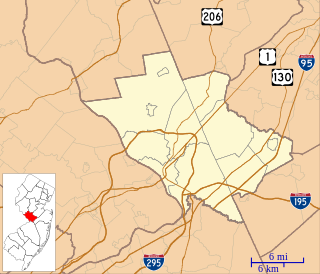
Post Corner is an unincorporated community located within West Windsor Township in Mercer County, New Jersey, United States.

Pages Corners or Pages Corner is an unincorporated community located within Robbinsville Township in Mercer County, New Jersey, United States. The intersection defining the corners is at Sharon Road and Gordon Road. The intersection is at a skewed angle which led to numerous accidents. The township installed a traffic signal at the intersection and activated it on September 25, 2015.

Alvater Corner is an unincorporated community located within Franklin Township in Hunterdon County, New Jersey, United States.
Bartles Corner is an unincorporated community located within Raritan Township in Hunterdon County, New Jersey, United States.

Furmans Corner is an unincorporated community located within East Amwell Township in Hunterdon County, New Jersey, United States. The area is very sparsely populated with only a few homes located along the two roads in the area, Wertsville Road and North Hill Road. The remainder of the area consists of the Union Cemetery of Wertsville and farmland.
Larisons Corners is an unincorporated community located along the border of East Amwell and Raritan townships in Hunterdon County, New Jersey, United States. Its location is at the corner of Old York Road and where New Jersey Route 30 split from Old York Road and headed north towards Flemington. Today, Old York Road is a part of Route 179 to the southwest and County Route 514/Amwell Road northeast of the point. U.S. Route 202 and Route 31 comprise the main road to Flemington though the highway was built on a new alignment to the south of this point after US 202 bypassed Ringoes in the 1960s. A gas station and some small businesses line US 202 in the area and some churches, Larison's Corner Cemetery, and houses make up the remainder of the area.
Mariannes Corner is an unincorporated community located within Clinton Township in Hunterdon County, New Jersey, United States.
Mechlings Corner is an unincorporated community located on the border of Alexandria and Union townships in Hunterdon County, New Jersey, United States.
Scrappy Corner is an unincorporated community located along the border of Lebanon Township in Hunterdon County and Washington Township in Morris County, New Jersey, United States.

Robinsville is an unincorporated community located within Upper Freehold Township in Monmouth County, New Jersey, United States. Located in the northeastern corner of the township near Millstone Township and Roosevelt, the area is located wholly in the Assunpink Wildlife Management Area, the area consists of forest and some farmland that was in existence prior to the creation of the WMA in the 1970s.

Tiltons Corner or Tiltons Corners is an unincorporated community located where the municipal boundaries of Keansburg Borough, Hazlet Township and Middletown Township intersect in Monmouth County, New Jersey, United States.
Van Marters Corner or Van Mariners Corners is an unincorporated community located along the border of Union Beach Borough and Hazlet Township in Monmouth County, New Jersey, United States.
Wileys Corner or Wileys Corners is an unincorporated community located within Tinton Falls in Monmouth County, New Jersey, United States.


