Everittstown, New Jersey

Last updated
Everittstown, New Jersey
EVERITTSTOWN HISTORIC DISTRICT, HUNTERDON COUNTY.JPG
Historic Baltus Pickel house in Everittstown
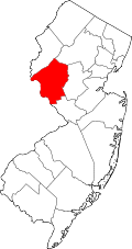
Location map of Hunterdon County, New Jersey.svg
Red pog.svg
Everittstown, New Jersey
Everittstown's location in Hunterdon County (Inset: Hunterdon County in New Jersey)
USA New Jersey location map.svg
Red pog.svg
Everittstown, New Jersey
Everittstown, New Jersey (New Jersey)
Usa edcp location map.svg
Red pog.svg
Everittstown, New Jersey
Everittstown, New Jersey (the United States)
Coordinates: 40°33′57″N75°1′44″W / 40.56583°N 75.02889°W / 40.56583; -75.02889 Coordinates: 40°33′57″N75°1′44″W / 40.56583°N 75.02889°W / 40.56583; -75.02889
Country Flag of the United States.svg  United States
State Flag of New Jersey.svg  New Jersey
County Hunterdon
Township Alexandria
Elevation
[1]
98 m (322 ft)
Time zone UTC-5 (Eastern (EST))
  Summer (DST) UTC-4 (EDT)
GNIS feature ID876242 [1]

Everittstown (also known as Everitts Town) is an unincorporated community located within Alexandria Township, in Hunterdon County, New Jersey, United States. [1] [2] The Everittstown Historic District was listed on the National Register of Historic Places in 1980.

Contents

Historic district

Everittstown Historic District
Area102.2 acres (41.4 ha)
Architectural styleItalianate, Vernacular Italianate
NRHP reference No. 80002496 [3]
NJRHP No.1558 [4]
Significant dates
Added to NRHPAugust 28, 1980
Designated NJRHPFebruary 20, 1980

The Everittstown Historic District is a historic district encompassing the village. The district is located at intersection of County Route 513, County Route 519 and Palmyra Road. It was added to the National Register of Historic in architecture, commerce, and industry. The Baltus Pickel house was built c.1860 with vernacular Italianate style. [5]

Related Research Articles

<span class="mw-page-title-main">Pittstown, New Jersey</span> Place in Hunterdon County, New Jersey, United States

Pittstown is an unincorporated community located at the intersection of the boundaries of Alexandria, Franklin and Union townships in Hunterdon County, New Jersey. The area is named after William Pitt. The area is served as United States Postal Service ZIP Code 08867. The area was named Hofftown in the 18th century after landowner Lawrence Hoff. The Pittstown Historic District was listed on the state and national registers of historic places in 1990.

<span class="mw-page-title-main">Quakertown, New Jersey</span> Unincorporated community in New Jersey, United States

Quakertown is an unincorporated community located within Franklin Township in Hunterdon County, New Jersey. It was once known as Fairview. The area was settled by Quakers from Burlington County, who organized a meeting house here in 1733. The Quakertown Historic District was listed on the state and national registers of historic places in 1990.

<span class="mw-page-title-main">Norton, New Jersey</span> Unincorporated community in New Jersey, United States

Norton is an unincorporated community located within Union Township, in Hunterdon County, New Jersey. Norton is located on County Route 635, approximately 1.5 mi (2.4 km) northwest of Interstate 78. The village is included in the Van Syckel Corner District, which was added to the National Register of Historic Places in 1979.

<span class="mw-page-title-main">Prallsville, New Jersey</span> Unincorporated community in New Jersey, United States

Prallsville is an unincorporated community located along New Jersey Route 29 by the border of Stockton and Delaware Township in Hunterdon County, New Jersey. The Delaware River and Wickecheoke Creek border the community. The Prallsville District was listed on the National Register of Historic Places in 1979.

<span class="mw-page-title-main">Fairmount, New Jersey</span> Unincorporated community in New Jersey, United States

Fairmount is an unincorporated community located along County Route 517 in Tewksbury Township of Hunterdon County, New Jersey. The community was first known as Parkersville, named after proprietor James Parker (1725–1797). The southern section of the community is known as Lower Fairmount.

<span class="mw-page-title-main">Potterstown, New Jersey</span> Unincorporated community in New Jersey, United States

Potterstown is an unincorporated community along the border of Clinton and Readington townships in Hunterdon County, New Jersey.

<span class="mw-page-title-main">Fairmount Historic District (Califon, New Jersey)</span> Historic district in New Jersey, United States

The Fairmount Historic District is a 409-acre (166 ha) historic district located along County Route 517 in the Fairmount section of Tewksbury Township, near Califon, in Hunterdon County, New Jersey. It was added to the National Register of Historic Places on December 20, 1996 for its significance in architecture, exploration/settlement, and industry. The district includes 72 contributing buildings that were deemed to be contributing to the historic character of the area, plus five contributing structures, nine contributing sites, and one contributing object. One contributing building is located in Washington Township, Morris County.

<span class="mw-page-title-main">Lambertville Historic District</span> Historic district in New Jersey, United States

Lambertville Historic District is located around the intersection of Route 29 and Route 179 in Lambertville, Hunterdon County, New Jersey, United States. The district was added to the National Register of Historic Places on June 30, 1983.

<span class="mw-page-title-main">Little York, Hunterdon County, New Jersey</span> Unincorporated community in New Jersey, United States

Little York is an unincorporated community located along the border of Alexandria and Holland townships in Hunterdon County, New Jersey, United States. Little York is located on County Route 614 3.1 miles (5.0 km) north-northeast of Milford. Little York has a post office with ZIP code 08834.

<span class="mw-page-title-main">Mount Pleasant, Hunterdon County, New Jersey</span> Unincorporated community in New Jersey, United States

Mount Pleasant is an unincorporated community located along County Route 519 on the border of Alexandria Township and Holland Township, in Hunterdon County, New Jersey. The Mount Pleasant Historic District was listed on the National Register of Historic Places in 1987.

<span class="mw-page-title-main">Readingsburg, New Jersey</span> Unincorporated community in New Jersey, United States

Readingsburg, also known as Stone Mill, is an unincorporated community located along the South Branch Raritan River within Clinton Township in Hunterdon County, New Jersey.

<span class="mw-page-title-main">Amsterdam, New Jersey</span> Unincorporated community in New Jersey, United States

Amsterdam is an unincorporated community located within Holland Township in Hunterdon County, New Jersey. Located on the southern flank of the Musconetcong Mountain, the area was settled in the first half of the 18th century. It was later named after Amsterdam, Netherlands. The Amsterdam Historic District, encompassing the community, was listed on the state and national registers of historic places in 1995.

<span class="mw-page-title-main">Cloverhill, New Jersey</span> Unincorporated community in New Jersey, United States

Cloverhill is an unincorporated community located at the intersection of the boundaries of East Amwell and Raritan townships in Hunterdon County and Hillsborough Township in Somerset County, in New Jersey, United States. The Clover Hill Historic District was listed on the state and national registers of historic places in 1980.

<span class="mw-page-title-main">Darts Mills, New Jersey</span> Unincorporated community in New Jersey, United States

Darts Mills is a historic unincorporated community located within Readington Township in Hunterdon County, New Jersey, United States. It is located on the South Branch of the Raritan River, and several mills were built there in the early 18th century. At its height, a merchant, blacksmith, store and complex of mills were here. The last mill at this site burnt down in 1994. Foundation walls and a mill race remain at the site today. On April 29, 1982, Dart's Mill was added to the National Register of Historic Places.

<span class="mw-page-title-main">Mountainville, New Jersey</span> Unincorporated community in New Jersey, United States

Mountainville is an unincorporated community located within Tewksbury Township in Hunterdon County, New Jersey. The Mountainville Historic District was listed on the National Register of Historic Places in 1993.

<span class="mw-page-title-main">Reaville, New Jersey</span> Unincorporated community in New Jersey, United States

Reaville is an unincorporated community located along the border of East Amwell and Raritan townships in Hunterdon County, New Jersey. By the 1830s, it was known as Greenville. It was later renamed after Runkle Rea, the first postmaster in 1850.

<span class="mw-page-title-main">Van Syckel, New Jersey</span> Unincorporated community in New Jersey, United States

Van Syckel is an unincorporated community located within Union Township in Hunterdon County, New Jersey. The Van Syckel Corner District was listed on the National Register of Historic Places in 1979.

<span class="mw-page-title-main">Wertsville, New Jersey</span> Unincorporated community in New Jersey, United States

Wertsville is an unincorporated community located along County Route 602 in East Amwell Township of Hunterdon County, New Jersey, United States.

<span class="mw-page-title-main">Headquarters, New Jersey</span> Unincorporated community in New Jersey, United States

Headquarters is an unincorporated community located within the Amwell Valley of Delaware Township in Hunterdon County, New Jersey. The settlement is centered around the intersection of Zentek Road and County Route 604. It is about 3 miles (4.8 km) from Ringoes to the east and 1 mile (1.6 km) from Sergeantsville to the west. The Headquarters Historic District was listed on the state and national registers of historic places in 2011 and had its boundary increased in 2016.

<span class="mw-page-title-main">Whitehouse–Mechanicsville Historic District</span> Historic district in New Jersey, United States

The Whitehouse–Mechanicsville Historic District is a historic district located along old New Jersey Route 28, Mill, Lamington and School Roads in Whitehouse and Mechanicsville, unincorporated communities in Readington Township, Hunterdon County, New Jersey. It was added to the National Register of Historic Places on March 17, 2015 for its significance in architecture and community development. The district includes 140 contributing buildings.

References

  1. 1 2 3 "Everittstown". Geographic Names Information System . United States Geological Survey, United States Department of the Interior.
  2. Locality Search, State of New Jersey. Accessed December 30, 2014.
  3. "National Register Information System  (#80002496)". National Register of Historic Places . National Park Service. November 2, 2013.
  4. "New Jersey and National Registers of Historic Places – Hunterdon County" (PDF). New Jersey Department of Environmental Protection – Historic Preservation Office. September 30, 2020. p. 1.
  5. Brasch, C.F.; Harrison, Ruth (1980). "National Register of Historic Places Inventory/Nomination: Everittstown Historic District". National Park Service. With accompanying 18 photos